Local Government
Goomalling
Region
Wheatbelt
Goomalling
Wheatbelt
| Type | Status | Date | Documents |
|---|---|---|---|
| (no listings) |
| Type | Status | Date | Documents |
|---|---|---|---|
| RHP - Does not warrant assessment | Current | 26 Jul 2019 |
| Type | Status | Date | Grading/Management | |
|---|---|---|---|---|
| Category | ||||
| (no listings) | ||||
Other Built Type
| Epoch | General | Specific |
|---|---|---|
| Original Use | FARMING\PASTORAL | Other |
| Present Use | Transport\Communications | Road: Other |
| Other Use | Transport\Communications | Road: Other |
This information is provided voluntarily as a public service. The information provided is made available in good faith and is derived from sources believed to be reliable and accurate. However, the information is provided solely on the basis that readers will be responsible for making their own assessment of the matters discussed herein and are advised to verify all relevant representations, statements and information.
Dowerin
Showground
Dowerin
Wheatbelt
Constructed from 1938
| Type | Status | Date | Documents |
|---|---|---|---|
| (no listings) |
| Type | Status | Date | Documents |
|---|---|---|---|
| (no listings) |
| Type | Status | Date | Grading/Management | |
|---|---|---|---|---|
| Category | ||||
| Municipal Inventory | Adopted | 19 Dec 1995 | ||
Individual Building or Group
| Epoch | General | Specific |
|---|---|---|
| Present Use | SOCIAL\RECREATIONAL | Other Community Hall\Centre |
| Original Use | SOCIAL\RECREATIONAL | Other Community Hall\Centre |
| Type | General | Specific |
|---|---|---|
| Roof | METAL | Corrugated Iron |
| Wall | BRICK | Other Brick |
| General | Specific |
|---|---|
| OCCUPATIONS | Grazing, pastoralism & dairying |
| SOCIAL & CIVIC ACTIVITIES | Cultural activities |
This information is provided voluntarily as a public service. The information provided is made available in good faith and is derived from sources believed to be reliable and accurate. However, the information is provided solely on the basis that readers will be responsible for making their own assessment of the matters discussed herein and are advised to verify all relevant representations, statements and information.
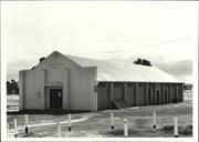
Dowerin Exhibition Hall was first used in September 1939. Dowerin Show was a venue for various people to exhibit their skills. Flowers, food, garden vegetables and preserves, as well as needlework, were judged in the hall. Today the hall remains in use. It has been divided in two. In one part, the lower, there is a concrete floor - this section is a store room. The other part has a timber floor and is used for gymnastic classes throughout the year. The hall is an essential part of Dowerin Field Day as it is the site of most of the catering. It this has high social heritage value.
The Dowerin Exhibition Hall was constructed from cement bricks made in Dowerin. It is a plain unembellished building, sturdy and strongly built. Its tin roof is unlined, its windows are unglazed. The concrete bricks are similar in style to diamond cut stone and this style is the major feature of the building. The front facade is smooth and painted
The first Dowerin Agricultural Show was held in 1917 although the Methodist Church held an annual flower show from 1910. The first exhibition hall was timber, unlined and with unglazed windows, where the grass tennis courts now stand to the east of the current exhibition hall. After the timber hall was damaged in a storm the current cement brick building was constructed. The last Dowerin Agricultural Show was held in the 1960s, some years after the start of the Dowerin Field Days. The current exhibition hall has had a number of purposes since then and currently is the venue for the art exhibition over the time of the Field Days, while the lower part is used by the youth club.
| Owner | Category |
|---|---|
| Shire of Dowerin | Local Gov't |
This information is provided voluntarily as a public service. The information provided is made available in good faith and is derived from sources believed to be reliable and accurate. However, the information is provided solely on the basis that readers will be responsible for making their own assessment of the matters discussed herein and are advised to verify all relevant representations, statements and information.
Dowerin
Namelcatching
Dowerin
Wheatbelt
Constructed from 1865
| Type | Status | Date | Documents |
|---|---|---|---|
| (no listings) |
| Type | Status | Date | Documents |
|---|---|---|---|
| (no listings) |
| Type | Status | Date | Grading/Management | |
|---|---|---|---|---|
| Category | ||||
| Classified by the National Trust | Classified | 10 Apr 2006 | ||
| Municipal Inventory | Adopted | 19 Dec 1995 | ||
Namelcatchem well has been restored in 2006 but at this point the area is not visitor friendly.
Historic site
| Epoch | General | Specific |
|---|---|---|
| Present Use | Transport\Communications | Water: Other |
| Original Use | Transport\Communications | Water: Other |
| Type | General | Specific |
|---|---|---|
| Wall | STONE | Local Stone |
| General | Specific |
|---|---|
| TRANSPORT & COMMUNICATIONS | Droving |
This information is provided voluntarily as a public service. The information provided is made available in good faith and is derived from sources believed to be reliable and accurate. However, the information is provided solely on the basis that readers will be responsible for making their own assessment of the matters discussed herein and are advised to verify all relevant representations, statements and information.
Constructed from 1865
Namelcatchem Well was referred to on the first map of Dowerin and its surroundings. The well is south of Minnivale and was used to water those horse teams which transported wheat to the rail siding at Minnivale. It was in constant use for this purpose from ca 1911 to ca 1945. The well has both historic and social significance. Access to water was essential for rural W.A. for both man and beast. When horses were the main power and strength used by farmers, water was1 essential. Farmers would transport wheat 15 miles, a day's drive for a horse team, and they used the well after unloading. The well was built some time before 1865 making it the earliest European-built structure in the area so far identified
Large stone well which held sufficient water for 70 horses. Built before 1865 when it was repaired, possibly convict built; possibly built by an early grazier/pastoralist in the area.
| Ref ID No | Ref Name | Ref Source | Ref Date |
|---|---|---|---|
| Denny CM; "Surveyor's Fieldbook". Book 3 p.6 | 1892 |
| Owner | Category |
|---|---|
| CALM | State Gov't |
This information is provided voluntarily as a public service. The information provided is made available in good faith and is derived from sources believed to be reliable and accurate. However, the information is provided solely on the basis that readers will be responsible for making their own assessment of the matters discussed herein and are advised to verify all relevant representations, statements and information.
Cottrell St Dowerin
Dowerin
Wheatbelt
Constructed from 1920
| Type | Status | Date | Documents |
|---|---|---|---|
| (no listings) |
| Type | Status | Date | Documents |
|---|---|---|---|
| (no listings) |
| Type | Status | Date | Grading/Management | |
|---|---|---|---|---|
| Category | ||||
| Statewide War Memorial Survey | Completed | 01 May 1996 | ||
Individual Building or Group
| Epoch | General | Specific |
|---|---|---|
| Present Use | MONUMENT\CEMETERY | Monument |
| Original Use | MONUMENT\CEMETERY | Monument |
| Type | General | Specific |
|---|---|---|
| Other | METAL | Other Metal |
| Other | TIMBER | Other Timber |
| General | Specific |
|---|---|
| OUTSIDE INFLUENCES | World Wars & other wars |
This information is provided voluntarily as a public service. The information provided is made available in good faith and is derived from sources believed to be reliable and accurate. However, the information is provided solely on the basis that readers will be responsible for making their own assessment of the matters discussed herein and are advised to verify all relevant representations, statements and information.
10 Cottrell St Dowerin
Dowerin
Wheatbelt
Constructed from 1940
| Type | Status | Date | Documents |
|---|---|---|---|
| (no listings) |
| Type | Status | Date | Documents |
|---|---|---|---|
| (no listings) |
| Type | Status | Date | Grading/Management | |
|---|---|---|---|---|
| Category | ||||
| Municipal Inventory | Adopted | 19 Dec 1995 | ||
| Name | Type | Year From | Year To |
|---|---|---|---|
| W G Pickering | Architect | - | - |
Individual Building or Group
| Epoch | General | Specific |
|---|---|---|
| Present Use | SOCIAL\RECREATIONAL | CWA Hall |
| Other Use | EDUCATIONAL | Pre-primary Centre |
| Original Use | SOCIAL\RECREATIONAL | CWA Hall |
| Type | General | Specific |
|---|---|---|
| Roof | METAL | Corrugated Iron |
| Wall | BRICK | Other Brick |
| General | Specific |
|---|---|
| SOCIAL & CIVIC ACTIVITIES | Institutions |
This information is provided voluntarily as a public service. The information provided is made available in good faith and is derived from sources believed to be reliable and accurate. However, the information is provided solely on the basis that readers will be responsible for making their own assessment of the matters discussed herein and are advised to verify all relevant representations, statements and information.
Constructed from 1940
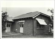
The CWA rest room and meeting place was built as the result of community fund raising and thus gains social and historic significance. Country Women combined in the Association to support development of local facilities, educational, health and social activities for themselves and also for children. The building was a meeting place and remains one. It is and has been used by other community groups and was at one time an infant health centre. The building materials were manufactured locally thus adding to the social and historic significance the architect, W.G. Pickering, also designed the Road Board building (now the hair dressing saloon and previously the kindergarten and Pre-primary Centre).
A cement brick building, the CWA Hall opened in 1940 and continued in use into the 2000s. Cement bricks were made in the town and the building is in a good state of repair. After the closure of the day branch of the CWA in Dowerin the building passed to the shire of Dowerin. The building is currently the site of the Lil' Tigers Childcare Centre.
The Dowerin branch of the CWA was formed in 1929 and acquired Town Lot 45 three years later. The block had initially been set aside for a Methodist Church Site, then re-gazetted as part of Reserve 14267 (Public Buildings) for twenty years ('Government Gazette' 13 August 1909, p.2695, 2 August 1912, p.3041 & 31 January 1913, p.252) There is evidence that a building belonging to the Methodist Church stood on the block for several years during the early twenties, but this was apparently moved about 1923. (DOLA File 5803/09) In 1932 the 'Public Buildings' reserve over the lot was cancelled in favour of Reserve 20884 for the purpose of 'Rest Room - Country Women's Association'. ('Government Gazette' 8 July 1932, p.955) This new reserve was immediately vested in the CWA and a Crown Grant in trust issued. (DOLA File 999/32) It was nearly six and a half years before the branch called tenders for the erection of a cement brick building on Lot 45 to be used as headquarters and rest room. According to the local newspaper, this was a facility which had long been wanted in Dowerin, but apparently no tender was accepted at that time. (The Dowerin Guardian 10 December 1938) Tenders were again called the following year when it was stated that plans and specifications could be seen at the residence of the branch secretary, Mrs R. Sargent. (The Dowerin Guardian 11 November 1939) A special committee was appointed to deal with all matters in connection with the building project, a committee consisting of Mesdames Place, Sargent, Harries and Erhardt and Miss Peggy Windsor. (The Dowerin Guardian 6 January 1940) Their architect was W. George Pickering and the successful tenderers were Messrs. Congdon and Hendry, a local firm engaged in making cement bricks and specialising in building baker's ovens, furnaces, chimneys and other cement or concrete work. (The Dowerin Guardian 3 & 24 February 1940) On 10 January 1940, a crowd of about forty people, presided over by the Rev. V.W. Deakin, witnessed the laying of the foundation stone by Mrs Place, the Branch President. (The Dowerin Guardian 27 January 1940) The building, of cement brick with plastered interior walls and plasterboard ceiling, was completed early in March. (The Dowerin Guardian 9 March 1940) It comprised a meeting room, rest room and kitchen, with the monogram of the Association embossed over the entrance porch. The interior was furnished with a library of books, a piano, pictures, cutlery and crockery etc. (The Dowerin Guardian 13 April 1940) A grand opening was staged on the afternoon of Wednesday, 3 April. Lunch was served to 150 people in the Dowerin Hall that day, and 200 attended the •'opening ceremony. After speeches from various dignitaries, the State president of the CWA, Mrs Leslie Craig, opened the doors with a silver key, formally declaring the building open. (The Dowerin Guardian 6 & 13 April 1940) In addition to its uses as a rest room and meeting place, the building was also used for a time as the local baby clinic.
| Name | Type | Year From | Year To |
|---|---|---|---|
| W. George Pickering | Architect | 1940 | - |
| Owner | Category |
|---|---|
| CWA | Inc. Non-profit body |
This information is provided voluntarily as a public service. The information provided is made available in good faith and is derived from sources believed to be reliable and accurate. However, the information is provided solely on the basis that readers will be responsible for making their own assessment of the matters discussed herein and are advised to verify all relevant representations, statements and information.

16 Cottrell St Dowerin
O'Shaughnessy House
Dowerin
Wheatbelt
Constructed from 1915
| Type | Status | Date | Documents |
|---|---|---|---|
| (no listings) |
| Type | Status | Date | Documents |
|---|---|---|---|
| RHP - Does not warrant assessment | Current | 24 Feb 2017 |
| Type | Status | Date | Grading/Management | |
|---|---|---|---|---|
| Category | ||||
| Municipal Inventory | Adopted | 19 Dec 1995 | ||
| Municipal Inventory | Adopted | 19 Dec 1995 | ||
| Classified by the National Trust | Classified | 05 Jun 1990 | ||
| Register of the National Estate | Indicative Place | |||
The building is in a good condition and is presently being maintained as the district's local historical museum.
| Library Id | Title | Medium | Year Of Publication |
|---|---|---|---|
| 10262 | Dowerin District Museum, Dowerin | Heritage Study {Cons'n Plan} | 2002 |
Individual Building or Group
| Epoch | General | Specific |
|---|---|---|
| Present Use | EDUCATIONAL | Museum |
| Original Use | RESIDENTIAL | Single storey residence |
| Type | General | Specific |
|---|---|---|
| Wall | TIMBER | Weatherboard |
| Roof | METAL | Corrugated Iron |
| General | Specific |
|---|---|
| OCCUPATIONS | Rural industry & market gardening |
| SOCIAL & CIVIC ACTIVITIES | Community services & utilities |
This information is provided voluntarily as a public service. The information provided is made available in good faith and is derived from sources believed to be reliable and accurate. However, the information is provided solely on the basis that readers will be responsible for making their own assessment of the matters discussed herein and are advised to verify all relevant representations, statements and information.
Mr O'Shaugnessey was a business man and saddler who came to the tow n i n 191 0 built the house i n 1915 and lived in it until 1968.Beari ng in mind that the tow n was gazetted in 1907 and the first recorded roads board meeting was not until 1912 it may be conceded that O'Shaughnessey·was a pioneer of the district. The building is considered of importance by the local community having been bought from the O'Shaughnessey family by the Apex Club and vested in the shire i n 1974. I t serves an important function in the tow n as the district museum . The houses on each·side are of compatible architecture and these together with the trees and house gardens form a significant streetscape. The jarrah boarded dados and pressed metal lining employed inside add to the significance of this building.
The cottage is a small timber framed weatherboard clad structure with corrugated iron roof . It has a front verandah continuing around on the southern side. The plan form shows a front living room and kitchen on the right hand side of the central· passage and two bed rooms and a vestibule on the left of the passage . The rooms have a dado of vertical fixed jarrah boards with pressed metal lining above and the ceilings are al so of pressed metal lining . The O'Shaughnessy home is typical of those in the wheatbelt being of weatherboard and having a corrugated iron roof. Structurally, it is quite sound (it was classed as in “ very good condition" by the Public Works Department) and any recommended repairs are being carried out. It is still painted in the original colour: Kalgoorlie Cream
Assessment 1990 It was built by the owner Eugene O'Shaughnessy, in 1910 in conjunction with Sylvester Grace. O'Shaughnessy was one of Dowerin's earliest businessmen. He was a bootmaker and saddler and the business is still in the family. The house is being transferred to the Dowerin District Museum and is to be vested in the Dowerin Shire Council . A committee of local residents are in the process of recreating the home as it was to show how the town 's early residents lived.
This information is provided voluntarily as a public service. The information provided is made available in good faith and is derived from sources believed to be reliable and accurate. However, the information is provided solely on the basis that readers will be responsible for making their own assessment of the matters discussed herein and are advised to verify all relevant representations, statements and information.
Constructed from 1915
Aesthetic, historic and social heritage values may be ascribed to the buildings which form Dowerin's District Museum. Integrity of fabric which has been carefully maintained in the cottage is outstanding. The educational value of the cluster of buildings is high. The heritage significance of the District Museum is considerably enhanced by the community support it has received. The objects collected in the saddlery shop came from local businesses and show technology and scientific knowledge of the times to which they belong.
Dowerin District Museum consists of a shop, a shed and weatherboard and iron cottage, the latter built in 1915. Interior walls and ceilings of pressed tin, together with timber floors and a timber dado in the hall and breezeway of the cottage combine to give the effect of a contemporary vernacular style.
The cottage was lived in and owned by the O 'Shaughnessy family from 1915 to 1974 and has been restored by the Shire with the help of a local community group who have furnished it. The house remains intact and the furnishings, which have been carefully chosen, enhance the notion of 'authenticity'. Behind the cottage is a reconstructed saddlery and shed containing blacksmiths and saddlery tools. These, too, are the result of significant community endeavour. Dowerin Town Lot 48 was declared open for sale at an upset price of £20-0-0 in June 1908. ('Government Gazette' 12 June 1908, p.1598) It was first offered at auction at the Northam Land Agent's office on 14 April 1910 ('Government Gazette' 18 March 1910, p.750), then made available for leasing at an annual rental of £1-0-0 in October 1912. ('Government Gazette' 23 October 1912, p.4148) It was granted to Thomas Brown Lee for £20-0-0 in November 1912. (DOLA - Crown Grant 535/146) Lee sold it to Eugene Raphael O'Shaughnessy on 16 April 1913. (DOLA - Certificate of Title 535/146) Eugene O'Shaughnessy, better known to Dowerin residents as 'Shock', had arrived in the town in 1910 and set himself up as a saddler and harness maker. (The Dowerin Guardian 9 July 1953) By November 1912 he was leasing a new shop erected by the Dowerin Trading Co. (The Doiverin Guardian 1 November 1912) By all accounts he was a prominent sportsman, at one time secretary of the Dowerin Football Club, and an immensely popular figure in the district. He is said to have built the weatherboard and iron cottage on Lot 48 (the present Dowerin District Museum), in 1915. (Early rate books, if retained by the Shire of Dowerin, may assist in confirming this date.) The building featured pressed metal walls and ceilings throughout. O'Shaughnessy brought his bride, Mrs Maeyolande O'Shaughnessy, to reside in the cottage in 1915 and it was there that they raised three sons and two daughters. (Central Districts Herald Tribune 17 October 1968, p.l) Mr O'Shaughnessy died in 1953, and ownership of the property passed to his widow. (DOLA - CT 535/146) She continued to reside in the cottage, and lived there for 53 years until her death in September 1968. (DOLA - CT 1166/480) The church was her main interest, and she was the Anglican Sunday School superintendent and secretary of the mission at Dowerin for 30 years. (Central Districts Herald Tribune 17 October 1968, p.l) The property passed to the children in equal shares in 1969. In 1973, public meetings were held in Dowerin to discuss the feasibility of establishing a district museum. {Central Districts Herald Tribune 3 May 1973, p.16) The former O'Shaughnessy family home, unoccupied for four years, was suggested as an ideal building to preserve and restore as a local museum, and a District Museum Committee was formed. (The West Australian 25 October 1973, p.53) Finance was provided by the Dowerin-Goomalling Apex Club for the purchase of the property which was transferred to the Shire of Dowerin in June 1974. (DOLA - CT 1166/480) Although the building was officially opened by Mr J.L. Bannister, Director of the W.A. Museum, on 6 October 1978, restoration work was not completed until March 1980 with the reconstruction of the back verandah roof. {The Country Museum No.25, September 1978, p.4 and Western Farmer 27 March 1980, p.74) The cottage has since been furnished in a style reminiscent of an early 1920s home. {Countryman 18 August 1988, p.65)
The cottage was lived in and owned by the O'Shaughnessy family from 1915 to 1974 and has been restored by the shire with the help of a local community group who have furnished it. The house remains intact and the furnishings, which have been carefully chosen, enhance the notion of 'authenticity'. Behind the cottage is a reconstructed saddlery and shed consisting of the original saddlery shopfront with reconstructed sides and rear and containing blacksmiths and saddlery tools. These, too, are the result of significant community endeavour.
| Ref ID No | Ref Name | Ref Source | Ref Date |
|---|---|---|---|
| "Newspaper Article". p. 65 | Countryman | 18/08/1988 | |
| "Newspaper Article". p.74 | Western Farmer | 27/03/1980 |
| Owner | Category |
|---|---|
| Shire of Dowerin | Local Gov't |
This information is provided voluntarily as a public service. The information provided is made available in good faith and is derived from sources believed to be reliable and accurate. However, the information is provided solely on the basis that readers will be responsible for making their own assessment of the matters discussed herein and are advised to verify all relevant representations, statements and information.
19 Cottrell St Dowerin
Anderson Hall
Dowerin
Wheatbelt
Constructed from 1909
| Type | Status | Date | Documents |
|---|---|---|---|
| (no listings) |
| Type | Status | Date | Documents |
|---|---|---|---|
| RHP - Assessed - Below Threshold | Current | 23 Feb 1996 |
| Type | Status | Date | Grading/Management | |
|---|---|---|---|---|
| Category | ||||
| Register of the National Estate | Permanent | 28 May 1996 | ||
| Classified by the National Trust | Classified | 05 Jun 1990 | ||
| Municipal Inventory | Adopted | 19 Dec 1995 | ||
Anderson Hall has been restored to its original finish of weatherboard. Its relocation to the Dowerin District High School sees it regularly used as the music and drama room. Restoration mid 1995, relocation 1999 .
| Library Id | Title | Medium | Year Of Publication |
|---|---|---|---|
| 991 | Conservation plan : Anderson Hall, Dowerin (formerly St Barnabas' Church). | Heritage Study {Cons'n Plan} | 1995 |
Individual Building or Group
| Epoch | General | Specific |
|---|---|---|
| Original Use | RELIGIOUS | Church, Cathedral or Chapel |
| Present Use | SOCIAL\RECREATIONAL | Other Community Hall\Centre |
| Type | General | Specific |
|---|---|---|
| Wall | ASBESTOS | Fibrous Cement, flat |
| Roof | METAL | Corrugated Iron |
| Wall | TIMBER | Weatherboard |
| General | Specific |
|---|---|
| SOCIAL & CIVIC ACTIVITIES | Religion |
This information is provided voluntarily as a public service. The information provided is made available in good faith and is derived from sources believed to be reliable and accurate. However, the information is provided solely on the basis that readers will be responsible for making their own assessment of the matters discussed herein and are advised to verify all relevant representations, statements and information.
The building i s significant as the first public building i n Dowerin, arriving on a camel jinker in the year following the gazetting of the town i n 1907. It is also significant as being one of a number of similar churches brough t from the goldfield s following the decline or abandonment of mining tow ns. The interior of the main hall is of interest for its jarrah board lining.
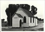
The hall is set in the centre of a large tow n lot of bare earth wit h some stands of mature trees. The building i s a small timbe r frame structure clad with flat asbestos sheet - the original weather boards having been replaced around 1 960 - with a steeply pitched gable roof on an east west axis. At the easter n end of the hall is a room under a lean-to roof. The room contains bench cupboards and a sink . At the western end of the hall is a small porch wit h a gable roof pitched to match the main gable. The interior of the main hall has jarrah boarding lining the wall s and the vaulted ceiling. The window heads are fashioned to the shape of Gothic arches as is the entrance door head on the south face of the porch. The church is thought to have been brought to Dowerin from the goldfields town of Kanowna on camel jinkers in about 1908. Postcards showing its interior and exterior ·were available i n 1910 so it arrived prior to this date. It was the first public building in Dowerin and used for a meeting place for Lodge etc. I n the early days the minister came from Goomalling on his horse which was stabled in a shad at the rea r of the church. The minister stayed in the vestry attached to the church while he held services and visited parishioners. The building was used as a kindergarten in 1930s. In 1968 the Anglican congregation bought the former Catholic Church and moved. The old St. Barnabas was used by Brownies and G i r l Guides. I n 1974 an independent committee was set up to rai se funds and a building was purchased and vested in the shire for use of the child ren of Dowerin . Since then it has been in continuous use by Brownies, Guides and later Cu bs and Scouts . Also as a baby sitting centre each yea r during the Annual Field Days. )
Assessment 1990
This information is provided voluntarily as a public service. The information provided is made available in good faith and is derived from sources believed to be reliable and accurate. However, the information is provided solely on the basis that readers will be responsible for making their own assessment of the matters discussed herein and are advised to verify all relevant representations, statements and information.
Constructed from 1909
Anderson Hall is representative of small timber buildings which once were scattered through rural areas. The conservation plan identifies this kind of building as under threat from demolition, and suggests that, today, it also has a rarity value. Historic significance may be ascribed to its long use as an Anglican Church, which reflects the social and ethnic background of many Dowerin settlers. Social significance may also be ascribed to the building as it has been maintained by a community group and is still used by local groups.
Timber clad hall which was the first church built in Dowerin and was originally a weatherboard structure. A conservation plan has already been written for this building.
This building was formerly St Barnabas' Anglican Church. Dowerin Town Lots 52 & 53 were reserved for an Anglican church on 4 September 1908. (Govt. Gazette p.2481) The building was constructed on Lot 53 by the Northam Back Blocks Mission in April/May 1909. Originally weatherboard, the timber for the church was probably precut in Northam, then railed or carted to Dowerin for assembly on site. Named St Barnabas' Church because the festival of that apostle was to occur during the following week, it was opened and consecrated by Bishop Riley, the Bishop of Perth, on the afternoon of Sunday, 6 June 1909. (The Northam Advertiser 9 June 1909) The front porch was destroyed by a 'willy willy' in 1923, but was restored during February/March 1924 through the generosity of one of the church members. (The Weekly Gazette 7 March 1924) The original weatherboards were replaced with asbestos cladding around 1960. The building did duty as a church for 58 years, the last service being held there on 11 June 1967. (The West Australian 10 June 1967, p. 11) In 1974 an independent committee was set up to raise funds and the building was purchased by the Shire for the use of the children of Dowerin. (DOLA – CT 1451/842). The building was vested in the Shire on 20 May 1975 and was administered by Trustees. It was in continuous use by Brownies, Guides, Cubs and Scouts from then until . It is also used as a baby sitting centre each year during the Annual Field Days. It was restored in the mid 1990s with weatherboard cladding and moved to Dowerin District High School where it functions as a music and drama centre and is used by local groups, notably the Wheatbelt Warblers choir.
| Ref ID No | Ref Name | Ref Source | Ref Date |
|---|---|---|---|
| by Kevin Palassis Architects; "Conservation Plan, Anderson Hall, Dowerin (former St. Barnabas' Church) prepared for the Shire of Dowerin and Anderson Hall Trustees,". | Shire of Dowerin | 1995 |
| Owner | Category |
|---|---|
| Shire of Dowerin | Local Gov't |
This information is provided voluntarily as a public service. The information provided is made available in good faith and is derived from sources believed to be reliable and accurate. However, the information is provided solely on the basis that readers will be responsible for making their own assessment of the matters discussed herein and are advised to verify all relevant representations, statements and information.
Cullimbin Nature Reserve Dowerin
Dowerin
Wheatbelt
Constructed from 1890
| Type | Status | Date | Documents |
|---|---|---|---|
| (no listings) |
| Type | Status | Date | Documents |
|---|---|---|---|
| (no listings) |
| Type | Status | Date | Grading/Management | |
|---|---|---|---|---|
| Category | ||||
| Municipal Inventory | Adopted | 19 Dec 1995 | ||
Historic site
| Epoch | General | Specific |
|---|---|---|
| Original Use | Transport\Communications | Water: Other |
| Present Use | Transport\Communications | Water: Other |
| Type | General | Specific |
|---|---|---|
| Wall | TIMBER | Other Timber |
| Roof | METAL | Corrugated Iron |
| General | Specific |
|---|---|
| OCCUPATIONS | Grazing, pastoralism & dairying |
| TRANSPORT & COMMUNICATIONS | Droving |
This information is provided voluntarily as a public service. The information provided is made available in good faith and is derived from sources believed to be reliable and accurate. However, the information is provided solely on the basis that readers will be responsible for making their own assessment of the matters discussed herein and are advised to verify all relevant representations, statements and information.
Constructed from 1890
Wells were significant sites in the Dowerin Shire before the widespread use of motor vehicles. It appears from research so far completed that Cullimbin Well on C.E.Dempster's Pastoral Lease was located near cross-roads of tracks from the north, west and south. It may have been a watering spot for people moving from Pilbara Goldfields to the Yilgarn. Although full documentary evidence of this use, and of the use to which the cleared and walled patches of ground has not yet been found, evidence from early maps point to the location as being historically significant.
Cullimbin Well is a timber lined well, now protected with a sheet metal top, surrounded by decaying railway sleepers. It was probably constructed in the early 1890s by pastoralist C.E.Dempster as part of a chain ofpermanent water supplies. The Well is alleged to be 50 feet deep (10 m) and is currently in a poor state of repair. The construction details make an interesting contrast with those noted in the Namalcatchem Well. Cullimbin Well is built in sandy soil and requires lining. The current timber lining is not believed to be original as it replaced the first bush timbers. In this reserve are three cleared patches of ground surrounded by low mud and stone walls. It is believed that these spaces and walls are contemporary with the well or were built only slightly later. There purpose is unknown.
| Ref ID No | Ref Name | Ref Source | Ref Date |
|---|---|---|---|
| Map 56/80 No. 1 501 377, | Chain Map | 11-11-1902 | |
| Map 56/80 No. 1 501 377, | Chain Map | 27-8-1907 |
| Owner | Category |
|---|---|
| WA Water Authority | State Gov't |
This information is provided voluntarily as a public service. The information provided is made available in good faith and is derived from sources believed to be reliable and accurate. However, the information is provided solely on the basis that readers will be responsible for making their own assessment of the matters discussed herein and are advised to verify all relevant representations, statements and information.
Dowerin-Koorda Rd approx 50 km out of Dowerin
No 4681
Dowerin
Wheatbelt
| Type | Status | Date | Documents |
|---|---|---|---|
| (no listings) |
| Type | Status | Date | Documents |
|---|---|---|---|
| (no listings) |
| Type | Status | Date | Grading/Management | |
|---|---|---|---|---|
| Category | ||||
| (no listings) | ||||
Historic site
| Epoch | General | Specific |
|---|---|---|
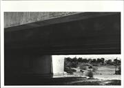
| Original Use | Transport\Communications | Road: Bridge |
| Present Use | Transport\Communications | Road: Bridge |
This information is provided voluntarily as a public service. The information provided is made available in good faith and is derived from sources believed to be reliable and accurate. However, the information is provided solely on the basis that readers will be responsible for making their own assessment of the matters discussed herein and are advised to verify all relevant representations, statements and information.
Goldfields Rd Dowerin
Tin Dog Creek
MRWA Bridge 0639
Dowerin
Wheatbelt
Constructed from 1934
| Type | Status | Date | Documents |
|---|---|---|---|
| (no listings) |
| Type | Status | Date | Documents |
|---|---|---|---|
| RHP - Does not warrant assessment | Current | 28 Aug 2015 |
| Type | Status | Date | Grading/Management | |
|---|---|---|---|---|
| Category | ||||
| (no listings) | ||||
Bridge 0639 is a timber hybrid bridge with a bitumen seal that is 81 years old. There are no archaeological sites located within close proximity of the bridge. The bridge crosses over Tin Dog Creek and is situated along Northam Cranbrook Road between the towns of York and Northam. The bridge is 12.20m in length with a deck surface area of 105.65m2. There is no asbestos in the structure of the bridge.
Individual Building or Group
| Epoch | General | Specific |
|---|---|---|
| Present Use | Transport\Communications | Road: Bridge |
| Original Use | Transport\Communications | Road: Bridge |
This information is provided voluntarily as a public service. The information provided is made available in good faith and is derived from sources believed to be reliable and accurate. However, the information is provided solely on the basis that readers will be responsible for making their own assessment of the matters discussed herein and are advised to verify all relevant representations, statements and information.
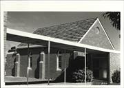
19 Goldfields Rd Dowerin
Methodist Church
Dowerin
Wheatbelt
Constructed from 1923
| Type | Status | Date | Documents |
|---|---|---|---|
| (no listings) |
| Type | Status | Date | Documents |
|---|---|---|---|
| (no listings) |
| Type | Status | Date | Grading/Management | |
|---|---|---|---|---|
| Category | ||||
| Municipal Inventory | Adopted | 19 Dec 1995 | ||
| Uniting Church Inventory | Completed | 01 Oct 1996 | ||
Individual Building or Group
| Epoch | General | Specific |
|---|---|---|
| Present Use | RELIGIOUS | Church, Cathedral or Chapel |
| Original Use | RELIGIOUS | Church, Cathedral or Chapel |
| Type | General | Specific |
|---|---|---|
| Wall | BRICK | Common Brick |
| Roof | TILE | Other Tile |
| General | Specific |
|---|---|
| SOCIAL & CIVIC ACTIVITIES | Religion |
This information is provided voluntarily as a public service. The information provided is made available in good faith and is derived from sources believed to be reliable and accurate. However, the information is provided solely on the basis that readers will be responsible for making their own assessment of the matters discussed herein and are advised to verify all relevant representations, statements and information.
Constructed from 1923
The Uniting (Methodist) Church Dowerin shares the social and historic significance that all churches built for small remote communities in the wheatbelt have. They stand as reminders that spiritual matters were not forgotten even in the hardest times. Methodism was significant in the wheatbelt. The first church in the area, built at Dowerin Lakes in 1908 was Methodist. The church was opened on 9 March 1924 and is still in use. It reflects the fact that Methodism closely followed the development of the wheatbelt. The 1920's was a decade of expansion and construction, halted only by the onset of the great depression. A new porch, vestry and hall were built in the 1950's, another decade of prosperity, optimism and expansion in Dowerin.
A simple brick building consisting of a nave, altar table, porch and vestry in good condition, the Dowerin Uniting (Methodist) Church is well built and well maintained. It forms part of a precinct as the church is linked to its hall by a covered way from the church porch. White details on this covered way picks up a decorative theme on supporting pillars and windows. The church windows are particularly fine, both in shape, which is traditional, and function. The church interior is plain. The church interior is plain. The floor is carpeted. The walls are painted There is a dropped false ceiling, presumably to deal with summer heat. A brick manse stands beside the church, adding to the pleasing design of the precinct.
This building is situated on Dowerin Town Lot 64 (Reserve 12299) However, the first Methodist Church, the earliest church in the Dowerin district, was built at 'Dowerin Lakes', sometimes referred to as 'Old Dowerin'. The Rev. A.K. Harris applied for the land on 17 July 1907 (Early church records published in The Dowerin Guardian 30 November 1929), resulting in Dowerin Agricultural Area Lot 115 being reserved for the purpose in October 1907. ('Government Gazette' 18 October 1907, p.3404) The church erected on that land is thought to have been built by April 1908. Nevertheless, in June 1909, the Methodist Church also applied for land within Dowerin townsite at the railhead. (DOLA File 5803/09) Initially Dowerin Town Lot 45 was set aside for a Methodist Church ('Government Gazette' 13 August 1909, p.2695), then in 1912 that was exchanged for Lots 22 and 23 in Stacy Street. ('Government Gazette' 2 August 1912, p.3041) In 1921 the Church applied for Lot 64 in lieu of Lots 22 and 23 and the reserve was regazetted accordingly. (Government Gazette' 26 August 1921, p.1485) The lots on either side were added to the reserve in 1923 and 1931. (DOLA File 5803/09 and 'Government Gazette' 3 August 1923, p.1433 & 27 March 1931, p.931) The movement for a brick church on Dowerin Lot 64 was apparently initiated by one of the visiting clergy, Reverend N. Hicks of Merredin, in 1922. A visit by Reverend S.J. Barclay in June 1923 is said to have 'advanced arrangements', and the arrival of a resident Methodist minister, Reverend Long, the following month would have given further impetus to the project. In late September that year, the successful tender of Mr. D.G. Carter, a building contractor from Wyalkatchem, was announced. The reason given for the long delay was the difficulty of selecting suitable plans. The new church was formally opened by visiting ministers on Sunday, 9 March 1924. (The Northam Advertiser 30 June, 14 July & 29 September 1923 and 1 March 1924)
| Ref ID No | Ref Name | Ref Source | Ref Date |
|---|---|---|---|
| Simpson AJ; "A History of Wesleyan Methodistism in Western Australia 1829-1956". |
| Owner | Category |
|---|---|
| Uniting Church in Australai | Church Property |
This information is provided voluntarily as a public service. The information provided is made available in good faith and is derived from sources believed to be reliable and accurate. However, the information is provided solely on the basis that readers will be responsible for making their own assessment of the matters discussed herein and are advised to verify all relevant representations, statements and information.
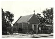
40 Goldfields Rd Dowerin
Roman Catholic Church
Dowerin
Wheatbelt
Constructed from 1939
| Type | Status | Date | Documents |
|---|---|---|---|
| (no listings) |
| Type | Status | Date | Documents |
|---|---|---|---|
| (no listings) |
| Type | Status | Date | Grading/Management | |
|---|---|---|---|---|
| Category | ||||
| Municipal Inventory | Adopted | 19 Dec 1995 | ||
| Anglican Church Inventory | YES | 31 Jul 1996 | ||
Individual Building or Group
| Epoch | General | Specific |
|---|---|---|
| Original Use | RELIGIOUS | Church, Cathedral or Chapel |
| Present Use | RELIGIOUS | Church, Cathedral or Chapel |
| Type | General | Specific |
|---|---|---|
| Wall | (none) |
| General | Specific |
|---|---|
| SOCIAL & CIVIC ACTIVITIES | Religion |
This information is provided voluntarily as a public service. The information provided is made available in good faith and is derived from sources believed to be reliable and accurate. However, the information is provided solely on the basis that readers will be responsible for making their own assessment of the matters discussed herein and are advised to verify all relevant representations, statements and information.
Constructed from 1939
St. Barnabas Church has been home to two different groups of worshippers. Built by the Roman Catholic Church, it was used by them until 1967 when the Anglican Community bought the building. As such it has social heritage value for each group.
The building is constructed from cement bricks made in the town and is a striking example of vernacular church design in a local building material. It is a small building, longer than it is wide, with a steeply pitched roof. Its design is typical of many churches in country areas.
Dowerin Town Lot 163 (Reserve 17657) was reserved as a site for a Catholic Church in 1921. ('Government Gazette' 11 February 1921, p.220) Records of the Department of Lands and Surveys indicate that the church was built by the Catholics in 1939, a statement confirmed by a local newspaper item, published in June of that year, reporting that work was 'progressing favourably with the construction of the new Roman Catholic Church'. (DOLA File 5717/08 and The Doiverm Guardian 3 June 1939 - Note: Exhaustive archival and newspaper searching has failed to reveal the identity of either the architect or the builder, or details of any opening ceremony. It may be worthwhile to consult Catholic parish records retained locally.) When the Catholics decided to build a new church in Dowerin, their old church was purchased by the Anglican community. The last service in the old St Barnabas' Anglican Church (now known as Anderson Hall) was held on 11 June 1967, and the Anglicans moved into the former Catholic Church three days later, transferring the name St Barnabas' to their new property. Bishop Rosier was present at services held there on 25 June 1967. (Central Districts Herald Tribune 8 & 22 June 1967) Earlier, the Parish Priest, Wyalkatchem, had applied to transfer the Catholic church reserve to the Anglican community at Dowerin, but it was only after considerable delay that this transfer was approved by the Department of Lands and Surveys in December 1968. The purpose of Reserve 17657 was finally changed from 'Church Site (R.C.)' to 'Church Site (C. of E.)' in April 1969, when a Crown Grant issued to the Perth Diocesan Trustees to be held in trust for an Anglican church site. (DOLA File 5717/08)
| Owner | Category |
|---|---|
| Perth Diocesan Trustees | Church Property |
This information is provided voluntarily as a public service. The information provided is made available in good faith and is derived from sources believed to be reliable and accurate. However, the information is provided solely on the basis that readers will be responsible for making their own assessment of the matters discussed herein and are advised to verify all relevant representations, statements and information.
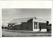
15 Government Rd Dowerin
Dowerin
Wheatbelt
Constructed from 1929
| Type | Status | Date | Documents |
|---|---|---|---|
| (no listings) |
| Type | Status | Date | Documents |
|---|---|---|---|
| (no listings) |
| Type | Status | Date | Grading/Management | |
|---|---|---|---|---|
| Category | ||||
| Municipal Inventory | Adopted | 19 Dec 1995 | ||
Individual Building or Group
| Epoch | General | Specific |
|---|---|---|
| Original Use | SOCIAL\RECREATIONAL | Masonic Hall |
| Present Use | SOCIAL\RECREATIONAL | Masonic Hall |
| Type | General | Specific |
|---|---|---|
| Roof | METAL | Corrugated Iron |
| Wall | BRICK | Common Brick |
| General | Specific |
|---|---|
| SOCIAL & CIVIC ACTIVITIES | Institutions |
This information is provided voluntarily as a public service. The information provided is made available in good faith and is derived from sources believed to be reliable and accurate. However, the information is provided solely on the basis that readers will be responsible for making their own assessment of the matters discussed herein and are advised to verify all relevant representations, statements and information.
Constructed from 1929
Opened in 1929, Dowerin Masonic Hall was one of the last halls built during the 1920's which was a decade of expansion for freemasonry in Western Australia. It is still in use. Halls are significant buildings in rural Western Australia as they are not only meeting places, but because most are constructed to satisfy a particular group in the community, they are evidence of social priorities and beliefs. Freemasonry, a male-only society, enjoyed a social significance which was enhanced by its exclusiveness and its ritual. This particular significance is probably waning, never the less the Lodge is still in use, its members working together for social and charitable ends. As such it has significant social heritage value.
Built along an east-west axis, Dowerin Masonic Lodge is equipped with a stage and a platform which follows the perimeter of the hall. The jarrah floor is carpeted with an inlaid timber design in its centre. The major architectural feature is a suspended ceiling designed to improve air-flow and acoustics. The hall's furnishings are original and some would be called 'antiques',. The hall and furnishings are well maintained.
The Dowerin Masonic Hall stands on Town Lots 16 and 17. These were originally granted to Ernest Charles Robert of Goomalling in 1910, transferred to Annie Sophia Williams of Dowerin in 1911, to Frederick Nicholas Pentreath of Dowerin in 1926, and to George Allanson (storekeeper), John Albert Maisey (farmer) and William Thomas Norris (agent and farmer), all of Dowerin, as joint tenants on 13 June 1928. (DOLA - Crown Grant 476/91 and CTs 476/91 & 926/136) Presumably these three were acting on behalf of the Dowerin Masonic Lodge as arrangements for the construction of the Masonic Hall thereon began soon afterwards. The contractor for this brick building was Mr D.G. Carter of Wyalkatchem. Construction was commenced in January 1929 and the hall was opened on Thursday 9 May 1929. (The Dowerin Guardian 26 January, 2 & 9 February and 4 Roy Alexander Richards replaced Norris as a joint tenant in 1940, and the property was vested in 'The Trustees of Dowerin Lodge No. 137' in 1958. (DOLA - CTs 926/136,1071/183 & 1967/164) May 1929)
| Ref ID No | Ref Name | Ref Source | Ref Date |
|---|---|---|---|
| Collins AR; "Golden Jubilee History 1900 - 1950". | |||
| "Grand Lodge of Western Australia of Ancient Free and Accepted Masons,". pp. 28-33 | Perth | 1950 |
| Owner | Category |
|---|---|
| Dowerin Lodge No.137 | Inc. Non-profit body |
This information is provided voluntarily as a public service. The information provided is made available in good faith and is derived from sources believed to be reliable and accurate. However, the information is provided solely on the basis that readers will be responsible for making their own assessment of the matters discussed herein and are advised to verify all relevant representations, statements and information.
17 Government Rd Dowerin
Dowerin
Wheatbelt
Constructed from 1980
| Type | Status | Date | Documents |
|---|---|---|---|
| (no listings) |
| Type | Status | Date | Documents |
|---|---|---|---|
| (no listings) |
| Type | Status | Date | Grading/Management | |
|---|---|---|---|---|
| Category | ||||
| Uniting Church Inventory | Completed | 01 Oct 1996 | ||
Individual Building or Group
| Epoch | General | Specific |
|---|---|---|
| Present Use | RELIGIOUS | Housing or Quarters |
| Original Use | RELIGIOUS | Housing or Quarters |
| Type | General | Specific |
|---|---|---|
| Wall | BRICK | Common Brick |
| Roof | TILE | Ceramic Tile |
| General | Specific |
|---|---|
| SOCIAL & CIVIC ACTIVITIES | Religion |
This information is provided voluntarily as a public service. The information provided is made available in good faith and is derived from sources believed to be reliable and accurate. However, the information is provided solely on the basis that readers will be responsible for making their own assessment of the matters discussed herein and are advised to verify all relevant representations, statements and information.
46 Government Rd Dowerin
Dowerin
Wheatbelt
Constructed from 1962
| Type | Status | Date | Documents |
|---|---|---|---|
| (no listings) |
| Type | Status | Date | Documents |
|---|---|---|---|
| (no listings) |
| Type | Status | Date | Grading/Management | |
|---|---|---|---|---|
| Category | ||||
| Catholic Church Inventory | Adopted | 01 Jul 1998 | ||
good
Individual Building or Group
| Epoch | General | Specific |
|---|---|---|
| Original Use | EDUCATIONAL | Combined School |
| Present Use | RELIGIOUS | Church, Cathedral or Chapel |
| Type | General | Specific |
|---|---|---|
| Roof | TILE | Ceramic Tile |
| Wall | BRICK | Common Brick |
| General | Specific |
|---|---|
| SOCIAL & CIVIC ACTIVITIES | Law & order |
This information is provided voluntarily as a public service. The information provided is made available in good faith and is derived from sources believed to be reliable and accurate. However, the information is provided solely on the basis that readers will be responsible for making their own assessment of the matters discussed herein and are advised to verify all relevant representations, statements and information.
Cnr Government Rd & Cottrell St Dowerin
Dowerin
Wheatbelt
| Type | Status | Date | Documents |
|---|---|---|---|
| (no listings) |
| Type | Status | Date | Documents |
|---|---|---|---|
| (no listings) |
| Type | Status | Date | Grading/Management | |
|---|---|---|---|---|
| Category | ||||
| Statewide War Memorial Survey | Completed | 01 May 1996 | ||
| Municipal Inventory | Adopted | 19 Dec 1995 | ||
Historic site
| Epoch | General | Specific |
|---|---|---|
| Present Use | MONUMENT\CEMETERY | Monument |
| Original Use | MONUMENT\CEMETERY | Monument |
| Type | General | Specific |
|---|---|---|
| Other | CONCRETE | Concrete Block |
| Other | STONE | Marble |
| General | Specific |
|---|---|
| OUTSIDE INFLUENCES | World Wars & other wars |
This information is provided voluntarily as a public service. The information provided is made available in good faith and is derived from sources believed to be reliable and accurate. However, the information is provided solely on the basis that readers will be responsible for making their own assessment of the matters discussed herein and are advised to verify all relevant representations, statements and information.
Each of the World Wars affected Dowerin in a number of ways and the memorials to the men who enlisted are worthy reminders of the fact that Dowerin, too, felt the pull of world events. These memorials have significant social heritage values. The number of young men whose names appear on them is surprisingly high, especially for the First World War. The First World War shield, now hanging in Minnivale Hall has significant aesthetic value (see photograph). The carving is particularly fine.
Dowerin War Memorial is a small obelisk with the names of more than 80 soldiers around the base. Minnivale Memorials are 2 wooden shields of which that for the First World War is magnificently carved and has names on metal plates. The Second World War shield is plainer - names have been inscribed in gold lettering. The shields were originally housed in the Minnivale Hall, but after its demolition the shields were removed to the Minnivale church where they are displayed on the back wall.
The Dowerin War Memorial was unveiled on ANZAC Day 1936 by Mr. Latham M.L.A. who gave a brief address. Rev. Arblaster, the local Anglican priest, officiated. The Dowerin sub-branch of the R.S.L. worked to ensure its construction.
The plaques listing the names of the fallen were originally marble but has been replaced by brass plaques.
This information is provided voluntarily as a public service. The information provided is made available in good faith and is derived from sources believed to be reliable and accurate. However, the information is provided solely on the basis that readers will be responsible for making their own assessment of the matters discussed herein and are advised to verify all relevant representations, statements and information.
Hindmarsh Back Rd Dowerin
Rabbit Proof Fence No. 2 runs through the Shire from just south of Gate 26 on Hindmarsh Back Road, north to Cadoux Pump. Beside the fence is the Pipeline.
Dowerin
Wheatbelt
| Type | Status | Date | Documents |
|---|---|---|---|
| (no listings) |
| Type | Status | Date | Documents |
|---|---|---|---|
| RHP - Does not warrant assessment | Current | 25 Nov 2005 |
| Type | Status | Date | Grading/Management | |
|---|---|---|---|---|
| Category | ||||
| Municipal Inventory | Adopted | 19 Dec 1995 | ||
05022 Rabbit Proof Fence No 2 and No 3
Other Built Type
| Epoch | General | Specific |
|---|---|---|
| Original Use | GOVERNMENTAL | Other |
| Present Use | GOVERNMENTAL | Other |
| Type | General | Specific |
|---|---|---|
| Other | METAL | Other Metal |
| General | Specific |
|---|---|
| SOCIAL & CIVIC ACTIVITIES | Government & politics |
This information is provided voluntarily as a public service. The information provided is made available in good faith and is derived from sources believed to be reliable and accurate. However, the information is provided solely on the basis that readers will be responsible for making their own assessment of the matters discussed herein and are advised to verify all relevant representations, statements and information.
Constructed from 1908, Constructed from 1907
Rabbit Proof Fence No. 2 originally went from Point Anne to north of Cue where it turned east to join Rabbit Proof Fence No. 1 at Gum Creek, but not all of it remains in place. It is one of three long fences in the state designed to control the rabbit plague which could wreak enormous havoc in agricultural areas. The fences failed in their purpose although much time and money was expended to make them work. They stand as a monument to human intention to control a pest which was a national problem. The fence No. 2 has historic and scientific heritage values, as it indicates the widely held fear of the rabbit invasion and the limited and desperate ideas used to control the pest.
The Rabbit Proof Fence No. 2 runs north/south through the eastern third of the shire. Built 1907 - 1908 much of the fence remains in good condition. Original gates may no longer exist but are recalled in names on the various roads. Mileposts mark distance from the south coast.
| Ref ID No | Ref Name | Ref Source | Ref Date |
|---|---|---|---|
| Broomehall Fh; "The longest Fence in the world: a history of the No. 1 Rabbit Proof Fence from its beginning until recent times.". | Carlisle, WA | 1991 |
| Owner | Category |
|---|---|
| Various | UNKNOWN |
| WA Water Authority | State Gov't |
This information is provided voluntarily as a public service. The information provided is made available in good faith and is derived from sources believed to be reliable and accurate. However, the information is provided solely on the basis that readers will be responsible for making their own assessment of the matters discussed herein and are advised to verify all relevant representations, statements and information.
McKinnon Rd Dowerin
Dowerin
Wheatbelt
Constructed from 1900
| Type | Status | Date | Documents |
|---|---|---|---|
| (no listings) |
| Type | Status | Date | Documents |
|---|---|---|---|
| (no listings) |
| Type | Status | Date | Grading/Management | |
|---|---|---|---|---|
| Category | ||||
| Municipal Inventory | Adopted | 19 Dec 1995 | ||
Individual Building or Group
| Epoch | General | Specific |
|---|---|---|
| Original Use | RESIDENTIAL | Single storey residence |
| Present Use | VACANT\UNUSED | Vacant\Unused |
| Type | General | Specific |
|---|---|---|
| Wall | TIMBER | Weatherboard |
| Wall | BRICK | Handmade Brick |
| Wall | EARTH | Adobe {Mud Brick} |
| Roof | METAL | Corrugated Iron |
| General | Specific |
|---|---|
| PEOPLE | Early settlers |
This information is provided voluntarily as a public service. The information provided is made available in good faith and is derived from sources believed to be reliable and accurate. However, the information is provided solely on the basis that readers will be responsible for making their own assessment of the matters discussed herein and are advised to verify all relevant representations, statements and information.
Constructed from 1900
The Fraser house and tree have considerable historic significance as the structure shows building materials used at various times in the wheatbelt, ideas of space and utility then current, and an appreciation of landscape as the house was located to have a fine outlook over a lake. Interpretation of the fabric of this cottage would be useful to those people interested in the development of the wheatbelt as the cottage grew in stages which presumably coincided with family size and increasing prosperity. Even as it stands, in a semi-ruined state, the Fraser property is redolent of the past.
The house he built is in a poor state of repair. The most remarkable thing about it is the number of building materials utilised He began with a mud brick construction (the bricks presumably were made on the property), moved to weatherboard, and completed the house with a kiln baked brick extension. The house faced a lake, trees were planted for shade and a verandah, now lost, was erected along the front. It is an example of vernacular architecture which shows change and development.
William Fraser arrived in Dowerin Shire in 1898 taking up a heavily timbered block of land which was well watered He marked one tree with a blaze in order to find his way to his property and this tree remains.
This information is provided voluntarily as a public service. The information provided is made available in good faith and is derived from sources believed to be reliable and accurate. However, the information is provided solely on the basis that readers will be responsible for making their own assessment of the matters discussed herein and are advised to verify all relevant representations, statements and information.
Memorial Av Dowerin
Dowerin
Wheatbelt
Constructed from 1968
| Type | Status | Date | Documents |
|---|---|---|---|
| (no listings) |
| Type | Status | Date | Documents |
|---|---|---|---|
| (no listings) |
| Type | Status | Date | Grading/Management | |
|---|---|---|---|---|
| Category | ||||
| Statewide War Memorial Survey | Adopted | 01 May 1996 | ||
sound
Other Built Type
| Epoch | General | Specific |
|---|---|---|
| SOCIAL\RECREATIONAL | Other Sports Building | |
| MONUMENT\CEMETERY | Monument |
This information is provided voluntarily as a public service. The information provided is made available in good faith and is derived from sources believed to be reliable and accurate. However, the information is provided solely on the basis that readers will be responsible for making their own assessment of the matters discussed herein and are advised to verify all relevant representations, statements and information.
This information is provided voluntarily as a public service. The information provided is made available in good faith and is derived from sources believed to be reliable and accurate. However, the information is provided solely on the basis that readers will be responsible for making their own assessment of the matters discussed herein and are advised to verify all relevant representations, statements and information.
Stacy St & Government Rd Dowerin
Dowerin Police Station
Dowerin
Wheatbelt
Constructed from 1971
| Type | Status | Date | Documents |
|---|---|---|---|
| (no listings) |
| Type | Status | Date | Documents |
|---|---|---|---|
| RHP - Does not warrant assessment | Current | 28 Sep 2012 |
| Type | Status | Date | Grading/Management | |
|---|---|---|---|---|
| Category | ||||
| (no listings) | ||||
Good
Individual Building or Group
| Epoch | General | Specific |
|---|---|---|
| Other Use | GOVERNMENTAL | Police Station or Quarters |
| Style |
|---|
| Late 20th-Century Perth Regional |
| Type | General | Specific |
|---|---|---|
| Roof | TILE | Terracotta Tile |
| Wall | BRICK | Rendered Brick |
| General | Specific |
|---|---|
| SOCIAL & CIVIC ACTIVITIES | Law & order |
This information is provided voluntarily as a public service. The information provided is made available in good faith and is derived from sources believed to be reliable and accurate. However, the information is provided solely on the basis that readers will be responsible for making their own assessment of the matters discussed herein and are advised to verify all relevant representations, statements and information.
Stewart St Dowerin
Northern side of Stewart Street
Dowerin
Wheatbelt
| Type | Status | Date | Documents |
|---|---|---|---|
| (no listings) |
| Type | Status | Date | Documents |
|---|---|---|---|
| (no listings) |
| Type | Status | Date | Grading/Management | |
|---|---|---|---|---|
| Category | ||||
| Municipal Inventory | Adopted | 19 Dec 1995 | ||
Stewart Street - underwent redevelopment, officially re-opened August 1999 with a completely new streetscape.
Precinct or Streetscape
| Epoch | General | Specific |
|---|---|---|
| Original Use | COMMERCIAL | Other |
| Present Use | COMMERCIAL | Other |
| General | Specific |
|---|---|
| OCCUPATIONS | Commercial & service industries |
| SOCIAL & CIVIC ACTIVITIES | Community services & utilities |
This information is provided voluntarily as a public service. The information provided is made available in good faith and is derived from sources believed to be reliable and accurate. However, the information is provided solely on the basis that readers will be responsible for making their own assessment of the matters discussed herein and are advised to verify all relevant representations, statements and information.
The Stewart Street townscape is a reminder of the first enthusiastic development of the wheatbelt. Dominated by the Commercial Hotel, the line of buildings on either side of the pub indicate a small town which has a continuous history. Many businesses remain in their original buildings eg. the banks and the post office and hotel. Other sites have changed uses and new tenants but remain in use. As such the townscape has both social and historical heritage value.
Dowerin townsite was proclaimed in 1907 and many of the buildings along Stewart Street were constructed in the next seven years. Most of these buildings are still in use - there are few empty shops or frontages in Stewart Street. Alterations have been made from time to time, bull-nosed verandahs have gone, but much of the building stock reflects its origins. There are few modern buildings and so the townscape retains style and character which can be related to the first period of expansion into the wheatbelt. Bricks, tin roofs, modest decorative features around windows and doors help produce a coherent and pleasing townscape. Weatherboard structures often have brick facades to fit into the streeetscape.
| Owner | Category |
|---|---|
| Various | UNKNOWN |
This information is provided voluntarily as a public service. The information provided is made available in good faith and is derived from sources believed to be reliable and accurate. However, the information is provided solely on the basis that readers will be responsible for making their own assessment of the matters discussed herein and are advised to verify all relevant representations, statements and information.

13 Stewart St Dowerin
Dowerin Community Resource Centre
Westpac Bank
Dowerin
Wheatbelt
Constructed from 1910 to 1911
| Type | Status | Date | Documents |
|---|---|---|---|
| (no listings) |
| Type | Status | Date | Documents |
|---|---|---|---|
| (no listings) |
| Type | Status | Date | Grading/Management | |
|---|---|---|---|---|
| Category | ||||
| Statewide Bank Survey | Completed | 01 Nov 1997 | ||
| Municipal Inventory | Adopted | 19 Dec 1995 | ||
Individual Building or Group
| Epoch | General | Specific |
|---|---|---|
| Other Use | COMMERCIAL | Bank |
| Original Use | COMMERCIAL | Bank |
| Present Use | SOCIAL\RECREATIONAL | Other Community Hall\Centre |
| Style |
|---|
| Federation Free Style |
| Type | General | Specific |
|---|---|---|
| Wall | BRICK | Common Brick |
| Roof | METAL | Corrugated Iron |
| General | Specific |
|---|---|
| OCCUPATIONS | Commercial & service industries |
This information is provided voluntarily as a public service. The information provided is made available in good faith and is derived from sources believed to be reliable and accurate. However, the information is provided solely on the basis that readers will be responsible for making their own assessment of the matters discussed herein and are advised to verify all relevant representations, statements and information.
Constructed from 1911, Constructed from 1910
The fact that Dowerin has two banks, of which Westpac is one, reflects the prosperous nature of the town and surroundings district. Built in 1910 - 1911, the brick building reflects a financial faith in the future of this particular part of the wheatbelt, thus it has both historic and social heritage values.
The bank originally had quarters attached to the office and the bank manager lived on site until the 1990s. Alterations have been made on more than one occasion to the interior and all rooms are now being used as part of the Community Resource Centre. The exterior remains largely unchanged and especially the facade on Stewart Street adds strength and character to the streetscape.
Gazetted as Open for Sale at an upset price of £32-0-0 on 12 June 1908, Dowerin Town Lot 42 was apparently purchased by Albert James Bower Bailey at auction at the Northam Land Agent's office on 10 September 1908, since the Crown Grant, dated 17 August 1909, is made out in his name. However, the Certificate of Title shows that this block was transferred to the Commercial Bank of Australia Ltd. on 24 June 1909. ('Government Gazette' 12 June 1908, p.1598 & 14 August 1908, p.2307 and DOLA - CG 447/71 & CT 447/71) Dowerin residents had a hard battle to induce banking institutions to open branches in their town, but both the Commercial and National banks advertised their branches open for business in June 1909. (The Northam Advertiser 9 & 23 June 1909) The Dowerin branch of the Commercial Bank first occupied a three roomed weatherboard building. During the latter half of 1910, N. Peterson of Subiaco won the contract to erect new brick offices for the bank and commenced work in October of that year. Bank officers moved into their new premises at the end of February 1911. (The Northam Advertiser 12 October 1910, p.2 and Goomalling-Dowerin Mail 3 March 1911, p.2) Postal Directories through to 1949 list branch managers of the Commercial Bank at Dowerin as E.A. Brown 1909-10, J.C. Martin 1911-1917, F.J.F. Atkins 1918-1925, A.G. Thorn 1926-1934/35, Reginald Turner 1935/36-1937/38, and Thomas G, Parker 1938/39-1949.
| Ref ID No | Ref Name | Ref Source | Ref Date |
|---|---|---|---|
| Wood RJ; "The Commercial Bank of Australia Ltd: a history of an Australian institution 1866 - 1981.". | Melbourne | 1900 |
| Owner | Category |
|---|---|
| Westpac Bank | Other Private |
This information is provided voluntarily as a public service. The information provided is made available in good faith and is derived from sources believed to be reliable and accurate. However, the information is provided solely on the basis that readers will be responsible for making their own assessment of the matters discussed herein and are advised to verify all relevant representations, statements and information.

15 Stewart St Dowerin
Dowerin
Wheatbelt
Constructed from 1913
| Type | Status | Date | Documents |
|---|---|---|---|
| (no listings) |
| Type | Status | Date | Documents |
|---|---|---|---|
| RHP - Assessed - Below Threshold | Current | 22 Nov 1996 |
| Type | Status | Date | Grading/Management | |
|---|---|---|---|---|
| Category | ||||
| Municipal Inventory | Adopted | 19 Dec 1995 | ||
| Statewide Post Office Survey | Completed | 01 Mar 1992 | ||
| Name | Type | Year From | Year To |
|---|---|---|---|
| Hilton Beasley | Architect | - | - |
Individual Building or Group
| Epoch | General | Specific |
|---|---|---|
| Present Use | Transport\Communications | Comms: Post or Telegraph Office |
| Original Use | Transport\Communications | Comms: Post or Telegraph Office |
| Type | General | Specific |
|---|---|---|
| Roof | TILE | Other Tile |
| Wall | BRICK | Common Brick |
| General | Specific |
|---|---|
| TRANSPORT & COMMUNICATIONS | Telecommunications |
This information is provided voluntarily as a public service. The information provided is made available in good faith and is derived from sources believed to be reliable and accurate. However, the information is provided solely on the basis that readers will be responsible for making their own assessment of the matters discussed herein and are advised to verify all relevant representations, statements and information.
Constructed from 1913
It is hard to over-state the significance of a reliable system of communications which is represented by the Post Office. Built in 1913 and still in use, Dowerin Post Office has played an essential part in the development of the Shire by allowing residents to keep in touch with the wider world.
A brick Post Office building which was modernised in the 1980's, the exterior shows little evidence of structural change. The post boxes and the public telephone have been moved but the walls, doors and roof appear to be original. The original counter is in situ although a laminex top has been fitted over the top surface.
Dowerin Town Lots 39 and 40 were reserved from sale by the State Government until 1911 when they were offered to the Commonwealth as a Post Office site. (DOLA - File 12219/06) A non-official receiving office for mail had first been designated in the locality in September 1906 during the construction of the railway out to Dowerin. A year later, after Dowerin townsite had been laid out and gazetted, the non-official office was re-designated as an Allowance Office. ('The Post, Telegraph & Telephone Offices of Western Australia - An Alphabetical List' compiled by George E. Owen, 1958) A 1909 report indicates that the office consisted of a few pigeon holes in one corner of a fruit and vegetable shop, a telephone on the wall and a letterbox outside on the corner post. (The Northam Advertiser 5 June 1909) The office was upgraded to Semi-Official from July 1910 (Owen), with business conducted by Semi-Official Postmaster James Gordon Holroyd in a large barn-like structure rented from Port, Honey & Co. Ltd. (Aust. Archives - Kl, Item 849/13 and The Goomalling-Dowerin Mail 31 December 1912), but this did little to mollify aggrieved residents. By March 1911 agitation within the town had succeeded in getting £1,600 for a proper Post Office at Dowerin placed on the estimates for the 1911-12 financial year. By August preliminary plans had been prepared, and by November the purchase of Lots 39 and 40 for £100 each had been approved by the Executive Council. (Aust. Archives - P0359/1, Item 1911/4) Early in 1912, details of this progress were relayed to the Secretary of the local Progress Association through the Federal Member for the district, Sir John Forrest, with the assurance that construction would commence immediately. (The Goomalling-Dowerin Mail 23 January 1912) Such was not the case, however, and it wasn't until May that the purchase of land was finalised (DOLA - CG 519/139) and tenders invited for PWD Contract No. 4643, erection of Dowerin Post Office. ('Government Gazette' 24 May 1912, p.1922 & 21 June 1912, p.2291 and The Goomalling-Dowerin Mail 13 February, 21 May, 11 June & 5 July 1912) Local dissatisfaction increased when it was learned that there had been no response from builders because the advertised contract specified peculiar moulded bricks and carried so many provisions and conditions that no contractor would even consider it. (The Goomalling-Dowerin Mail 20 August, 11 & 29 October & 31 December 1912) The rented premises were designated an Official Office from 1 July 1912. (Owen) From the surviving evidence, it would appear that the original plans were eventually scrapped as unworkable. An architectural plan of the present building, signed by Hilton Beasley, Chief Architect, is dated 20 March 1913 (Aust. Archives -PP668/1, WA 16425), and tenders were called for PWD Contract No. 4879, erection of Dowerin Post Office, the same day. ('Government Gazette' 20 March 1913, p.1415 and The Goomalling-Dowerin Mail 8 April 1913) A tender of £1,476-10-0 was accepted from John G. Fettes of East Perth in May ('Government Gazette' 9 May 1913, p. 1763), and an immediate start was made seventeen months after it had been promised. By the erid of June the roof was on, and a new postmaster, Mr J.F. Wall, arrived in Dowerin with his wife and family in mid July. (The Goomalling-Dowerin Mail 13 & 24 June & 22 July 1913) The new building was completed on 12 September and the keys were handed over to the postmaster for him to take formal possession of the building on 17 September. (Aust. Archives -Kl, Item 849/13) Postmasters listed in Postal Directories to 1949 are Miss Rothwell (acting) 1917, H.E. Tombs 1918, D. Masters 1920-1925, A. Tonkin 1926-1934/35, Percy H. Bower 1935/36-1938/39 (when Bower was transferred in October 1938, the local paper stated that he had been resident in Dowerin for six years), A. Gray 1939/40-1944, and E.W. Alp 1945-1949.
| Name | Type | Year From | Year To |
|---|---|---|---|
| Hilson Beasley | Architect | 1913 | - |
| Ref ID No | Ref Name | Ref Source | Ref Date |
|---|---|---|---|
| Owen GE; "The Postal History of Western Australia, 1829 - 1901,". | Melbourne | 1959 |
This information is provided voluntarily as a public service. The information provided is made available in good faith and is derived from sources believed to be reliable and accurate. However, the information is provided solely on the basis that readers will be responsible for making their own assessment of the matters discussed herein and are advised to verify all relevant representations, statements and information.
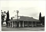
20-21 Stewart St Dowerin
Cnr Memorial Av
Dowerin Hairdressing Salon
Kindergarten
Pre-Primary Centre
Dowerin
Wheatbelt
Constructed from 1924
| Type | Status | Date | Documents |
|---|---|---|---|
| (no listings) |
| Type | Status | Date | Documents |
|---|---|---|---|
| (no listings) |
| Type | Status | Date | Grading/Management | |
|---|---|---|---|---|
| Category | ||||
| Municipal Inventory | Adopted | 19 Dec 1995 | ||
| Name | Type | Year From | Year To |
|---|---|---|---|
| W G Pickering | Architect | - | - |
Individual Building or Group
| Epoch | General | Specific |
|---|---|---|
| Present Use | COMMERCIAL | Shop\Retail Store {single} |
| Other Use | EDUCATIONAL | Pre-primary Centre |
| Original Use | GOVERNMENTAL | Office or Administration Bldg |
| Type | General | Specific |
|---|---|---|
| Wall | BRICK | Common Brick |
| Roof | TILE | Other Tile |
| General | Specific |
|---|---|
| SOCIAL & CIVIC ACTIVITIES | Community services & utilities |
This information is provided voluntarily as a public service. The information provided is made available in good faith and is derived from sources believed to be reliable and accurate. However, the information is provided solely on the basis that readers will be responsible for making their own assessment of the matters discussed herein and are advised to verify all relevant representations, statements and information.
Constructed from 1924
Built in 1924 and used for 44 years by the Road Board, now in use as a kindergarten, this building has both social and historical significance. The Road Board's influence in the development of the Shire's infrastructure and amenities was considerable. The membership was elected The building was designed by an architect who was also a farmer and later a Country Party Politician, W.G. Pickering, (see enclosure) The design is aesthetically pleasing as the shape of the building, and its wide verandah are both individual and original compared to other buildings nearby, but do not disturb the overall streetscape in any intrusive way.
The Dowerin Hairdressing Salon, formerly the Dowerin Kindergarten, and originally the Dowerin Road Board Office, has three main rooms, each with a high ceiling (over 12 ft), and one small side room with a cement floor, believed to have been the safe. The roof is tiled, finials. There was a large fireplace, now blocked up, and there is a chimney still, giving the roof line added character. The building is shaded by a wide and distinctive verandah. The whole is in a good state of repair.
The kindergarten situated on Dowerin Town Lot 88 was originally built as the first Road Board Office. After the split from Goomalling, the first Dowerin Road Board elections were held on 10 April 1912 and for many years the board met at various centres within the district. In 1918 Dowerin Lot 103 was requested as an office site by the board and this was set aside as Reserve 17203 - Road Board Office Site the following year. (DOLA - File 2772/18 and 'Government Gazette' 11 April 1919, p.775) Plans prepared by architect VV.G. Pickering of Perth were approved by the board in August 1919. However, when it was moved that tenders be called, several members opposed the erection of the building at Dowerin which apparently caused the project to be abandoned at that time. (C.F. Fraser Dowerin 1897-1929 Dowerin Road Board 1929, p.25) Nevertheless, those who favoured Dowerin as the Road Board centre persevered. In 1922, after a proposal to erect offices attached to the Dowerin Agricultural Hall had been allowed to drop, the secretary was instructed to procure plans for a brick office and residence to be erected on Dowerin Lot 37. (Fraser p.50) However, once again the scheme was abandoned. Finally, in 1923, it was decided to purchase Lots 88, 101 and 102 from John Albert Kenny for £500. (Fraser p.52 and DOLA - CT 562/144) These blocks already had old buildings erected on them that could be utilised as a storeroom, caretaker's quarters and stables, and surrounded the Office Site Reserve, Lot 103, which had become the board's storage site. W.G. Pickering was again requested to submit draft designs, this time for a building on Lot 88. The Building Committee made a selection from Pickering's sketches in December 1923, and the final plans and specifications were approved at a Board meeting on 9 February 1924. This meeting also approved a loan to raise £1,300 for the erection and furnishing of the building. (Fraser p.52 and The Northam Advertiser 17 November 1923 & 16 February 1924) The Public Works Department agreed to make a special grant of £200 towards the cost of erection and subsequent Road Board meetings authorised tenders to remove the timber and iron building then standing on Lot 88 and discussed details with several firms submitting tenders to construct the new building. (The Northam Advertiser 8 March 1924) A report of the Dowerin Road Board meeting of 14 June indicates that five tenders were received for the erection and furnishing of the office and Board room, the costs ranging from £845 to £1,440, and that it was agreed to accept the lowest tender, that of Mr Knox of Perth. (The Northam Advertiser 21 June 1924) However, a history published by the Board states that a special meeting was held a week later at which it was decided to accept the tender of Mr Browne at a cost of £1,055. When the contract was signed on 3 July, the contractor agreed to a reduction in his price of £10. (Fraser p.53) Note: Confusion over the identity of the contractor may be resolved by a search of the Dowerin Road Board Minute Books (1912-1941). These were deposited in WA Archives in November 1960 (AN 115, Acc. No. 966, Vols. 1-16), but were returned to the Shire of Dowerin in August 1971. During the course of construction a local reporter described the building, consisting of a board room, office and ante-room, as very substantial, and though severe in outline, very artistic. (The Northam Advertiser 6 September 1924) The new office was formally opened by the Minister for Works, Alex McCallum, on Friday, 31 October 1924. Other dignitaries present that day included Vernon Hamersley MLC, Thomas Heron MLA, C.P. Wansbrough MLA and John Lindsay MLA, the member for the district. Afternoon tea was served in the Board Room and a banquet was held in the evening. (The Northam Advertiser 8 November 1924) These offices were used by the Dowerin Road Board and, later, the Dowerin Shire Council for a period of 44 years. By 1966 the increase in staff necessitated by population growth and additional administrative responsibilities, meant that the old building no longer had adequate space. (Central Districts Herald Tribune 10 November 1966, p.l) Plans were ordered for a new administrative building which was opened in April 1968. During Council's first meeting there, permission was granted for the girl guides and brownies to use the front rooms of the old offices (Central Districts Herald Tribune 2 May 1968, p.9 & 6 June 1968, p.12) Since then it has become the Dowerin kindergarten.
| Name | Type | Year From | Year To |
|---|---|---|---|
| VV.G. Pickering | Architect | 1924 | - |
| Ref ID No | Ref Name | Ref Source | Ref Date |
|---|---|---|---|
| "Newspaper Article". | The Northam Advertiser | 17/11/1923 | |
| "Newspaper Article". | The Northam Advertiser | 16/02/1924 | |
| Fraser CF; "Dowerin 1897 - 1929". p.52 | Dowerin Road Board, | 1929 |
| Owner | Category |
|---|---|
| Shire of Dowerin | Local Gov't |
This information is provided voluntarily as a public service. The information provided is made available in good faith and is derived from sources believed to be reliable and accurate. However, the information is provided solely on the basis that readers will be responsible for making their own assessment of the matters discussed herein and are advised to verify all relevant representations, statements and information.
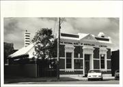
3 Stewart St Dowerin
Dowerin
Wheatbelt
Constructed from 1909
| Type | Status | Date | Documents |
|---|---|---|---|
| (no listings) |
| Type | Status | Date | Documents |
|---|---|---|---|
| (no listings) |
| Type | Status | Date | Grading/Management | |
|---|---|---|---|---|
| Category | ||||
| Statewide Bank Survey | Completed | 01 Nov 1997 | ||
| Municipal Inventory | Adopted | 19 Dec 1995 | ||
Individual Building or Group
| Epoch | General | Specific |
|---|---|---|
| Present Use | COMMERCIAL | Bank |
| Original Use | COMMERCIAL | Bank |
| Style |
|---|
| Federation Free Classical |
| Type | General | Specific |
|---|---|---|
| Roof | METAL | Corrugated Iron |
| Wall | BRICK | Common Brick |
| General | Specific |
|---|---|
| OCCUPATIONS | Commercial & service industries |
This information is provided voluntarily as a public service. The information provided is made available in good faith and is derived from sources believed to be reliable and accurate. However, the information is provided solely on the basis that readers will be responsible for making their own assessment of the matters discussed herein and are advised to verify all relevant representations, statements and information.
Constructed from 1909
Banks in rural Australia have historically been very important institutions. Assessments made of the financial potential of the wheatbelt, and the viability of individual customers have spelled life or death to people and places. In Dowerin the judgements have been favourable and the bank continues in business. Its continued presence since 1909 is thus historically significant in the development of the shire. The building moreover has aesthetic value as it has been sympathetically maintained and extended It adds considerably to the townscape of Stewart Street.
The National Bank facade on Stewart Street appears to be original, such changes as have been made to the quarters behind are obscured by the front. The facade with its neat symmetry and decoration adds an element of Edwardian style to Dowerin's Main Street.
Dowerin Town Lot 3 was originally granted to Edwin Joseph Lawliss of Goomalling in July 1908. A small strip along the northern boundary was purchased by Devlin and Rogalasky, owners of the Commercial Hotel, in December 1908, and the remaining portion of the block by the National Bank of Australasia Ltd. in October 1909. (DOLA - CG 425/16, CT 425/16 & CT 436/31) Dowerin residents had a hard battle to induce banking institutions to open branches in their town, but both the Commercial and National banks advertised their branches open for business in June 1909. (The Northam Advertiser 9 & 23 June 1909) Rented premises would have been utilised initially. Work on the construction of new offices for the National Bank in Dowerin commenced in October 1910 and the building was completed early the following year. The contractor was McGrath and the design may have been a standard one for country branches of the National Bank as the street facade closely resembles the original Goomalling office (cnr of Railway Terrace and Hoddy Street) built a few years earlier. The Dowerin building was officially opened on 18 January 1911 in the presence of Perth manager, J.F. Mullen, Inspector of Branches, Mr Strickland, Northam manager, J. Anderson, and a large and representative gathering. Refreshments were served at the Commercial Hotel next door. (The Northam Advertiser 8 October 1910, p.3 & Goomalling-Dowerin Mail 24 January 1911, p.2) Postal Directories through to 1949 list branch managers of the National Bank at Dowerin as R.A. Hughes 1909-1910, E.A. Moseley 1911-1914 (he was actually transferred to Kellerberrin in November 1913 - The Goomalling-Dowerin Mail 18 November 1913), J.E.A. Stuart 1915-1916, Thomas Horswill 1917, W.H. Stevenson 1918-1919, W.H.L. Campbell 1920-1922, E.L. Seymour 1923-1927, F.J. Blood 1928- 1933/34, M.C. Murrie 1934/35-1937/38, W.R. Petticrew 1938/39-1940/41, A.J. Simond 1941/42-1944, C.B. Thomas 1945, and A.H. Ralph 1946-1949. Early in 1929, National Bank staff moved temporarily into premises belonging to George Allanson. This was to facilitate extensive alterations and additions to the bank's offices by local contractor, W.H. Roberts. Reports indicate that much of the old residential part of the building was pulled down at this time. The renovations were completed in August 1929. (The Dowerin Guardian 12 & 26 January, 2 February & 3 August 1929) Dowerin residents had a hard battle to induce banking institutions to open branches in their town, but both the Commercial and National banks advertised their branches open for business in June 1909. (The Northam Advertiser 9 & 23 June 1909) Rented premises would have been utilised initially. Work on the construction of new offices for the National Bank in Dowerin commenced in October 1910 and the building was completed early the following year. The contractor was Mc Grath and the design may have been a standard one for country branches of the National Bank as the street facade closely resembles the original Goomalling office (cnr of Railway Terrace and Hoddy Street) built a few years earlier. The Dowerin building was officially opened on 18 January 1911 in the presence of Perth manager, J.F. Mullen, Inspector of Branches, Mr Strickland, Northam manager, J. Anderson, and a large and representative gathering. Refreshments were served at the Commercial Hotel next door. (The Northam Advertiser 8 October 1910, p.3 & Goomalling-Dowerin Mail 24 January 1911, p.2) Postal Directories through to 1949 list branch managers of the National Bank at Dowerin as R.A. Hughes 1909-1910, E.A. Moseley 1911-1914 (he was actually transferred to Kellerberrin in November 1913 - The Goomalling-Dowerin Mail 18 November 1913 - although he is listed on the Dowerin War Memorial), J.E.A. Stuart 1915-1916, Thomas Horswill 1917, W.H. Stevenson 1918-1919, W.H.L. Campbell 1920-1922, E.L. Seymour 1923-1927, F.J. Blood 1928-1933/34, M.C. Murrie 1934/35-1937/38, W.R. Petticrew 1938/39-1940/41, A.J. Simond 1941/42-1944, C.B. Thomas 1945, and A.H. Ralph 1946-1949. Early in 1929, National Bank staff moved temporarily into premises belonging to George Allanson. This was to facilitate extensive alterations and additions to the bank's offices by local contractor, W.H. Roberts. Reports indicate that much of the old residential part of the building was pulled down at this time. The renovations were completed in August 1929. (The Dowerin Guardian 12 & 26 January, 2 February & 3 August 1929)
| Ref ID No | Ref Name | Ref Source | Ref Date |
|---|---|---|---|
| Blainey G; "Gold and paper 1858 - 1982: a history of the National Bank of Australasia Ltd,". | Melbourne | 1983 |
| Owner | Category |
|---|---|
| National Bank Australia | Other Private |
This information is provided voluntarily as a public service. The information provided is made available in good faith and is derived from sources believed to be reliable and accurate. However, the information is provided solely on the basis that readers will be responsible for making their own assessment of the matters discussed herein and are advised to verify all relevant representations, statements and information.

4 Stewart St Dowerin
Dowerin
Wheatbelt
Constructed from 1908
| Type | Status | Date | Documents |
|---|---|---|---|
| (no listings) |
| Type | Status | Date | Documents |
|---|---|---|---|
| (no listings) |
| Type | Status | Date | Grading/Management | |
|---|---|---|---|---|
| Category | ||||
| Statewide Hotel Survey | Completed | 01 Nov 1997 | ||
| Municipal Inventory | Adopted | 19 Dec 1995 | ||
| Municipal Inventory | Adopted | 19 Dec 1995 | ||
Commercial Hotel has had a room added out back and revamped.
| Name | Type | Year From | Year To |
|---|---|---|---|
| Richard J Dennehy | Architect | - | - |
Individual Building or Group
| Epoch | General | Specific |
|---|---|---|
| Original Use | COMMERCIAL | Hotel, Tavern or Inn |
| Present Use | COMMERCIAL | Hotel, Tavern or Inn |
| Type | General | Specific |
|---|---|---|
| Roof | METAL | Corrugated Iron |
| Wall | BRICK | Common Brick |
| General | Specific |
|---|---|
| OCCUPATIONS | Hospitality industry & tourism |
| SOCIAL & CIVIC ACTIVITIES | Sport, recreation & entertainment |
This information is provided voluntarily as a public service. The information provided is made available in good faith and is derived from sources believed to be reliable and accurate. However, the information is provided solely on the basis that readers will be responsible for making their own assessment of the matters discussed herein and are advised to verify all relevant representations, statements and information.
Constructed from 1908
The significance of Dowerin's Commercial Hotel lies in its design and construction. FW Gustav Liebe who built the hotel in 1908 also constructed His Majesty's Theatre, Hay St Perth, and The Peninsular Hotel, Maylands, both of which are on the State Register of Heritage Buildings. Changes made to the fabric can be identified and illustrate periods of prosperity in Dowerin.
The Commercial Hotel is a two storey brick building with a verandah. Downstairs there is a bar, dining room, kitchen, two bedrooms and an imposing entry and hallway. There are 2 staircases leading to the upper level where there are 25 bedrooms. The hotel was extended in the 1920's and has been altered from time to time. However pressed tin ceilings, jarrah fittings, fireplaces and staircases recall the grandeur of the first plans. The fabric is sound.
Considerable rivalry was attached to the advent of Dowerin's hotel. In March 1908, at the quarterly meeting of the Northam Licensing Court, no less than four provisional license applications were received for proposed premises. Margaret Heerey proposed enlarging a building on Lot 1 that her husband had begun erecting with locally made bricks the previous year (C.F. Fraser Dowerin 1897-1929 Dowerin Road Board 1929, p.21 and The Northam Advertiser 1 May & 27 November 1907 & 4 January 1908), W.H.A. Phillips had almost completed brick and stone premises designed as a hotel on Lots 31 and 32 (The Northam Advertiser 25 January & 19 February 1908), while Arthur S. Munyard and Joseph P. Devlin proposed erecting their buildings on Lots 34 and 4 respectively. Mrs Heerey's application was rejected because the Licensing Bench did not believe she could complete the building. Phillips faced opposition because of a technical flaw in his plans and because his premises were opposite the agricultural hall where church services were held. He would later utilise the building as a hostel with a gallon license. After considerable argument, the provisional certificate was eventually granted to Devlin, a Northam draper who had the backing of wine merchant, Barnot Rogalasky, also of Northam, and was purchasing the adjoining Lot 5 to increase the hotel frontage. (The Northam Advertiser 4 March 1908) Devlin's architect, Richard J. Dennehy, had designed a two-storey brick building with a 16ft x 13ft dining room, a 16ft x 12ft kitchen, scullery, storeroom, one sitting room 16ft x 12ft, another 14ft x 12ft, a bar and a billiard room on the ground floor. Upstairs there were twelve bedrooms, a third sitting room, bathrooms and linen closet. The walls were to be 12ft high upstairs and lift downstairs, and the estimated cost was £2,500. (The Northam Advertiser 4 March 1908) The construction contract was let to F.W. Gustav Liebe of Milligan Street, Perth, work commenced in August under Dennehy's supervision and the hotel was completed about 23 November 1908. (The Northam Advertiser 29 August, 3 October, 25 November & 9 December 1908) Alex Gordon supervised the furnishing. The completed building was lit throughout with acetylene gas lights and cost close on £3,000. (The Northam Advertiser 9 January 1909) Although a full publican's licence was applied for within a fortnight, the Northam Licensing Court had no power to grant an immediately effective licence, so the opening had to be put off until 1 January the following year. (The Northam Advertiser 9 December 1908) Devlin and Rogalasky further enlarged their holding by purchasing part of Lot 3 from Edwin Lawliss in December 1908 (DOLA -CT 434/130), then transferred the license to Frank L. Rose who took up a seven year lease of the property with Alex Gordon as his manager. (The Northam Advertiser 9 January & 17 February 1909 and DOLA - CT 423/146) The opening of the Commercial Hotel on New Year's Day 1909 was celebrated in lavish style. About 100 people attended and some 75 residents partook of the midday meal at the invitation of the licensee. (The Northam Advertiser 9 January 1909) The solid construction of the building was put to the test just six weeks after the opening when a tornado hit Dowerin. The original agricultural hall was totally destroyed and many buildings in the town were severely damaged, but the hurricane winds and torrential rain had little effect on the hotel. A large galvanised iron tank just obtained by Rose was lifted off its stand, blown hundreds of metres and left in a battered and useless condition. A second empty water tank at the hotel would have suffered the same fate had it not been held down by several men until the rain partially filled it and anchored it down. But the building itself remained untouched. (The Northam Advertiser 24 February 1909) T.J. Conroy managed the hotel for Rose for twelve months in 1911-12, but had to give it up because of ill health. Bert Teague of billiard fame took over from him and was there for a number of years. (The Goomailling-Dowerin Mail 13 February 1912) After Rose's lease expired at the end of 1916, subsequent licensees were H.E. Hardy and F.J. Littlewood. ('Postal Directories' 1910-1919) But, in June 1919, Joseph Devlin bought out Rogalasky's interest and took over the license personally for several years. (DOLA - CTs 423/146 & 425/17 and 'Postal Directories' 1920-1922) During that period he sold the northern portion of Lot 5. (DOLA - CT 712/168) In November 1921 Devlin leased the property to Alexander A. Leitch. (DOLA - CT 742/86) Apparently the twelve year old building was beginning to look a little run down because Leitch gave the place something of a facelift, advertising in September 1922 that the hotel had been thoroughly renovated throughout. (Central Districts Advocate 16 September 1922) He relinquished control of the hotel on 27 December 1926, after the property had been purchased by Alfred O. Rippon. (DOLA - CT 742/86 and The Northam Advertiser 1 December 1926) Rippon, late of the Commercial Hotel, Busselton, decided the place required extensive alterations and additions. Plans for a new wing were prepared by Messrs Poole and Mowritzen, a design that included new dining rooms, four additional bedrooms and other accomodation. Work on these extensions was under way by May 1927 and appears to have been completed by August that year at a cost of about £8,000. (The Northam Advertiser 1 & 15 December 1926 & 7 May & 24 August 1927, The Weekly Gazette 28 January, 25 February & 15 July 1927 and Western Mail 18 July 1929, p.47) In June 1929, Rippon sold the place for £30,000 to Albert E. Pryce and moved to the Broken Hill Hotel in Victoria Park. (DOLA - CT 742/86, The Dowerin Guardian 1 & 29 June 1929 and Western Mail 18 July 1929, p.47) Pryce too, was reported to have made various alterations to increase the popularity of the hotel. He held the licence for five years, before selling to Amy M. Crisp of the Broken Hill Hotel, Victoria Park, in 1935. Known licensees during the period of Amy Crisp's ownership include George W. Keeley 1936-1942, F.E. Pascoe 1942-1944, V.P. Tippett 1945-1947, George W. Keeley 1949 and Mr & Mrs A.C. (Bert) Francis 1954. ('Postal Directories' 1936-1949 and The Dozverin Guardian 1954) Amy Crisp died on 31 December 1964 and, on 16 June 1965, probate of her will was granted to Theodore P. Crisp, retired chemist of Melville, and Shane Dunne Paltridge, Senator of South Perth, her executors. On 21 January 1966 Paitridge died leaving Theodore Crisp the sole proprietor as surviving executor. The property was transferred to John and June Evans in 1968, then to Douglas S. Schofield in 1976, Lancaster Nominees Pty. Ltd. in 1985, Kemdea Pty. Ltd. in 1988, Tallabrook Pty. Ltd. in 1989 and Peter L O'Hanlon and Harold D. Luxton in 1993. (DOLA - CTs 1045/608 & 1430/591)
| Name | Type | Year From | Year To |
|---|---|---|---|
| Richard J. Dennehy, | Architect | 1908 | - |
| Ref ID No | Ref Name | Ref Source | Ref Date |
|---|---|---|---|
| "Australian Dictionary of Biography". |
This information is provided voluntarily as a public service. The information provided is made available in good faith and is derived from sources believed to be reliable and accurate. However, the information is provided solely on the basis that readers will be responsible for making their own assessment of the matters discussed herein and are advised to verify all relevant representations, statements and information.
15 Dowall St Minnivale
Dowerin
Wheatbelt
Constructed from 1914
| Type | Status | Date | Documents |
|---|---|---|---|
| (no listings) |
| Type | Status | Date | Documents |
|---|---|---|---|
| (no listings) |
| Type | Status | Date | Grading/Management | |
|---|---|---|---|---|
| Category | ||||
| Statewide War Memorial Survey | Completed | 01 May 1996 | ||
| Municipal Inventory | Adopted | 19 Dec 1995 | ||
Demolished c2003 following a decision by the Minnivale Hall Committee in December 2001 after a meeting with the Minnivale community who considered the cost and level of maintenance required to bring the building back to a satisfactory standard.
Individual Building or Group
| Epoch | General | Specific |
|---|---|---|
| Present Use | VACANT\UNUSED | Vacant\Unused |
| Original Use | SOCIAL\RECREATIONAL | Other Community Hall\Centre |
| Type | General | Specific |
|---|---|---|
| Roof | METAL | Corrugated Iron |
| Wall | ASBESTOS | Fibrous Cement, flat |
| Wall | TIMBER | Weatherboard |
| General | Specific |
|---|---|
| SOCIAL & CIVIC ACTIVITIES | Sport, recreation & entertainment |
This information is provided voluntarily as a public service. The information provided is made available in good faith and is derived from sources believed to be reliable and accurate. However, the information is provided solely on the basis that readers will be responsible for making their own assessment of the matters discussed herein and are advised to verify all relevant representations, statements and information.
Constructed from 1914
Minnivale Hall has both historic and social significance. It is one of the few community halls of this nature and style remaining in the central wheatbelt. Built in 1914 and in use until the 1960s the hall was central to the sense of community expressed in Minnivale and surrounding country. Weddings, balls, polling booths and welcomes to returning soldiers took place in this hall. Amateur dramatics, musical events and films were performed or shown here. The hall is still used for an annual Christmas function and is occasionally let to groups for parties. A community committee looks after its maintenance, adding to its social significance.
Large Community Hall raised on stumps, half-clad with asbestos fibre sheeting and half timbered. Interior of hall has stage, and one particularly fine first world war memorial as well as a plainer second world war memorial. The walls of the hall have timber dado. The floor is timber boards which are not tongue in groove but straight edged It is a 1950's replacement of an earlier floor. The hall also has a kitchen with fuel stove and copper. There is a small ticket office and window. The general condition of the hall is reasonably good Its main features are intact, but it requires maintenance from time to time and some replacement of plaster sheets behind the stage.
| Owner | Category |
|---|---|
| Crown | Commonwealth Gov't |
This information is provided voluntarily as a public service. The information provided is made available in good faith and is derived from sources believed to be reliable and accurate. However, the information is provided solely on the basis that readers will be responsible for making their own assessment of the matters discussed herein and are advised to verify all relevant representations, statements and information.
17 Dowall St Minnivale
Dowerin
Wheatbelt
| Type | Status | Date | Documents |
|---|---|---|---|
| (no listings) |
| Type | Status | Date | Documents |
|---|---|---|---|
| (no listings) |
| Type | Status | Date | Grading/Management | |
|---|---|---|---|---|
| Category | ||||
| Municipal Inventory | Adopted | 19 Dec 1995 | ||
| Municipal Inventory | Adopted | 19 Dec 1995 | ||
Individual Building or Group
| Epoch | General | Specific |
|---|---|---|
| Present Use | RELIGIOUS | Church, Cathedral or Chapel |
| Original Use | RELIGIOUS | Church, Cathedral or Chapel |
| Type | General | Specific |
|---|---|---|
| Wall | BRICK | Common Brick |
| Roof | METAL | Corrugated Iron |
| General | Specific |
|---|---|
| SOCIAL & CIVIC ACTIVITIES | Religion |
This information is provided voluntarily as a public service. The information provided is made available in good faith and is derived from sources believed to be reliable and accurate. However, the information is provided solely on the basis that readers will be responsible for making their own assessment of the matters discussed herein and are advised to verify all relevant representations, statements and information.
Minnivale Church is significant because of the number of people who worshipped here. All denominations were permitted to use the building. As such it stands as a reminder of times when small communities had their spiritual welfare attended to by travelling ministers and priests. Minnivale Church is cm example of the determination to provide and scattered population. Today it is used mainly by the Church of Christ, although originally it was a Methodist Church.
Minnivale Church us a simple brick building with timber floor, altar rail and ceiling. It is well maintained and is an excellent example of vernacular church building in the wheatbelt.
| Owner | Category |
|---|---|
| Shire of Dowerin (vested in) | Local Gov't |
This information is provided voluntarily as a public service. The information provided is made available in good faith and is derived from sources believed to be reliable and accurate. However, the information is provided solely on the basis that readers will be responsible for making their own assessment of the matters discussed herein and are advised to verify all relevant representations, statements and information.
23 Hewitt St Minnivale
Dowerin
Wheatbelt
| Type | Status | Date | Documents |
|---|---|---|---|
| (no listings) |
| Type | Status | Date | Documents |
|---|---|---|---|
| RHP - Does not warrant assessment | Current | 24 Apr 2020 |
| Type | Status | Date | Grading/Management | |
|---|---|---|---|---|
| Category | ||||
| (no listings) | ||||
• The place has the potential to comprise archaeological artefacts associated with the operation of the place as a bakery and residence between 1925 and 1970. • The place is associated with the Lynn family well known and respected in the Wheatbelt region as a family baking dynasty. • The place is associated with the small town of Minnivale and valued by the local community for associations with the bakery business previously conducted there, which symbolise a past way of life. • The place is representative of small bakery ovens operating in regional areas in the interwar and post-World War II periods. The oven demonstrates the common construction and design technology developed at the time.
The place is located on Hewitt Street, opposite the Minnivale Rail Station and wheat silo. It comprises the remnants of a bakery building and oven within an otherwise vacant lot. The bakery oven is clearly visible from Hewitt Street, flanked by two large pepper trees. The oven is constructed in local stone with an intact square chimney of faced red brick. The interior of the oven is also constructed with faced brick, and steel framework. The doors of the oven were removed in the 1990s and are stored elsewhere. The residence and shop that adjoined the oven were removed in the 1970s, and two concrete pads and a circle of bricks are all that remain of the structures and a domestic rainwater tank. A dilapidated brick toilet building is located at the southern boundary of the lot.
In 1927 the Minnivale Bakery was established in its current location by Stokes Ulysses Stubbs, the son of an American-born greengrocer and eating house proprietor from central Perth. Stubbs previously owned a successful bakery business in Wongan Hills and lived in Dalwallinu when he established his premises in Minnivale. However, he transferred the business and property to ‘Minnivale Baker’, Thomas Tait in 1928 , which suggests that he may not have actually operated the bakery himself, but simply bought the property to be managed by Tait prior to selling it to him. In 1934, the Minnivale Bakery was bought by Sophia Lynne of Goomalling. The Lynn family, headed by Samuel and Sophie, were owns of a successful bakery at Goomalling. All four sons also learnt the baking and pastrycook trade, and Samuel Lynn was renowned as owning ‘one of the finest baking plants outside the metropolitan area, specialising in cakes and small goods’. The business was so successful that the sons opened branches in Lake Brown and Dowerin, and on selling the Goomalling bakery, Samuel Lynn moved to Minnivale to manage that bakery with his son Alan. It appears that both the bakery and a residence were located in the lot (Minnivale Lot 29), so presumably Sophie, Samuel and Alan all resided there. The property was transferred to Alan’s ownership in 1964, by which time he was designated Baker and Confectioner. The bakery was reportedly abandoned around this time and the oven fell into disrepair. The property, and presumably the residence, was sold to Maisie Heelander, Married Woman of Minnivale in 1967. The residence and shop that adjoined the oven were reportedly removed in the 1970s. The property changed ownership five times, between 1975 and 1989, before it was acquired by the current owner. The doors of the oven were removed in the 1990s for safe-keeping, and are stored ready to be replaced when the structure is secure. No other changes have been made.
There is some potential for archaeological features and or artefacts to be present across the site, particularly in the vicinity of the bakery oven structure and the concrete pads. Although potential archaeological features or artefacts may provide some information regarding the operations of the bakery, such archaeological elements are unlikely to provide any additional information that is not already available from other sources.
Fair
Individual Building or Group
| Epoch | General | Specific |
|---|---|---|
| Original Use | COMMERCIAL | Other |
| Style |
|---|
| Vernacular |
| Type | General | Specific |
|---|---|---|
| Wall | STONE | Local Stone |
| Wall | BRICK | Face Brick |
| Other | CONCRETE | Concrete Slab |
| General | Specific |
|---|---|
| OCCUPATIONS | Commercial & service industries |
This information is provided voluntarily as a public service. The information provided is made available in good faith and is derived from sources believed to be reliable and accurate. However, the information is provided solely on the basis that readers will be responsible for making their own assessment of the matters discussed herein and are advised to verify all relevant representations, statements and information.
Northampton to Ravensthorpe
Goes thro following LGAs: Northampton, Yalgoo, Perenjori, Dalwallinu, Wongan-Ballidu, Koorda, Dowerin, Cunderdin, Tammin, Quairading, Corrigin, Wickepin, Kulin, Dumbleyung, Kent, Gnowangerup, Jerramungup, Ravensthorpe. Almost parallel with No 1 Fence, 100 km or so further west.
Emu Barrier Fence
Corrigin
Wheatbelt
Constructed from 1906 to 1908
| Type | Status | Date | Documents |
|---|---|---|---|
| (no listings) |
| Type | Status | Date | Documents |
|---|---|---|---|
| RHP - Does not warrant assessment | Current | 25 Nov 2005 |
| Type | Status | Date | Grading/Management | |
|---|---|---|---|---|
| Category | ||||
| Municipal Inventory | Adopted | 17 Oct 2002 | Category D | |
Good - although it varies along the route
Other Built Type
| Epoch | General | Specific |
|---|---|---|
| Original Use | GOVERNMENTAL | Other |
| Present Use | GOVERNMENTAL | Other |
| Type | General | Specific |
|---|---|---|
| Other | METAL | Other Metal |
| General | Specific |
|---|---|
| OCCUPATIONS | Rural industry & market gardening |
| SOCIAL & CIVIC ACTIVITIES | Government & politics |
This information is provided voluntarily as a public service. The information provided is made available in good faith and is derived from sources believed to be reliable and accurate. However, the information is provided solely on the basis that readers will be responsible for making their own assessment of the matters discussed herein and are advised to verify all relevant representations, statements and information.
Constructed from 1907
The Rabbit Proof Fence has historic and representative cultural heritage significance. The Fence was a major attempt by the WA Government to prevent the pestilence of rabbits, an introduced animal to Australia. The Rabbit Proof Fence No.2 divides the Shire of Dumbleyung and has had a marked influence on the history of land development in the region. Names of roads in the district east of Dumbleyung reflect the effect of the Fence with Fence Rd and 125 Gate Rd being two examples. The fence, though extremely long and crossing many Local Government Areas throughout WA, had a particularly strong influence over land development patterns in Dumbleyung and is representative of early government attempts to help sustain agriculture.
In the late 19th century rabbits which were not established in WA, were recognised as a possible menace to agriculture. The rabbits were travelling from the eastern seaboard at a rate of 35 miles a year and the Western Australian Government formed a plan to try and prevent the pests entry. A decision was made to construct a rabbit proof fence from the 80 Mile Beach in the north, through the Great Sandy Desert to end at Starvation Beach near Esperance in the south. When Rabbit Proof Fence Number One was completed in 1903, it was the longest unbroken line of fence in the world. However, on its completion rabbits had already appeared west of the barrier. Another fence was therefore hurriedly erected roughly 60 miles parallel inside the first. It was built in the period between March and July 1904. The fence was constructed of jam posts placed 12 feet apart with wire netting of which the lowest 6 inches were dipped in coal tar and buried (towards the east) to prevent the rabbits from digging under. A wide clearing either side provided for a fire break and access for boundary riders. The second fence built divided the Dumbleyung district. The fence was kept in order by Government employees. Riders were employed to check the fence, using bicycles for transport. Gates in the fence needed to be opened and closed each time and location was often determined by the gate number (eg. 125 Gate Rd). The many gates made collection of water difficult for some farmers who had to travel many miles to a water supply. The first rabbit proof fence was abandoned in 1916 when it was obvious it had failed and that more time was needed maintaining the second fence. By the 1940s it was realised that the rabbit proof fence had failed but the gates were still patrolled and fines were issued if left open. This vigilance was maintained into the 1950s In 1959 the Rabbit Proof Fence Department was finally disbanded and the gates were left permanently open. At the same time myxomatosis was introduced which greatly reduced the rabbit population. Today the rabbit proof fence is still referred to as 'the fence'. Though no longer a physical divide, people still talk in terms of their community being east or west of the fence.
| Ref ID No | Ref Name | Ref Source | Ref Date |
|---|---|---|---|
| J Timperley; "Beyond the Fence: A History of Kukerin, Moluyinning and Nearby Communities". | 1996 | ||
| O'Brien Planning Consultants; "Municipal Heritage Inventory". | Shire of Dumbleyung | 1998 |
This information is provided voluntarily as a public service. The information provided is made available in good faith and is derived from sources believed to be reliable and accurate. However, the information is provided solely on the basis that readers will be responsible for making their own assessment of the matters discussed herein and are advised to verify all relevant representations, statements and information.