Local Government
East Pilbara
Region
Pilbara
Chinaman Creek 5km West of Marble Bar
Covering an area of 1.4 Kms on the south bank of Chinaman Creek. Located 5km west of Marble Bar. De Grey Land District - Sheet 2855 Edition 1, Australia Topographic Map Series, and is a square bounded by AGM coordinates 779500 7656500; 780500 7656500; 780500 7655500; 779500 7655500.
East Pilbara
Pilbara
| Type | Status | Date | Documents |
|---|---|---|---|
| (no listings) |
| Type | Status | Date | Documents |
|---|---|---|---|
| (no listings) |
| Type | Status | Date | Grading/Management | |
|---|---|---|---|---|
| Category | ||||
| Classified by the National Trust | Classified {Lscpe} | 01 Jun 1995 | ||
| Aboriginal Heritage Sites Register | Registered | |||
| Register of the National Estate | Indicative Place | |||
04443 Marble Bar & Chinaman's Pool
Geological monument
| Epoch | General | Specific |
|---|---|---|
| Original Use | OTHER | Other |
| General | Specific |
|---|---|
| SOCIAL & CIVIC ACTIVITIES | Environmental awareness |
| DEMOGRAPHIC SETTLEMENT & MOBILITY | Exploration & surveying |
| SOCIAL & CIVIC ACTIVITIES | Education & science |
This information is provided voluntarily as a public service. The information provided is made available in good faith and is derived from sources believed to be reliable and accurate. However, the information is provided solely on the basis that readers will be responsible for making their own assessment of the matters discussed herein and are advised to verify all relevant representations, statements and information.
Lewers Rd Carnarvon
Adjacent to south back on the river; Lot 1281 on Plan 217414; Reserve 22313
Chinaman Pools
Kuwinwardu Soak
Carnarvon
Gascoyne
| Type | Status | Date | Documents |
|---|---|---|---|
| (no listings) |
| Type | Status | Date | Documents |
|---|---|---|---|
| (no listings) |
| Type | Status | Date | Grading/Management | |
|---|---|---|---|---|
| Category | ||||
| Municipal Inventory | Adopted | 23 Jun 2015 | Category 5 | |
Historic Site
| Epoch | General | Specific |
|---|---|---|
| Original Use | RESIDENTIAL | Other |
| Present Use | VACANT\UNUSED | Vacant\Unused |
| General | Specific |
|---|---|
| DEMOGRAPHIC SETTLEMENT & MOBILITY | Aboriginal Occupation |
This information is provided voluntarily as a public service. The information provided is made available in good faith and is derived from sources believed to be reliable and accurate. However, the information is provided solely on the basis that readers will be responsible for making their own assessment of the matters discussed herein and are advised to verify all relevant representations, statements and information.
Aesthetic Value – Importance for its contribution to the aesthetic values of the setting demonstrated by a landmark quality. Historic Value – Importance in relation to an event, phase or activity of historic importance in the locality. Research Value – Importance for its potential to yield information contributing to a wider understanding of the history of human occupation of the locality. Social Value – Importance as a place highly valued by a community or cultural group for reasons of social, cultural, religious, spiritual and education associations. It is of particular importance to the Aboriginal community in relation to a sacred waterhole on the site and in relation to male initiation ceremonies. Social Value –Importance in contributing to a community’s sense of place.
The reserve comprised 22 camps made up of galvanised sheds, tents and humpies with up to 150 residents. The structures were washed away during the floods in 1980. Its inhabitants were moved to the new ‘Mungallah Village’ in 1981.
Low/Low
Fair
| Reserve | Lot/Location | Plan/Diagram | Vol/Folio |
|---|---|---|---|
| 22313 | 1281 | 217414 |
| Owner | Category |
|---|---|
| Aboriginal Land Trust | Other Private |
This information is provided voluntarily as a public service. The information provided is made available in good faith and is derived from sources believed to be reliable and accurate. However, the information is provided solely on the basis that readers will be responsible for making their own assessment of the matters discussed herein and are advised to verify all relevant representations, statements and information.
Off Toapin Weir Rd Dangin
East of Dangin in the region of Toapin Weir.
Chinese Market Garden, Chinaman's Rock
Nookaminny Hill, Dangin Golf Links
Quairading
Wheatbelt
Constructed from 1910
| Type | Status | Date | Documents |
|---|---|---|---|
| (no listings) |
| Type | Status | Date | Documents |
|---|---|---|---|
| (no listings) |
| Type | Status | Date | Grading/Management | |
|---|---|---|---|---|
| Category | ||||
| Municipal Inventory | Adopted | 18 Apr 1996 | Category 5 | |
The garden is now a golf course, but the well remain on Fairways 10 & 11.
Historic Site
| Epoch | General | Specific |
|---|---|---|
| Original Use | FARMING\PASTORAL | Other |
| Present Use | SOCIAL\RECREATIONAL | Other |
| General | Specific |
|---|---|
| OCCUPATIONS | Rural industry & market gardening |
| DEMOGRAPHIC SETTLEMENT & MOBILITY | Immigration, emigration & refugees |
This information is provided voluntarily as a public service. The information provided is made available in good faith and is derived from sources believed to be reliable and accurate. However, the information is provided solely on the basis that readers will be responsible for making their own assessment of the matters discussed herein and are advised to verify all relevant representations, statements and information.
The site represents a number of significant elements in the settlement and history of Dangin; association with Parker, the Railways, foreign nationals, occupation in the produce of food, and the sporting development of golf links.
A spring at "Nookaminny" hill provided fresh running water, and the property owner, JWS Parker allowed the Railways to draw water from there. In c1910, the spring also watered a large vegetable garden where Parker employed a full-time gardener. The gardener was a Chinese national, hence the reference to the rock as "Chinaman's Rock. The watermelons form the garden were taken to the Parker homestead and lowered down the well to cool for eating. It is probable that two stoned wells in the vicinity were also used for watering the garden. Only 4 kilometres away, Toapin Rock was developed as a Weir in 1912. The golf course was established where the vegetable garden had been, with the two wells being on Fairways 11 and 12. Golf was not as popular as the other sports in Dangin, and by c1935 it was focused in Quairading.
Site
| Ref ID No | Ref Name | Ref Source | Ref Date |
|---|---|---|---|
| Adamson P; "unpublished research paper". | Unpublished | 1995 | |
| Eaton F; "The Golden Grain and the Silver Fleece, A History of Quairading from 1859-1930". | Shire of Quairading | 1979 |
This information is provided voluntarily as a public service. The information provided is made available in good faith and is derived from sources believed to be reliable and accurate. However, the information is provided solely on the basis that readers will be responsible for making their own assessment of the matters discussed herein and are advised to verify all relevant representations, statements and information.
129 William St East Carnarvon
Adjacent to East Carnarvon School & along the river between Sandhurst Tavern and 'Red House'; Lot 50 on Plan 051718 & Reserve 31444
Chinamans Pool
Site of the former ‘White House’
Carnarvon
Gascoyne
| Type | Status | Date | Documents |
|---|---|---|---|
| (no listings) |
| Type | Status | Date | Documents |
|---|---|---|---|
| (no listings) |
| Type | Status | Date | Grading/Management | |
|---|---|---|---|---|
| Category | ||||
| Municipal Inventory | Adopted | 23 Jun 2015 | Category 5 | |
Historic Site
| Epoch | General | Specific |
|---|---|---|
| Present Use | VACANT\UNUSED | Vacant\Unused |
| Original Use | RESIDENTIAL | Other |
| General | Specific |
|---|---|
| TRANSPORT & COMMUNICATIONS | Road transport |
This information is provided voluntarily as a public service. The information provided is made available in good faith and is derived from sources believed to be reliable and accurate. However, the information is provided solely on the basis that readers will be responsible for making their own assessment of the matters discussed herein and are advised to verify all relevant representations, statements and information.
Historic Value – Importance for close associations with individuals whose life, works or activities have been significant within the history of the locality. Social Value – Importance as a place highly valued by the community or cultural group for reasons of social, cultural, religious, spiritual or education associations. The Afghan teamsters established the Gascoyne’s early transport network. The teamsters and their camels were a distinct feature of the region.
The Afghan population used to camp along many notable places within Carnarvon along the camel route. These places included Chinamans Pool, Site of the former ‘White House’ and the Sandhurst Hotel. Only date palms mark the sites of the original camps. At the start of World War I, horse and bullock teams were replaced by the camel trains. Camel trains remained in use until the 1950s.
A degree of mystery surrounds the origins of the now demolished White House in East Carnarvon, except that it was built around the same time as the more publicised Red House, not far away. It is claimed that the White House never stood idle and had been occupied during its entire history. For much of this time it was a gathering place for many of the Afghan population in the camel wagon days with a room where meals were eaten from a communal bowl placed in the middle of a circle of diners, seated on the floor. Another room served as a venue for worship and devotions to Allah. It is believed that in 1906 a Mr. Newman used part of the house as a shop. The Sandhurst Tavern (see MI52) and Chinamans Pool were also important campsites for the Afghan population that followed the camel route into town.
Medium/Medium
Fair
| Reserve | Lot/Location | Plan/Diagram | Vol/Folio |
|---|---|---|---|
| 31444 | 50 | 051718 |
| Owner | Category |
|---|---|
| Department of Parks & Wildlife | State Gov't |
This information is provided voluntarily as a public service. The information provided is made available in good faith and is derived from sources believed to be reliable and accurate. However, the information is provided solely on the basis that readers will be responsible for making their own assessment of the matters discussed herein and are advised to verify all relevant representations, statements and information.
3.5km west from the town of Marble Bar Marble Bar
- Turnoff from Hillside Road
East Pilbara
Pilbara
| Type | Status | Date | Documents |
|---|---|---|---|
| (no listings) |
| Type | Status | Date | Documents |
|---|---|---|---|
| (no listings) |
| Type | Status | Date | Grading/Management | |
|---|---|---|---|---|
| Category | ||||
| Municipal Inventory | Adopted | 27 Aug 1999 | ||
| Classified by the National Trust | Classified {Lscpe} | 22 Mar 1991 | ||
| Register of the National Estate | Indicative Place | |||
| Aboriginal Heritage Sites Register | Registered | |||
| Library Id | Title | Medium | Year Of Publication |
|---|---|---|---|
| 2356 | Marble Bar and Chinaman Pool : nomination of a geological monument for the register of the National Estate. | Book | 1991 |
Geological monument
| Epoch | General | Specific |
|---|---|---|
| Original Use | OTHER | Other |
| Present Use | SOCIAL\RECREATIONAL | Other |
| General | Specific |
|---|---|
| SOCIAL & CIVIC ACTIVITIES | Sport, recreation & entertainment |
| OUTSIDE INFLUENCES | Tourism |
| DEMOGRAPHIC SETTLEMENT & MOBILITY | Environmental change |
| SOCIAL & CIVIC ACTIVITIES | Education & science |
| DEMOGRAPHIC SETTLEMENT & MOBILITY | Exploration & surveying |
This information is provided voluntarily as a public service. The information provided is made available in good faith and is derived from sources believed to be reliable and accurate. However, the information is provided solely on the basis that readers will be responsible for making their own assessment of the matters discussed herein and are advised to verify all relevant representations, statements and information.
Scientifically the jasper outcrop at the Marble Bar Pool has unique geological features. Historically the semipermanent pool was one of the popular camping spots for original prospectors in the early Pilbara gold rushes. Socially the Marble Bar Pool has always been a community meeting place for leisure and fun times. Aesthetically, the Marble Bar Pool, whatever the season or the time of day, is strikingly beautiful. It is an unspoilt natural phenomenon which has stimulated nostalgia and pleasure for many people from all walks of life. Its significance has been recognised and it is classified by the National Trust and registered by the Australian Heritage Commission.
4 kms west of the Marble Bar township the Coongan River winds through the hills and approaches from the south through two opposing tumbled, terra cotta bluffs. At this point a huge bar of jasper is faulted sharply across the river. This red, black and white striped jasper outcrop is the real 'Marble Bar'. Once across the bar, the Coongan River widens and settles into pools as it flows north. The pool immediately below the jasper outcrop is known as the Marble Bar Pool. On a classified 96 Ha reserve, the jasper is protected from tourist collectors and mining leases alike.
| Ref ID No | Ref Name | Ref Source | Ref Date |
|---|---|---|---|
| K Mallett; "To the Bar Bonded". p. 3-4 | 1992 |
This information is provided voluntarily as a public service. The information provided is made available in good faith and is derived from sources believed to be reliable and accurate. However, the information is provided solely on the basis that readers will be responsible for making their own assessment of the matters discussed herein and are advised to verify all relevant representations, statements and information.
Williams Rd Narrogin
Narrogin (S)
Wheatbelt
| Type | Status | Date | Documents |
|---|---|---|---|
| (no listings) |
| Type | Status | Date | Documents |
|---|---|---|---|
| (no listings) |
| Type | Status | Date | Grading/Management | |
|---|---|---|---|---|
| Category | ||||
| Municipal Inventory | Adopted | 30 Dec 1996 | Category 5 | |
Historic Site
| Epoch | General | Specific |
|---|---|---|
| Present Use | FARMING\PASTORAL | Other |
| Original Use | FARMING\PASTORAL | Other |
This information is provided voluntarily as a public service. The information provided is made available in good faith and is derived from sources believed to be reliable and accurate. However, the information is provided solely on the basis that readers will be responsible for making their own assessment of the matters discussed herein and are advised to verify all relevant representations, statements and information.
The site is significant on the following grounds: HISTORIC: 1. A reminder of the significant services provided by individual Chinese settlers in the early days of Narrogin. SOCIAL: 1. Many Chinese worked the gardens the last of whom was murdered.
Several soaks provided water for growing vegetables which were brought to Narrogin by horse and cart and sold door to door.
Site
This information is provided voluntarily as a public service. The information provided is made available in good faith and is derived from sources believed to be reliable and accurate. However, the information is provided solely on the basis that readers will be responsible for making their own assessment of the matters discussed herein and are advised to verify all relevant representations, statements and information.
Northampton
To be assessed as part of P15875 Galena Heritage Area.
Northampton
Midwest
| Type | Status | Date | Documents |
|---|---|---|---|
| (no listings) |
| Type | Status | Date | Documents |
|---|---|---|---|
| RHP - To be assessed | Current | 27 Feb 2004 |
| Type | Status | Date | Grading/Management | |
|---|---|---|---|---|
| Category | ||||
| (no listings) | ||||
15875 Galena Heritage Area
| Library Id | Title | Medium | Year Of Publication |
|---|---|---|---|
| 9051 | Galena mine field archaeological report. | Heritage Study {Other} | 2008 |
Individual Building or Group
| Epoch | General | Specific |
|---|---|---|
| Present Use | VACANT\UNUSED | Vacant\Unused |
| Style |
|---|
| Other Style |
| Type | General | Specific |
|---|---|---|
| Wall | STONE | Local Stone |
| General | Specific |
|---|---|
| DEMOGRAPHIC SETTLEMENT & MOBILITY | Workers {incl. Aboriginal, convict} |
| OCCUPATIONS | Mining {incl. mineral processing} |
This information is provided voluntarily as a public service. The information provided is made available in good faith and is derived from sources believed to be reliable and accurate. However, the information is provided solely on the basis that readers will be responsible for making their own assessment of the matters discussed herein and are advised to verify all relevant representations, statements and information.
North West Coastal Hwy Oakajee
Adjacent to Oakajee River; Lot 5663 Plan 254830
Chinaman House - Stone Ruins
Stone Cottage Ruins
Chapman Valley
Midwest
Constructed from 1925
| Type | Status | Date | Documents |
|---|---|---|---|
| (no listings) |
| Type | Status | Date | Documents |
|---|---|---|---|
| RHP - Assessed - Consultation (Preliminary) | Current | 10 Oct 2012 |
| Type | Status | Date | Grading/Management | |
|---|---|---|---|---|
| Category | ||||
| Municipal Inventory | Adopted | 17 Oct 2012 | Category 4 | |
23650 Howatharra Lime Kilns & Stone Ruin, Oakajee
| Library Id | Title | Medium | Year Of Publication |
|---|
Historic site
| Epoch | General | Specific |
|---|---|---|
| Original Use | RESIDENTIAL | Single storey residence |
| Present Use | RESIDENTIAL | Single storey residence |
| Type | General | Specific |
|---|---|---|
| Other | STONE | Other Stone |
| General | Specific |
|---|---|
| PEOPLE | Famous & infamous people |
This information is provided voluntarily as a public service. The information provided is made available in good faith and is derived from sources believed to be reliable and accurate. However, the information is provided solely on the basis that readers will be responsible for making their own assessment of the matters discussed herein and are advised to verify all relevant representations, statements and information.
Constructed from 1930
The place has only some heritage significance as a representative example of a small-scale vernacular dwelling associated with the agricultural settlement of the Chapman Valley district in the first half of the twentieth century.
Chinaman’s House comprises the ruins of a vernacular stone dwelling situated adjacent to the Oakajee River at Howatharra. Located in a paddock approximately 2 kilometres west of the North West Coastal Highway, the site is accessed via a rough track skirting the topography of hills and riverbank. Only small sections of low remnant wall remain of the cottage, believed to have comprised of two-rooms. Surrounding scattered piles of rocks are presumed to have come from former walls. The stone is local granite in random sizes.
The cottage would appear to have been constructed sometime during the c1930s. The cottage appears on a 1943 Army aerial survey map of the district but not on a 1926 Lands & Survey map. It is believed to have been occupied by a person, or family, by the name of McDonald, who may have undertaken market gardening of tomatoes. The 1943 map indicates what could be a fenced plot of land immediately south of the cottage. A local legend said that the place was occupied by a Chinaman who grew tomatoes which is just that – a legend. A vague event involving a Chinaman found hanging from a tree in the area sometime in the late 1940s prompted local leaseholder Trevor Royce to call the place Chinaman’s Hut when, in fact, the Chinaman concerned had no association with the place. (Source: HCWA Assessment Documentation P6358)
Integrity: Low Original Fabric: Ruins Modifications: Unknown
Poor
| Ref ID No | Ref Name | Ref Source | Ref Date |
|---|---|---|---|
| HCWA P6358 | "Register Assessment Documentation". | HCWA |
| Owner | Category |
|---|---|
| Western Australian Land Authority | State Gov't |
This information is provided voluntarily as a public service. The information provided is made available in good faith and is derived from sources believed to be reliable and accurate. However, the information is provided solely on the basis that readers will be responsible for making their own assessment of the matters discussed herein and are advised to verify all relevant representations, statements and information.
Lee Cr York
York
Avon Arc
Constructed from 1910
| Type | Status | Date | Documents |
|---|---|---|---|
| (no listings) |
| Type | Status | Date | Documents |
|---|---|---|---|
| (no listings) |
| Type | Status | Date | Grading/Management | |
|---|---|---|---|---|
| Category | ||||
| Local Heritage Survey | Adopted | 25 Nov 2019 | Grade C | |
Individual Building or Group
| Epoch | General | Specific |
|---|---|---|
| Original Use | RESIDENTIAL | Two storey residence |
| Present Use | RESIDENTIAL | Two storey residence |
| Type | General | Specific |
|---|---|---|
| Wall | BRICK | Common Brick |
| Wall | EARTH | Adobe {Mud Brick} |
| Roof | METAL | Corrugated Iron |
| General | Specific |
|---|---|
| OCCUPATIONS | Rural industry & market gardening |
This information is provided voluntarily as a public service. The information provided is made available in good faith and is derived from sources believed to be reliable and accurate. However, the information is provided solely on the basis that readers will be responsible for making their own assessment of the matters discussed herein and are advised to verify all relevant representations, statements and information.
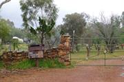
Constructed from 1880
Chinamans’ Cottage and Market Garden is significant for the association with the Chinese brothers Lee Lee Chong and Lee Wan Chong who established and worked the market garden on this site for over sixty years, representing a way of life no longer practiced that contributes to the history of York.
A single storey cottage with a pavilion gable roof break pitch along the front veranda with a two-storey addition. There is no obvious evidence of the market garden
In 1901, brothers Lee Lee Chong and his young brother Lee Chan Chong arrived in Western Australia and worked in market gardens in Osborne Park before moving to York a few years later. They lived in a shack on corner of Water Street and Avon Terrace for 3 years, and moved to corner of Bland and Ninth Ave before moving to the two-roomed cottage (in what is now called Lee Cres) where they tended their market garden sending produce to Perth and generously providing local residents. There was no electricity or plumbing in the cottage and very basic facilities, although the previous occupant had installed a septic tank toilet. They worked hard, played dominoes and gambled. They played for high stakes in a Domino Club in Perth where they regularly frequented. They were bankrupt in the 1950s and were unable to return to China (ot leave Australia) on one of their visits due to their debt to the Taxation Office. In 1974, the younger brother was in ill health and required extended care nursing. In 1975, the Lee brothers returned to China for good. At that time the eldest was 102, and the younger 95 years old. It was great news at the time; that they were accepted back into China, and was the subject of West Australian newspaper reporters. The Chung Wah Association organised a farewell for the brothers. In 1984 Ken Sue, President of Chung Wah Association visited Lee Lee at his home in a small village of Hung Kay, Toi Shan Island near Shanghai off the coast of Chekiang Province. The elder brother was in excellent health, although blind, partially deaf and in need of assistance to walk- he was 112 years old. Li Hong Shu (grandson) advised when Lee Lee had passed away on 19 April 1985.
Low/Medium
Poor/Fair
This information is provided voluntarily as a public service. The information provided is made available in good faith and is derived from sources believed to be reliable and accurate. However, the information is provided solely on the basis that readers will be responsible for making their own assessment of the matters discussed herein and are advised to verify all relevant representations, statements and information.