Local Government
Vincent
Region
Metropolitan
198 Harold St Mount Lawley
was in MI as 35 Vincent St, Mt Lawley
Vincent
Metropolitan
Constructed from 1905
| Type | Status | Date | Documents |
|---|---|---|---|
| (no listings) |
| Type | Status | Date | Documents |
|---|---|---|---|
| (no listings) |
| Type | Status | Date | Grading/Management | |
|---|---|---|---|---|
| Category | ||||
| Municipal Inventory | Adopted | 27 Nov 1995 | ||
Individual Building or Group
| Epoch | General | Specific |
|---|---|---|
| Original Use | RESIDENTIAL | Single storey residence |
| Present Use | RESIDENTIAL | Single storey residence |
| Style |
|---|
| Federation Queen Anne |
| Type | General | Specific |
|---|---|---|
| Roof | METAL | Corrugated Iron |
| Wall | TIMBER | Weatherboard |
| Wall | RENDER | Roughcast |
| General | Specific |
|---|---|
| DEMOGRAPHIC SETTLEMENT & MOBILITY | Settlements |
This information is provided voluntarily as a public service. The information provided is made available in good faith and is derived from sources believed to be reliable and accurate. However, the information is provided solely on the basis that readers will be responsible for making their own assessment of the matters discussed herein and are advised to verify all relevant representations, statements and information.
57-75 Harold St Mount Lawley
MHI notes street numbers as 57, 59, 63, 65, 67, 69, 71, 73, 75
Vincent
Metropolitan
Constructed from 1902 to 1914
| Type | Status | Date | Documents |
|---|---|---|---|
| Heritage List | Adopted | 12 Sep 2006 |
| Type | Status | Date | Documents |
|---|---|---|---|
| (no listings) |
| Type | Status | Date | Grading/Management | |
|---|---|---|---|---|
| Category | ||||
| Municipal Inventory | Adopted | 21 Nov 2006 | ||
| Municipal Inventory | Adopted | 12 Sep 2006 | Category B | |
Individual Building or Group
| Epoch | General | Specific |
|---|---|---|
| Present Use | RESIDENTIAL | Single storey residence |
| Original Use | RESIDENTIAL | Single storey residence |
| Style |
|---|
| Federation Italianate |
| Federation Bungalow |
| Type | General | Specific |
|---|---|---|
| Roof | TILE | Other Tile |
| Other | TIMBER | Other Timber |
| Wall | BRICK | Face Brick |
| Wall | BRICK | Rendered Brick |
This information is provided voluntarily as a public service. The information provided is made available in good faith and is derived from sources believed to be reliable and accurate. However, the information is provided solely on the basis that readers will be responsible for making their own assessment of the matters discussed herein and are advised to verify all relevant representations, statements and information.
Constructed from 1902
This group of modest Federation period houses, has a high level of intactness apart from the adaptations to No. 75. There are six Federation Bungalows set between a Federation Italianate single fronted house and a Postwar Immigrant Nostalgic conversion of a Federation Bungalow. It is one of the largest cultural groups of individual residences in the district.
No. 57 Harold Street is a detached single fronted Federation Italianate house with a simple traingulated pediment set between pilasters topped with ovoid finials. A simple full width bullnose verandah in two abys recreates the symmetry of the lower facade, which is countered by the off centre window and front door, with fanlight. No. 59 is an L shaped bungalow with a simplicity and robustness of detail akin to a stripped Arts and Crafts style. No. 63 is a textbook example of a prelevant model of Federation Bungalow style in form, character and details. No. 65 is a textbook example if another prevalent model of Federation Bungalow style in form, character and details. Nos.s 76, 71 and 73 are handed examples of the Federation Bungalow model of No. 63 Harold Street. Each is very similar in form and character with minor variations in detaiil, for example No. 71 has a faceted bay window in the front gable, No. 73 has been painted, but also its gable is decorated in the Arts and Crafts style. No. 75 was a Bungalow form which has had its roof replaced with clay tiles, its verandah replaced with a flat concrete slab on steel columns and windows have been replaced. Nos. 57 - 73 all have front fences and gardens in keeping with the Federation Period and No. 75 has been changed in keeping with the Postwar period. No. 75 has been extensively modified in the Postwar period.
The residences at Nos. 57, 63, 65, 67, 71, 73 and 75 Harold Street are situated between Wright and Smith Street, overlooking Forrest Park. They were constructed on Suburban Lots 142 and 147. None of the residences appear on the 1900 PWD sewerage plans, but all are listed on the 1915 Post Office Directory. The Post Office Directory indicates that the dwellings were constructed between 1902 and 1915.
This information is provided voluntarily as a public service. The information provided is made available in good faith and is derived from sources believed to be reliable and accurate. However, the information is provided solely on the basis that readers will be responsible for making their own assessment of the matters discussed herein and are advised to verify all relevant representations, statements and information.
29 & 30 Hutt St Mount Lawley
corner Raflan Rd
Vincent
Metropolitan
Constructed from 1900
| Type | Status | Date | Documents |
|---|---|---|---|
| Heritage List | Adopted |
| Type | Status | Date | Documents |
|---|---|---|---|
| (no listings) |
| Type | Status | Date | Grading/Management | |
|---|---|---|---|---|
| Category | ||||
| Municipal Inventory | Adopted | 21 Nov 2006 | Category B | |
Individual Building or Group
| Epoch | General | Specific |
|---|---|---|
| Present Use | RESIDENTIAL | Single storey residence |
| Original Use | RESIDENTIAL | Single storey residence |
| Style |
|---|
| Federation Bungalow |
| Type | General | Specific |
|---|---|---|
| Wall | BRICK | Face Brick |
| Wall | BRICK | Rendered Brick |
| Wall | BRICK | Painted Brick |
| Roof | METAL | Corrugated Iron |
| General | Specific |
|---|---|
| OUTSIDE INFLUENCES | Depression & boom |
This information is provided voluntarily as a public service. The information provided is made available in good faith and is derived from sources believed to be reliable and accurate. However, the information is provided solely on the basis that readers will be responsible for making their own assessment of the matters discussed herein and are advised to verify all relevant representations, statements and information.
Constructed from 1900
The dwellings are good and intact examples of their style contstructed in the Gold Boom period in Perth.
The dwelling at No. 29 Hutt Street is a single storey brick and iron Federation Bungalow. The dwelling features a front protruding gable with face brickwork and quoining to the corners and openings. The roof is hipped with a bullnose verandah supported by timber posts. Two chimneys are extant on the eastern portion of the roof. The single storey brick and iron dwelling at No. 30 Hutt Street has the character of a Late Colonial period bungalow due to its extensive return bullnose verandah, which also engages the front gable wall and visually aligns with the window awning. The dwelling has been rendered and painted cream. Setback from the street between timber picket fence and established gardens. Minimal apparent
Hutt Street was named after Governor Jophn Hutt, the second governor of the Swan River Colony (Western Australia) from 1839 - 1946, even though he was not a popular governor. The dwellings at No. 29 and 30 Hutt Street and located on the corner of Raglan Road. These dwellings appear on the 1900 PWD sewerage plans. Pluses for prospective purchasers of blocks in the street at this time would have been that they were situated close to the developing Beaufort/Walcott Street shopping area and jsut a block from the early shops on the corner of Hutt and Raglan. The street was listed in Wise's Post Office Directories for the first time in 1903 but no street numbers had been allocated. At that time there were four houses erected, three on what was to be the uneven numbered side and one of the even side. This situation remained until 1909 when the numbers were allocated. Thomas J.O'Brien was listed as living in the street from 1908 and in 1909 his name was attached to No. 29 and from 1909 No. 30 was occupied by William Gobbart, a carrier. In 1920, No. 29 was occupied by Edward P. Harris and No. 30 by Victor Houston, a police constable. In 1930 Victor Houston was still in residence but he had been promoted to sergeant and Frank Matthews was at No. 29. In 1949 both Houston and Mathews were still there, indicating that that the policeman had been in residence from at least 1920 to 1949 and beyond and Matthews from at least 1940 to 1949. Residents' complaints regarding traffic using Raglan and Chelmsford roads as shortcuts through from Walcott and Beaufort streets led to changes being made to the traffic flows at this portion of Hutt Street. The result was that southbound traffic could only turn left into the eastern section of Raglan at the intersection and northbound traffic was forced to turn left into the western end of Raglan.
High
This information is provided voluntarily as a public service. The information provided is made available in good faith and is derived from sources believed to be reliable and accurate. However, the information is provided solely on the basis that readers will be responsible for making their own assessment of the matters discussed herein and are advised to verify all relevant representations, statements and information.
125 Joel Tce Mount Lawley
Vincent
Metropolitan
Constructed from 1913
| Type | Status | Date | Documents |
|---|---|---|---|
| Heritage List | Adopted |
| Type | Status | Date | Documents |
|---|---|---|---|
| (no listings) |
| Type | Status | Date | Grading/Management | |
|---|---|---|---|---|
| Category | ||||
| Municipal Inventory | Adopted | 12 Sep 2006 | Category B | |
The property is rundown.
Individual Building or Group
| Epoch | General | Specific |
|---|---|---|
| Present Use | RESIDENTIAL | Single storey residence |
| Original Use | RESIDENTIAL | Single storey residence |
| Style |
|---|
| Federation Queen Anne |
| Type | General | Specific |
|---|---|---|
| Other | TIMBER | Other Timber |
| Roof | METAL | Corrugated Iron |
| Wall | BRICK | Face Brick |
| Other | STONE | Limestone |
This information is provided voluntarily as a public service. The information provided is made available in good faith and is derived from sources believed to be reliable and accurate. However, the information is provided solely on the basis that readers will be responsible for making their own assessment of the matters discussed herein and are advised to verify all relevant representations, statements and information.
Constructed from 1913
The house at 125 Joel Terrace is a good example of the Federation Queen Anne style, with a high degree of integrity. It may have associations with the builder Roger Rogerson.
The house has a mildly assymmetrical plan with a central entry placed beside a projecting front room. It is constructed of face brickwork set on limestone foundations. The predominantly hipped roof has gambrel ridge ventilators, with a projecting half timbered gable over the window bay of the front room. The separate bullnose verandah spans the whole width of the principal façade. It is supported on four turned posts, with timber brackets, supporting a decorative valence with alternating hit and miss panels of diagonal beading. The face brickwork is banded at sill and door level. Windows are double hung sashes and the door has a leadlight panel and fanlight. The face brickwork chimney has a rendered corbelled head. The property is rundown. Comparatively unchanged.
Joel Terrace is part of the East Norwood Estate, which was developed in 1898, on part of Locations A4 and A5, on the eastern side of the Femantle-Guildford Railway line, in the East Perth/Mt Lawley area. The subdivision was carried out surveyors Crossland & Hardy on behalf of the Perth (WA) Estate Company Limited of No. 364 Hay Street, Perth. The strong demand for new housing was a result of the population boom created by the gold discoveries in the State. One member of the Perth (WA) Estate Company Limited was Zebina Lane, who was an engineer and mine owner at the Great Boulder mines, and one of a number of people who made money in gold mining and reinvested it in land developments during this period. The Company had previously developed the adjoining Westralia Estate on the west side of the railway line on Location A4. The estate was promoted as having 'splendid building lots', 'main roads' and 'river frontages'. In the latter case these were the lots along Joel Terrace, which were expected to attract the wealthier buyers. This block does not have river frontage, being on the western side of the street but in contrast to this and those blocks with river frontages were the cheaper ones where 'spec' housing was erected along the line for rental market. A number of these and a few of the blocks on the south side of Bramall Street and in Summers Street were the first to have houses erected on them. Nos. 123, 127 and 129 are known to have been built by Robert Rogerson who built nine houses in the street. No 125 is of similar design. In 1913, the subject place was listed in the Wise's Post Office Directories as being occupied by William H. McNamara, when this part of the street was allotted numbers for the first time. Prior to that William McNamara was listed as living in this part of the street (from 1911) between Pakenham and Leslie Streets on the western side as was the builder, Robert Rogerson. One earlier resident who lived in a street nearby remembered going down to the river from Joel Terrace as a young girl. While they enjoyed playing on the bank and in the water, it was very muddy and the mud was hard to wash it off their legs afterwards. They called it 'The Mucks' as did many of the other children from the area and further afield who walked or road their bicycles - often considerable distances - to play along the river's edge and swim in the river there.
Moderate to High
This information is provided voluntarily as a public service. The information provided is made available in good faith and is derived from sources believed to be reliable and accurate. However, the information is provided solely on the basis that readers will be responsible for making their own assessment of the matters discussed herein and are advised to verify all relevant representations, statements and information.
1 Monmouth St Mount Lawley
Vincent
Metropolitan
Constructed from 1912
| Type | Status | Date | Documents |
|---|---|---|---|
| Heritage List | Adopted |
| Type | Status | Date | Documents |
|---|---|---|---|
| (no listings) |
| Type | Status | Date | Grading/Management | |
|---|---|---|---|---|
| Category | ||||
| Municipal Inventory | Adopted | 03 Apr 2007 | Category B | |
Individual Building or Group
| Epoch | General | Specific |
|---|---|---|
| Present Use | RESIDENTIAL | Single storey residence |
| Original Use | COMMERCIAL | Shop\Retail Store {single} |
| Original Use | RESIDENTIAL | Single storey residence |
| Style |
|---|
| Federation Free Classical |
| Type | General | Specific |
|---|---|---|
| Wall | BRICK | Common Brick |
| Roof | METAL | Corrugated Iron |
| Wall | BRICK | Rendered Brick |
This information is provided voluntarily as a public service. The information provided is made available in good faith and is derived from sources believed to be reliable and accurate. However, the information is provided solely on the basis that readers will be responsible for making their own assessment of the matters discussed herein and are advised to verify all relevant representations, statements and information.
Constructed from 1912
The place has some aesthetic value as a good example of a corner shop and attached house constructed in the Federation Free Classical style of architecture with its distinct parapet with precast ball motifs. The strong presence of the place on the corner of Forrest and Monmouth Streets has some aesthetic value through the contribution to the quality of its setting. The place has some historic value through illustrating the popular rise of local shops and attached housing in the newly established suburbs north of Perth in the early part of the 20th century and the later conversion to residential use in the post WW2 period. The place has some rarity value as a former shop and attached house anchored on the corner of Forrest and Monmouth Streets constructed c1912 in the Federation Free Classical style of architecture with its distinct parapet with precast ball moti
The former rendered brick and iron shop and attached house was constructed c1912 in the Federation Free Classical style of architecture on the corner of Monmouth Street and Forrest Street, Mount Lawley. The former shop is truncated on the corner of the two streets with a moulded parapet wall extending part way along the two street elevations respectively. Two precast ball motifs are positioned on the parapet on the corner truncation. The original entry to the shop on the corner truncation has been bricked up, however the steps and an indentation of the outline of the entry to the former shop is still extant. The southern elevation comprises two sections. The first leads from the corner intersection and comprises a moulded parapet wall that conceals an iron hipped roof. There is one precast ball motif positioned at the end of the parapet. There are two window openings along this portion of the facade, one a small flush window and the second being a double hung sash window. The section along the southern elevation comprises a skillion addition with a small window opening. The eastern elevation of the former shop and attached house addresses Monmouth Street. The former shop section is rendered the same as the southern elevation outlined above and has one small window opening that has been covered by a security grill. A recessed entry to the shop is located to the northern end of the parapet wall. The entry is recessed at a right angle to the street and two precast ball motifs are positioned on the parapet above the entry. Two rendered flower beds are located either side of the entry, the one to the north contains a bougainvillea that has extended partially across the facade of the attached house. It is assumed that this is now the main entry to both the former shop and the attached house, which are now used as the one private residence. A description of the attached dwelling is restricted to a street viewing with the facade being partially obscured by a head high corrugated fence and a bougainvillea. The gable end of the protruding roof section of the attached house features a timber bargeboard and is rough cast with timber battens. Two double hung sash windows that are partially visible from the street beneath the gable and a face brick chimney is extant on the northern elevation of the roof line. An internal site visit was not undertaken in the preparation of this assessment which limits any further information relating to the physical characteristics of the place. Corner location of Monmouth and Forrest Street. Moderate
Monmouth Street, which runs at an angle between Forrest and York streets, was originally named Robinson Street. It was changed to Monmouth in 1916. Population increases, the result of the Western Australian gold boom, led to the suburbanization of the areas north of Perth. However, prior to the introduction of the tram service in the later part of the 1890s, development to the north of the city was slow. W.E. Bold recalled '˜there was little settlement north of Bulwer Street North, Perth, it was non existent, except for a small settlement known as Woodville and beyond Walcott Street was bushland'. In 1896 there was public discussion on the introduction of a tram service with one line that would go along Beaufort Street up to Highgate Hill. There is evidence from the Land Titles Office of a flurry of re-subdivision of land into smaller lots in the inner areas near the proposed routes, in anticipation of the introduction of the tram services. Subdivision of the Crown land and farmland began to occur in response to the demand for housing in Mount Lawley '“ north of Vincent Street and along the railway line. The first of these was Highgate Hill, which took place in the area bounded by Walcott, Burt, Harold and Curtis Streets. Building began in 1889 on the eastern side of Beaufort Street, which had recently been extended as far as Walcott Street. The first house was a small cottage on the corner of Barlee and Beaufort Streets erected by John Marriott. Mr Marriott set up a dairy at the rear of the dwelling which operated for some years. Various other subdivisions included the East Norwood Estate, the North Perth Estate, the Hyde Park Heights Estate and Forrest Hill Estate. The location of the former shop on the corner of Monmouth and Forrest streets formed part of the Forrest Hill Estate. The northern boundary of this estate was Walcott Street and it included the south side of Government Road (renamed York Street subsequently) plus Forrest, Shenton (renamed Wasley in 1917), Burt, Marmion, Robinson (re-named Monmouth in 1914) and Venn Streets '“ the streets being named after members of Sir John Forrest's cabinet. Sir John Forrest was Baron Forrest of Bunbury and Western Australia's Premier from 1890 to 1901. One of the main attractions of this estate was the nearby '˜terminus of the tram and present bus route'. Trams had replaced horse-drawn buses in 1900. The tramway ran along Beaufort Street almost to Walcott Street and a further extension was proposed. This was to connect the existing Fitzgerald and Beaufort Street routes via a small section of Walcott and Forrest streets but it was not carried out. Instead, the route was extended west along Walcott Street to York Street in 1906. The cost of this extension was subsidized by J. Robinson and S. Copley, the developers of the Mount Lawley Estate, which was within what is now the City of Stirling. In the period dating from the 1890s until the end of the World War I the population of Mount Lawley was largely centred within close proximity to the railway line and it gradually spread along Guildford Road and Walcott and Beaufort streets. The Beaufort Street shopping strip developed during this period to cater for the needs of the local residents. This growth in residential development was coupled with a growth in services to cater for the everyday requirements of the growing population. Many of these services were located primarily along public transport routes or close to train, bus or tram stops. Services, however, were also dispersed within the growing residential areas as well, one such example being the corner store. Such shops, often with residences attached, were common in an era of poor storage facilities when shopping was usually done on a daily basis. After World War II, however, the increases in car ownership and the mass production of refrigerators followed by the advent of supermarkets meant the majority of these shops were no longer viable. The former corner shop and attached house was constructed on the triangular-shaped Lot 237 on the corner of Monmouth and Forrest streets circa 1908. Being on a corner location the building has held the address for both Monmouth and Forrest streets at various times. The former shop, however, was first listed as No. 1 Robinson Street (as mentioned above Monmouth Street was first named Robinson Street until it was changed in 1916). The first residents to run a business from the shop at No. l Monmouth Street were Annie and John Turner who were listed in Wise's Post Office Directories from 1909. There were no numbers listed in the Directories for 1908 but A.D. and H.F. Letch were the first residents listed on the left-hand side (odd numbered) and the shop may have been operating then. In 1912 Alfred Wood and Mrs J. Wood were listed and they ran the shop from then until 1917. In 1918 William Pearson, a boot maker, resided at No. 1 Monmouth and Mrs Edith Kew was listed as running the store in 1919. Between 1920 and 1922 the Directories indicate Mrs Pat Doherty resided at the house and ran a greengrocer's. Robert Kerss is listed as running a mixed business from the former shop in 1923, Mrs E.J. Baldock and Robert Baldock in 1924, Mrs Quilty in 1925 and then Mrs Phyllis Sugg from 1927 until 1931. In 1923 the street address for the former shop and attached houses changed from No. 1 Monmouth to No. 12 Forrest. The listing as No. 12 Forrest remained until at least 1949 when the Directories ceased. Throughout the 1930s the shop was listed as being run as a mixed business, with a relatively high turnover of occupants. These included Mrs M.E. Worner who resided at the attached house and ran a mixed business in 1934 and Jesse Slack in 1935. In the early part of the 1940s the former shop and attached house remained vacant. From 1944 both were occupied by Noel and Lucy Ward, who ran a mixed business. However, in 1949 only Lucy was listed and there was no mention of a mixed business. No further information has been obtained to how long the subject place continued to run as a shop. In more recent times it was converted to residential use and according to the City of Perth building licence cards additions to the dwelling and a garage were added in 1985. Further changes occurred in the 1990s. In 1994 architect David Breen designed modifications (a second storey) and the addition of a second storey unit. There was very strong opposition from nearby residents and the first application was refused. Work was carried out in 1996 on the construction of a second unit but the first remained a single storey. At the Orindary Meeting of Council held on 10 July 2007, the Council approved the development of an additional two-storey singe house and alterations and additions to the existing building. The plans were prepared by architect James Taylor.
Medium
This information is provided voluntarily as a public service. The information provided is made available in good faith and is derived from sources believed to be reliable and accurate. However, the information is provided solely on the basis that readers will be responsible for making their own assessment of the matters discussed herein and are advised to verify all relevant representations, statements and information.
12 Monmouth St Mount Lawley
Vincent
Metropolitan
Constructed from 1904
| Type | Status | Date | Documents |
|---|---|---|---|
| Heritage List | Adopted |
| Type | Status | Date | Documents |
|---|---|---|---|
| (no listings) |
| Type | Status | Date | Grading/Management | |
|---|---|---|---|---|
| Category | ||||
| Municipal Inventory | Adopted | 12 Sep 2006 | Category B | |
Individual Building or Group
| Epoch | General | Specific |
|---|---|---|
| Original Use | RESIDENTIAL | Single storey residence |
| Present Use | RESIDENTIAL | Single storey residence |
| Style |
|---|
| Other Style |
| Type | General | Specific |
|---|---|---|
| Wall | BRICK | Face Brick |
| Wall | METAL | Zincalume |
This information is provided voluntarily as a public service. The information provided is made available in good faith and is derived from sources believed to be reliable and accurate. However, the information is provided solely on the basis that readers will be responsible for making their own assessment of the matters discussed herein and are advised to verify all relevant representations, statements and information.
Constructed from 1904
Wisteria Cottage, at 12 Monmouth Street, is a fine and representative example of the Federation Georgian style, still in use well into the Gold Boom era.
The single storey brick dwelling has a hipped roof with a separate skillion verandah across the front, the frontage is slightly assymmetrical with an offset front door flanked each side by a double hung sash window. The verandah is supported by turned posts that have filigree angle and valence details. Low brick and palisade fence with pillars. Garden in small setback. None apparent except new roof sheeting
Monmouth Street was originally named Robinson Street, and was part of the Forrest Hill Estate developed in the mid 1890s. The development was given streets named after Sir John Forrest and his first five cabinet ministers, Shenton (now Wasley Street), Burt, Marmion, Venn and Robinson. There were two Robinson Streets in North Perth in the early 1900s so this one was renamed Monmouth in 1916 and the other was changed to Gill Street. There were no rear laneways in the subdivisions and many of the lots in the subdivision have since been divided in half, creating narrow frontages. The house at 12 Monmouth Street has no street setback and is positioned on a relatively narrow lot frontage of 10m. This lot configuration is identical to that adjacent at No. 10 Monmouth Street. The MWSSDD Sewerage Plans show a small weatherboard cottage at No. 10 Monmouth Street, which has since been demolished and remains vacant under the ownership of the Town of Vincent. The subject dwelling was built circa 1902 for Charles Wheeler, and was named 'Wisteria Cottage'. Wheeler was listed for the first time in 1903 and there were five other houses but there were no numbers and no cross streets were identified. The following year the cross streets were included but still no numbers. At that time there were seven other residents in the street but Wheeler's was the only house on the right-hand side of the street between Clifton Street and Government Road (later Anzac Road). No numbers were given. By 1910 the numbers had been allocated and No 12 was occupied by Mrs Armitage and in 1915 by John Smith who was still there in 1920. The entries at this time match the houses on the 1920 MWWSS & DD sewerage plan, which also indicates that there was a well at the rear of the dwelling. In 1930 the house was vacant but the following year (1931) it was occupied by Mrs Phyllis Sugg. In 1940 the resident was Mrs Binch and in 1949 it was Don Smith.
High
This information is provided voluntarily as a public service. The information provided is made available in good faith and is derived from sources believed to be reliable and accurate. However, the information is provided solely on the basis that readers will be responsible for making their own assessment of the matters discussed herein and are advised to verify all relevant representations, statements and information.
2 Raglan St Mount Lawley
Cnr Raglan & Walcott St
Vincent
Metropolitan
Constructed from 1935
| Type | Status | Date | Documents |
|---|---|---|---|
| Heritage List | Adopted |
| Type | Status | Date | Documents |
|---|---|---|---|
| (no listings) |
| Type | Status | Date | Grading/Management | |
|---|---|---|---|---|
| Category | ||||
| Municipal Inventory | Adopted | 13 Nov 1995 | Category B | |
Individual Building or Group
| Epoch | General | Specific |
|---|---|---|
| Present Use | RESIDENTIAL | Single storey residence |
| Other Use | RELIGIOUS | Church Hall |
| Original Use | SOCIAL\RECREATIONAL | Other Community Hall\Centre |
| Other Use | COMMERCIAL | Office or Administration Bldg |
| Type | General | Specific |
|---|---|---|
| Roof | METAL | Corrugated Iron |
| Wall | BRICK | Face Brick |
| General | Specific |
|---|---|
| SOCIAL & CIVIC ACTIVITIES | Community services & utilities |
This information is provided voluntarily as a public service. The information provided is made available in good faith and is derived from sources believed to be reliable and accurate. However, the information is provided solely on the basis that readers will be responsible for making their own assessment of the matters discussed herein and are advised to verify all relevant representations, statements and information.
Constructed from 1935 to 1946
The former community hall at No. 2 Raglan Road is a good example of a community hall constructed in the Interwar period, with the modest means available at that time.
A single storey small gable roofed hall with an enclosed entrance porch. The gable is vented and infilled with fibro. Small buttresses along the side at regular intervals form bays. It has recently been converted to a residence (2001) and a covered entry gate and perimeter fence have been constructed. Hardcourt carpark forms the street front setback Adaptation to residential
Raglan Road was gazetted on 12 October 1900. It was named after Field Marshall Lord Raglan, 1st Baron Raglan who was a general serving at the Crimean War. During this war he became well-known for his incompetence but, in spite of this, several battles resulted in an allied victory and he was promoted to the rank of Field Marshall. The 'raglan' sleeve is named after him as his uniform coat was designed to accommodate the loss of his arm at the Battle of Waterloo. Alma Road, which was also gazetted on 12 October 1990, also has connections to the Crimean War (1854-56); the Battle of Alma (fought near the River Alma) is generally known as the first battle. Raglan Road was part of the North Perth Estate which extended from Grosvenor Road on the south side to Alma Road on the north and from Walcott (and a piece of Burt Street on the eastern side to John Street (now Leake) on the west. The area was developed by the Perth Land & Agency Coy. The surveyors of the original subdivision were Crossland & Hardy and blocks could be purchased from the developers on just a ₤2 deposit. It was advertised as a 'magnificent estate' which overlooked 'the whole of the City'. Also included in the advertisement was the following: Married men who wish to have a nest egg; young men who desire to put something by which will increase day by day; parents who desire to endow their children with a gift; and guardians, trustees, etc., who look for an immediate return, invest your money in this property as from its position and surroundings it must rapidly increase in value. The hall at No. 2 Raglan Road did not appear on the MWSS & DD sewerage plans circa 1930 but the block appears to have been excised from the one on the corner of Raglan and Walcott streets and the one immediately to the north of that. The land between Walcott Street and No. 18 was vacant ground at this time. Nor did it appear in the City of Perth rate books prior to 1944. The latter does not exclude its existence, however, as it may have been given rate exemption and therefore not have been listed. It appeared in Wise's Post Office Directories in 1933 for the first time listed as 'Raglan Road Hall'. The building was later used as a gospel church/hall and then as a photogrammatrist's office before being converted to a single residence in 1999 by Barry Robinson Architects & Associates. In 2007 a disabled ramp and toilet were installed and it was again used as an office.
Intact
This information is provided voluntarily as a public service. The information provided is made available in good faith and is derived from sources believed to be reliable and accurate. However, the information is provided solely on the basis that readers will be responsible for making their own assessment of the matters discussed herein and are advised to verify all relevant representations, statements and information.
100 Vincent St Mount Lawley
Vincent
Metropolitan
Constructed from 1917
| Type | Status | Date | Documents |
|---|---|---|---|
| Heritage List | Adopted |
| Type | Status | Date | Documents |
|---|---|---|---|
| (no listings) |
| Type | Status | Date | Grading/Management | |
|---|---|---|---|---|
| Category | ||||
| Municipal Inventory | Adopted | 31 Jan 2007 | Category B | |
Individual Building or Group
| Epoch | General | Specific |
|---|---|---|
| Original Use | RESIDENTIAL | Single storey residence |
| Present Use | RESIDENTIAL | Single storey residence |
| Style |
|---|
| Federation Bungalow |
| Type | General | Specific |
|---|---|---|
| Wall | BRICK | Painted Brick |
| Other | TIMBER | Other Timber |
| Other | METAL | Tin |
| Roof | TILE | Other Tile |
| Other | CONCRETE | Concrete Slab |
| Wall | BRICK | Face Brick |
| Other | RENDER | Roughcast |
| Other | STONE | Limestone |
This information is provided voluntarily as a public service. The information provided is made available in good faith and is derived from sources believed to be reliable and accurate. However, the information is provided solely on the basis that readers will be responsible for making their own assessment of the matters discussed herein and are advised to verify all relevant representations, statements and information.
Constructed from 1917
The subject dwelling at No. 100 Vincent Street, Mount Lawley has some aesthetic value as an individual building displaying elements of the Federation Bungalow style of architecture with Inter-war modifications. The dwelling has considerable aesthetic value in terms of its relation to the surrounding dwellings and the overall contribution to the style and character of places along this portion of Vincent Street. The aesthetic cohesiveness of the original dwellings is considered to be sympathetic and complementary to the vista of Hyde Park. The place has some historic value as it forms part of the evolution and pattern of the history of the Town of Vincent, with particular reference to the early part of the twentieth century following the Gold Rush period and the expansion of Perth and its outlying suburbs.
The subject brick and tile dwelling was constructed circa 1917 in the Federation Bungalow style of architecture. The dwelling is setback approximately 6 metres behind the footpath and sits, off centre over two large lots. Along the western side of the dwelling there is a driveway, which leads to a brick and tile garage at the rear of the dwelling. Elevated above the natural ground level by a limestone base the dwelling is accessed via six centrally located steps, which are headed by two short decorative pillars. The single-storey dwelling has a hipped roof, which extends over the front and side verandahs at a lower pitch. The roof is headed by a gable vent with a terracotta ridge and crest. Two gables, which feature infill timber battens and terracotta crests also protrude from the hipped roof and head two protruding bays. A fourth gable feature is located over the front entry porch and a large fifth gable protrudes from the western facing portion of the roof. Two tall rough cast rendered brick chimney's protrude above the roof line of the building. A verandah, which is continuous with the main roof form, runs the whole perimeter of the dwelling. The verandah was originally supported by timber posts. However, it is understood that these posts were removed due to deterioration and were replaced with the current Doric columns. The verandah floor is concrete. The dwelling has a grand central front entry, which comprises a timber door with a stained glass infill and wide stained glass side lights and a fan light. The main central fan light has the word 'Mincol' demarcated in lead lights. The meaning of the word Mincol has not been determined. The entry is flanked on either side by identical protruding bays with timber casement window arrangements and fanlights above. The dwelling comprises painted brick work to sill height, which is headed by a band with roughcast (rock faced) render above. The brickwork to the front of the house is tuck pointed. An internal inspection revealed that the internal layout and much of the original detailing has been retained. The entrance to the dwelling opens into a large entrance hall with pressed tin ceilings and a picture rail. Two rooms project either side of the entrance hall. Both rooms comprise fireplaces with timber fire place surrounds, picture rails, high ceilings with deep cove cornices, deep timber architraves, decorative vents and a pair of French doors with a fanlight above, which open out onto the side verandahs. The room to the west has an ornate pressed tin ceiling. The original pressed tin ceiling has been replaced due to deterioration in the eastern room. The entrance area reduces to a central hallway from which a lounge and dining room protrude to the west and a smaller bedroom and kitchen to the east. The lounge room has a bay along its western wall with two French doors with fanlights and two single timber framed casement windows, which open out on the verandah. The lounge room has a deep cove cornice detail, a picture rail and a decorative pressed tin ceiling and vents and an exposed brick fireplace along its southern wall. The kitchen has been modernised. However, it still retains its original pressed tin ceiling, vents, picture rail and timber door with fanlight, which opens onto the east verandah. At the end of the entrance hall a timber door with fanlight above opens into a large open room, which features decorative vents, a pressed tin ceiling and a three panel timber casement window arrangements with associated fanlights. To the east of this rear room there is the original bathroom and toilet facilities, which feature pressed tin ceilings and single timber sash windows. To the west there is an ancillary room also with pressed tined ceilings and a bricked up fireplace with timber mantle. The room to the west and the toilet to the east also contain doors, which provide access to the rear verandah. A store room has been constructed along the eastern side of the verandah. It has been finished to match the external detailing of the dwelling. The rear of the dwelling is mostly paved with a hills hoist and some flower beds. The subject dwelling is located along the portion of Vincent Street between Norfolk and Hyde Streets in Mount Lawley. This portion of Vincent Street comprises a consistent group of early twentieth century dwellings with the exception of the Parkside Flats, which are situated further along Vincent Street. The Parkside Flats are an exemplar of the Interwar Mediterranean style of architecture and are listed on the Town's Municipal Heritage Inventory. All the buildings along this portion of Vincent Street have a consistent street setback and over look Hyde Park, which is located directly opposite the subject place along the southern side of Vincent Street. Verandah Posts / Rough cast render
The subject place is located along Vincent Street directly opposite Hyde Park. Hyde Park was once known as the Third Swamp, which was part of a string of lakes and swamplands that covered an extensive area north of Perth. Prior to and during the early part of European Settlement Hyde Park and its immediate surrounds was an indigenous camping ground. The Swamp was an important source of water and its fertile soil supported a variety of plant foods and attracted wildlife. Europeans were attracted to the Third Swamp for the same reasons however, whilst the land was fertile, it was difficult to settle due to seasonal flooding and its steep and deep topographical surroundings. The Swamp became a duck shooting resort for Europeans, and as late as 1888, drovers used the places as a camp when bringing sheep to Perth. In the 1890s the Lands Department gave permissions to the Perth City Council to allow camping on the Third Swamp in order to accommodate the huge influx of people who had travelled to Western Australia as a result of the Gold Rush. From 1897, the wealth generated by the Gold Rush began to be seen in Perth as buildings and services were constructed. Money was provided to construct a 17 mile tramway network the majority of which was north of the railway line in Perth's Northern suburbs. The tramline of which one ran from Charles Street to Vincent Street encouraged residential development. In 1897 the Third Swamp was gazetted as a Public Reserve for the purposes of Public Gardens. This coincides with the influence of town and social planning ideals from overseas, increased prosperity and a civic desire to emulate the more established cities of other countries, all of which encouraged the development of public parks gardens and recreation reserves close to the city. Vincent Street was named after George Vincent, Chief Draftsman in the Lands Department, the original grantee of the land on the north side of this street, to the east of Charles Street, who named the street for himself on the issue of the grant circa 1876. The street once formed part of the Hyde Park Heights Estate, with the eastern end also called the Tramways Estate. The Post Office Directories list no dwellings for the north side of Vincent Street between William (formerly Clifton Street) and Fitzgerald Streets until 1910. That year there was one dwelling listed to Mr Albert Holding at No.76 Vincent Street, Perth. The City of Perth Building Licence Archive cards indicated that Mrs J Willis submitted a set of plans for the subject place in 1915. However, these plans are recorded as missing. The subject place at No.100 Vincent Street, Perth is first listed in the Wise Post Office Directories in 1917 and is occupied by J Willis. Evidence in the Directories indicates that the place may have been constructed a year earlier with a street address of No. 98 Vincent Street. Mr Willis is listed in the Directories as the resident of the place until 1949.
High
This information is provided voluntarily as a public service. The information provided is made available in good faith and is derived from sources believed to be reliable and accurate. However, the information is provided solely on the basis that readers will be responsible for making their own assessment of the matters discussed herein and are advised to verify all relevant representations, statements and information.
102a & b Vincent St Mount Lawley
Vincent
Metropolitan
Constructed from 1914
| Type | Status | Date | Documents |
|---|---|---|---|
| Heritage List | Adopted |
| Type | Status | Date | Documents |
|---|---|---|---|
| (no listings) |
| Type | Status | Date | Grading/Management | |
|---|---|---|---|---|
| Category | ||||
| Municipal Inventory | Adopted | 03 Apr 2007 | Category B | |
Individual Building or Group
| Epoch | General | Specific |
|---|---|---|
| Original Use | RESIDENTIAL | Single storey residence |
| Present Use | RESIDENTIAL | Single storey residence |
| Style |
|---|
| Federation Bungalow |
| Type | General | Specific |
|---|---|---|
| Other | TIMBER | Other Timber |
| Other | STONE | Limestone |
This information is provided voluntarily as a public service. The information provided is made available in good faith and is derived from sources believed to be reliable and accurate. However, the information is provided solely on the basis that readers will be responsible for making their own assessment of the matters discussed herein and are advised to verify all relevant representations, statements and information.
Constructed from 1914
The subject dwelling at Nos. 102A and 102B Vincent Street, Mount Lawley has some aesthetic value as an individual building displaying elements of the Federation Bungalow style of architecture. The dwelling has considerable aesthetic value in terms of its relation to the surrounding dwellings and the overall contribution to the style and character of places along this portion of Vincent Street. The aesthetic cohesiveness of the original dwellings is considered to be sympathetic and complementary to the vista of Hyde Park. The place has some historic value as it forms part of the evolution and pattern of the history of the Town of Vincent, with particular reference to the early part of the twentieth century following the Gold Rush period and the expansion of Perth and its outlying suburbs.
The subject brick and tile dwelling was constructed circa 1914 in the Federation Bungalow style of architecture. The dwelling is setback approximately 6 metres behind the footpath and sits centrally over two large lots. Along either side of the dwelling run two driveways, which lead to a rear garage along the western side and a carport along the eastern side. Elevated above the natural ground level by a limestone base the dwelling is accessed via five centrally located steps, which are headed by two short decorative plaster pillars. The dwelling has a symmetrical presentation to the street with a high pitched hipped tile roof that features twin front gables and a terracotta ridge and crest. The gables have a decorative infill, which comprises vertical and diagonal battens. Two tall brick chimney's protrude above the roof line of the building and comprise a rendered top and string course. A third chimney is located at the north east corner of the dwelling. A verandah, which is continuous with the steep main roof form, runs the full width of the façade. The verandah is supported by turned timber posts and has a flat arched valance detail. The verandah floor comprises timber boards, which are weathered. The dwelling has a central front entry, which comprises a timber door with side lights and a fan light. The entry is flanked on either side by identical bay windows with sets of three timber framed sash windows with decorative sill detail. Two rendered vermiculated bands run the width of the façade at sill and head height. The symmetry of the façade is some what distorted by the enclosure of the verandah return, along the eastern side of the dwelling, with a timber framed glass wall. The sleep out area was created in 1966 when the dwelling was converted into a duplex. Although an internal inspection of the place was not undertaken, City of Perth Building Licence Plans dated 1966, provide an indication of the floor plan after the place was converted into a duplex pair. A copy of the floor plan is contained within this Heritage Assessment. The subject dwelling is located along the portion of Vincent Street between Norfolk and Hyde Streets in Mount Lawley. This portion of Vincent Street comprises a consistent group of early twentieth century dwellings with the exception of the Parkside Flats, which are situated along the western side of the subject place. The Parkside Flats are an exemplar of the Interwar Mediterranean style of architecture and is listed on the Town's Municipal Heritage Inventory. All the buildings along this portion of Vincent Street have a consistent street setback and overlook Hyde Park, which is located directly opposite the subject place along the southern side of Vincent Street. Alterations to the rear
The subject place is located along Vincent Street directly opposite Hyde Park. Hyde Park was once known as the Third Swamp, which was part of a string of lakes and swamplands that covered an extensive area north of Perth. Prior to and during the early part of European Settlement Hyde Park and its immediate surrounds was an indigenous camping ground. The Swamp was an important source of water and its fertile soil supported a variety of plant foods and attracted wildlife. Europeans were attracted to the Third Swamp for the same reasons however, whilst the land was fertile, it was difficult to settle due to seasonal flooding and its steep and deep topographical surroundings. The Swamp became a duck shooting resort for Europeans, and as late as 1888, drovers used the places as a camp when bringing sheep to Perth. In the 1890s the Lands Department gave permissions to the Perth City Council to allow camping on the Third Swamp in order to accommodate the huge influx of people who had travelled to Western Australia as a result of the Gold Rush. From 1897, the wealth generated by the Gold Rush began to be seen in Perth as buildings and services were constructed. Money was provided to construct a 17 mile tramway network the majority of which was north of the railway line in Perth's northern suburbs. The tramline of which one ran from Charles Street to Vincent Street encouraged residential development. In 1897 the Third Swamp was gazetted as a Public Reserve for the purposes of Public Gardens. This coincides with the influence of town and social planning ideals from overseas, increased prosperity and a civic desire to emulate the more established cities of other countries, all of which encouraged the development of public parks, gardens and recreation reserves close to the city. Vincent Street was named after Mr George Vincent, Chief Draftsman in the Lands Department, the original grantee of the land on the north side of this street, to the east of Charles Street, who named the street for himself on the issue of the grant circa 1876. The street once formed part of the Hyde Park Heights Estate, with the eastern end also called the Tramways Estate. The Post Office Directories list no dwellings for the north side of Vincent Street between William (formerly Clifton Street) and Norfolk Streets until 1909. That year there was one dwelling listed to Mr Albert Holding at No.76 Vincent Street, Perth. The subject place at No.102 Vincent Street, Perth was the second dwelling built along this portion of Vincent Street, between Hyde and Norfolk Streets, and first appears in the Wise Post Office Directories in 1914 and is occupied by Mr Archibald Hill-Rennie. Mr Hill-Rennie is listed in the Directories as the resident of the place until 1949. City of Perth Building Licence Plans dated 1966 document that the then owners Mr R E and Mrs D A Turner converted the dwelling into a duplex house of two occupancies. It is understood from the current owner that the place still maintains this dual occupancy.
High
This information is provided voluntarily as a public service. The information provided is made available in good faith and is derived from sources believed to be reliable and accurate. However, the information is provided solely on the basis that readers will be responsible for making their own assessment of the matters discussed herein and are advised to verify all relevant representations, statements and information.
104 Vincent St Mount Lawley
Vincent
Metropolitan
Constructed from 1930
| Type | Status | Date | Documents |
|---|---|---|---|
| Heritage List | Adopted |
| Type | Status | Date | Documents |
|---|---|---|---|
| RHP - To be assessed | Current | 25 Nov 2011 |
| Type | Status | Date | Grading/Management | |
|---|---|---|---|---|
| Category | ||||
| Municipal Inventory | Adopted | 13 Nov 1995 | Category A | |
The place is a good example of an Inter-War Mediterranean style residence, which would have been fashionable the time of construction.
The place is representative of the type of flats and apartments that were built in Perth, and its immediate suburbs from the 1930s in order to accommodate the growing population.
The two-storey residential property contains four flats, with a symmetrical façade and pedimented entry tower, situated to the direct north of Hyde Park. The central tower reads ‘Parkside’ at the top above an elongated stained-glass window. The walls are rendered white with a enclosed round arched loggia on the ground floor, and a square roofed terrace on the first floor.
After the Swan River Colony was established in 1829, settlement by the colonists began in and around the Perth area. The area to the north of the Perth was part wetlands stretching 50 or 60 miles northwards, and was not considered an ideal site for settlement. However, despite the swampy conditions, by the early 1830s land to the north of Perth was beginning to be being settled, and land had been granted to individuals such as John H. Monger, William Leeder, Thomas Mews. Drainage of the lakes close to the city begun in the 1840s freeing up additional land for settlement. With the arrival of convicts from the 1850s, infrastructure and public works increased and improved. Some basic roads were constructed with convict labour, but the area now known at the Town of Vincent was mainly occupied by dairy farmers, markets and gardens and the roadways were left as gravel. During the latter part of the nineteenth century, the Town of Vincent area was subdivided and slowly populated with residences, workers cottages, hotels, and churches. By the turn of the century, the area to the north of Perth began developing rapidly, particularly in Leederville and North Perth. Leederville became a municipality in 1896 and in 1899 the suburb of North Pert was declared. Post Offices and Police Stations were established in central areas, as well as town halls and religious meeting places, to meet the needs of the rapidly expanding population. By the 1930s the construction of residential complexes began, as boarding houses were being converted into self contained flats. Many applications for the construction of flats were submitted, but refused as the land was too small for development. This led to specific areas being zones for flats. The block of ‘Parkside’ flats was constructed in 1930, because of the growing fashion ability of the flat lifestyle, and the densification of the area’s population. It is unknown, at this time, who originally owned the building or who it was designed by.
Individual Building or Group
| Epoch | General | Specific |
|---|---|---|
| Present Use | RESIDENTIAL | Flats\Apartment Block |
| Original Use | RESIDENTIAL | Flats\Apartment Block |
| Style |
|---|
| Inter-War Mediterranean |
| Type | General | Specific |
|---|---|---|
| Roof | TILE | Other Tile |
| Wall | BRICK | Rendered Brick |
| General | Specific |
|---|---|
| DEMOGRAPHIC SETTLEMENT & MOBILITY | Settlements |
This information is provided voluntarily as a public service. The information provided is made available in good faith and is derived from sources believed to be reliable and accurate. However, the information is provided solely on the basis that readers will be responsible for making their own assessment of the matters discussed herein and are advised to verify all relevant representations, statements and information.
Constructed from 1930 to 1940
Parkside is an exemplar of the Interwar Mediterranean style of flats, which is one of the most sophisticated designs of its style and period, with a formality and exactness of detail that is noteworthy. The place contributes to the streetscape and demonstrates the attractiveness of apartment life in the latter Interwar period.
This two storey building contains four flats, two up and two down. It has a symmetrical façade with a pedimented entry tower featuring a Moderne front entry with a tall arched leadlight window on the upper floor. The name PARKSIDE is formed in relief above the window within the capped and corbelled pediment. The walls are of white render with a formal composition of door and window openings, protected by awnings on the upper level. The principal façade has a two storey loggia with the lower level functioning as an open verandah and the upper balcony enclosed enabling it to function as balcony or plein air sleeping area. The front garden behind a low brick wall, has a number of mature plantings that obscure the vistas of the place to and from Hyde Park on the opposite side of the road. None apparent
The subject place is located along Vincent Street opposite Hyde Park. Hyde Park was once known as the Third Swamp, which was part of a string of lakes and swamplands that covered an extensive area north of Perth. Prior to and during the early part of European Settlement Hyde Park and its immediate surrounds was an indigenous camping ground. The Swamp was an important source of water and its fertile soil supported a variety of plant foods and attracted wildlife. Europeans were attracted to the Third Swamp for the same reasons however, whilst the land was fertile, it was difficult to settle due to seasonal flooding and its steep and deep topographical surroundings. The Swamp became a duck shooting resort for Europeans, and as late as 1888, drovers used the places as a camp when bringing sheep to Perth. In the 1890s the Lands Department gave permissions to the Perth City Council to allow camping on the Third Swamp in order to accommodate the huge influx of people who had travelled to Western Australia as a result of the Gold Rush. From 1897, the wealth generated by the Gold Rush began to be seen in Perth as buildings and services were constructed. Money was provided to construct a 17 mile tramway network the majority of which was north of the railway line in Perth's northern suburbs. The tramline of which one ran from Charles Street to Vincent Street encouraged residential development. In 1897 the Third Swamp was gazetted as a Public Reserve for the purposes of Public Gardens. This coincides with the influence of town and social planning ideals from overseas, increased prosperity and a civic desire to emulate the more established cities of other countries, all of which encouraged the development of public parks, gardens and recreation reserves close to the city. Vincent Street was named after Mr George Vincent, Chief Draftsman in the Lands Department, the original grantee of the land on the north side of this street, to the east of Charles Street, who named the street for himself on the issue of the grant circa 1876. The street once formed part of the Hyde Park Heights Estate, with the eastern end also called the Tramways Estate. In 1933, it was reported that 'flat life' was becoming more popular in Perth and suburbs, as evidenced by the construction of several blocks in and around the city. Flat conversion was also seen as a way of dealing with old-fashioned residences at this time, with a number undergoing extensive refurbishment and renovation, which often included a new façade. Other of the older homes were removed to make way for the new flat developments. The Wises Post Office Directories first list the block of flats in 1935 as 'new flats' indicating that they were constructed at that time. In 1939 the block of four flats were occupied by Mrs de Pedro at unit 1; Mr John Graham at unit 2; Mr R Musgrove at unit 3 and Mr H Schruth at unit. 4. In 1945 the residents at units 1 and 2 remain the same with Mr Geoff Featherstone at unit 3 and Mr John Taylor at unit 3. In 1949, the last year of the Directories Mrs de Pedro remains the occupant at unit 1; Mr Robert Graham is at unit 2, Mr William Cox at unit 3 and Mr Jack Graham at unit 4. A Building Licence was issued to Mrs de Pedro in 1935 for the construction of the block of flats. A survey of The Wises Post Office Directories and the City of Perth Building Licences indicate that Mrs de Pedro resided and owned the property next door at No. 106 prior to the construction of the flats, suggesting that the land comprising No. 106 Vincent Street included the land at No. 104 Vincent Street prior to the construction of the flats. In 2005 the owners of the 'Parkside Flats' were awarded first place in the Town of Vincent Building Design and Conservation Awards for conservation works undertaken on the property that demonstrated sound conservation and heritage management principles.
Intact
This information is provided voluntarily as a public service. The information provided is made available in good faith and is derived from sources believed to be reliable and accurate. However, the information is provided solely on the basis that readers will be responsible for making their own assessment of the matters discussed herein and are advised to verify all relevant representations, statements and information.
49a-49b Vincent St Mount Lawley
Vincent
Metropolitan
Constructed from 1903
| Type | Status | Date | Documents |
|---|---|---|---|
| Heritage List | Adopted |
| Type | Status | Date | Documents |
|---|---|---|---|
| (no listings) |
| Type | Status | Date | Grading/Management | |
|---|---|---|---|---|
| Category | ||||
| Municipal Inventory | Adopted | 13 Nov 1995 | Category B | |
Good
| Name | Type | Year From | Year To |
|---|---|---|---|
| Michael Cavanagh | Architect | 1903 | - |
| Catholic Church | Architect | - | - |
Individual Building or Group
| Epoch | General | Specific |
|---|---|---|
| Present Use | RELIGIOUS | Office or Administration Bldg |
| Original Use | RELIGIOUS | Housing or Quarters |
| Style |
|---|
| Federation Queen Anne |
| Federation Bungalow |
| Type | General | Specific |
|---|---|---|
| Wall | BRICK | Face Brick |
| Roof | METAL | Corrugated Iron |
| General | Specific |
|---|---|
| SOCIAL & CIVIC ACTIVITIES | Religion |
This information is provided voluntarily as a public service. The information provided is made available in good faith and is derived from sources believed to be reliable and accurate. However, the information is provided solely on the basis that readers will be responsible for making their own assessment of the matters discussed herein and are advised to verify all relevant representations, statements and information.
Constructed from 1903
The land in which the Catholic Women’s League building now stands was part of the original 1891/3 residential subdivision of Highgate Hill by Matthew Gibney, Catholic Bishop of Perth. The building was originally called ’La Mascotte’ and was owned and occupied by tobacconist Alfred Benjamin Mayer. Since 1972 the building has been home to the Catholic Women’s League and re named ’Downey House’ after Mrs Carmel Downey, former State and National President of the Catholic Womens’ League. The building is an unusual example of the Federation Bungalow style because of the width of its principal frontage and its irregular lot configuration.
This single storey building has a long principal façade set parallel to the long street frontage. The façade has a prominent bay window, marked by a gablet, an eastern glazed entry door with leadlighted sidelights and fanlights. The western corner and main entrance is truncated and maked by a diagonal gablet. The roof is hipped with a ridge gambrel marking the junction with the roof to the rear wing. Original chimneys are located on the outer east and west walls. The house has a bullnose verandah along the entire front which returns, with a diagonal corner, onto the west facade. Short garden setback behind a low limestone wall None apparent
In 1892, land in Highgate Hill was acquired by Catholic Bishop Matthew Gibney and subdivided as the Mount Heart Estate. A two-acre site for church and school, known as Alacoque Square, after the Sacred Heart of Jesus, St Margaret Mary Alacoque, was set aside in the centre of the subdivision. In 1897, Bishop Gibney engaged the architect Michael Cavanagh to design 20 houses for the Highgate subdivision. The residence at No. 49 Vincent Street was first named 'La Mascotte' and it was numbered 47 Vincent Street until 1917. It was constructed on Lot N149 about 1902 and its original owner was Alfred Benjamin Mayer. Mayer was believed to have arrived from Switzerland during the 1890s gold rush. He taught French and German from his home where he resided with Mrs C. Mayer, possibly until his death in 1917. In addition, Mayer had a tobacconist shop in Hay Street Perth where he also ran a hairdressing business and in 1907 a wig and costume hire business. Alfred Mayer, who died on 31 July 1917, was buried in the Jewish Orthodox section of Karrakatta Cemetery and it is believed the house was then rented out. In the 1926 edition of Wise's Post Office Directories Jacob Meyer was listed as the occupant; in 1937 it was Miss Angelina Langdon and in 1949 Mrs Mary Kenney. The City of Perth building licence cards indicated S. Burnes was the owner between at least 1965 and 1970 when applications were received for a brick laundry (1965) and a garage (1970). Another resident was Mrs Carmel Downey and it was she that recommended it to the Catholic Women's League. The house was purchased by the Catholic Women's League in 1972 with the help of a loan from the Archbishop of Perth and personal loans from members. It was named Downey House after Mrs Downey, who was both a State and National President. The League was founded in England in 1906 by Margaret Fletcher. The first meeting of this non-political association in Australia was held in Adelaide in 1914. It was established in WA in 1937 by Archbishop Prendiville and its first president was Mrs J.P. Maxwell. In 2008 the two sections were used as a residential unit and an office/meeting room with associated facilities. In 2010 the property was subdivided resulting in the excision of the western portion of the property.
Intact
This information is provided voluntarily as a public service. The information provided is made available in good faith and is derived from sources believed to be reliable and accurate. However, the information is provided solely on the basis that readers will be responsible for making their own assessment of the matters discussed herein and are advised to verify all relevant representations, statements and information.
74 Vincent St Mount Lawley
Vincent
Metropolitan
Constructed from 1910
| Type | Status | Date | Documents |
|---|---|---|---|
| Heritage List | Adopted |
| Type | Status | Date | Documents |
|---|---|---|---|
| (no listings) |
| Type | Status | Date | Grading/Management | |
|---|---|---|---|---|
| Category | ||||
| Municipal Inventory | Adopted | 13 Nov 1995 | Category B | |
Individual Building or Group
| Epoch | General | Specific |
|---|---|---|
| Original Use | RESIDENTIAL | Single storey residence |
| Present Use | RESIDENTIAL | Single storey residence |
| Style |
|---|
| Federation Bungalow |
| Type | General | Specific |
|---|---|---|
| Wall | BRICK | Face Brick |
| Roof | METAL | Corrugated Iron |
| General | Specific |
|---|---|
| DEMOGRAPHIC SETTLEMENT & MOBILITY | Settlements |
This information is provided voluntarily as a public service. The information provided is made available in good faith and is derived from sources believed to be reliable and accurate. However, the information is provided solely on the basis that readers will be responsible for making their own assessment of the matters discussed herein and are advised to verify all relevant representations, statements and information.
Constructed from 1910 to 1915
The house at 74 Vincent Street is a good example of an earlier Federation Bungalow style, which retains many of the characteristics of the Late Colonial model on which it was based.
Modest single storey detached bungalow with hipped roof, a bullnose verandah, and half-timbered gable over the central entrance. The straightforward design with its central front entry, with fanlight and sidelights, and symmetrical double hung sashes to the two front rooms, is a house model which carried over with relatively minor decorative change from the Late Colonial period into the Federation period. The bullnose verandah and stucco banding of the brickwork at sill level are typical decorative changes of the period. Garden behind the low picket front fence. None apparent
The subject place is located along Vincent Street directly opposite Hyde Park. Hyde Park was once known as the Third Swamp, which was part of a string of lakes and swamplands that covered an extensive area north of Perth. Prior to and during the early part of European Settlement Hyde Park and its immediate surrounds was an indigenous camping ground. The Swamp was an important source of water and its fertile soil supported a variety of plant foods and attracted wildlife. Europeans were attracted to the Third Swamp for the same reasons however, whilst the land was fertile, it was difficult to settle due to seasonal flooding and its steep and deep topographical surroundings. The Swamp became a duck shooting resort for Europeans, and as late as 1888, drovers used the places as a camp when bringing sheep to Perth. In the 1890s the Lands Department gave permissions to the Perth City Council to allow camping on the Third Swamp in order to accommodate the huge influx of people who had travelled to Western Australia as a result of the Gold Rush. From 1897, the wealth generated by the Gold Rush began to be seen in Perth as buildings and services were constructed. Money was provided to construct a 17 mile tramway network the majority of which was north of the railway line in Perth's northern suburbs. The tramline of which one ran from Charles Street to Vincent Street encouraged residential development. In 1897 the Third Swamp was gazetted as a Public Reserve for the purposes of Public Gardens. This coincides with the influence of town and social planning ideals from overseas, increased prosperity and a civic desire to emulate the more established cities of other countries, all of which encouraged the development of public parks, gardens and recreation reserves close to the city. Vincent Street was named after Mr George Vincent, Chief Draftsman in the Lands Department, the original grantee of the land on the north side of this street, to the east of Charles Street, who named the street for himself on the issue of the grant circa 1876. The street once formed part of the Hyde Park Heights Estate, with the eastern end also called the Tramways Estate. The Post Office Directories list no dwellings for the north side of Vincent Street between William (formerly Clifton Street) and Hyde Street until 1914 when six residents are listed, including the subject property, indicating that the majority of dwellings in this portion of Vincent Street were constructed in 1913. The street numbering of the dwellings following construction changed regularly with the subject property first known as No. 82 in 1914 and No. 84 until 1917 when the property became known as No. 74 as it is today. The Wises Post Office Directories indicate that the first resident of the place was John McColl who resided at the dwelling until 1925 when Mr Frank North occupies the dwelling. Frank North remains in residency until 1933 when Mr Albert Cugley and later Mrs Clarice Cugley take up residency. Given the relatively long occupancy of each of the residents it can be assumed that they were also the owners of the property.
Intact
This information is provided voluntarily as a public service. The information provided is made available in good faith and is derived from sources believed to be reliable and accurate. However, the information is provided solely on the basis that readers will be responsible for making their own assessment of the matters discussed herein and are advised to verify all relevant representations, statements and information.
82 Vincent St Mount Lawley
Vincent
Metropolitan
Constructed from 1915
| Type | Status | Date | Documents |
|---|---|---|---|
| Heritage List | Adopted |
| Type | Status | Date | Documents |
|---|---|---|---|
| (no listings) |
| Type | Status | Date | Grading/Management | |
|---|---|---|---|---|
| Category | ||||
| Municipal Inventory | Adopted | 13 Nov 1995 | Category B | |
Individual Building or Group
| Epoch | General | Specific |
|---|---|---|
| Present Use | RESIDENTIAL | Single storey residence |
| Original Use | RESIDENTIAL | Single storey residence |
| Style |
|---|
| Federation Arts and Crafts |
| Type | General | Specific |
|---|---|---|
| Wall | BRICK | Face Brick |
| Roof | METAL | Corrugated Iron |
| Other | TIMBER | Other Timber |
| General | Specific |
|---|---|
| DEMOGRAPHIC SETTLEMENT & MOBILITY | Settlements |
This information is provided voluntarily as a public service. The information provided is made available in good faith and is derived from sources believed to be reliable and accurate. However, the information is provided solely on the basis that readers will be responsible for making their own assessment of the matters discussed herein and are advised to verify all relevant representations, statements and information.
Constructed from 1915 to 1930
The house at 82 Vincent Street, is a representative example of a Federation Arts and Crafts cottage showing the influence of the Arts and Crafts movement across the time of the First World War.
Modest single storey detached cottage with a half-timbered gable, a skillion verandah on two sides with decorative timber brackets and triple corner posts. The house demonstrates the transition in styles, which was starting to occur during the period of the First World War with the simplified timber elements derived from the Arts and Crafts style. Garden behind a brick and gothic picket front fence None apparent
The subject place is located along Vincent Street directly opposite Hyde Park. Hyde Park was once known as the Third Swamp, which was part of a string of lakes and swamplands that covered an extensive area north of Perth. Prior to and during the early part of European Settlement Hyde Park and its immediate surrounds was an indigenous camping ground. The Swamp was an important source of water and its fertile soil supported a variety of plant foods and attracted wildlife. Europeans were attracted to the Third Swamp for the same reasons however, whilst the land was fertile, it was difficult to settle due to seasonal flooding and its steep and deep topographical surroundings. The Swamp became a duck shooting resort for Europeans, and as late as 1888, drovers used the places as a camp when bringing sheep to Perth. In the 1890s the Lands Department gave permissions to the Perth City Council to allow camping on the Third Swamp in order to accommodate the huge influx of people who had travelled to Western Australia as a result of the Gold Rush. From 1897, the wealth generated by the Gold Rush began to be seen in Perth as buildings and services were constructed. Money was provided to construct a 17 mile tramway network the majority of which was north of the railway line in Perth's northern suburbs. The tramline of which one ran from Charles Street to Vincent Street encouraged residential development. In 1897 the Third Swamp was gazetted as a Public Reserve for the purposes of Public Gardens. This coincides with the influence of town and social planning ideals from overseas, increased prosperity and a civic desire to emulate the more established cities of other countries, all of which encouraged the development of public parks, gardens and recreation reserves close to the city. Vincent Street was named after Mr George Vincent, Chief Draftsman in the Lands Department, the original grantee of the land on the north side of this street, to the east of Charles Street, who named the street for himself on the issue of the grant circa 1876. The street once formed part of the Hyde Park Heights Estate, with the eastern end also called the Tramways Estate. The Post Office Directories list no dwellings for the north side of Vincent Street between William (formerly Clifton Street) and Hyde Street until 1914 when six residents are listed, indicating that the majority of dwellings in this portion of Vincent Street were constructed in 1913. The subject property however was not one of these earlier dwellings to have been constructed. No. 82 Vincent Street was first listed in the Wises Post Office Directory in 1926 indicating that it was constructed circa 1926. The first occupier of the dwelling was Abraham Biger, who lived there until 1929 when A H Carlise becomes the resident. Throughout the first part of the 1930s Albert Catts occupies the dwelling until 1936 when Mr Leo Ritcher becomes the resident. Leo Ritcher remains at the dwelling until at least 1949 when the Post Office Directories cease. A Building Licence was issued to Mr Ritcher in 1936 indicating that he was also the owner of the property during that time.
Intact
This information is provided voluntarily as a public service. The information provided is made available in good faith and is derived from sources believed to be reliable and accurate. However, the information is provided solely on the basis that readers will be responsible for making their own assessment of the matters discussed herein and are advised to verify all relevant representations, statements and information.
92 Vincent St Mount Lawley
Vincent
Metropolitan
Constructed from 1910
| Type | Status | Date | Documents |
|---|---|---|---|
| Heritage List | Adopted |
| Type | Status | Date | Documents |
|---|---|---|---|
| (no listings) |
| Type | Status | Date | Grading/Management | |
|---|---|---|---|---|
| Category | ||||
| Municipal Inventory | Adopted | 13 Nov 1995 | ||
Individual Building or Group
| Epoch | General | Specific |
|---|---|---|
| Original Use | RESIDENTIAL | Single storey residence |
| Present Use | RESIDENTIAL | Single storey residence |
| Style |
|---|
| Federation Bungalow |
| Type | General | Specific |
|---|---|---|
| Roof | TILE | Other Tile |
| Wall | BRICK | Face Brick |
| General | Specific |
|---|---|
| DEMOGRAPHIC SETTLEMENT & MOBILITY | Settlements |
This information is provided voluntarily as a public service. The information provided is made available in good faith and is derived from sources believed to be reliable and accurate. However, the information is provided solely on the basis that readers will be responsible for making their own assessment of the matters discussed herein and are advised to verify all relevant representations, statements and information.
Constructed from 1910 to 1915
The house at 92 Vincent Street is a example of a Federation Bungalow style which also has elements of Arts and Crafts influence, indicating the start of the transition in styles between the Federation and Interwar periods. The dwelling was built for Reverend William Barnet Blakemore who was an American pastor at the Church of Christ in Lake Street which has been since demolished.
A single storey detached cottage with a hipped roof with a crippled extension to form a verandah on two sides. The verandah is supported by turned posts and has a decorative timber valance. The central location of the vermiculated chimney in front of the gable shows an Arts and Crafts influence. Garden setback behind high timber fence None apparent
The subject place is located along Vincent Street directly opposite Hyde Park. Hyde Park was once known as the Third Swamp, which was part of a string of lakes and swamplands that covered an extensive area north of Perth. Prior to and during the early part of European Settlement Hyde Park and its immediate surrounds was an indigenous camping ground. The Swamp was an important source of water and its fertile soil supported a variety of plant foods and attracted wildlife. Europeans were attracted to the Third Swamp for the same reasons however, whilst the land was fertile, it was difficult to settle due to seasonal flooding and its steep and deep topographical surroundings. The Swamp became a duck shooting resort for Europeans, and as late as 1888, drovers used the places as a camp when bringing sheep to Perth. In the 1890s the Lands Department gave permissions to the Perth City Council to allow camping on the Third Swamp in order to accommodate the huge influx of people who had travelled to Western Australia as a result of the Gold Rush. From 1897, the wealth generated by the Gold Rush began to be seen in Perth as buildings and services were constructed. Money was provided to construct a 17 mile tramway network the majority of which was north of the railway line in Perth's northern suburbs. The tramline of which one ran from Charles Street to Vincent Street encouraged residential development. In 1897 the Third Swamp was gazetted as a Public Reserve for the purposes of Public Gardens. This coincides with the influence of town and social planning ideals from overseas, increased prosperity and a civic desire to emulate the more established cities of other countries, all of which encouraged the development of public parks, gardens and recreation reserves close to the city. Vincent Street was named after Mr George Vincent, Chief Draftsman in the Lands Department, the original grantee of the land on the north side of this street, to the east of Charles Street, who named the street for himself on the issue of the grant circa 1876. The street once formed part of the Hyde Park Heights Estate, with the eastern end also called the Tramways Estate. A survey of the Wises Post Office Directories and the PWD Sewerage Plans show that by 1914 there were six houses listed between Clifton and Norfolk Streets and No. 92 was one of them. The subject dwelling was built for Reverend William Barnet Blakemore who was an American pastor at the Church of Christ in Lake Street which has been since demolished. Rev Blakemore was listed at the dwelling from 1914 until 1917. He returned to the USA and his son became a prominent theologian there. The Wises Post Office Directories show that from 1920 until the early 1930s Mr Henry Phillips resided at the subject dwelling. In 1926 a Building Licence was issued to Mr Phillips indicating that he also owned the property during this time. The Wises Post Office Directories indicate that there was a relatively high turn over of occupancy in the latter part of the 1930s. In 1940 Mrs Florence Kirby took up residency and remained at the dwelling until at least 1949. In 1972 a Building Licence was issued to a Mr Morgan for the construction of a verandah and a laundry.
Intact
This information is provided voluntarily as a public service. The information provided is made available in good faith and is derived from sources believed to be reliable and accurate. However, the information is provided solely on the basis that readers will be responsible for making their own assessment of the matters discussed herein and are advised to verify all relevant representations, statements and information.
Walcott St Mount Lawley
Cnr Walcott & Raglan St
Vincent
Metropolitan
| Type | Status | Date | Documents |
|---|---|---|---|
| Heritage List | Adopted |
| Type | Status | Date | Documents |
|---|---|---|---|
| (no listings) |
| Type | Status | Date | Grading/Management | |
|---|---|---|---|---|
| Category | ||||
| Municipal Inventory | Adopted | 12 Sep 2006 | Category B | |
Individual Building or Group
| Epoch | General | Specific |
|---|---|---|
| Present Use | Transport\Communications | Road: Other |
| Original Use | Transport\Communications | Road: Other |
| Style |
|---|
| Inter-War Functionalist |
| General | Specific |
|---|---|
| TRANSPORT & COMMUNICATIONS | Road transport |
This information is provided voluntarily as a public service. The information provided is made available in good faith and is derived from sources believed to be reliable and accurate. However, the information is provided solely on the basis that readers will be responsible for making their own assessment of the matters discussed herein and are advised to verify all relevant representations, statements and information.
The tram pole is a surviving artefact from the extensive and efficient tramway system that operated in the district and linked it to central Perth, between 1898 and the late 1950s.
An unadorned circular pole rising to a bracketed collar, formerly used to support overhead tram wires, topped with a spherical cap.
Trams had replaced horse-drawn buses in the 1900s. The first tram service north of Perth was inaugurated in 1900, by Tram No. 15 which ran from the Weld Club corner (Esplanade) in Barrack Street and in Beaufort Street and Walcott Street. This was a double track with a crossover at each Terminus and at the Town Hall corner. The tramway was extended northwest along Walcott Street up to York Street in 1906. In 1916, the Walcott Street line became the Mount Lawley Line, numbered 19. The population was centered in the vicinity of the railway line, spread along Walcott and Beaufort Streets. The Beaufort Street shopping strip developed during this period to cater for the needs of the local residents. At the time, all trams were driven by electric motors and tram poles were erected along the tram lines to support the electrical distribution system. The subject tram pole, at the corner of Walcott Street and Raglan Street, was the remnant of the tramway system. The trams were phased out when trolley buses were introduced in the 1930s. The Walcott Street line ceased operation in 1953. The last Tram Service in Beaufort Street was closed in 1958, with Tram No. 66 leading a parade of people on its last trip to Barrack Street, closing the tramway system.
Moderate
This information is provided voluntarily as a public service. The information provided is made available in good faith and is derived from sources believed to be reliable and accurate. However, the information is provided solely on the basis that readers will be responsible for making their own assessment of the matters discussed herein and are advised to verify all relevant representations, statements and information.
105 Walcott St Mount Lawley
Vincent
Metropolitan
Constructed from 1936 to 1977
| Type | Status | Date | Documents |
|---|---|---|---|
| Heritage List | Adopted |
| Type | Status | Date | Documents |
|---|---|---|---|
| (no listings) |
| Type | Status | Date | Grading/Management | |
|---|---|---|---|---|
| Category | ||||
| Municipal Inventory | Adopted | 12 Sep 2006 | Category B | |
Individual Building or Group
| Epoch | General | Specific |
|---|---|---|
| Present Use | RESIDENTIAL | Single storey residence |
| Original Use | RESIDENTIAL | Single storey residence |
| Style |
|---|
| Inter-War Mediterranean |
| Type | General | Specific |
|---|---|---|
| Wall | BRICK | Rendered Brick |
| Roof | TILE | Other Tile |
This information is provided voluntarily as a public service. The information provided is made available in good faith and is derived from sources believed to be reliable and accurate. However, the information is provided solely on the basis that readers will be responsible for making their own assessment of the matters discussed herein and are advised to verify all relevant representations, statements and information.
Constructed from 1936
The house at No 105 Walcott Street is a good and comparatively intact example of the Interwar Mediterranean style, which is comparatively rare within the district.
The residence was constructed in the Interwar period as a symmetrical building with a triple arch portico and central front entry. The roofline of the building is hipped over the original part of the house with a front gable built into the hip, which then forms a skillion over the kitchen, with a flat roof over the laundry and wc's at the rear. The large side gables formed by the original hipped roof are infilled with timber battens. There are four roof gables and each has a ram's horn finial at its apex. The portico has a gabled roof with a battened gable end. There are two sets of three-paned casement windows on the front elevation. The front entry is recessed under the portico and comprises a pair of timber framed glazed doors. There is a sleep-out along the south eastern side, which is part of the original dwelling. Internally the place has had adaptations, however, there are numerous original elements, including all of the original ceilings featuring ornate Interwar patterns, and French doors connecting interior and exterior spaces. The lot on which the building is situated is spacious, however, its triangular shape means that most of the open space is situated to the north-west of the dwelling. To the rear there is a small courtyard area and a small rear yard containing a hills-hoist clothesline. The rear yard areas are mostly paved. A red brick garage at the back of the lot is accessed from Alma Road. A low limestone fence to Walcott Street enclosing a mostly grassed front yard. A vehicular access from Alma Road serving a rear garage. Internal alterations and additions in 1977.
The place is situated on Lot 1, with a street frontage to Walcott Street. The site is one half of a larger triangular lot (289) formed by the intersection of Walcott Street with Alma Road and Forrest Street. When the City of Perth was established in 1871 as a result of the Municipal Institutions Act, Walcott Street was designated as the north-eastern boundary of the municipality. Walcott Street remained the north eastern boundary of the City of Perth for a period of more than a century and in 1994, it became the north-eastern boundary of the Town of Vincent, following the splitting of the City of Perth into a series of smaller municipalities. Walcott Street has been regarded and utilised as a major thoroughfare since early in the twentieth century. The installation of a tramline along Walcott Street in 1906 was an impetus for residential expansion. The subject dwelling replaced an earlier dwelling which was built on the subject lot in 1901. The Wise's Post Office Directories indicate that the original dwelling was occupied by Herbert Crossley between 1901 and 1910, then Mrs. Alice Sarah Crossley between 1913 and 1920. In 1917, the street number of the place changed from No. 31 to No. 105. Henry P. Ford lived at the dwelling after Mrs. A. Crossley and stayed until 1936 when R. Kenny took up the residency. In 1935, Roderick Kenny, a railway inspector, purchased the property and it was then subdivided onto two smaller triangular parcels of land, numbered Lots 1 & 2 respectively. In 1936, R. Kenny was the owner of the subject site and was issued with a building licence for the subject dwelling. It is inferred that R. Kenny demolished the original dwelling and constructed the house which is extant today. In 1943 Olive Isabel Reilly became the new owner and retained it for a period of almost twenty years. In 1962 the property was sold to Florence Mary Lethbridge, a widow and resident of the property. Upon her death in 1972, ownership was transferred to Lloyd and Allan Lethbridge and Dawn Stamford. Later that same year the property was bought by Harold Waler Scott and his wife Yvonne May Scott. In 1977 they undertook additions and adaptations including a new kitchen, laundry and two water closets to the rear of the dwelling and a brick garage that accessed Alma Road. Since 1998 Mrs Scott has been registered as the sole owner. In 2003, alterations and additions to the existing single house at Lot 1 have been approved by the Town.
Moderate to High
This information is provided voluntarily as a public service. The information provided is made available in good faith and is derived from sources believed to be reliable and accurate. However, the information is provided solely on the basis that readers will be responsible for making their own assessment of the matters discussed herein and are advised to verify all relevant representations, statements and information.
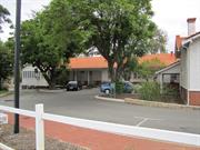
3 Walcott St Mount Lawley
MI notes address as 399 Lord St Inc Main Building, Nurses' Qtrs (fmr), Detention Ward (fmr), Wood & Metal Workshops & various ancillary bldgs
Government Receiving Depot; Child Welfare Rec
Walcott Street Reception Home
Vincent
Metropolitan
Constructed from 1921, Constructed from 1980
| Type | Status | Date | Documents |
|---|---|---|---|
| Heritage List | Adopted | ||
| State Register | Registered | 14 May 2002 | HCWebsite.Listing+ListingDocument, HCWebsite.Listing+ListingDocument |
| Type | Status | Date | Documents |
|---|---|---|---|
| (no listings) |
| Type | Status | Date | Grading/Management | |
|---|---|---|---|---|
| Category | ||||
| Municipal Inventory | Adopted | 12 Sep 2006 | Category A | |
| Register of the National Estate | Indicative Place | |||
Generally in fair to good condition
| Library Id | Title | Medium | Year Of Publication |
|---|---|---|---|
| 5269 | Walcott Centre (Government Receiving Depot fmr), Mount Lawley : Conservation Plan / prepared for CAMS on behalf of the Ministry of Justice, June 2001 : Heritage and Conservation Professionals. | Heritage Study {Cons'n Plan} | 2001 |
Individual Building or Group
| Epoch | General | Specific |
|---|---|---|
| Original Use | GOVERNMENTAL | Other |
| Present Use | RESIDENTIAL | Institutional Housing |
| Present Use | GOVERNMENTAL | Other |
| Original Use | RESIDENTIAL | Institutional Housing |
| Style |
|---|
| Federation Bungalow |
| Type | General | Specific |
|---|---|---|
| Roof | METAL | Zincalume |
| Wall | TIMBER | Weatherboard |
| Roof | TILE | Terracotta Tile |
| Wall | RENDER | Roughcast |
| Wall | STONE | Limestone |
| Roof | METAL | Corrugated Iron |
| Wall | BRICK | Common Brick |
| Wall | BRICK | Rendered Brick |
| General | Specific |
|---|---|
| SOCIAL & CIVIC ACTIVITIES | Institutions |
| SOCIAL & CIVIC ACTIVITIES | Community services & utilities |
| PEOPLE | Aboriginal people |
| DEMOGRAPHIC SETTLEMENT & MOBILITY | Government policy |
This information is provided voluntarily as a public service. The information provided is made available in good faith and is derived from sources believed to be reliable and accurate. However, the information is provided solely on the basis that readers will be responsible for making their own assessment of the matters discussed herein and are advised to verify all relevant representations, statements and information.
Constructed from 1921
The Walcott Centre is the oldest government run institution providing child welfare services in WA and was the only government receiving home from 1921 to 1984. The place played an important role in the development and implementation of Child Welfare practices by the State Government and has strong associations for the people who lived or worked there. It was the only fully government funded child welfare institution until 1960. Its main buildings are an example of the Federation Bungalow style and are situated in a landscaped setting. A curved galvanised iron security fence on the site is the only known example of its type.
The group of single storey dwellings consist of a Main Building, former Nurses Quarters, former Dention Wards and security fence, and a collection of out buildings including a Wood and Metal Workshop, Woodshed, Workshed, Boy's Flat and Laundry. All the buildings are single storey.The Main Building and former Nurses' Quarters are in the Federation Bungalow style. MAIN BUILDING: This building is brick and tile with a hipped roof. The roof ends in a gable which is rendered with a louvered timber roof vent. One metre of the brickwork is exposed with render above it. The windows are timber framed double hung sashes or fixed pane and awning windows. The main part of the building is rectangular in plan with two wings built off the main section which run north south. Additions to the rear of the building consist of a toilet block and offices. These are constructed from brick and timber frame clad with weatherboard and asbestos respectively. FORMER NURSES' QUARTERS: The original rectangular shaped building has been added to the rear at right angles. The front of the building consists of two rooms with a verandah along the Walcott Street elevation. The original part of the building is timber framed, clad in weatherboards and rough cast render. The verandah is located under a skillion roof. At the rear of the building the verandahs have been enclosed with asbestos panels and louvered windows. WORKSHOPS: These buildings are rectangular in plan and are constructed with bricks, asbestos sheeting and weatherboards. A zincalume shed is attached to the rear of the Metal Workshop. The hippped roofs of both buildings have been replaced with zincalume sheeting. A lean to is attached to the Wood Workshop. WOODSHED: This building is rectangular in plan with a hipped roof. It is clad with metal sheets and has a set of metal double doors. DETENTION WARD: The main building is surrounded by verandahs which are infilled. The original cells are located in the centre of the building, although many of the internal walls have been removed. The original walls are constructed from brick and the newer section is construced with bricks and timber frame clad in weatherboard. FORMER BOY'S FLAT: The building consists of three rooms in an L shape with a verandah on the southern elevation. It is timber framed and clad in asbestos with a corrugated iron hipped roof. WORKSHED: This is a simple timber framed weatherboard building consisting of two rooms. It has a hipped corrugated iron roof and timber floorboards. LAUNDRY: This is a rectangular brick building with rendered panels and brick infill. It has a parapet wall at the eastern and western ends and high timber framed windows. The roof is gabled and a steel framed verandah is located on the north and west ends. DEMOUNTABLE: A demountable building is used by the TAFE and is a typical cement sheet clad demountable classroom. The group of buildings are set back from the road and are located in a landscaped setting. The site covers an area of 1.0547 hectares and is located on the north west corner of the intersection of Lord and Walcott Streets. The buildings have been altered in different degrees.
The subject place, now known as the Walcott Centre, was variously called the State Children's Receiving Home/Depot, Government Receiving Home/Depot and Mount Lawley (Children's) Receiving Home Depot. Under the 1874 Industrial Schools Act the State could care and educate orphans and destitute children and place juvenile offenders in institutions other than prisons, such as Industrial Schools. These schools came under the Public Charities Department under 1907 when the State Children's Department was formed. The first Government Receiving Depot was established at Subiaco. It was relocated to West Perth when its buildings were converted for the King Edward Memorial Hospital. Following a Royal Commission in 1919 into conditions at the West Perth facility (which was described was 'unsuitable' and 'undesirable'. The State Government had started to build a new facility in Lord/Walcott streets for the Government Receiving Depot. This was to house children waiting for entry to a Child Welfare Institution or were in juvenile detention. The Government Receiving Depot was the only place which dealt with the Child Welfare Department delt with admission and the discharge of wards of the state, foster children, orphans, destitute and delinquents. By 1932 children were also taken into care if their mothers could not care for them while they were in hospital. The centre dealt with approximately 700 admissions and discharges annually and there was an average of 40 children in residence at the centre at a time. The ages ranged from a few days' old to 17 years of age. The detention wards housed juveniles awaiting trial in the Children's Court, delinquents and uncontrollable children. These wards were separated from the other children's wards and were often unoccupied as the juveniles were often granted bail. The State Children's Department's Annual Report for 1922 stated: 'The new buildings have been occupied for 12 months and the change from the old site has proved beneficial in many directions, and has undoubtedly tended to reduce the morality amongst amongst the young infants. The location of the Detention Wards adjacent to the main building had reduced overhead charges. The matron has the power to grant bail, and this is being freely exercised when there is no serious objection. In 1926 substantial works were carried out on the buildings. By 1929 when the establishment was listed in Wise's Post Office Directories for the first time (under the Walcott Street address) the Matron was Isabella J. Borwick. By that stage the depot had become very overcrowded. In the 1930s some public buildings were neglected as a result of the Depression but a program of maintenance works was started in 1937. In the 1930s the Depot had 14 staff including a matron, three nurses, four female attendents and one male attendant, a male clerk, a cook, laundress, seamstress and a gardener. The seamstress, along with the older girls, made clothing for the children to be given to foster parents. From 1934 what were then considered 'backward' or sub-normal' children were sent there and a kindergarten commenced. School-aged inmates attended Maylands Primary School or Mount Lawley Senior High School. In 1938 it was reported that the Depot was able to house 64 children- 16 babies, 31 children aged two and up, 9 beds for girls aged fourteen and up and 8 beds in the detention ward. Matron Borwick retired that year. In 1949 the last year of the Directories the Matron was Miss Vera Gill. An article in the Daily News the following year (26 January 1950) reported that it was known to its neighbours as the 'gaol in the city'. The vewi from the street was of 'barred windows, cyclone wire enclosures, high picket fencing and barbed wire'. Between 1955 and 1957 additions and alterations were made to the buildings. In 1955 the dormitory building was configured so that the nursery and girls were located on the east wing. The west wing was the boys' side, the kitchen, dining room and scullery were located in the south wing and the north wing was the matron's room, sewing and clothes room. The intersection of these wings was an open play area. The nurses' quarters were located in a separate building to the north-west of the main building. From the late 1950s the name changed to the Child Welfare Reception Home. Then between the 1960s and the 1990s changes in the structure of the government departments changed the use of the Walcott Centre. In 1960 the Child Welfare Department built other facilities to house State Wards. Due to this the amount of children reduced in the Child Welfare Reception Home. Children between the ages of three and eighteen only stayed at the Reception Home for a short time (one to eight days) while waiting for a permanent placement. The other facilities housed children for longer time periods. In the late 1960s and 1970s a special education programs were introduced and a school was recognised by the Education Department in 1975. Changes in Departmental practices also meant that during the 1970s Aboriginal children made up between one third and one half of the children at the Reception Home. Extensive renovations were carried out in 1971 and 1972. In the 1970s training programs were established to help find employment for those wards of an employable aged. Those who worked whent to their jobs daily and returned in the evenings. In 1980 the name was changed to the Walcott Centre to reflect the change in the focus of the facility towards the corrective management of children. In 1984 two Community Service Programs (C-BOP) were relocated to th Centre and it no longer catered for residents. Until 1993 it was the headquarters for the C-BOP Offenders Program, a new government initiative which coordinated work programs for juvenile offenders. In the early 1990's part of the east wing was used by Worksyde, ann employment and training support program funded by the YMCA and Ministry of Justice. Some changes were made during this tiem. it is currently (2008) vested with the Ministry of Justice and offers rehabilitation and counsellling to juvenile and adult offenders. Two workshops are used for community programs and part of the east wing is occupied by the Court Diversion Service for those with drug problems. The nurses' quarters have not been used since a fire in the 1990's. In 1987 the land comprising the compound area and western car park was acquired by the Mount Lawley TAFE campus, with some of the Walcott Centre buildings used as classrooms. A fence divided the two areas. TAFE also took over the laundry building and the detention ward for classrooms circa 1990. In 1997 the latter was substantially renovated. Other subsequent changes in the TAFE portion included a demountable building and other associcated amenities. The subject place was entered on the State Register of Heritage Places Permanent List on 14 May 2002. Some further alterations took place in 2006, which included an addition to the workshop and a security upgrade. Further works were planned for the period 2008 to 2010.
Moderate
| Name | Type | Year From | Year To |
|---|---|---|---|
| Public Works Department | Architect | - | - |
This information is provided voluntarily as a public service. The information provided is made available in good faith and is derived from sources believed to be reliable and accurate. However, the information is provided solely on the basis that readers will be responsible for making their own assessment of the matters discussed herein and are advised to verify all relevant representations, statements and information.

41 Walcott St Mount Lawley
Appears to also include 43 Walcott St
Forrest Park Methodist Church (fmr)
Methodist Church (fmr)
Vincent
Metropolitan
Constructed from 1933
| Type | Status | Date | Documents |
|---|---|---|---|
| Heritage List | Adopted |
| Type | Status | Date | Documents |
|---|---|---|---|
| (no listings) |
| Type | Status | Date | Grading/Management | |
|---|---|---|---|---|
| Category | ||||
| Municipal Inventory | Adopted | 13 Nov 1995 | Category B | |
| Name | Type | Year From | Year To |
|---|---|---|---|
| Powell, Cameron & Chisholm | Architect | 1933 | - |
Individual Building or Group
| Epoch | General | Specific |
|---|---|---|
| Original Use | RELIGIOUS | Church, Cathedral or Chapel |
| Present Use | COMMERCIAL | Restaurant |
| Style |
|---|
| Inter-War Gothic |
| Type | General | Specific |
|---|---|---|
| Wall | BRICK | Face Brick |
| Roof | METAL | Corrugated Iron |
| Wall | STONE | Other Stone |
| General | Specific |
|---|---|
| SOCIAL & CIVIC ACTIVITIES | Religion |
This information is provided voluntarily as a public service. The information provided is made available in good faith and is derived from sources believed to be reliable and accurate. However, the information is provided solely on the basis that readers will be responsible for making their own assessment of the matters discussed herein and are advised to verify all relevant representations, statements and information.
Constructed from 1933
Church Restaurant, former Methodist Church, is a fine and notable example of Interwar Gothic architecture that is a landmark on Walcott Street. It was a grand and confident gesture in the future at the time of its construction during the Depression. It has associations with the Methodist Church and demonstrates an appropriate adaptation to a new use after the discontinuance of its church function.
The imposing gable fronted brick structure with stone quoins and tracery was constructed with Gothic design elements including arched windows and doors, and buttresses at the sides. The windows feature fine stone tracery and stained glass lead lighting. The great stepped gabled north wall features tripartite doors and windows, divided by mullions that rise to Gothic finials. A louvred decorative ventilator, at the centre of the gable, surmounts the composition. Vestries and meeting rooms are formed into a two storey wing at the rear of the Church, which gives the appearance of a transept. The church is grander than a comparable Interwar Methodist Church by the same architects in Shenton Park, now St. Matthew's Anglican Church, at the corner of Onslow and Derby Roads. In a prominent location on the side of the hill overlooking a park, it is set back from the street behind a low brick wall. Internal modifications
The ecclesiastical building on the corner of Walcott and Curtis Streets was constructed in 1933, as the Forrest Park Methodist Church, the name taken from the park that is bordered by the two streets. At the time of the construction in 1933, a church hall named 'Wesleyan Hall', which was constructed circa 1929, already existed at the rear of subject lot, to the immediate southwest of the proposed church. The Wise's Post Office Directories list the subject lot as 'Wesleyan Hall' between 1930 and 1934 and later as 'Forrest Park Methodist Church' from 1935. The church was designed by architectural firm Powell, Cameron and Chisholm '˜on perpendicular Gothic lines'. The builder was John Hawkins & Sons, and construction costs were £2,483. The church, which measured 38 ft x 48 ft, was designed to seat 250 people, with provision for a choir, two vestries and an organ loft. Forrest Park Methodist Church was officially opened on 1 July 1933 by Mrs R. Hocking. A Metropolitan Water Supply Sewerage & Drainage Department (MWSSD) Plan dated 1953 illustrates that the weatherboard church hall was extant at the rear of the brick Methodist Church in that year. A two-storey flat, with two brick garages at the rear, were located to the immediate northwest of the church. These two adjacent buildings are both no longer extant. Following the amalgamation of the Congregational, Methodist and Presbyterian Churches to form the Uniting Church in 1977, the new body had an oversupply of churches. Surplus buildings in the Mount Lawley Parish were disposed of, among them the Forrest Park Methodist Church which was deconsecrated, prior to its conversion for use as a restaurant in 1982. The conversion was undertaken by Colin Rule Christou & Associates for the then owner Keppel Nominees. As a result of the conversion, various alterations and additions has been undertaken at the subject place included the construction of a new alfresco deck area and the widening of the mezzanine level.
High
| Name | Type | Year From | Year To |
|---|---|---|---|
| Powell, Cameron and Chisholm | Architect | - | - |
This information is provided voluntarily as a public service. The information provided is made available in good faith and is derived from sources believed to be reliable and accurate. However, the information is provided solely on the basis that readers will be responsible for making their own assessment of the matters discussed herein and are advised to verify all relevant representations, statements and information.
51-55 & 61 Walcott St Mount Lawley
Numbers 51, 53, 55 and 61
Vincent
Metropolitan
Constructed from 1894
| Type | Status | Date | Documents |
|---|---|---|---|
| Heritage List | Adopted |
| Type | Status | Date | Documents |
|---|---|---|---|
| (no listings) |
| Type | Status | Date | Grading/Management | |
|---|---|---|---|---|
| Category | ||||
| Municipal Inventory | Adopted | 12 Sep 2006 | Category B | |
Individual Building or Group
| Epoch | General | Specific |
|---|---|---|
| Original Use | RESIDENTIAL | Single storey residence |
| Present Use | RESIDENTIAL | Single storey residence |
| Style |
|---|
| Inter-War California Bungalow |
| Federation Bungalow |
| Type | General | Specific |
|---|---|---|
| Wall | BRICK | Face Brick |
| Wall | TIMBER | Weatherboard |
| Roof | METAL | Corrugated Iron |
| Roof | TILE | Other Tile |
| Other | TIMBER | Other Timber |
| Wall | BRICK | Rendered Brick |
This information is provided voluntarily as a public service. The information provided is made available in good faith and is derived from sources believed to be reliable and accurate. However, the information is provided solely on the basis that readers will be responsible for making their own assessment of the matters discussed herein and are advised to verify all relevant representations, statements and information.
Constructed from 1894 to 1918
This lively and coherent group of houses, at 51, 53, 55 and 61 Walcott Street are variations on the Federation and Interwar Bungalow style, with 61 being an exemplar of the Interwar Bungalow style and the others being representative of the variety of the Federation Bungalow style.
This group of four single storey buildings are variations of the Federation and Interwar Bungalow styles, with simple and dominant roof forms, sheltering verandahs and detail subordinated within the overall effect. The group provides a lively and cohesive piece of streetscape from the Federation period, with consistent setbacks, variation in height, variation of hipped and gabled roofs, attached and detached verandah roofs and the unadorned (51) to the considered timber and render detailing of the Interwar Bungalow (61). Residential -short garden setbacks behind low fences None apparent
No. 51 is first listed in the Post Office Directories in 1905 with George Davies as the occupier who lived at the dwelling until 1909. The residents of the dwelling over the times included Harry Speight (1910), Mrs. B. Laffer (1913), Walter A. Garrett (1915), George J. Davies (1916-1917), George J.Winzer and Mrs. H. Winzer (1918), Smith Wood (1919), Robert R. Baldock (1930), Flor McMillan (1935), Eric Simonsolin (1940) and Mrs. Marie New (1949). The dwelling was originally numbered No. 27 before 1916. A Metropolitan Water Supply Sewerage & Drainage Department (MWSSD) Plan dated 1953 shows that No. 51 was built within the front portion of the subject lot, however as additions has been erected in a later stage, the dwelling has since extended its border. The dwelling at No. 53 was built circa 1907 with the first resident, Bernard Lee, listed in the Post Office Directories in 1908. James Lowry lived at No. 53 between 1909 and 1913. The dwelling was then occupied by Richard Mason (1915), Mrs H. Winzer (1916-1917), Mrs. R. Teplitzky (1918), John H. Coffen (1920) and Walter Hastwell (1935-1949). The dwelling changed its street number from No. 31 to No. 53 in 1916. The original interior layout of the dwelling has a central hallway which divides the dwelling into four rooms that accommodates two bedrooms, a lounge and dining room. A back verandah was constructed in 1939. No. 55, originally numbered No. 33 before 1916, appears on the 1897 PWD Sewerage Plan and is the earliest residency listed in the Post Office Directories in this section of Walcott Street between Gerald and Roy Streets. The first occupant of No. 55 was George H. Seymour who is listed in 1901-1902. The subsequent residents included John E. Medley (1905-1910), Maurice W. H. Norton, journalist (1913-1920), Mrs. Rosalie Wilson (1930), Joseph W. Wyatt (1935) and Harry Weeks (1949). No. 61 is a large brick house on the corner of Roy Street. The dwelling is not shown on the 1897 PWD Sewerage Plan and is first listed in the Post Office Directories in 1930. John P. D. Le Tessier is listed as the occupant in 1930 and the other residents over the years included Wilford Morton (1935) and Lenehan Hurley (1940-1949). A Certificate of Title indicates that the first proprietor of the subject lot is the Perth Benefit Building Investment and Loan Society (Permanent) which acquired the land in 1930. The subject land then transferred to Michael Henry Lenehan Hurley in 1935, Charlotte Kathleen Hurley in 1949 and Raymond Harry Weeks in 1979. The change of use from single house to office building of the subject dwelling was approved by the Town in 2003.
High
This information is provided voluntarily as a public service. The information provided is made available in good faith and is derived from sources believed to be reliable and accurate. However, the information is provided solely on the basis that readers will be responsible for making their own assessment of the matters discussed herein and are advised to verify all relevant representations, statements and information.
71-77 Walcott St Mount Lawley
Corner of Beaufort St
Broadway Buildings
Vincent
Metropolitan
Constructed from 1911, Constructed from 1938
| Type | Status | Date | Documents |
|---|---|---|---|
| Heritage List | Adopted |
| Type | Status | Date | Documents |
|---|---|---|---|
| RHP - To be assessed | Current | 12 Dec 2003 |
| Type | Status | Date | Grading/Management | |
|---|---|---|---|---|
| Category | ||||
| Municipal Inventory | Adopted | 13 Nov 1995 | Category A | |
| Art Deco Significant Bldg Survey | Completed | |||
| Classified by the National Trust | Classified | 10 May 1999 | ||
16802 Beaufort Street Commercial Precinct
| Name | Type | Year From | Year To |
|---|---|---|---|
| John Douglas Alexander | Architect | 1938 | - |
| Simon BremnerAlexander | Architect | 1911 | - |
Individual Building or Group
| Epoch | General | Specific |
|---|---|---|
| Original Use | COMMERCIAL | Shop\Retail Store {single} |
| Original Use | COMMERCIAL | Office or Administration Bldg |
| Present Use | COMMERCIAL | Shop\Retail Store {single} |
| Style |
|---|
| Inter-War Functionalist |
| Inter-War Art Deco |
| Type | General | Specific |
|---|---|---|
| Wall | BRICK | Painted Brick |
| Roof | METAL | Corrugated Iron |
| General | Specific |
|---|---|
| OCCUPATIONS | Commercial & service industries |
This information is provided voluntarily as a public service. The information provided is made available in good faith and is derived from sources believed to be reliable and accurate. However, the information is provided solely on the basis that readers will be responsible for making their own assessment of the matters discussed herein and are advised to verify all relevant representations, statements and information.
Constructed from 1911 to 1938
Alexander Buildings is a substantial example of a 1938 Interwar Art Deco refurbishment and renaming of the Federation period, Broadway Building. It is a landmark at the important intersection of Walcott and Beaufort Streets. Simon Alexander was responsible for the design and construction of the Broadway Building and his son was responsible for its adaptation into the Alexander Buildings. The history, form, style and landmark qualities of the Alexander Buildings complement the Lyceum Buildings opposite, now the Astor Cinema, also designed, developed and adapted by Simon and John Alexander. These landmark buildings have long been considered the heart of the Mt Lawley town centre.
Prominent two storey commercial building with modern (c. 1990's) single storey extension and arcade built to reflect the original. The original Federation period façade was substantially adapted in 1938 with Art Deco elements including stylised low relief ornament with strong horizontal banding, and a stepped parapet that reinforces the corner and steel framed windows and new shopfronts. Prominent corner location. Zero setback to both street fronts and faceted corner. Restoration in 1990s. Single storey extension
Beaufort Street was the main thoroughfare to the rapidly developing residential areas of Highgate and immediate surrounds. Mixed residential and commercial development spread along the street, encouraged by the construction of the tramline from the Barrack Street jetty to Walcott Street, completed in 1902. The first shop on the southwest corner of Beaufort and Walcott Streets, on Perth Town Lot N148, was built c.1898, with a Beaufort Street frontage. The subject place at Nos. 71-77 was occupied by residential dwellings in the early twentieth century. The Post Office Directories first listed Taylor Brothers (G. M. & A. R.), paint and white ant exterminator manufacturers, as the occupants at the subject place along Walcott Street in 1901, however no street number was located. By 1910, three residents are listed at the subject place whom included George Bracey, electrical engineer at No. 1, R.O. Collins at No. 3 and Frederick Mitchell at No. 7.x In 1911, owner and builder Simon Bremner Alexander redeveloped the corner site with the construction of the Broadway Building (later known as Alexander Building), a two-storey shopping and residential building which addressed both street frontages. Directly opposite, on the northwest corner, he built the Lyceum Building, which housed shops, the Lyceum Theatre (now the Astor) and a picture garden. Both buildings were constructed in Federation Free Classical style. In 1917, the shopping and residential building at the subject place changed their street numbers from Nos. 1-7 to Nos. 71-77. The then occupiers included Thomas Armstrong and Mrs. A. E. Armstrong at No. 71, Mrs. A. Hall at No. 73 and George Worth at No. 77. Simon Bremner Alexander, who also built the Fremantle Railway Station buildings, Perth Modern School, additions to the WA Museum and the Police Court buildings in Beaufort Street, died in 1933, and his wife Jane inherited the Broadway and Lyceum buildings. In 1938, John Douglas Alexander, the son of Simon Bremner Alexander, submitted an application to the City of Perth to refurbish both buildings and gave them an art deco style façade. John Douglas Alexander was the builder of the refurbishment and the architect was R. Summerhayes. The subject place was owned under the name S. B. Alexander Estate at that time. In the same year, the Broadway Building was renamed the Alexander Building. The original building plans for the refurbishment reveal that residential quarters were proposed to be built at the rear of two existing shops. By 1949, the subject place were occupied by R. Crooks (electronic shop at No. 71), E. F. Wagland (fruiter at No. 71A), E. H. Davies (boot repairer at No. 73), Dooke's (Dry cleaners at No. 75) and Mrs. Babette Augustin at No. 77. The Alexander Building has been refurbished in recent years in keeping with the development of this section of Beaufort Street as the entertainment and coffee strip in the heart of Mount Lawley.
Intact above ground floor. Redeemable ground floor.
This information is provided voluntarily as a public service. The information provided is made available in good faith and is derived from sources believed to be reliable and accurate. However, the information is provided solely on the basis that readers will be responsible for making their own assessment of the matters discussed herein and are advised to verify all relevant representations, statements and information.