Local Government
Kalamunda
Region
Metropolitan
Hacket Gully, Mundaring Wier Road, Kalamunda
Kalamunda
Metropolitan
| Type | Status | Date | Documents |
|---|---|---|---|
| (no listings) |
| Type | Status | Date | Documents |
|---|---|---|---|
| RHP - Does not warrant assessment | Current | 27 Jul 2018 |
| Type | Status | Date | Grading/Management | |
|---|---|---|---|---|
| Category | ||||
| (no listings) | ||||
• The place is a demonstration of the widespread use of timber as a structural material in the early twentieth century.
• The place is associated with the growth of regional infrastructure in the early twentieth century, particularly with the development of the Perth Hills as a recreation area.
Bridge 828 over Hackett Gully, Mundaring Weir Road is a double lane timber, steel and concrete road bridge spanning Hackett Gully east of Kalamunda. The bridge is approximately 6.1 m long, 8.6 m wide and sits approximately 1 m above the gully bed. The trestle bridge consists of a single span constructed along a north-south axis. The bridge abutments consist of round timber logs laid on top of each other against the soil with cement and masonry wing walls, topped by modern concrete. The original bridge deck is not visible but is assumed to be timber planks, set onto a series of sawn timber stringers set between the abutments. The outer edges of the span are protected by galvanised steel plates.
The economic policies of the Western Australian government during the 1920s can be described as broadly expansionist, in particular agricultural and pastoral expansion. However, these policies suffered severe contraction due to droughts and the effects of the Great Depression. At the end of the 1920s and into the early 1930s, the government responded in a number of ways, including stimulating the building market and investing in the expansion of industrial development such as the mining industry or capital works projects such as dams, sewerage, clearing and roads. The development of roads became particularly important as families migrated to Perth seeking work, resulting in rapid urbanisation. The Main Roads Board was established in 1926, taking over some of the responsibilities of the Public Works Department. The board was re-established as the Main Roads Department in 1930. Main Roads became an active part of the state’s response to the economic crisis, providing short-term work for unemployed on a variety of infrastructure projects, even while struggling to cut costs and staff within their own structure. These works included road works and bridgeworks, with a focus on the southwest of the state. Timber trestle bridges were a common sight since the early days of the Swan River Colony as timber was easily obtainable and fire-resistant. As such the use of concrete for abutments and as a foundation structure was still relatively unknown in the inter-war period.
Other Built Type
This information is provided voluntarily as a public service. The information provided is made available in good faith and is derived from sources believed to be reliable and accurate. However, the information is provided solely on the basis that readers will be responsible for making their own assessment of the matters discussed herein and are advised to verify all relevant representations, statements and information.
Mundaring
Mundaring
Metropolitan
| Type | Status | Date | Documents |
|---|---|---|---|
| (no listings) |
| Type | Status | Date | Documents |
|---|---|---|---|
| (no listings) |
| Type | Status | Date | Grading/Management | |
|---|---|---|---|---|
| Category | ||||
| (no listings) | ||||
26283 King Jarrah, Sawmills and Sawpit
In August 1883, Smith and Company, who had won contract to build the Eastern Railway platforms and some rolling stock, and whose directods included Alexander Forrest and Stephen Henry Parker (after whom Parkerville was names), obtained the rights to 1,920 acres 777 ha) near Gugeri's Vineyard (Site 20). For approximately 3 years, the stipulated rent free period, timber was removed from here and cut at their city mill. The first saw mill in the area was operated by William Sexton, who from c 1890 to 1894, employed 24 men and shipped the timber from the newly created Gugeri siding. In December 1894, George Shepherdson of the Adelaide Timber Company leased Sexton's mill, and to Sexton's dismay was granted conditional purchase of the land in 1899. On the land, Shepherdson created an orchard and slaughterhouse to supply the nearby Mundaring Weir construction workforce (site 55). In the 1930s, Mundaring Sawmills, known locally as Underwoods, was located in town on the York Road (Great Eastern Highway), and until the 1950s produced jarrah scantling and orchadist's fruit cases. In the later stages of its operation it was run by Robert Malcolm-Smith, the owner of a saw mill in Sawyers Valley.
Historic Site
| Epoch | General | Specific |
|---|---|---|
| Original Use | FORESTRY | Other |
| Present Use | PARK\RESERVE | Park\Reserve |
This information is provided voluntarily as a public service. The information provided is made available in good faith and is derived from sources believed to be reliable and accurate. However, the information is provided solely on the basis that readers will be responsible for making their own assessment of the matters discussed herein and are advised to verify all relevant representations, statements and information.
3 Craigie Pl Mundaring
Jacoby House
Mundaring Sharing
Mundaring
Metropolitan
Constructed from 1916
| Type | Status | Date | Documents |
|---|---|---|---|
| (no listings) |
| Type | Status | Date | Documents |
|---|---|---|---|
| (no listings) |
| Type | Status | Date | Grading/Management | |
|---|---|---|---|---|
| Category | ||||
| Municipal Inventory | Adopted | 22 Apr 1997 | 3 - Moderate significance | |
Individual Building or Group
| Epoch | General | Specific |
|---|---|---|
| Other Use | RESIDENTIAL | Single storey residence |
| Present Use | SOCIAL\RECREATIONAL | Other Community Hall\Centre |
| Original Use | RESIDENTIAL | Institutional Housing |
| Other Use | HEALTH | Other |
| Type | General | Specific |
|---|---|---|
| Wall | TIMBER | Weatherboard |
| Roof | METAL | Corrugated Iron |
| General | Specific |
|---|---|
| OCCUPATIONS | Hospitality industry & tourism |
This information is provided voluntarily as a public service. The information provided is made available in good faith and is derived from sources believed to be reliable and accurate. However, the information is provided solely on the basis that readers will be responsible for making their own assessment of the matters discussed herein and are advised to verify all relevant representations, statements and information.
Constructed from 1916
Craigie House has some social and historic significance to the Mundaring community for its associations with the Jacoby family and as an example of lifestyle and adaptive use.
Craigie house is a rambling residence that has grown and been added to in what appears to be a fairly ad hoc manner over the years. Originally located on a large lot, the land around the site has gradually been subdivided.There are several out-buildings that origianlly may have been staff accommodation or stables, but more latterly have provided outside laundry and storage accommodation. A small weatherboard and asbestos cottage was also located in the grounds recently used as a creche, but has been demolished for redevelopment of the grounds for carparking to serve the Mundaring Sharing and new child care facilities.
In c.1916, this house was built for Ted (Theodore) Jacoby, brother of Fred and mathrieson. Prior to that, from c.1900, when he returned from the Boer War, ted, his wife Frances and children Harry, Colin, Nola and Lucy lived in the house at "Portagabra'. At the house in Phillips Road, they operated a boarding and guest house, and a married couple who worked as gardener and housemaid, lived in a cottage on the property. An advertisement of c.1924, mentions that the Jacoby's boarding house as offering accommodation for 14 people at 8/- a day or 2 pound/2/- a week. By the mid 1930's, the amenities had improved to the extent that visitors were told to expect electric lights and water laid on to the bedrooms, and a septic system for the house. Harry Jacoby is said to have made the tennis court, and the family planted vines and fruit trees. Although Ted died in the late 1940's, Francis stayed in the house until c.1950, when the boarding house was sold. After WWII, possibly about the mid 1950's, Nursing Sisters Desda Brown and Ethel Carter changed it's role to that of a nursing home. They are said to have changed the name to 'Craigie House', to reflect their connections with the Craig family of Northam/York area. Over it's long history, the property has undergone sub-division and after a period as a private residence, it was purchased by the shire of Mundaring in 1987, and since has been extensively used by the community as the headquarters of Mundaring Sharing. A creche was initially located in what used to be the weatherboard and iron, married couples cottage at the south-east corner of the site.
Integrity: High Modifications: Various, verandah enclosures and accretions.
| Ref ID No | Ref Name | Ref Source | Ref Date |
|---|---|---|---|
| The Reporter; "'Council gives home and loan to MSLC". p 5 | 27th October 1987, |
| Owner | Category |
|---|---|
| Shire of Mundaring | Local Gov't |
This information is provided voluntarily as a public service. The information provided is made available in good faith and is derived from sources believed to be reliable and accurate. However, the information is provided solely on the basis that readers will be responsible for making their own assessment of the matters discussed herein and are advised to verify all relevant representations, statements and information.
68 Great Eastern Hwy Mundaring
Mundaring
Metropolitan
Constructed from 1925 to 1926
| Type | Status | Date | Documents |
|---|---|---|---|
| (no listings) |
| Type | Status | Date | Documents |
|---|---|---|---|
| (no listings) |
| Type | Status | Date | Grading/Management | |
|---|---|---|---|---|
| Category | ||||
| Municipal Inventory | Adopted | 22 Apr 1997 | 3 - Moderate significance | |
Individual Building or Group
| Epoch | General | Specific |
|---|---|---|
| Present Use | Transport\Communications | Comms: Post or Telegraph Office |
| Original Use | Transport\Communications | Comms: Post or Telegraph Office |
| Style |
|---|
| Inter-War Stripped Classical |
| Type | General | Specific |
|---|---|---|
| Wall | TIMBER | Weatherboard |
| Roof | METAL | Corrugated Iron |
| General | Specific |
|---|---|
| TRANSPORT & COMMUNICATIONS | Mail services |
This information is provided voluntarily as a public service. The information provided is made available in good faith and is derived from sources believed to be reliable and accurate. However, the information is provided solely on the basis that readers will be responsible for making their own assessment of the matters discussed herein and are advised to verify all relevant representations, statements and information.
Constructed from 1926
The former Mundaring Post office has high social and historic significance for the community it has served over the years and the landmark value of the site.
The former Mundaring Post Office is located on the south-west corner of the intersection of Nichol Street with Great Eastern Highway. Located opposite the police station and diagonally opposite the old primary school and war memorial, the former post office completes a civic precinct in the centre of Mundaring on the Nichol Street axis. The weatherboard building, built in 1926 exhibits elements of the Federation / Inter-War period Arts and Craft and Bungalow styles of architecture. This is evidenced by the decorative weatherboard gable end, pediment to the roof, the half timbered frieze around the top of the walls under the eaves. Vertically proportioned, double hung windows with six paned top sashes and single bottom sashes contribute to the character of the building. The entry porch, facing Great Eastern Highway, sits uncomfortably with the rest of the building. It has been rebuilt and its pipe columns and flat gable end pediment are out of keeping with the original fabric (see Elliot, I., p. 129). In 1997 the former post office was modified internally for use as an art gallery for the Mundaring Arts Centre Inc.
The first post office in Mundaring operated from July 1898, to late 1925 in a weatherboard and iron building on the corner of Jacoby and Hodgson Streets. As well as posts and telegraphs, from sometime after 1912, the post office, in common with many others, operated as a Commonwealth Savings Bank Agency. The original post office is now used as a playgroup centre (Site 44). In early 1926, in line with the shift of the commercial centre of Mundaring from the railway line side of town to the York Road (Great Eastern Highway), a new weatherboard and iron post office was opened on the corner of York Road and Nichol Street. Postal-facilities now operate from the new Mundaring Shopping Centre, on part of the site of the original Mundaring Primary School (Site 41). In June 1997, after some internal modifications, the former post office building re-opened as the Mundaring Art Gallery, which had previously operated from a converted service station in Great Eastern Highway Mahogany Creek.
Integrity: Very high Modifications: front entry porch rebuilt together with other additions to the rear.
Very Good
| Ref ID No | Ref Name | Ref Source | Ref Date |
|---|---|---|---|
| "Swan Express". | 11/12/1925 | ||
| MHHS File; "Mundaring". | |||
| Eliot; ibid. pp. 117, 129 |
This information is provided voluntarily as a public service. The information provided is made available in good faith and is derived from sources believed to be reliable and accurate. However, the information is provided solely on the basis that readers will be responsible for making their own assessment of the matters discussed herein and are advised to verify all relevant representations, statements and information.
7225 Great Eastern Hwy Mundaring
Mundaring District Museum, Visitor Centre &
War Memorial; the Old School
Mundaring
Metropolitan
Constructed from 1908, Constructed from 1923
| Type | Status | Date | Documents |
|---|---|---|---|
| Heritage List | YES | 08 Mar 2016 |
| Type | Status | Date | Documents |
|---|---|---|---|
| RHP - Does not warrant assessment | Current | 31 Jan 2003 |
| Type | Status | Date | Grading/Management | |
|---|---|---|---|---|
| Category | ||||
| Classified by the National Trust | Classified | 14 May 2007 | ||
| Municipal Inventory | Adopted | 22 Apr 1997 | 1 - Exceptional significance | |
| Name | Type | Year From | Year To |
|---|---|---|---|
| PWD (Chief Architect: Hillson Beasley) | Architect | - | - |
| Library Id | Title | Medium | Year Of Publication |
|---|---|---|---|
| 12114 | Old Mundaring Primary School - Heritage Assessment | Heritage Study {Other} |
Individual Building or Group
| Epoch | General | Specific |
|---|---|---|
| Present Use | EDUCATIONAL | Museum |
| Original Use | MONUMENT\CEMETERY | Monument |
| Present Use | SOCIAL\RECREATIONAL | Other Community Hall\Centre |
| Original Use | EDUCATIONAL | Primary School |
| Type | General | Specific |
|---|---|---|
| Roof | METAL | Corrugated Iron |
| Wall | TIMBER | Weatherboard |
| General | Specific |
|---|---|
| SOCIAL & CIVIC ACTIVITIES | Education & science |
This information is provided voluntarily as a public service. The information provided is made available in good faith and is derived from sources believed to be reliable and accurate. However, the information is provided solely on the basis that readers will be responsible for making their own assessment of the matters discussed herein and are advised to verify all relevant representations, statements and information.
The Old School Master's House is closely associated with the development of the Parkerville Primary School and has strong links to the school's first site in Parker Road. Both the former quarters and the former school demonstrate the tenacity of parents to fight for "their" school and their persistence in trying to obtain the best conditions for their children. Historic Value Although the quarters have been altered and moved from their original site, they provide a strong link back to the first school as further research could demonstrate that the core of this building is the first residence. The quarters are strongly linked with the development of the Parkerville School as it was the poor condition of the quarters which first prompted the Education Department to suggest the closure of the Parkerville School. The building has strong associations with Fred Schoch, who was the longest serving Head Teacher at Parkerville Primary School. He was highly respected by the community which was demonstrated when a street was named in his honor. Social Value The removal of the quarters from its old location to its present position demonstrates the depth of community spirit felt by the Parkerville residents towards what they considered inappropriate housing for their head teacher. The original quarters were constructed by the residents and much of the materials came at discounted prices from local suppliers. Over the ensuing years the residents were again forced to rally to save their school from closure and again to gain support for connection to the mains water supply and later connection to a septic tank system. The survival of Parkerville School and the quarters are a reminder that small rural schools often had to fight for their existence during the depression years as this was a time when the Education Department was under extensive pressure to save money. The removal of students from one school appear a simple cost effective manoeuvre to the Department, however to parents it meant longer trips for their children and the loss of buildings and equipment which they had usually provided. The recent centenary was well attended by both past and present students of the school. Representativeness The house is a representative example of the type of housing constructed by the Western Australian Depart. of Education for public purposes. Condition
The former teacher's quarters is a timber framed structure, set in a bushland on the southern side of Riley Road (which runs parallel to the old railway line), on a sloping site. The building lies approximately 75 metres to the west of the former Parkerville Primary School. The exterior of the building is clad with cream painted weatherboards and the hipped roof is covered with green zincalume. A new wing has been added to the southern end of the building on the eastern side(rear). Verandahs are located on the northern side (front) and eastern sides of the building. The verandah on the eastern side has been partially enclosed at the southern end. The main entrance to the building is at the rear via a new set of glass doors. The original front door has been removed as have the original front stairs. A set of stairs has been placed on the western side of the front verandah to provide access to this area. French doors provide access to the two front rooms. The building has retained four brick chimneys and stacks. The interior has five main rooms (lounge, kitchen/dining room, 2 bedrooms) plus a toilet, bathroom and laundry. The new section at the rear of the house contains the master bedroom and ensuite toilet. The bedroom at the south west comer is a new addition. The toilet and bathroom were formerly a bedroom and a wall has been knocked down between the kitchen and the "dining room". While the interior has been altered the building has retained some original joinery and fittings. The tongued and grooved floor boards are original and the high ceilings have a simple cornice. The internal linings are all new. The fireplace in the lounge room is awkwardly located in the north west comer; it has retained its original mantle piece. However, the mantle piece in the bedroom on the north west side is new. There are also a fireplaces in the dining room (formerly a bedroom) and the kitchen . The extension on the southern side of the building is timber framed and clad with weatherboards. A timber framed, weatherboard building is located to the south west of the main building. This was original the wash house. It has a brick chimney in the south west comer. It is covered with a new CGI skillion roof.
Assessment 2000 Construction 1914 Architect/Designer: H. Beasley Builder: Wallace & Jones Parkerville was settled in the 1890s by timber cutters and quarry workers. The arrival of the railway in 1896 saw the settlement increase in size and by 1897 parents were requesting the provision of a school. The first Parkerville School was constructed on Loe. 86, on Parker Road in 1899. A simple two roomed building was provided as the teacher's residence. At some later stage the building was enlarged, although at this stage when and what these alterations were is not known. The location of both the school and the quarters was found to be unsatisfactory with several teachers complaining about the unhealthy nature of the site. It was not until the death of Mr. Duncombe in 1910 that action was taken to find a new school site. A new school was built on the site in Riley Road in 1911 however, it was not until 1914 that the school residence was moved to this new location. Problems about the inadequate condition of the quarters continued to be voiced by various head teachers and in 1921 the Education Department felt it could resolve its problems by closing the village school and re-locating the children to the school run by the Parkerville Children's Home. Parents protested strongly to this suggestion and the Department reluctantly re-opened the village school. Some years later (1925) the Department carried out extensive alterations to the quarters. No further alterations were made to the building until 1989 when the present owners added a new wing to the rear of the original building. Minor alterations were also made to the interior. Parkerville was settled in the 1890s by timber cutters and quarry workers. The arrival of the railway in 1896 saw the settlement increase in size and by 1897 parents were requesting the provision of a school. The first school quarters were located in Parker Road close to the first school. This building was a simple, single roomed structure, built by local residents. ' At some stage this building was either enlarged or possibly rebuilt. The quarters had a long history of being damp and were supposedly responsible for the death of Mr Duncombe in 1910 who was the head teacher at the time (he was admitted to hospital in November 1913 with bronchitis and pneumonia and later died).2 As it was the location that was considered to be largely responsible for the dampness of the quarters, it was proposed in 1914 to move the quarters to a site close to the new school in Riley Road (teachers also found the mile long trek from the new school to the quarters inconvenient).3 The tender was won by contractors Wallace & Jones (£140) and work was completed by April 1914.4 Even in this new location the building was still condemned bl various health inspectors (and teachers) although the Public Works Department remained unconvinced . Several of the head teachers refused to occuy the house and rented other accommodation, much to the annoyance of the Education Department. In 1917, the building was described as having 4 rooms and a kitchen , built of wood, lined partly with iron and partly with asbestos sheets.7 By 1921, the building was in need of repair and at this stage the Education Department decided to close the village school and send the pupils to the school at the Parkerville Children's Home, thus saving themselves the expense of repairing the quarters. The parents were not pleased with this decision and removed their children and the equipment which they had purchased for the school. The children also went and strike and, after visiting the site, the Education Department was forced to back down.8 However, a major overhaul of the building (which had been suggested in 1921), did not start until 1925. The work included raising the roof line and adding a verandah to the eastern side of the building. The head teacher at the time of the extensions was Fred Schoch. He had to move his furniture into the school building, and his family were housed in the local hotel. Classes were temporarily held in the Parkerville Hall.9 Over the ensuing years complaints continued about the unsatisfactory nature of the quarters however, no further alterations were made to the structure. The building was connected to the town water supply in 1939. The high cost of extending the mains water supply (approximately 660 yards), to the quarters was considered to be more cost effective than constantly cleaning out and repairing the four tanks fitted to the quarters10 In 1950, the walls and ceilings were relined and the chimney stacks rebuilt. 11 It is not known when the school was sold by the Education Department. The present owners made additions to the rear of the building in 1989.12 Parkerville Primary School celebrated its centenary in September 1999 and the quarters were visited by many past and present residents of Parkerville.
This information is provided voluntarily as a public service. The information provided is made available in good faith and is derived from sources believed to be reliable and accurate. However, the information is provided solely on the basis that readers will be responsible for making their own assessment of the matters discussed herein and are advised to verify all relevant representations, statements and information.
Constructed from 1997, Constructed from 1908
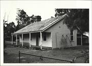
The old Mundaring Primary School sits on the north-east corner of Nichol St and Great Eastern Highway, adjacent to the War Memorial and diagonally opposite the former Post Office. The Police Station on the opposite southern corner completes an old civic precinct although the original weatherboard Police Station has been replaced by a brick structure in the 1960's. The school is of a simple two classroom design, although the two adjoining rooms were built several years apart. The external walls are of jarrah weatherboard interrupted only by the brick chimneys and fireplaces built across the south-west corner of each room. The south wall, facing the Highway, has three tall, four pane double hung windows with highlights. The east and west walls are plain weatherboard gable ends except for a small window on the west end and a pair of double doors on the east which formerly connected to the rest of the school (built later). The north wall is weatherboard, enclosing a veranda which had cloakroom wash-basin facilities at each end and gave access to the classrooms. A former entry porch in the centre of the wall has been enclosed as a store. Internally the original wall and ceiling lining has been replaced with flat asbestos sheeting with battened joints. One classroom still retains its vertical boarded dado but otherwise the rooms are relatively austere. The dividing wall between the two classrooms has been opened up to create a combined teaching space. The external ground levels appear to have progressively been raised and now nearly cover the 'goanna' boards around the timber stumped base. Rainwater goods are badly rusted and in need of repair. (The above problems identified with the building fabric were rectified when the place was restored during 1997, for use as a tourism and local history information centre.)
Before the Mundaring Primary School was built in 1908, on 5 acres of land on the north side of York Road (Great Eastern Highway), local students were taught in the 1901 Mundaring Agricultural Hall (Site 40). In July 1908, the tender for the standard design weatherboard and iron school and quarters was let to Mr. A. Nelson for £688. The school opened on 10th November 1908, and the first Headmaster and later local MLA was Philip Turvey. By June 1909, there were 44 students, and with increasing enrolments, a new classroom, almost identical in design to the 1908 room, was built on its eastern end. Because of delays in the arrival of desks, the new room was not used until May 1913, four months after the contract had been let to Mr. W.E. Hayes for £347/12/-. By then the school had 70 students, some of whom, until the new room was built, had been taught in the school's shelter shed. Various other buildings were added to the site in the 1920's and 1950's. In 1990, the Mundaring Primary School moved to a new location in Stevens Street, and the site was sold to a private developer for a shopping centre which opened in late 1995. The 1908 and 1913 classrooms remain in their original position in the shopping centre precinct. The buildings were restored by the Shire of Mundaring in 1997, for use by the Hills Tourism Association and the Mundaring & Hills Historical Society as an information centre.
Integrity: high, although all other buildings associated with the school have been removed and a shopping centre built on the site. Modifications: porch enclosed, wall between classrooms opened up.
Fair
| Name | Type | Year From | Year To |
|---|---|---|---|
| PWD (Chief Architect: Hillson Beasley) | Architect | - | - |
| Ref ID No | Ref Name | Ref Source | Ref Date |
|---|---|---|---|
| MHHS File; "Mundaring". | |||
| I Elliot; ibid pp. 115, 120-123, 127 | |||
| Bruce Callow & Assoc; "Mundaring Primary School Heritage Assessment". | HCWA | 1994 |
This information is provided voluntarily as a public service. The information provided is made available in good faith and is derived from sources believed to be reliable and accurate. However, the information is provided solely on the basis that readers will be responsible for making their own assessment of the matters discussed herein and are advised to verify all relevant representations, statements and information.
7250 Great Eastern Hwy Mundaring
Mundaring
Metropolitan
Constructed from 1980
| Type | Status | Date | Documents |
|---|---|---|---|
| (no listings) |
| Type | Status | Date | Documents |
|---|---|---|---|
| RHP - Does not warrant assessment | Current | 24 Oct 2025 |
| Type | Status | Date | Grading/Management | |
|---|---|---|---|---|
| Category | ||||
| (no listings) | ||||
Good
Individual Building or Group
| Epoch | General | Specific |
|---|---|---|
| Other Use | GOVERNMENTAL | Police Station or Quarters |
| Style |
|---|
| Late 20th-Century Perth Regional |
| Type | General | Specific |
|---|---|---|
| Roof | ASBESTOS | Fibrous Cement, corrugated |
| Wall | CONCRETE | Concrete Block |
| General | Specific |
|---|---|
| SOCIAL & CIVIC ACTIVITIES | Law & order |
This information is provided voluntarily as a public service. The information provided is made available in good faith and is derived from sources believed to be reliable and accurate. However, the information is provided solely on the basis that readers will be responsible for making their own assessment of the matters discussed herein and are advised to verify all relevant representations, statements and information.
Lot 502 Hall Rd Mundaring
Cnr Weir Village & Hall Rds; to be included in P8538 Mundaring Weir Precinct
Goldfields Reservoir Hotel
Weir Lodge Hotel
Mundaring
Metropolitan
Constructed from 1898 to 1999
| Type | Status | Date | Documents |
|---|---|---|---|
| Heritage List | YES | 08 Mar 2016 | |
| State Register | Registered | 20 Apr 2004 | HCWebsite.Listing+ListingDocument, HCWebsite.Listing+ListingDocument |
| Type | Status | Date | Documents |
|---|---|---|---|
| (no listings) |
| Type | Status | Date | Grading/Management | |
|---|---|---|---|---|
| Category | ||||
| Municipal Inventory | Adopted | 22 Apr 1997 | 1 - Exceptional significance | |
| Aboriginal Heritage Sites Register | Permanent | |||
| Classified by the National Trust | Classified | 10 Feb 2003 | ||
| Statewide Hotel Survey | Completed | 01 Nov 1997 | ||
08538 Mundaring Weir, Gardens and Village Precinct
| Name | Type | Year From | Year To |
|---|---|---|---|
| Jacoby Bros. | Architect | - | - |
| Library Id | Title | Medium | Year Of Publication |
|---|---|---|---|
| 7463 | Conservation plan for Mundaring Weir Hotel, Mundaring Weir. | Heritage Study {Cons'n Plan} | 2005 |
| 9485 | Mundaring Weir Hotel conservation works: final conservation work report. | Conservation works report | 2009 |
| 6452 | Mundaring Weir Precinct masterplan : final master plan report. | Heritage Study {Other} | 2002 |
Individual Building or Group
| Epoch | General | Specific |
|---|---|---|
| Present Use | COMMERCIAL | Hotel, Tavern or Inn |
| Original Use | COMMERCIAL | Hotel, Tavern or Inn |
| Style |
|---|
| Federation Filigree |
| Type | General | Specific |
|---|---|---|
| Wall | BRICK | Common Brick |
| Roof | METAL | Corrugated Iron |
| General | Specific |
|---|---|
| DEMOGRAPHIC SETTLEMENT & MOBILITY | Workers {incl. Aboriginal, convict} |
| PEOPLE | Famous & infamous people |
| TRANSPORT & COMMUNICATIONS | Mail services |
| OUTSIDE INFLUENCES | Tourism |
| OCCUPATIONS | Hospitality industry & tourism |
| DEMOGRAPHIC SETTLEMENT & MOBILITY | Settlements |
This information is provided voluntarily as a public service. The information provided is made available in good faith and is derived from sources believed to be reliable and accurate. However, the information is provided solely on the basis that readers will be responsible for making their own assessment of the matters discussed herein and are advised to verify all relevant representations, statements and information.
Constructed from 1920, Constructed from 1897
16610 Goldfields Water Supply Scheme
The Mundaring Weir Hotel has very high social, historic and aesthetic significance, both locally and State, for its associations with the Weir's construction, operation and tourist activities together with its two storey architectural style of which there are only several examples in the Shire.
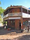
The approach and entry into the Hotel today is through the newer two storey brick additions carried out in the early 1900's; however, parts if the original 1898 single storey weatherbaord hotel are still visible on the west (rear) and south sides. The architectural style of the building falls into the broad Federation style category and, although restrained in it's decoration, has elements of Queen Anne and Arts and Crafts with it's timber verandah detailing. Brickwork to the "new" front section is plain red brick laid in English bond. The roof form, using corrugated iron, features rendered mouldings to a large chimney, gambrel ends on ridges and a rendered parapet across the front. The steeply sloping site drops away significantly tot he rear, allowing recent infill to provide cafe/bistro below what was the original single storey weatherboard section. new single storey brick accommodation units step further down the site to the rear. Internally the rear single storey, timber framed section, still accommodates it's original ballroom and dining room which feature richly detailed pressed metal ceilings, timber panelling and full height coloured glass folding doors to divide the large overall space into smaller function rooms if required, From a connecting hallway, between the old and "new" sections, a jarrah staircase, with stained glass windows on the half landing, leads to the first floor of the front brick section which now accommodates the manager's residence. The interiors of the front ground floor bars have been renovated over the years and retain little of their original detail; for example ceilings that are now plain plasterboard with coved cornices.
From 1903, when the weir first overflowed, the re-named 'Goldfields Weir Hotel', enjoyed patronage from sightseers as well as locals. Sometime in the period 1904-7, Fred Jacoby took over the running of the hotel, and added a two storey section to the front of the 1898 building. A postal agency operated here from c.1907. Also in 1907, he was able to open the bar on Sundays, and in 1909, when the Western Australian Government Railways took over the Weir line, the tourist trade increased rapidly. Aside from a short period during World War I when the Weir was off limits to civilians, excursion trains remained popular until the advent of World War II. As evidenced by advertisements in the "Motorist and Wheelman", the 1920's saw an increase in motor traffic coming to the hotel. The hotel was later run by Fred Jacoby's daughter, Elfreda Devenish. In the time since World War II, the hotel remained licensed and continued to be used as a post office agency. It gradually fell into poor condition until restoration work was begun in the mid 1970's by the late Kerry Burke and subsequent owners. Additions include the building in the early 1990's, of ten accommodation units and a swimming pool. In recent years, the Goldfields Weir Hotel has been the scene of classical and jazz music concerts, and other diverse social and cultural activities.
Integrity: high- Although the original single storey buildings are dominated by the later two storey brick buildings.
Good
| Ref ID No | Ref Name | Ref Source | Ref Date |
|---|---|---|---|
| "MHHS files 'Karda Mordo' & 'Mundaring Weir'." | |||
| Elliot; ibid pp. 139, 142 |
This information is provided voluntarily as a public service. The information provided is made available in good faith and is derived from sources believed to be reliable and accurate. However, the information is provided solely on the basis that readers will be responsible for making their own assessment of the matters discussed herein and are advised to verify all relevant representations, statements and information.
following reasons: the place contains part of the oldest surviving permanent building at Mundaring Weir which developed as a service centre for the Goldfields Water Supply Scheme; the place served as a popular tourist venue for the people of Perth for nearly 100 years and has become a popular cultural venue for local entertainers; the place has associations with C.YO'Connor, the engineer who designed the Goldfields Water Supply Scheme, David Helfgott, an internationally renowned pianist, Frank Pash and internationally acclaimed painter and the Goldfields Water Supply Scheme; the place has become a cultural venue which attracts residents who live locally, people from the wider Perth community and international visitors; and, the place is a good example of the Federation Filigree style and, together with the Mundaring Weir Hall forms a small historic precinct.
Mundaring Weir Hotel is composed of two distinct sections The earliest component is a single storey weatherboard and iron structure built in 1898. The later section is a two storey brick and iron structure, with a double storey verandah, built inc. 1906. The building is an example of Federation Filigree. The earlier section was built for Mathieson and Frederick Jacoby, while the later section was built for Frederick Jacoby. A comparatively small community lives at Mundaring Weir, which lies to the south of Mundaring. The villagers mainly home to support personnel for C.A.L.M., who are responsible for the state-forests surrounding the Mundaring weir and some private residents. Mundaring Weir Hotel is located on the corner of Weir Village Road (south eastern) and Hall Road. Several residences are located on the eastern side of Weir Village Road while on the north western side of Hall Road is the Mundaring Weir Hall. Both Mundaring Weir Hotel and the Mundaring Weir Hall are located close to the entrance of the public park at Mundaring Weir. The site slopes downwards on the southern and western sides The land on the western side of Mundaring Weir Hotel has been retained behind a rendered brick wall which runs parallel with Weir Village Road. This area has several mature trees planted along it, including a row of coral trees. The land at the rear of Mundaring Weir Hotel (western side) has been terraced to form an amphitheatre. Immediately to the west of the terracing is a flat piece of land which contains a pool and a grassed area. To the west of this is another flat area of land, before the site slopes down steeply to Portagabra Creek at the western edge of the site.
Assessment 2003 Construction 1898 Mundaring Weir Hotel was built by the Jacoby brothers, Matheison and Frederick Jacoby in 1898. At the time of the hotel's construction work has just commenced on the construction of the Goldfields Water Supply Scheme, with the construction of a dam on the Helena River in the Darling Ranges, the key component. The dam construction attracted a large work force and a camp was established 'on the southern' side of the Helena River to the west of the dam wall. The lack of legal supplies of alcohol were soon felt at the dam and the Jacoby brothers were successful in applying for a liquor license in 1898. The Goldfields Water Supply Scheme was officially opened in January 1903 and although the vast numbers of workmen soon left the site, a small community stayed on at the weir servicing the two pumping stations that were constructed to pump water out of the valley and on its way to Kalgoorlie. Frederick Jacoby enlarged the hotel by adding a two storey brick section to the front of the original weatherboard building in c.1906. The hotel prospered and became particularly popular during the first quarter of the twentieth century when large numbers of people came to visit the Weir. Patronage declined during the Depression years and it was not until the end of the twentieth century that the hotel again became a popular venue when concerts were staged in the outdoor amphitheatre at the rear of the hotel. David Helfgott gave his first concerts at the hotel in 1985, and once the film 'Shine- was released in 1995, the concerts "became particularly popular, leading to a more formalised arrangement to the amphitheatre.
This information is provided voluntarily as a public service. The information provided is made available in good faith and is derived from sources believed to be reliable and accurate. However, the information is provided solely on the basis that readers will be responsible for making their own assessment of the matters discussed herein and are advised to verify all relevant representations, statements and information.
Cnr Jacoby & Hodgson Sts Mundaring
Mundaring Playgroup Building
Mundaring
Metropolitan
Constructed from 1898
| Type | Status | Date | Documents |
|---|---|---|---|
| (no listings) |
| Type | Status | Date | Documents |
|---|---|---|---|
| (no listings) |
| Type | Status | Date | Grading/Management | |
|---|---|---|---|---|
| Category | ||||
| (no listings) | ||||
Individual Building or Group
| Epoch | General | Specific |
|---|---|---|
| Original Use | Transport\Communications | Comms: Post or Telegraph Office |
| Present Use | EDUCATIONAL | Pre-primary Centre |
| Type | General | Specific |
|---|---|---|
| Roof | METAL | Corrugated Iron |
| Wall | TIMBER | Weatherboard |
| General | Specific |
|---|---|
| TRANSPORT & COMMUNICATIONS | Mail services |
This information is provided voluntarily as a public service. The information provided is made available in good faith and is derived from sources believed to be reliable and accurate. However, the information is provided solely on the basis that readers will be responsible for making their own assessment of the matters discussed herein and are advised to verify all relevant representations, statements and information.
Cnr Jacoby & Nichol Sts Mundaring
Mundaring Agricultural Hall
Mundaring
Metropolitan
Constructed from 1901
| Type | Status | Date | Documents |
|---|---|---|---|
| (no listings) |
| Type | Status | Date | Documents |
|---|---|---|---|
| (no listings) |
| Type | Status | Date | Grading/Management | |
|---|---|---|---|---|
| Category | ||||
| Municipal Inventory | Adopted | 22 Apr 1997 | 3 - Moderate significance | |
| Name | Type | Year From | Year To |
|---|---|---|---|
| F.W.B. Hawkins | Architect | - | - |
Individual Building or Group
| Epoch | General | Specific |
|---|---|---|
| Other Use | SOCIAL\RECREATIONAL | Agricultural Hall |
| Present Use | SOCIAL\RECREATIONAL | Other Community Hall\Centre |
| Original Use | SOCIAL\RECREATIONAL | Other Community Hall\Centre |
| Type | General | Specific |
|---|---|---|
| Wall | BRICK | Common Brick |
| Roof | METAL | Corrugated Iron |
| General | Specific |
|---|---|
| SOCIAL & CIVIC ACTIVITIES | Community services & utilities |
This information is provided voluntarily as a public service. The information provided is made available in good faith and is derived from sources believed to be reliable and accurate. However, the information is provided solely on the basis that readers will be responsible for making their own assessment of the matters discussed herein and are advised to verify all relevant representations, statements and information.
Constructed from 1901
The Mundaring Hall has high social and historic significance as the focus for social activities in the district and associations with prominent people in the community. Its aesthetic significance has been diminished by unsympathetic alterations and additions to the Jacoby Street frontage.
The Mundaring Hall sits at the corner of Nichol and Jacoby Streets opposite Railway Reserve sculpture park tot he south and the Mundaring Hotel on the adjacent eastern corner. The appearance of the original hall has been significantly altered by rendering and painting the brickwork and the addition to the Jacoby Street elevation of a flat roofed porch and an adjoining room on the west side. The latter room was added in c.1955, and used by the Commercial Bank. In 1938, major extensions tot he hall were built at the rear with a side entrance off Nichol Street. The buildings remain in good condition and have high integrity although their aesthetics have suffered and this detracts from their important location in the townsite.
Following the end of the Depression, and with increasing demands on the hall, in September 1937, the Mundaring Road Board called tenders for reconstruction and enlargement. The official opening of the £ 2,000 works designed by architect F.W.B. Hawkins and built by Mr Goodlet was held in February 1938. The opening was performed by the former Premier and Lieutenant-Governor, Sir James Mitchell and was followed by dancing until midnight. A contemporary account described the improvements as consisting of better ventilation, acoustics and lighting, and with the older building now becoming the lesser hall, cloakroom, kitchen and stage. Soon afterwards, the CWA were given permission to use the hall. The badminton players were not so lucky, as their application was refused. In December 1938, Evans and Bleakley applied for the sole rights to show pictures in the hall. In November of the previous year, 'Star Talkies' had applied for a similar right. From c 1955, the Commercial Bank of Australia Ltd operated from premises on the west of the Lesser Hall, fronting Jacoby Street. Prior to this, and from c 1927, the manager of the Midland Junction branch had conducted a weekly service from the Road Board office in Mann Street. The hall continues to be used for community activities, including as a polling places for local, state and federal elections.
Integrity: High Modifications: Front elevation modified and new hall built to the rear.
Good
| Ref ID No | Ref Name | Ref Source | Ref Date |
|---|---|---|---|
| "Swan Express". | 2/8/1929 | ||
| "Swan Express". | 16/9/1937 | ||
| "Swan Express". | 14/1/1937 | ||
| "Swan Express". | 20/10/1937 | ||
| "Swan Express". | 15/6/1939 | ||
| "Swan Express". | 11/11/1937 | ||
| "Swan Express". | 15/12/1938 | ||
| "Swan Express". | 2/12/1937 | ||
| "Swan Express". | 19/8/1927 | ||
| "Swan Express". | 17/2/1939 | ||
| "Swan Express". | 114/4/1922 | ||
| "Swan Express". | 12/11/1926 |
This information is provided voluntarily as a public service. The information provided is made available in good faith and is derived from sources believed to be reliable and accurate. However, the information is provided solely on the basis that readers will be responsible for making their own assessment of the matters discussed herein and are advised to verify all relevant representations, statements and information.
Jacoby St Mundaring
Includes: landscaped park containing 9 pieces of artwork, CWA Rest Room, rotunda, playground, amphitheatre, former station master's house and Scout Hall
Mundaring Community Park
Mundaring Railway Station & Railway Reserve
Mundaring
Metropolitan
Constructed from 1898 to 1996
| Type | Status | Date | Documents |
|---|---|---|---|
| Heritage List | YES | 08 Mar 2016 | |
| State Register | Registered | 28 Nov 2003 | HCWebsite.Listing+ListingDocument, HCWebsite.Listing+ListingDocument |
| Type | Status | Date | Documents |
|---|---|---|---|
| (no listings) |
| Type | Status | Date | Grading/Management | |
|---|---|---|---|---|
| Category | ||||
| Municipal Inventory | Adopted | 22 Apr 1997 | 1 - Exceptional significance | |
| Classified by the National Trust | Classified | 12 May 2003 | ||
| Name | Type | Year From | Year To |
|---|---|---|---|
| Jon Tarry & Peter Dailey | Architect | - | - |
| Hans Arkeveld & Stuart Elliot | Architect | - | - |
| Ross Donaldson, Phil Palmer, Trevor Woodward | Architect | - | - |
| Ronald Sims & Ron Gomboc | Architect | - | - |
| Nola Farnham & Alan Clark | Architect | - | - |
Historic site
| Epoch | General | Specific |
|---|---|---|
| Original Use | Transport\Communications | Rail: Railway Station |
| Present Use | PARK\RESERVE | Park\Reserve |
| Style |
|---|
| Victorian Georgian |
| Type | General | Specific |
|---|---|---|
| Other | BRICK | Common Brick |
| Other | METAL | Bronze |
| Wall | ASBESTOS | Fibrous Cement, flat |
| Other | CONCRETE | Reinforced Concrete |
| Other | TIMBER | Other Timber |
| Roof | METAL | Corrugated Iron |
| Other | METAL | Other Metal |
| Other | METAL | Steel |
| Other | STONE | Granite |
| General | Specific |
|---|---|
| TRANSPORT & COMMUNICATIONS | Rail & light rail transport |
| OUTSIDE INFLUENCES | Tourism |
| SOCIAL & CIVIC ACTIVITIES | Community services & utilities |
This information is provided voluntarily as a public service. The information provided is made available in good faith and is derived from sources believed to be reliable and accurate. However, the information is provided solely on the basis that readers will be responsible for making their own assessment of the matters discussed herein and are advised to verify all relevant representations, statements and information.
Constructed from 1898, Constructed from 1995
The Mundaring Sculpture Park has very high aesthetic, social and historic significance for the State and the Shire of Mundaring for its unique arts concept, associations with prominent Local, State and Nationally recognised artists; and with the history of the railways.
The Mundaring Sculpture Park is located among the trees on the railway reserve at the southern boundary of the town centre. Numerous sculptures from prominent State and local artists are strategically placed throughout the reserve in the naturally landscaped park setting complimented by a performance ampitheatre space centred on the old railway line itself is now part of a continuous walk/bridle trail throughout the Shire and forms a linear axis for the Sculpture park.
The linear sculpture park, which occupies a small section along the route of the original Eastrn Railway Reserve in Mundaring, is an ongoing project which was officially opened as part of the Bicentennial celebrations on 11th September 1988. The main conceptual design for the park arose from a report prepared in 1984, for the Mundaring park Committee, by architct Ross Donaldson and landscape architect Phil Palmer, with the assistance of artist Trevor Woodward. The Committee, now headed by Ross Donaldson, included various Community Arts Officers, members of the Mundaring Arts Board, Shire of Mundaring, Mundaring Ratepayers Associaition and Andra Kins, who later became the Executive Director of the Crafts Council WA. Initially the artists represented in the park were Hans Arkeveld, Ron Gomboc, Richard Fry, Peter Dailey, Jon Tarry and Stuart Elliot, whose vandalised tourist figures were restored on site in June 1990. In 1989, on the embankment opposite the former Mundaring Railway Platform, work began on the ampitheatre. Nearby, a signal sculture acknowledging the site's railway heritage and designed by Alan Clark, was opened in 1990. Since then, two sound sculptures, one by Ron Sims (1992) and one by Nola Farman (1995) have been added to the park. Since it's opening in late 1988, the park has gained Australia wide recognition for it's community arts focus. The importance of the sculptures has been recognised in the renaming of the park to Mundaring Sculpture Park.
Integrity: Very High
Very Good
| Name | Type | Year From | Year To |
|---|---|---|---|
| Phil Palmer | Architect | - | - |
| Ross Donaldson | Architect | - | - |
| Trevor Woodward | Architect | - | - |
| Andra Kins | Architect | - | - |
| Ref ID No | Ref Name | Ref Source | Ref Date |
|---|---|---|---|
| Echo; "A Day in the park".p.12 | 28/8/1988 | ||
| Echo; :"A Seat in the park". | 17/7/1988 | ||
| 'Take a fresh look-they're unreal'. p.34 | West Australian | 8/9/1988 | |
| I Elliot; ibid p. 117 | |||
| Donaldson Smith Architects & Urban Designers; 'Mundaring Park: the Art of Good Community'. | 1984 | ||
| 'Art for the people' West Australian". p.viii | West Australian | 10/9/1988 | |
| Echo; "Vandals: a personal attack". p.1 | 30/9/1988 | ||
| Echo; "Unique park". p.3 | 4/9/1988 |
| Owner | Category |
|---|---|
| Shire of Mundaring | Local Gov't |
This information is provided voluntarily as a public service. The information provided is made available in good faith and is derived from sources believed to be reliable and accurate. However, the information is provided solely on the basis that readers will be responsible for making their own assessment of the matters discussed herein and are advised to verify all relevant representations, statements and information.
Mundaring Sculpture Park, a landscaped park containing several pieces of artwork, a CWA Rest Room, playground, Amphitheatre, former station master's house and Scout Hall, all contained within what was formerly a railway station reserve, has cultural heritage significance for the following reasons: . the place is the only community sculpture park in Western Australia; . the Earth Sound Device, an audio installation by artist Nola Farnham, is recognised nationally as an innovative piece of artwork; . the place successfully combines natural landscaping with built elements and sculpted pieces to create a fully integrated cultural precinct; . the place has become a popular venue for local festivals and other cultural events and is held in high esteem by the local community; and, . the place has retained physical reminders of the site's railway heritage, such as the former Station Master's House, the former Mundaring station platform and the former railway formation, all of which were important to the development of Mundaring
Mundaring Sculpture Park is located at the southern end of Nichol Street on the edge of the central business district of Mundaring. The site is bounded by Jacoby Street to the north, Maddock Street to the east, Phillips Road to the south and Gugeri Street to the west. Nichol Street bisects Jacoby Street approximately halfway along the length of the park. The southern side of the park is bounded by a residential area, while the eastern and western sides represent the continuation of the Railway Heritage Trail. The route of the former railway line bisects the site east - west and there are secondary paths which run through the site approximately north - south. A prominent feature of the park are the numerous mature trees on the northern and southern side of the park (at the eastern end). These trees include pines, plane trees and a variety of eucalypts. Numerous, younger trees are clustered randomly along the northern and southern edges of the former railway line and some have also been planted down the centre of the former line, at the eastern end, creating two distinct paths. A central lawned area lies opposite the terminus of Nichol Street. The area directly opposite the southern end of Nichol Street is a cleared open space with a backdrop of mature eucalypts and native plants. On the southern side of this area are four large, roughly squared logs which bear the name of the park 'Mundaring Community Sculpture Park. Just to the west of these logs is an exit point for one of the north- south pathways. The former Mundaring Station Master's House lies on the western side of the cleared area. The amphitheatre and former railway platform lie to the west of the lawned area and south of the former Mundaring Station Master's House. The Scout Hall is located on Nichol Street to the west of the former Mundaring Station Master's House. The rotunda is to the south west of the Scout Hall amongst young saplings and native plants. The CWA building is located at the eastern end of the park, while the sculptures are spread along the paths at the eastern end of the park and near the amphitheatre. The sculptural pieces are: Mother (Jon Tarry), Tractor (Peter Dailey), Moondae Ring (Ronald Sims), Missed Last Train (Ron Gomboc), Mainstream (Hans Arkveld), Tourists (Stuart Elliot), Second Wave (Alan dark) and Earth Sound Device (Nola Farnham).
Assessment 2003 Construction 1902 - 1996 Mundaring Sculpture Park comprises the former Mundaring Station platform (1898), the former Mundaring Station Master's House (1902), the Mundaring CWA Hall (1954), the Mundaring Scout Hall (1960s), several pieces of public sculpture (1988 - 1995), a rotunda (1993), landscaped grounds (1988 & 1991) and a children's playground (1960s - 996). These elements are all located on a section of the Railways Heritage Trail (1988). The Park was officially opened on 11 September 1988 as part of the Commonwealth Bicentennial celebrations. The development of the Park was organised by a community based committee which consulted regularly with the local community. Many of the artists lived locally and gave their time freely to the project, while local businesses donated materials. 2 Mundaring Sculpture Park was placed on the Shire ofMundaring's Municipal Inventory in 1997. In April 2003, the Park is heavily used by local community groups for various activities and there are proposals in place for the commissioning of additional sculptural pieces.
This information is provided voluntarily as a public service. The information provided is made available in good faith and is derived from sources believed to be reliable and accurate. However, the information is provided solely on the basis that readers will be responsible for making their own assessment of the matters discussed herein and are advised to verify all relevant representations, statements and information.
Jacoby St Mundaring
Mundaring Station-master's House
Mundaring
Metropolitan
Constructed from 1902
| Type | Status | Date | Documents |
|---|---|---|---|
| (no listings) |
| Type | Status | Date | Documents |
|---|---|---|---|
| (no listings) |
| Type | Status | Date | Grading/Management | |
|---|---|---|---|---|
| Category | ||||
| Municipal Inventory | Adopted | 22 Apr 1997 | 3 - Moderate significance | |
08577 Mundaring Sculpture Park
The former Station Master's House is in poor condition (2003) although repairs to the roof have ensured that the interior is now protected from further water damage through the roof.
| Library Id | Title | Medium | Year Of Publication |
|---|---|---|---|
| 5167 | Station Master's House (former), Mundaring : conservation plan / prepared for Shire of Mundaring by Laura Gray in association with Philippa Rogers. | Heritage Study {Cons'n Plan} | 2001 |
| 5971 | Mundaring Stationmaster's House, Stage 1 conservation works : final report. | Conservation works report | 2002 |
Individual Building or Group
| Epoch | General | Specific |
|---|---|---|
| Present Use | RESIDENTIAL | Single storey residence |
| Original Use | Transport\Communications | Rail: Housing or Quarters |
| Type | General | Specific |
|---|---|---|
| Roof | METAL | Corrugated Iron |
| Wall | BRICK | Common Brick |
| General | Specific |
|---|---|
| TRANSPORT & COMMUNICATIONS | Rail & light rail transport |
This information is provided voluntarily as a public service. The information provided is made available in good faith and is derived from sources believed to be reliable and accurate. However, the information is provided solely on the basis that readers will be responsible for making their own assessment of the matters discussed herein and are advised to verify all relevant representations, statements and information.
Constructed from 1902
The Mundaring Station-master's house has high social and historic significance as one of the few railway fragments remaining intact and as a reminder of the importance of the railways to the development of the region and the impact it had on the community lifestyle.
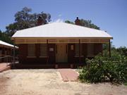
The Mundaring station-master's house is diagonally opposite the Mundaring Hotel in Jacoby Street and side on to the street and railway reserve which is now the site of the Mundaring sculpture park (Site 269). The house is near the original station platform which has been adapted as a stage for the park's amphitheatre. It is a simple brick residence, typical of the standard government pattern of the period, with central hall, rooms off either side and rear leanto providing bathroom, laundry etc. The hipped corrugated iron roof extends down lower across the front (east) to form a full width veranda.
When the townsite of Mundaring was gazetted in May 1898, one of the earliest buildings constructed was the railway station. The brick and iron station-master's house was built some time later, and is one of the few remaining railway residences in the shire. The others are a weatherboard and iron house at Glen Forrest (Site 102), and what is thought to be the former station-master's residence at Wooroloo.
Integrity: HIgh
Good
| Ref ID No | Ref Name | Ref Source | Ref Date |
|---|---|---|---|
| I Elliot; ibid. pp 116, 117 |
This information is provided voluntarily as a public service. The information provided is made available in good faith and is derived from sources believed to be reliable and accurate. However, the information is provided solely on the basis that readers will be responsible for making their own assessment of the matters discussed herein and are advised to verify all relevant representations, statements and information.
2815 Jacoby St Mundaring
Mundaring
Metropolitan
Constructed from 1926
| Type | Status | Date | Documents |
|---|---|---|---|
| Heritage List | YES | 08 Mar 2016 |
| Type | Status | Date | Documents |
|---|---|---|---|
| RHP - Does not warrant assessment | Current | 31 Jan 2003 |
| Type | Status | Date | Grading/Management | |
|---|---|---|---|---|
| Category | ||||
| Municipal Inventory | Adopted | 22 Apr 1997 | 1 - Exceptional significance | |
Individual Building or Group
| Epoch | General | Specific |
|---|---|---|
| Original Use | SOCIAL\RECREATIONAL | Masonic Hall |
| Present Use | SOCIAL\RECREATIONAL | Masonic Hall |
| Type | General | Specific |
|---|---|---|
| Wall | STONE | Other Stone |
| Roof | METAL | Corrugated Iron |
| General | Specific |
|---|---|
| SOCIAL & CIVIC ACTIVITIES | Institutions |
This information is provided voluntarily as a public service. The information provided is made available in good faith and is derived from sources believed to be reliable and accurate. However, the information is provided solely on the basis that readers will be responsible for making their own assessment of the matters discussed herein and are advised to verify all relevant representations, statements and information.
Constructed from 1926
The Mundaring Masonic Lodge was built in 1926 of laterite stone with brick quoins and buttresses. The basic plan of the original building is T shaped over which a corrugated iron roof has its main ridge along the north - south axis starting from a gable end on the north and meeting a hipped east -west wing across the south end. The roof features vented gambrels on the hipped ends and has a brick chimney at the centre of the transverse east - west wing. A flat roof extension and new entry porch has been built (c 1950s ?) across the south end of the stone building in a most expedient and unsympathetic manner using framed construction and flat sheet asbestos cladding. In the process of building the extension thought has been given to relocating the original foundation stone so that it is still visible on the new outside wall. The overall character of the original building is elegant and well proportioned, reflecting the earlier style of the Federation free style period.
The Mundaring Branch of the Freemasons Lodge (No 90 WAC) was dedicated and consecrated on 5th November 1910, and before the present building was opened in 1926, they met in the Mundaring Agricultural Hall (Site 40) and the Mundaring Hotel (Site 39). Some of the prominent members included the Jacoby Brothers and Alex McCallum of Ballindown ( Site 23), who went on to become Grand Master from c 1936-39, the highest position in the Freemasons organization. E . D. Forsyth, who was Greenmount Road Board secretary from 1905 to 1933, was also secretary of the Mundaring Lodge for 14 years. Other long serving members of the Lodge included Mundaring storekeeper James Wells (Site 232) and stone mason and quarry manager E. (Ted) Ingram (Site 158) of Mahogany Creek. According to the foundation stone, the oldest section of the Mundaring Lodge building was opened on 13th March 1926, by the then Grand Master, the Most Reverend C.O.L. Riley DD LLD OBE VD, Archbishop of Perth. It was a busy weekend for Archbishop Riley who, the following day, unveiled the memorial tablets at the Mundaring War Memorial (Site 42). Since then additions and alterations have been made to the Lodge building which indicates that the foundation stone is not in its original position.
Integrity: High Modifications: Extension and entry porch added at front.
This information is provided voluntarily as a public service. The information provided is made available in good faith and is derived from sources believed to be reliable and accurate. However, the information is provided solely on the basis that readers will be responsible for making their own assessment of the matters discussed herein and are advised to verify all relevant representations, statements and information.
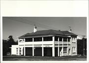
3115 Jacoby St Mundaring
Cnr Nichol St
Mundaring
Metropolitan
Constructed from 1899
| Type | Status | Date | Documents |
|---|---|---|---|
| Heritage List | YES | 08 Mar 2016 |
| Type | Status | Date | Documents |
|---|---|---|---|
| RHP - Assessed - Below Threshold | Current | 27 Feb 2004 |
| Type | Status | Date | Grading/Management | |
|---|---|---|---|---|
| Category | ||||
| Statewide Hotel Survey | Completed | 01 Nov 1997 | ||
| Municipal Inventory | Adopted | 22 Apr 1997 | 1 - Exceptional significance | |
| Library Id | Title | Medium | Year Of Publication |
|---|---|---|---|
| 7022 | Images CD No. 26 : assessment images : Mundaring Hotel, Temuka, Faversham, Armadale Brickworks (fmr). | C D Rom | 2004 |
Individual Building or Group
| Epoch | General | Specific |
|---|---|---|
| Present Use | COMMERCIAL | Hotel, Tavern or Inn |
| Original Use | COMMERCIAL | Hotel, Tavern or Inn |
| Style |
|---|
| Federation Free Style |
| Type | General | Specific |
|---|---|---|
| Roof | METAL | Corrugated Iron |
| Wall | BRICK | Common Brick |
| General | Specific |
|---|---|
| SOCIAL & CIVIC ACTIVITIES | Sport, recreation & entertainment |
This information is provided voluntarily as a public service. The information provided is made available in good faith and is derived from sources believed to be reliable and accurate. However, the information is provided solely on the basis that readers will be responsible for making their own assessment of the matters discussed herein and are advised to verify all relevant representations, statements and information.
Constructed from 1899
The Mundaring Hotel has very high aesthetic, social and historic significance for its two storey styling and landmark qualities; its associations with the old heart of Mundaring and prominent people involved with the development of the district.
The two storey Mundaring Hotel sits on the corner of Jacoby and Nichol Streets Mundaring opposite the railway reserve sculpture park to the south and the Mundaring Hall on the adjacent (west) corner. It is of the Federation Free Style period and has landmark qualities, positioned prominently in the old heart of Mundaring around the railway station. The first floor verandas and balustrades still overhang the footpath and have not been removed as has been the fate of most of the hotels throughout the State. However, the original decorative timber veranda columns and first floor balustrades have unfortunately been replaced with brick piers and flush panel balustrades. The verandas wrap around the street frontage from Nichol Street to Jacoby Street, terminating at a projecting 'residents' entry featuring narrow, arched windows and door. The red brick walls have been painted 'off-white' and the rendered band at door head height painted dark red, all of which has changed the character of the place although its form and integrity remain quite high. Obtrusive signage on the walls and veranda detract from the appearance and original character of the Hotel. The corrugated iron roof is painted red and has a simple hipped form punctuated by two, relatively tall brick chimneys with decorative rendered mouldings. Internally the hotel has undergone various 'modernisations' which has removed much of its original decoration and finish.
On 22nd October 1898, soon after the Mundaring townsite was gazetted in May 1898, H.A. Hummerston, then licensee of the Helena Vale Hotel in Railway Parade Midland, acquired lots 54 and 55 on the corner of Jacoby and Nichol Streets and near to the newly-built Mundaring Railway Station. In April 1899, the first publican Albert Maddock, opened the two-storey, brick building for business. In June 1900, John Chipper took over the lease and began to advertise to attract the holiday resort trade. It became a very popular weekend retreat and many other guest houses and cottages, such as 'Temuka' (Site 26), followed the trend. Before the Masonic Lodge (Site 46) in Jacoby Street was built in 1926, meetings of the local Freemasons Lodge were held in the hotel. In January 1929, the lease was taken over by Bob Crawford from the Freemasons Hotel in Bridgetown. After Hummerston died in 1932, the hotel was bought by Mundaring identity Fred Jacoby. Jacoby first came to Mundaring in November 1893, when he and brother Mathieson Harry and father Daniel purchased the vineyard Peter Gugeri had established in 1882 (Site 20). In recent times, the hotel was owned by prominent Mundaring family, the Italiano Brothers.
Integrity: High Modifications: Painted brickwork; verandah and internal alterations.
| Ref ID No | Ref Name | Ref Source | Ref Date |
|---|---|---|---|
| "Swan Express". | 18/1/1929 | ||
| I Elliot; ibid pp. 112, 116-117, 197 |
This information is provided voluntarily as a public service. The information provided is made available in good faith and is derived from sources believed to be reliable and accurate. However, the information is provided solely on the basis that readers will be responsible for making their own assessment of the matters discussed herein and are advised to verify all relevant representations, statements and information.
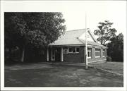
Cnr Mann St & Great Eastern Hwy Mundaring
Mundaring
Metropolitan
Constructed from 1935, Constructed from 1926
| Type | Status | Date | Documents |
|---|---|---|---|
| (no listings) |
| Type | Status | Date | Documents |
|---|---|---|---|
| RHP - Does not warrant assessment | Current | 31 Jan 2003 |
| Type | Status | Date | Grading/Management | |
|---|---|---|---|---|
| Category | ||||
| Municipal Inventory | Adopted | 22 Apr 1997 | ||
Individual Building or Group
| Epoch | General | Specific |
|---|---|---|
| Original Use | GOVERNMENTAL | Office or Administration Bldg |
| Present Use | GOVERNMENTAL | Office or Administration Bldg |
| Type | General | Specific |
|---|---|---|
| Roof | TILE | Other Tile |
| Wall | BRICK | Common Brick |
| Other | ASBESTOS | Fibrous Cement, flat |
| General | Specific |
|---|---|
| SOCIAL & CIVIC ACTIVITIES | Government & politics |
This information is provided voluntarily as a public service. The information provided is made available in good faith and is derived from sources believed to be reliable and accurate. However, the information is provided solely on the basis that readers will be responsible for making their own assessment of the matters discussed herein and are advised to verify all relevant representations, statements and information.
Constructed from 1983
The council officers of the Shire of Mundaring at Great eastern Highway, Mundaring have high aesthetic, historic and social significance for the people of the Shire as the centre of Local Government since 1926. Aesthetically they provide a very good example of late twentieth century architecture from the "WA School".
The original Mann Street Shire Offices on the site fronting Great Eastern Highway, had been added to several times and the verandahs enclosed before being demolished in 1982, to make way for the new offices. The old Shire Secretary's House, built 1947, remains and exhibits minor elements of Art Deco which were common in the post war period. The old house is now an annexe to the new building, providing office accommodation for community recreation staff. The new Shire Offices, built in 1982 and officially opened in February 1983, are a good example of the Late twentieth Century Perth Regional or "WA School" style of RJ Ferguson & Associates: Architects. The extensive single storey building has a strong horizontal profile with a large roof encompassing wide verandahs. It uses natural looking materials to acknowledge the local environment and climate which is indicative of the philosophy of the "WA School", which sought to identify a vernacular style.
Between 1906 and 1925, the original Greenmount Road Board administrative building was located in Mt Helena, then known as Lion Mill. In February 1926, with the emergence of Mundaring as the main centre of the district, a new building was opened in what was then Mann Street. The Swan Express described it's exterior as having a verandah, and the interior as being painted white. The interior space, which seems to have served as both office and boardroom, had a strong room located in one corner. The room had two doors, two windows, wall ventilators and a fire place. Soon after the Greenmount Road District changed to the Mundaring Road District on 29th March 1934, work began on improvements and alterations to the administrative building. The improvements, which may have included demolishing the older room, were officially opened on 7th February 1935, by Mr R Rattray. Photographs in the possession of the shire indicate that a post WWII civic rose garden was planted on the Great Eastern Highway frontage. The last substantial alterations to this building took place in 1965, and were opened by the then Premier David Brand in 14th December 1965. In January 1961, the Mundaring Road District became the Shier of Mundaring. By the late 1970's, it became obvious that the ad hoc additions to the shire's administrative building were inadequate to meet the needs of an expanding population base. The third and current building was designed by RJ Ferguson and Associates and was opened on 12th February 1983, by the State Governor Sir Richard Trowbridge KCVO. KSTJ. Those present included the Shire President Tom Broz and the Shire Clerk, now General Manager, Max Williams.
Integrity: Very High Modifications: Various extensions to the old office.
Very Good
| Name | Type | Year From | Year To |
|---|---|---|---|
| RJ Ferguson | Architect | 1982 | - |
| Ref ID No | Ref Name | Ref Source | Ref Date |
|---|---|---|---|
| Swan Express. | Feb 1926 | ||
| Mundaring Shier Information Services | |||
| I Elliot; ibid pp. 289-291 |
| Owner | Category |
|---|---|
| Shire of Mundaring | Local Gov't |
This information is provided voluntarily as a public service. The information provided is made available in good faith and is derived from sources believed to be reliable and accurate. However, the information is provided solely on the basis that readers will be responsible for making their own assessment of the matters discussed herein and are advised to verify all relevant representations, statements and information.
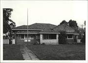
Cnr Mann St & Great Eastern Hwy Mundaring
Mundaring Police Station and Quarters
Mundaring
Metropolitan
Constructed from 1907
| Type | Status | Date | Documents |
|---|---|---|---|
| (no listings) |
| Type | Status | Date | Documents |
|---|---|---|---|
| (no listings) |
| Type | Status | Date | Grading/Management | |
|---|---|---|---|---|
| Category | ||||
| (no listings) | ||||
Individual Building or Group
| Epoch | General | Specific |
|---|---|---|
| Present Use | GOVERNMENTAL | Government Residence |
| Original Use | GOVERNMENTAL | Police Station or Quarters |
This information is provided voluntarily as a public service. The information provided is made available in good faith and is derived from sources believed to be reliable and accurate. However, the information is provided solely on the basis that readers will be responsible for making their own assessment of the matters discussed herein and are advised to verify all relevant representations, statements and information.
Mundaring Weir Rd Mundaring
Mundaring Sports Ground
Mundaring
Metropolitan
Constructed from 1901
| Type | Status | Date | Documents |
|---|---|---|---|
| (no listings) |
| Type | Status | Date | Documents |
|---|---|---|---|
| (no listings) |
| Type | Status | Date | Grading/Management | |
|---|---|---|---|---|
| Category | ||||
| Municipal Inventory | Adopted | 22 Apr 1997 | 3 - Moderate significance | |
Individual Building or Group
| Epoch | General | Specific |
|---|---|---|
| Present Use | SOCIAL\RECREATIONAL | Other |
| Original Use | SOCIAL\RECREATIONAL | Other |
| Type | General | Specific |
|---|---|---|
| Roof | METAL | Corrugated Iron |
| Wall | OTHER | Other Material |
| General | Specific |
|---|---|
| SOCIAL & CIVIC ACTIVITIES | Sport, recreation & entertainment |
This information is provided voluntarily as a public service. The information provided is made available in good faith and is derived from sources believed to be reliable and accurate. However, the information is provided solely on the basis that readers will be responsible for making their own assessment of the matters discussed herein and are advised to verify all relevant representations, statements and information.
Constructed from 1901
The Mundaring Recreation Ground has high social and historic significance to the Shire and the Mundaring community for it's past and present activities.
The Mundaring Recreation Ground comprises a full sized, grassed football oval, c.1989 brick club rooms, corrugated iron former agricultural pavillion come changerooms, four bitumen basketball courts ans extensive gravel carparks. Other than the old change rooms, few reminders if the former activities of the site remain.
In the 1880's, this area had been the original camp site and well for Mundaring before the townsite was gazetted in 1898. For obvious reasons, it was known locally as "Cold Alley Settlement". At that time the well was known as Byfield's Well. In July 1901, MH Jacoby, Chairman of Mundaring's first Progress Committee and later local MLA, succeeded in having the area now known as the Mundaring Recreation Ground cleared. His initial suggestions in August 1897, had been rejected by those responsible for the Coolgardie Water Supply Scheme because of the possibility that the Helena Reservoir would be polluted. To avoid this problem, the recreation area now known as Harry Riseborough Oval, on the north side of Great eastern Highway, was reserved, but work did not even begin here until July 1927. Initially then, Jacoby had his way and the Mundaring Showgrounds in Mundaring Weir Road was rebuilt and used for sports meetings, log chops and in the 1920's and 1930's for brumby races. In February 1937, the Mundaring Road Board called tenders for the erection of 60x40 ft hall at the showgrounds. In September 1940, permission was given for horses from the Tenth Light Horse Regiment to use the grounds for grazing.
Integrity: High Modifications: Various
Good
| Ref ID No | Ref Name | Ref Source | Ref Date |
|---|---|---|---|
| Swan Express. | 22/7/1927 | ||
| MHHS File; "Mundaring". | |||
| Swan Express. | 12/9/1940 | ||
| I Elliot; ibid pp. 117-118, 120 |
| Owner | Category |
|---|---|
| Shire of Mundaring | Local Gov't |
This information is provided voluntarily as a public service. The information provided is made available in good faith and is derived from sources believed to be reliable and accurate. However, the information is provided solely on the basis that readers will be responsible for making their own assessment of the matters discussed herein and are advised to verify all relevant representations, statements and information.
Mundaring Weir Rd Mundaring
Includes: Air Raid Shelter
Coolgardie/Goldfields Water Supply Scheme
Mundaring Weir & Gardens
Mundaring
Metropolitan
Constructed from 1898 to 1903
| Type | Status | Date | Documents |
|---|---|---|---|
| Heritage List | YES | 08 Mar 2016 |
| Type | Status | Date | Documents |
|---|---|---|---|
| RHP - To be assessed | Current | 31 Jan 2003 |
| Type | Status | Date | Grading/Management | |
|---|---|---|---|---|
| Category | ||||
| Municipal Inventory | Adopted | 22 Apr 1997 | 1 - Exceptional significance | |
| Register of the National Estate | Indicative Place | |||
· The place was a crucial aspect of the Coolgardie Water Supply Scheme, a unique and groundbreaking project in Australia. The place is connected to the importance of the goldrushes of the 1890s to the growth of the state and specific region of Mundaring.
· The place stands as a marker of the work of C.Y. O’Connor and his almost mythic-like status in WA. The place is also associated with those who supported the project, including John Forrest.
· The place reflects technological advances of the time and the large degree of scepticism with which they were met.
· The place is an important tourist destination, and has been so since it’s opening.
A walkway and Valve tower cap the concrete spillway. The wall is 308m long and almost 40m high and was raised in 1947. The impounded lake formed by the dam extends 16kn back into the Helena Valley. The No.1 pump station (now C.Y. O’Connor museum) is at the base of the weir wall. Situated 8 km south of Mundaring. The gardens are on the northern hillside.
Prior to the implementation of the Coolgardie Water Supply Scheme, the population of the goldfields relied on carted water. The government explored means of sourcing water supplies until the P.W.D.’s engineer in chief C.Y. O’Connor came up with the scheme in the late 1890s. His estimates were presented to Parliament in July of 1896 and approved in September. A great deal of scepticism surrounded the proposal, despite Premier John Forrest’s support. Construction began in April 1898. The concrete wall was finished in early 1902, but further work remained on the pipeline and pumping stations. The pipeline utilised locking bar pipes that were invented for the project. Pumping tests began in March 1902. Water reached Coolgardie in November of that year, and the extended line reached Kalgoorlie in January of 1903. C.Y. O’Connor committed suicide on the 9th of March 1902. The opening ceremony saw Lady Margaret Forrest start the No.1 pump at Mundaring Weir on January 22 1903 and Premier John Forrest turn on the taps in Coolgardie and Kalgoorlie 2 days later. The place was a population tourist destination from its opening and excursion trains that began in 1907 ran almost continuously until WW2. It is thought that the Weir Gardens were laid out by Paddy Dawson in the 1920s. The railway was closed in 1952. In 1947 the pipeline was extended north and south to supply agricultural areas in keeping with the post-war Soldier Settlement Schemes undertaken by the government. The Weir Wall was extended by a further 9.8 metres, trebling its capacity. In 1959 the erection of adjustable steel gates further increased capacity. Electrification of the pumping stations began in 1954 and was completed in 1970. The O’Connor Museum was opened in the old No.1 Pumping Station in 1964. In 1971 the Lower Helena Pipehead Dam was completed. The place continues to function as a water storage facility and a tourist destination.
High
Good
| Name | Type | Year From | Year To |
|---|---|---|---|
| C.Y. O'Connor | Architect | - | - |
| John Oldham - landscaping | Architect | - | - |
| Library Id | Title | Medium | Year Of Publication |
|---|---|---|---|
| 3825 | Mundaring centenary, 1898-1998. | Brochure | 1998 |
| 10181 | Mundaring Weir: photographic record | Archival Record | 2013 |
| 9899 | Mundaring Weir water supply improvement project: heritage management strategy. | Heritage Study {Other} | 2011 |
| 3824 | Mundaring Weir among the hills. | Book | 1978 |
| 6675 | Mundaring Weir : conservation plan (draft). | Heritage Study {Cons'n Plan} | 2000 |
| 9936 | Remnant pump foundation & pipeline. Mundaring Weir, Mundaring | Archival Record | 2011 |
| 6972 | Perth ... and South-Western Australia in natural colour. | Book | 1960 |
| 12390 | Mundaring Weir School & Quarters (fmr) (Mundaring Youth Hostel) | Archival Record | 2025 |
| 12236 | Mundaring Weir : decommissioning and disposal of assets | Heritage Study {Other} | 2013 |
| 9692 | Remnant pump foundations and pipeline, Mundaring Weir: heritage impact statement. | Heritage Study {Other} | 2010 |
| 11575 | A history of dam technology in Australia 1850 - 1990 | Electronic | 1999 |
| 8351 | Mundaring Weir : proposed operational access into upper gallery - options summary report. | Heritage Study {Other} | 2006 |
| 9933 | Air raid shelter, Mundarind Weir. 341 Mundaring Weir Road, Mundaring Heritage Impact Statement | Heritage Study {Other} | 2012 |
| 9806 | Mundaring Weir water Supply interpretation precinct design. | Book | 2010 |
| 6452 | Mundaring Weir Precinct masterplan : final master plan report. | Heritage Study {Other} | 2002 |
| 9984 | Perth's early water supplies. Australian Heritage Engineering Record. | Book | 1984 |
| 10001 | Mundaring Weir water supply improvement project - historial atrefact curation project report. | Heritage Study {Other} | 2012 |
Precinct or Streetscape
| Epoch | General | Specific |
|---|---|---|
| Present Use | GOVERNMENTAL | Reservoir or Dam |
| Original Use | GOVERNMENTAL | Reservoir or Dam |
| Style |
|---|
| Federation Warehouse |
| Federation Bungalow |
| Type | General | Specific |
|---|---|---|
| Roof | METAL | Corrugated Iron |
| Wall | TIMBER | Weatherboard |
| Wall | CONCRETE | Other Concrete |
| General | Specific |
|---|---|
| TRANSPORT & COMMUNICATIONS | Technology & technological change |
| DEMOGRAPHIC SETTLEMENT & MOBILITY | Settlements |
| SOCIAL & CIVIC ACTIVITIES | Community services & utilities |
This information is provided voluntarily as a public service. The information provided is made available in good faith and is derived from sources believed to be reliable and accurate. However, the information is provided solely on the basis that readers will be responsible for making their own assessment of the matters discussed herein and are advised to verify all relevant representations, statements and information.
Constructed from 1898, Constructed from 1903
The Mundaring/Goldfields Weir and gardens has very high significance nationally, tot he State of WA and tot he Shire of Mundaring for social, historic and scientific reasons because of importance to the State, gold mining and agricultural industry and the magnitude of it's engineering achievement.
The Mundaring Weir dams the picturesque Helena River valley approximately 30 kms east of Perth and 8 kms south of Mundaring townsite and the Great Eastern Highway. With an original height of 30 metres (100 feet) the graceful concrete spillway, capped with its walkway and elegant circular Valve Tower, featuring a faceted, domed, sheet copper roof. When built, it was the highest overflow weir in the Southern hemisphere. The height of the wall was raised 9.8 metres in 1951. The wall is now 308 metres long. When the wall was raised the steel walkway and railings together with the turret like roof of the Valve Tower were re-fitted on the new wall to replicate the original appearance. The concrete walls of the Tower has been cast with joints to give the appearance of bonded stonework. The original concrete foundations extended down to 27 metres (90 feet) below the river bed to reach a satisfactory base after bad fissures were discovered across the excavated granite rock face of the initial foundations when construction commenced in 1898. The original capacity of the Weir was 21.16 million cubic metres of water, increasing to 68.89 million cubic metres when the wall was raised and 77.13 cubic metres with the crest gates raised. The impounded lake formed by the weir extends back 16 kms into the Helena Valley. In 1971 a pipehead dam was constructed 10 km downstream between Darlington and Glen Forrest from which water is pumped back into the main reservoir.
In 1898, work began on the Mundaring Weir and Helena Reservoir, (originally known as the Greenmount Reservoir), began as part of the Coolgardie (later Goldfields) Water Supply Scheme. When gold was discovered in Coolgardie in 1892, and Kalgoorlie in 1893, the inhabitants relied on tanks and carted water, In the period 1895 to 1899, before the Mundaring Weir was finished the Government spent 500,000 pounds in water conservation tanks, experimental boring and condensation plants. They also railed water from pools on the Avon River. The Goldfields water Supply Scheme was a unique concept for it's time. The idea was to pump water 525km to the east, lifting it 340m thorough the eight relay stations. Estimates prepared by the PWD's Engineer-In-Chief Charles Yelverton O'Connor in 1895 and 1896, were presented to Parliament in July 1896. It was not approved until September 1896, because of factors including the transitory nature of other goldfields such as those in the Kimberley, general scepticism about the scale of the project, and a view held by some Eastern Goldfields residents that, despite geological evidence to the contrary, artesian water would be found to satisfy their needs. O'Connor had the support of the Premier John Forrest, who was mindful of the local pressure group in the Eastern Goldfields area. By 1896, nearly half the male population of the State lived there, although in Parliament, they only had 6 of the 44 Legislative Assembly seats, and 3 of the 24 Legislative Council seats. It took nearly two years for London finance for the Goldfields water Supply Scheme to eventuate, and so work on the Weir itself did not begin until April 1898. By then, nearly 300 hopeful unemployed men had camped in the vicinity. While awaiting finance, O'Connor and his team surveyed the pipe track which was to follow the route of the newly completed Northam to Coolgardie railway. Other work at this time included selecting the pumping station sites, calling tenders for the cement and steel pipes, examining pumping equipment, and selecting the Helena Rive Weir site. In June 1898, despite the initial plan to begin at Sawyers Valley, the Mundaring Weir branch of the Eastern railway was routed along the better grades from the newly gazetted townsite of Mundaring. Clearing the valley basin and lower catchment area took place between April and November of 1898. After the completion of a small concrete diversion dam and channel, work on the dam foundations began in April 1898. In order to reach solid bed-rock, and by-pass any granite "floaters", lighting and double shifts were employed until December 1899, when the job was complete and the resulting 30m cavity could be filled. Sand for the concrete came from as far away as Bayswater and Lion Mill (Mount Helena). The concrete itself was initially taken to the wall by barrow men using a steep ramp, and then by a conveyor system. Later, small trucks filled with concrete were lowered by a steam-powered crane onto rails which were laid on a staging above the dam wall. In February 1901, William Aldridge was killed when, he became entangled in a rope and fell 11 metres onto projecting timber and then into the 5 metre deep reservoir. Although the wall reached its full 30 metre height in early 1902, the pipeline and pumping stations were incomplete. To minimize leakage and friction, special rivetless locking bar pipes were invented by Melbourne Engineer, Mephan Ferguson, and manufactured both at his Maylands factory and that of Hoskins in Midland Junction. Pumping tests began in March 1902, with the water reaching Coolgardie in November the same year. Because of the emergence of Kalgoorlie as the major supply centre of gold, the pipeline was extended and the water arrived in Kalgoorlie on 16th January 1903. The scheme had cost approximately £2,700,000 which compared favourably with the estimated £250,000,000 worth of gold from the Kalgoorlie region over the same period. The opening celebrations were marred by the absence of O'Connor who, without the support of his staunch ally Sir John Forrest, responded to years of bitter criticism by some members of Parliament and the Sunday Times newspaper, by committing suicide on 9th March 1902. On 22nd January 1903, Lady Margaret Forrest started the No. 1 pump at Mundaring Weir (Site 56), and two days later, Sir John Forrest turned on the taps at Coolgardie and Kalgoorlie. Staff who kept the No. 1 and No. 2 pumping stations at the Weir operational, lived in timber and iron cottages opposite the Reservoir (Goldfields Weir) Hotel (Site 50). In 1906, Midland and Guildford were supplied by water from the Mundaring Weir. In 1922, reafforestation of the catchment area using Pinus radiata was begun by the Forests Department. From the time it first overflowed in September 1903, the Mundaring Weir proved to be an attractive tourist destination. Except for a period during World War I, excursion trains which began in 1907, operated until World War II. The Mundaring Weir railway line closed in 1952, and since then the most common means of transport to the Weir has been car or tourist coach. The Weir gardens are thought to have been laid out by Paddy Dawson in the 1920's. A feature of the gardens is the bust of C.Y. O'Connor, by Pietro Porcelli, and an Oak tree which marks the site of the former caretaker's residence. In order to reach solid bed-rock, and by-pass any granite "floaters", lighting and double shifts were employed until December 1899, when the job was complete and the resulting 30m cavity could be filled. Sand for the concrete came from as far away as Bayswater and Lion Mill (Mount Helena). The concrete itself was initially taken to the wall by barrow men using a steep ramp, and then by a conveyor system. Later, small trucks filled with concrete were lowered by a steam-powered crane onto rails which were laid on a staging above the dam wall. In February 1901, William Aldridge was killed when, he became entangled in a rope and fell 11 metres onto projecting timber and then into the 5 metre deep reservoir. Although the wall reached its full 30 metre height in early 1902, the pipeline and pumping stations were incomplete. To minimize leakage and friction, special rivetless locking bar pipes were invented by Melbourne Engineer, Mephan Ferguson, and manufactured both at his Maylands factory and that of Hoskins in Midland Junction. Pumping tests began in March 1902, with the water reaching Coolgardie in November the same year. Because of the emergence of Kalgoorlie as the major supply centre of gold, the pipeline was extended and the water arrived in Kalgoorlie on 16th January 1903. The scheme had cost approximately £2,700,000 which compared favourably with the estimated £250,000,000 worth of gold from the Kalgoorlie region over the same period. The opening celebrations were marred by the absence of O'Connor who, without the support of his staunch ally Sir John Forrest, responded to years of bitter criticism by some members of Parliament and the Sunday Times newspaper, by committing suicide on 9th March 1902. On 22nd January 1903, Lady Margaret Forrest started the No. 1 pump at Mundaring Weir (Site 56), and two days later, Sir John Forrest turned on the taps at Coolgardie and Kalgoorlie. Staff who kept the No. 1 and No. 2 pumping stations at the Weir operational, lived in timber and iron cottages opposite the Reservoir (Goldfields Weir) Hotel (Site 50). In 1906, Midland and Guildford were supplied by water from the Mundaring Weir. In 1922, reafforestation of the catchment area using Pinus radiata was begun by the Forests Department. From the time it first overflowed in September 1903, the Mundaring Weir proved to be an attractive tourist destination. Except for a period during World War I, excursion trains which began in 1907, operated until World War II. The Mundaring Weir railway line closed in 1952, and since then the most common means of transport to the Weir has been car or tourist coach. The Weir gardens are thought to have been laid out by Paddy Dawson in the 1920's. A feature of the gardens is the bust of C.Y. O'Connor, by Pietro Porcelli, and an Oak tree which marks the site of the former caretaker's residence.
Integrity: Very High- most original fabric intact including roof of circular valve tower re-used when wall raised. Modifications: Height of weir wall raised 9.8m in 1951 and steel crest gates added 1959.
| Ref ID No | Ref Name | Ref Source | Ref Date |
|---|---|---|---|
| The Institute of Engineers, Asutralia; "Coolgardie Goldfields Water Supply Scheme 1898-1903". pp. 1-2, 12-16, 38-43 | Perth WA Division IE (Aust), WAWA | June 1986 | |
| I Elliot; ibid ch 8, pp. 133-145 | |||
| O'Connor Museum Display & WAW Pamplet; "Goldfields and Agriculture Area Water Supply". |
| Owner | Category |
|---|---|
| Water Corporation | State Gov't |
This information is provided voluntarily as a public service. The information provided is made available in good faith and is derived from sources believed to be reliable and accurate. However, the information is provided solely on the basis that readers will be responsible for making their own assessment of the matters discussed herein and are advised to verify all relevant representations, statements and information.
Mundaring Weir Rd Mundaring
CALM Headquarters Mundaring
Forest Department Headquarters Mundaring
Mundaring
Metropolitan
Constructed from 1923
| Type | Status | Date | Documents |
|---|---|---|---|
| (no listings) |
| Type | Status | Date | Documents |
|---|---|---|---|
| (no listings) |
| Type | Status | Date | Grading/Management | |
|---|---|---|---|---|
| Category | ||||
| Classified by the National Trust | Classified | 09 Mar 2009 | ||
Overall, the place was in fair to good condition. Most of the buildings were likely to be demolished or relocated as part of the development of a new water treatment plant on the site.
| Library Id | Title | Medium | Year Of Publication |
|---|---|---|---|
| 10001 | Mundaring Weir water supply improvement project - historial atrefact curation project report. | Heritage Study {Other} | 2012 |
| 9806 | Mundaring Weir water Supply interpretation precinct design. | Book | 2010 |
| 10179 | Mundaring Weir Forestry Settlement 1923 - 2011 | Heritage Study {Other} | 2013 |
Individual Building or Group
| Epoch | General | Specific |
|---|---|---|
| Present Use | GOVERNMENTAL | Office or Administration Bldg |
| Original Use | Transport\Communications | Rail: Housing or Quarters |
| Original Use | FORESTRY | Housing or Quarters |
| Type | General | Specific |
|---|---|---|
| Roof | METAL | Corrugated Iron |
| Wall | TIMBER | Weatherboard |
| General | Specific |
|---|---|
| PEOPLE | Innovators |
| DEMOGRAPHIC SETTLEMENT & MOBILITY | Settlements |
| DEMOGRAPHIC SETTLEMENT & MOBILITY | Workers {incl. Aboriginal, convict} |
| DEMOGRAPHIC SETTLEMENT & MOBILITY | Government policy |
| OCCUPATIONS | Timber industry |
| SOCIAL & CIVIC ACTIVITIES | Environmental awareness |
This information is provided voluntarily as a public service. The information provided is made available in good faith and is derived from sources believed to be reliable and accurate. However, the information is provided solely on the basis that readers will be responsible for making their own assessment of the matters discussed herein and are advised to verify all relevant representations, statements and information.
341 Mundaring Weir Rd Mundaring
Mundaring
Metropolitan
Constructed from 1942
| Type | Status | Date | Documents |
|---|---|---|---|
| (no listings) |
| Type | Status | Date | Documents |
|---|---|---|---|
| (no listings) |
| Type | Status | Date | Grading/Management | |
|---|---|---|---|---|
| Category | ||||
| (no listings) | ||||
08538 Mundaring Weir, Gardens and Village Precinct
Good
Other Built Type
| Epoch | General | Specific |
|---|---|---|
| Present Use | VACANT\UNUSED | Vacant\Unused |
| Original Use | MILITARY | Other |
| Style |
|---|
| Vernacular |
| Type | General | Specific |
|---|---|---|
| Wall | EARTH | Other Earth |
| Roof | METAL | Cast Iron |
| General | Specific |
|---|---|
| OUTSIDE INFLUENCES | World Wars & other wars |
This information is provided voluntarily as a public service. The information provided is made available in good faith and is derived from sources believed to be reliable and accurate. However, the information is provided solely on the basis that readers will be responsible for making their own assessment of the matters discussed herein and are advised to verify all relevant representations, statements and information.
618 Mundaring Weir Rd Mundaring
Near Hall Road
Perth Hills Youth Hostel
Mundaring
Metropolitan
Constructed from 1905, Constructed from 1898
| Type | Status | Date | Documents |
|---|---|---|---|
| Heritage List | YES | 08 Mar 2016 |
| Type | Status | Date | Documents |
|---|---|---|---|
| RHP - Assessed - Below Threshold | Current | 24 Jun 2005 |
| Type | Status | Date | Grading/Management | |
|---|---|---|---|---|
| Category | ||||
| Municipal Inventory | Adopted | 22 Apr 1997 | 2 -Considerable significance | |
| Classified by the National Trust | Classified | 14 May 2007 | ||
08538 Mundaring Weir, Gardens and Village Precinct
Fair - School Poor - Quarters
| Name | Type | Year From | Year To |
|---|---|---|---|
| M.H. Jacoby | Architect | - | - |
| Education Department of WA | Architect | - | - |
| Library Id | Title | Medium | Year Of Publication |
|---|---|---|---|
| 12390 | Mundaring Weir School & Quarters (fmr) (Mundaring Youth Hostel) | Archival Record | 2025 |
Individual Building or Group
| Epoch | General | Specific |
|---|---|---|
| Original Use | EDUCATIONAL | Primary School |
| Present Use | RESIDENTIAL | Institutional Housing |
| Other Use | EDUCATIONAL | Housing or Quarters |
| Style |
|---|
| Vernacular |
| Type | General | Specific |
|---|---|---|
| Roof | METAL | Corrugated Iron |
| Wall | TIMBER | Weatherboard |
| General | Specific |
|---|---|
| SOCIAL & CIVIC ACTIVITIES | Education & science |
| OUTSIDE INFLUENCES | Water, power, major t'port routes |
| DEMOGRAPHIC SETTLEMENT & MOBILITY | Settlements |
| TRANSPORT & COMMUNICATIONS | Technology & technological change |
This information is provided voluntarily as a public service. The information provided is made available in good faith and is derived from sources believed to be reliable and accurate. However, the information is provided solely on the basis that readers will be responsible for making their own assessment of the matters discussed herein and are advised to verify all relevant representations, statements and information.
Mundaring Weir School (fmr), which comprises a single storey timber and iron building has cultural heritage significance for the following reasons:: • The place is associated with the construction of the Goldfields Water Supply Scheme and the development of Mundaring Weir as a water supply area; • The place is associated with Mathieson Jacoby who was the co-owner of the only hotel constructed at the Weir, the designer of the school house and an important figure in the Mundaring district; and, • The place contributes to the community's sense of place as a remnant of what was once a vital community which helped ensured the smooth operations of the water supply scheme.
The building is located on the north western side of Mundaring Weir Road in an area of state forest. The school site is surrounded by mature eucalypts and common understorey vegetation together with some exotic tree species. The site slopes down the south however, the school is located on a flat area of land while the former teacher's residence lies to the north on a sloping section of the site. A new single storey structure (an activity centre), lies to the west of the school building and a new toilet block and laundry lie just to the north of the activity centre. The school house is a timber framed building clad with weatherboards and the roof hipped roof is covered with corrugated iron. The roof has ventilated gambrels on the north and south sides and a brick chimney stack on the western side. The northern wall features a skill ion roof with two rooms on either side of a porch which leads to the front door. This area was originally the front verandah, with an enclosed section of the western side which housed ablution facilities. The enclosed area on the eastern represents a later addition. Entry to the room on the eastern side is off the front porch; the room is now used for storage. The main door leads into a large open space which has been divided into three rooms by timber framed partitions. To the left of the main door, an opening in the north east section of the front wall leads into the enclosed, eastern verandah section which has been fitted out as a kitchen. The floor is tongued and grooved timber boards. An original blackboard remains in the north-west corner and a pot belly stove has also been placed here. Aluminium , framed, double hung windows in the southern wall have been fitted to the original timber architraves, while the original timber window in the room on the western side of the verandah has been retained. The interior walls are clad with asbestos cement sheeting.
Assessment 2007 Construction School 1898, quarters 1907 Architect/designer: M.H. Jacoby Builder: M.H. Jacoby The construction of the Goldfields Water Supply Scheme on the Helena River in 1898 saw the development of a large shanty town below the dam wall. Wives and children accompanied the men who worked on the wall and by 1898 the Lands Department requested the Education Department to construct a school at the Weir as there were between 50 - 100 children around the site (including children from nearby sawmills and vineyards). Local landowner Mathieson Jacoby offered to design and construct a school and lease the land to the Department. The land was to revert to the Jacobys (or their heirs) in the event that the school closed. The Department accepted the offer and the school was ready for occupancy by October 1898. Eli Wallis, the first teacher, built his own house and lived in fairly primitive conditions until the Department constructed a residence for him in 1907. The school was directly affected by the fluctuating numbers of men employed at the Weir. Numbers fell off after the Weir was opened in 1903 and then during the raising of the Weir wall between 1946 - 1951, school enrolments rose due to the large number of men, particularly newly arrived migrants, who were employed on the construction of the new wall. School enrolments expanded to such an extent that for a short time pupils had to be accommodated in the Mundaring Weir Hall. By 1953, school enrolment numbers had again declined to pre I946 levels. Changes to the operations of the pump stations lead to a further decline in population at the Weir and by October 1959 the Education Department decided to close the school and bus any children to Mundaring School. In 1961, the site was leased to the National Fitness Council for use as a Youth Hostel. In I978, a fifty year lease was arranged with the Youth Hostel Organization. Mundaring Weir School & Quarters was placed on the Shire of Mundaring's Municipal Inventory in I997. The place was assessed by the Heritage Council of Western Australia in 2004 and considered to be below threshold for the state register. In 2006, the place continues to be used as a Youth Hostel. The school house is used for hostel accommodation, while the school quarters are used as a residence by the caretaker of the property.
This information is provided voluntarily as a public service. The information provided is made available in good faith and is derived from sources believed to be reliable and accurate. However, the information is provided solely on the basis that readers will be responsible for making their own assessment of the matters discussed herein and are advised to verify all relevant representations, statements and information.
Constructed from 1905, Constructed from 1898
16610 Goldfields Water Supply Scheme
The old Mundaring Weir Primary School and Headmaster's residence is of very high social and historic significance as one of few remaining school and quarters on a single site in the Shire, and because of its origins and associations with the Weir communities.
| Ref ID No | Ref Name | Ref Source | Ref Date |
|---|---|---|---|
| I Elliot; ibid; MHHS file "Mundaring Weir". pp 121, 139-140 |
This information is provided voluntarily as a public service. The information provided is made available in good faith and is derived from sources believed to be reliable and accurate. However, the information is provided solely on the basis that readers will be responsible for making their own assessment of the matters discussed herein and are advised to verify all relevant representations, statements and information.
Cnr Nichol St & Great Eastern Hwy Mundaring
Mundaring
Metropolitan
Constructed from 1923, Constructed from 1926
| Type | Status | Date | Documents |
|---|---|---|---|
| Heritage List | YES | 08 Mar 2016 |
| Type | Status | Date | Documents |
|---|---|---|---|
| RHP - Does not warrant assessment | Current | 31 Jan 2003 |
| Type | Status | Date | Grading/Management | |
|---|---|---|---|---|
| Category | ||||
| Statewide War Memorial Survey | Completed | 01 May 1996 | ||
| Municipal Inventory | Adopted | 22 Apr 1997 | 1 - Exceptional significance | |
Individual Building or Group
| Epoch | General | Specific |
|---|---|---|
| Present Use | MONUMENT\CEMETERY | Monument |
| Original Use | MONUMENT\CEMETERY | Monument |
| Type | General | Specific |
|---|---|---|
| Other | STONE | Granite |
| Other | STONE | Marble |
| General | Specific |
|---|---|
| OUTSIDE INFLUENCES | World Wars & other wars |
This information is provided voluntarily as a public service. The information provided is made available in good faith and is derived from sources believed to be reliable and accurate. However, the information is provided solely on the basis that readers will be responsible for making their own assessment of the matters discussed herein and are advised to verify all relevant representations, statements and information.
Constructed from 1923, Constructed from 1926
The Mundaring War Memorial site has very high local social and historic significance because of its recognition of local people who fought in two world wars, continuing associations with the RSL and past associations with earlier people in the district who contributed to its establishment. This significance continues today as the focus for commemorative activities in the community. The memorial also has high aesthetic significance as a local landmark and streetscape element in the civic heart of Mundaring.
The War Memorial is a blue/grey granite needle formed on stepped base with an engraved marble memorial name plaques around it's base. The memorial was on an island in the centre of Nichol Street with it's avenue of roses running back tot he north in a garden bed edged with matching stone kerbing. Some of the roses have died and others are suffering from neglect and aging root stock but sufficient remain to define and maintain the basis of the original memorial garden. Road modifications have reduced the island layout with only the western side of Nichol Street adjacent tot he memorial, continuing to handle traffic in a one way, south to north direction. To the east of the site he road has been removed and absorbed into the old Mundaring Primary School building reserve. this is adjacent to the newly built Mundaring Shopping Centre which occupies the balance of the former school site. The memorial also sits close to the northern edge of the Great eastern Highway which has been widened over the years to the extent it now encroaches on the "personal' space around the site. Nichol Street originally formed a north south axis with the memorial as a central focus with the road continuing in a very wide format across Great Eastern Highway tot he railway in the south. Opposite the Memorial, the Police Station and former Post Office, on separate corners of the highway with Nichol Street, together with the adjacent Primary School formed a civic precinct. The weatherboard former Post Office still stands, however the Police Station has been replaced by a brick building.
In May 1937, the Greenmount Road Board accepted a tender from Whittaker Bros for a 36ft Oregon timber flagpole at a cost of £13/10/- to be placed at the war memorial. It is not known exactly when the rose garden was established, although it is thought that in the late 1930's, some were donated by A.C. McCallum of'Ballindown' (Site 23), and tended by his gardener Mr. Atkinson. One the names added to the memorial after World War II, was that of Fred Schoch from HMAS Sydney. Fred was the son of Fred Schoch, a long serving headmaster of Parkerville School (Site 72). After World War II, the RSL assumed responsibility for the roses until they became the Shire's concern. In 1995, as part of the Australia Remembers programme to celebrate 50 years from the end of World War II, the war memorial is being re-dedicated.
Integrity: High, although site needs better integration with it's surroundings which have undergone redevelopment. Modifications: Surrounding road reserve modified and Great Eastern Hwy widened.
Good: although some of the original rose stock is aged or deteriorated
| Ref ID No | Ref Name | Ref Source | Ref Date |
|---|---|---|---|
| "Swan Express". | 12th June 1925 | ||
| "Swan Express". | 19th March 1926, | ||
| "Swan Express". p 127 | 12th October 1923, | ||
| "Swan Express". | 13th May 1937 |
This information is provided voluntarily as a public service. The information provided is made available in good faith and is derived from sources believed to be reliable and accurate. However, the information is provided solely on the basis that readers will be responsible for making their own assessment of the matters discussed herein and are advised to verify all relevant representations, statements and information.
Cnr Stoneville & Hartung Rds Mundaring
Mundaring
Metropolitan
Constructed from 1934, Constructed from 1988
| Type | Status | Date | Documents |
|---|---|---|---|
| (no listings) |
| Type | Status | Date | Documents |
|---|---|---|---|
| RHP - Does not warrant assessment | Current | 10 Dec 2004 |
| Type | Status | Date | Grading/Management | |
|---|---|---|---|---|
| Category | ||||
| Uniting Church Inventory | Completed | 01 Oct 1996 | ||
Good
Individual Building or Group
| Epoch | General | Specific |
|---|---|---|
| Present Use | RELIGIOUS | Church, Cathedral or Chapel |
| Original Use | RELIGIOUS | Church, Cathedral or Chapel |
| Style |
|---|
| Inter-War Gothic |
| Type | General | Specific |
|---|---|---|
| Roof | TILE | Other Tile |
| Wall | BRICK | Common Brick |
| Wall | ASBESTOS | Fibrous Cement, weatherboard |
| Roof | METAL | Corrugated Iron |
| General | Specific |
|---|---|
| SOCIAL & CIVIC ACTIVITIES | Religion |
This information is provided voluntarily as a public service. The information provided is made available in good faith and is derived from sources believed to be reliable and accurate. However, the information is provided solely on the basis that readers will be responsible for making their own assessment of the matters discussed herein and are advised to verify all relevant representations, statements and information.
Yarri Gr Mundaring
Mundaring General Cemetery
Mundaring Public Cemetery
Mundaring
Metropolitan
Constructed from 1915
| Type | Status | Date | Documents |
|---|---|---|---|
| Heritage List | YES | 08 Mar 2016 |
| Type | Status | Date | Documents |
|---|---|---|---|
| RHP - Assessed - Below Threshold | Current | 31 Aug 2001 |
| Type | Status | Date | Grading/Management | |
|---|---|---|---|---|
| Category | ||||
| Municipal Inventory | Adopted | 22 Apr 1997 | 1 - Exceptional significance | |
Historic site
| Epoch | General | Specific |
|---|---|---|
| Present Use | MONUMENT\CEMETERY | Cemetery |
| Original Use | MONUMENT\CEMETERY | Cemetery |
| General | Specific |
|---|---|
| DEMOGRAPHIC SETTLEMENT & MOBILITY | Settlements |
| SOCIAL & CIVIC ACTIVITIES | Community services & utilities |
This information is provided voluntarily as a public service. The information provided is made available in good faith and is derived from sources believed to be reliable and accurate. However, the information is provided solely on the basis that readers will be responsible for making their own assessment of the matters discussed herein and are advised to verify all relevant representations, statements and information.
Constructed from 1909, Constructed from 1906
The Mundaring Cemetery has high social significance to the community as the burial place of many local residents who lived in the district from the early part of this century. Previously, families travelled to Midland and Guildford to conduct their funerals.
The Mundaring Cemetery is located in Yarri Grove, just off Great eastern Highway and Railway terrace on the eastern outskirts of the townsite approaching Sawyers valley and adjacent to where the railway line once crossed the highway. The entrance tot he cemetery is marked by a small picket fence and otherwise the flat site, surrounded by trees has few features of note. Recently the Shire has carried out landscaping and created a garden of remembrance to enhance the facilities.
The earliest recorded burial so far located in the cemetery appears to be that of Albert Henry Lemmey, dating from 1916. Another grave of note is that of Gordon Jacques, whose name appears on the Mundaring War Memorial (Site 42). His grave has an unusual surround of sheok, hand carved by his brother. Jacques died on 3rd January 1919, following a period in the tent hospital set up on what is now the Sacred Heart Church (Site 47).
Integrity: High
| Ref ID No | Ref Name | Ref Source | Ref Date |
|---|---|---|---|
| Elliot, I. ibid. pp. 114-115, 117, 118, 119, 120, 121, 122, 136, 139, 174; | |||
| "Government Gazette". p. 2068 | 23/7/1922 | ||
| "Government Gazette". p 3218 | 22/1019/09 | ||
| "Government Gazette". p 1318 | 04/05/1906 |
| Owner | Category |
|---|---|
| Shire of Mundaring | Local Gov't |
This information is provided voluntarily as a public service. The information provided is made available in good faith and is derived from sources believed to be reliable and accurate. However, the information is provided solely on the basis that readers will be responsible for making their own assessment of the matters discussed herein and are advised to verify all relevant representations, statements and information.
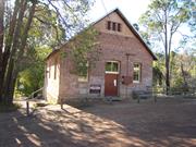
Weir Village Rd Mundaring Weir
to be included in P8538 Mundaring Weir Precinct assessment
Mechanics' Institute
Mundaring
Metropolitan
Constructed from 1908
| Type | Status | Date | Documents |
|---|---|---|---|
| Heritage List | YES | 08 Mar 2016 | |
| State Register | Registered | 22 Jan 2002 | HCWebsite.Listing+ListingDocument, HCWebsite.Listing+ListingDocument |
| Type | Status | Date | Documents |
|---|---|---|---|
| (no listings) |
| Type | Status | Date | Grading/Management | |
|---|---|---|---|---|
| Category | ||||
| Municipal Inventory | Adopted | 22 Apr 1997 | 2 -Considerable significance | |
| Classified by the National Trust | Classified | 09 Jul 2001 | ||
| Register of the National Estate | Indicative Place | |||
08538 Mundaring Weir, Gardens and Village Precinct
Appears sound but has movement in the exterior west wall
| Library Id | Title | Medium | Year Of Publication |
|---|---|---|---|
| 6452 | Mundaring Weir Precinct masterplan : final master plan report. | Heritage Study {Other} | 2002 |
Individual Building or Group
| Epoch | General | Specific |
|---|---|---|
| Original Use | SOCIAL\RECREATIONAL | Other Community Hall\Centre |
| Present Use | SOCIAL\RECREATIONAL | Other Community Hall\Centre |
| Other Use | SOCIAL\RECREATIONAL | Mechanics Institute |
| Style |
|---|
| Federation Arts and Crafts |
| Type | General | Specific |
|---|---|---|
| Wall | BRICK | Common Brick |
| Roof | METAL | Corrugated Iron |
| General | Specific |
|---|---|
| SOCIAL & CIVIC ACTIVITIES | Institutions |
| SOCIAL & CIVIC ACTIVITIES | Cultural activities |
| OCCUPATIONS | Technology & technological change |
This information is provided voluntarily as a public service. The information provided is made available in good faith and is derived from sources believed to be reliable and accurate. However, the information is provided solely on the basis that readers will be responsible for making their own assessment of the matters discussed herein and are advised to verify all relevant representations, statements and information.
Mundaring Weir Gallery, has cultural heritage significance for the following reasons: the place is a reminder of the once thriving community that formerly existed at Mundaring Weir; the place has historical associations with the Goldfields pipeline and Fred Jacoby; the place is historically associated with the Mechanics' Institute movement; the place is held in high esteem by the people of Mundaring and Mundaring Weir; and, the place is representative of the type of building constructed by local community groups to service as their Institute Hall.
Mundaring Weir Gallery is a single storey brick and iron building completed in 1908 as a Mechanics Institute for the community of Mundaring Weir. The building sits on-a sloping site which has been terraced at the front to provide parking. Two terraces are also-located on the north eastern side of the building and were formerly the location of two tennis courts. The building has a simple rectangular form and stylistically could be termed as a fairly plain version of Federation Arts and Crafts. The brick walls, laid in English bond, sit on an undressed stone foundation which is approximately 30cm above ground at the front, gradually increasing in height towards the rear of the building. The stone used is local granite. Above the stone foundation are three courses of brickwork which form a plinth for the brick walls which rise above. The gable roof is clad with Zincalume and there are no gutters. Stylistically, the Arts and Crafts elements are to be found on the front wall. The apex of this wall is decorated with pebble dash into which has been set three narrow, rectangular ventilation louvres. The front facade has a centrally located entrance with a fanlight above a pair of sheeted, ledged and braced double doors. A new yale lock has been fitted to one door. The original, metal door knob has been retained. On either side of the door are fixed, timber framed windows with three panes and fanlights. The door and window openings feature brick arches with a metal arch band. A marble foundation stone is fixed just below the window on the western side of the front facade. The stone records the following details: This stone was laid _by the Hon. James Price MLA Minister for Works 9th May 1908. Committee: H. Ball, Chairman, A.G. Eggleton, Fred W. Jacoby, E.S.A. Willis Hon. Sec. The rear wall is timber framed and clad with painted, sheets of corrugated galvanised iron. These sheets were probably placed here sometime after 1965 when the rear toilet section was demolished. The exact date of this demolition is not known. As this side is half a storey higher than the front, a storage area has been created beneath the floor area. The iron cladding covers this wall to floor height. Below this cladding the wall is undressed stone. A pair of ledged and sheeted doors are located at the western end of this wall, at floor height and a staircase" leads down to ground level. These stairs have a pipe balustrade and timber treads. _A pair of double doors is centrally located in the stone section of the wall providing access to an under floor storage area. The opening is faced with brickwork. The two side walls are identical. Three windows are evenly spaced along the walls. The windows are the same style as those found in the front elevation. Wall vents have been placed between the windows and under floor ventilators are located at intervals, down both sides of the brickwork, above the stone foundation. The south west wall has several long cracks which run down the wall from the centre of the southern and central windows. The brick arches above both these windows also show evidence of past movement. Without the benefit of monitoring it is not possible to determine if movement is still occurring in this wall. The north easier wall shows no evidence of movement. The interior of the hall is basically a rectangular open space. The timber floor is covered with carpet. The ceiling is plasterboard with the gaps between the sheets covered with plastic cover strips. The rear wall is clad with painted,tongued and grooved boards (laid underside up). Timber picture rails have been fitted around the walls however, these are not original. The current fittings are all modern and the shelving which is used to display craft items are free-standing and could be easily removed.
Assessment 2001 Construction 1908 Builder: Mr Jordan The locality around present day Mundaring Weir was first settled in 1882 by Walter Jecks who owned the Rose and Crown in Guildford. Jecks established a vineyard and orchard on his land which lay to the north east of the dam site in an area known toady as Jacoby Park. Jecks was soon joined by both his brothers Thomas and John Allpike who managed Padbury’s Guildford stores. In 1883 F.W. Byfield occupies occupied Swan Loc. 1324 slightly to the east of the dam site. The discovery of gold around Coolgardie and Kalgoorlie in the 1890s, led to a large influx of people into what was a comparatively arid area. An additional factor to this equation was the development of the Eastern Railway which while providing access to the goldfields, also required large quantities of water to run the steam locomotives. A solution to the problem of a lack of water to this area was provided by C.Y O'Connor (Chief Engineer in the Department of Public Works) in 1895. O'Connor proposed constructing a pipeline from the Perth area out to the eastern goldfields. The Coolgardie Goldfields Water Supply Scheme came into being in 1896 and a location on the Helena River was chosen as a dam site. A spur line from the Eastern Railway line to the reservoir site was the first requirement and this was completed in June 1898.6 The pipeline was officially opened on 22 January 1903 by Lady Forrest. Housing was provided for the employees who operated the No. 1 Pumping Station and the nearby No. 2 Pumping Station (O'Connor) and a small community sprang up around the Mundaring Weir Hotel which had been established by the Jacoby brothers (Mathieson and Frederick), in 1898. In 1906, members of this community fanned a committee to raise funds for the construction of a Mechanics' Institute building. The members of the committee included Harry Ball, A. Eggleston, (engineer in charge of the No 1 Pumping Station), Fred Jacoby (the hotel owner) and Eli Will is (the local school master). Over a period of two years the committee raised the sum of £70 and were successful m receiving a subsidy of £203 from the government. The hall was constructed by Mr Jordan of Parkerville. The final cost of the building was £308. The Weir Gallery was officially opened on the 9 May 1908 by Mr Price, Minister for Works. The building proved to be a popular venue with the local community and at some stage (possibly the 1920s), two tennis courts were constructed on the north east side of the building. During the 1920s and 1930s, large numbers of tourists flocked to the Weir to enjoy the picnic grounds. The popularity of the Weir as a tourist destination declined during the Depression years13 and in 1936, the Secretary of the Mechanics' Institute wrote to the Mundaring Road Board requesting assistance in making repairs to the hall.14 It is not known if this was forthcoming. During the 1950s; the population at Mundaring Weir declined when the steam engines at the No. 1 pumping station were replaced with electric engines and No. 2 pumping station was decommissioned. By the 1960s, Mundaring Weir Gallery had fallen into disrepair and in March 1965 a Health Inspector sent a letter to the Shire o fMundaring noting that the rear portion of the hall, which housed the toilets, was riddled with termites and was in danger of collapse. At this stage the Shire of Mundaring was not willing to take on the up-keep of the hall. It is not known if the tennis courts were still in use at this time. The building ceased to be used by the Mechanics' Institute in November 1968. In 1971, Mundaring Weir Gallery was vested with the Shire of Mundarmg.During the 1970s the building was used as a local art gallery. In January 1973, the Art Co-Op Group arranged to lease the building from the Shire. Mundaring Weir Gallery was placed on the National Trust of Australia's (WA) Recorded list in August 1978. The photograph taken at the time of the assessment shows the building much as it appears today with the exception that the original corrugated galvanised roof was still in place.21 It is not known when the roof was re-clad with Zincalume sheeting. Today the hall is leased from the Shire of Mundaring by the Eastern Hills Arts and Crafts Inc.22 This is the same group as the Art Co-op. The craft group display and sell local arts and crafts to tourists and maintain the building.
This information is provided voluntarily as a public service. The information provided is made available in good faith and is derived from sources believed to be reliable and accurate. However, the information is provided solely on the basis that readers will be responsible for making their own assessment of the matters discussed herein and are advised to verify all relevant representations, statements and information.
Constructed from 1908
16610 Goldfields Water Supply Scheme
The Mundaring Weir Hall (Mechanic Institute) has very high social and historical significance for Mundaring, for it's associations with the early community supporting the Weir, pumping stations, forestry and agricultural industry of the area.
The Mundaring Weir Hall is opposite the Mundaring Weir Hotel on the corner of Weir Village Road (formerly Mundaring Weir Road) and Hall Road. The brick building is a simple rectangular form with corrugated iron roof and gable walls at each end. The brick walls, sitting on granite footings, are of "English" bond, although the rear wall has been built of framed construction clad with corrugated iron awaiting future extensions which have not occurred. The long brick side walls have three evenly spaced windows with highlights and arched brick lintels. The front brick gable end wall is tall and imposing, incorporating a central ledged and braced double entry door with highlight over and arched brick lintel. Either side of the door a pair of windows with arched brick lintels balances the symmetry. The triangular peak of the gable entry wall is finished with a roughcast stucco rendered panel inset with three narrow, vertical ventilation louvres separated by brick piers. The overall effect is one of Federation Free Style / Arts and Crafts styling. The front wall contains an engraved marble foundation stone which has to compete for attention with unsympathetic signage (including the "Gallery" sign) on the wall which, together with an intrusive meter box and power connection, detract from the frontage.
As local community and education centres, halls and Mechanics Institutes were an important part of early social and cultural history. Western Australia's first Mechanics Institute was established in Perth in January 1851. The closest one for hills residents was at Guildford, built in 1865. In 1906, the same year Midland Junction opened their Mechanics Institute, Mundaring Weir citizens, Harry Ball, Eli Willis, Fred Jacoby and Engineer-in-Charge of the No. 1 Pumping Station, Mr. A Eggleton, began to raise funds for the Mundaring Weir Hall and Mechanics Institute. Delays in construction caused by storm damage meant the building was not ready for official opening until April 1908. A crowd of 200 people attended the opening by M.L.A. Mr A.C. Gull. The foundation stone shows the name of James Price, Minister for Works and Mr Jordan as the Builder. An indication that the community was expected to grow can be seen in the temporary nature of the corrugated iron rear of the Hall. In the 1920s and 30s, after the forestry headquarters were established at nearby 'Portagabra' (Site 60), the hall and nearby tennis courts were used for dances and tennis. Between c 1947 and 1951, when the wall of the Mundaring Weir (Site 55), was being raised, children of the construction workforce were taught here as an overflow class from the Mundaring Weir school (Site 58). The building was well used by local people until, with declining population levels, it fell into disrepair. In the early 1980's, the Shire of Mundaring rehabilitated the building for use by community groups.
Integrity: High - although the Hall is now used as a Gallery
Good
| Ref ID No | Ref Name | Ref Source | Ref Date |
|---|---|---|---|
| FK Crowley; ibid pp. 51, 55, 80 | |||
| I Elliot; ibid p. 142 | |||
| MHHS interview; "mrs H Hunt" | 25/9/1995 | ||
| MHHS File; "Mundaring Weir". | |||
| CT Stannage; "A new history of Western Australia". pp. 606-607 | UWA Press | 1981 | |
| MJ Bourke; "On the Swan". pp. 216, 269 |
This information is provided voluntarily as a public service. The information provided is made available in good faith and is derived from sources believed to be reliable and accurate. However, the information is provided solely on the basis that readers will be responsible for making their own assessment of the matters discussed herein and are advised to verify all relevant representations, statements and information.
580 Seaborne St Parkerville
Mundaring
Metropolitan
Constructed from 1962
| Type | Status | Date | Documents |
|---|---|---|---|
| (no listings) |
| Type | Status | Date | Documents |
|---|---|---|---|
| RHP - Does not warrant assessment | Current | 24 Feb 2017 |
| Type | Status | Date | Grading/Management | |
|---|---|---|---|---|
| Category | ||||
| Municipal Inventory | Adopted | 22 Apr 1997 | 3 - Moderate significance | |
Individual Building or Group
| Epoch | General | Specific |
|---|---|---|
| Original Use | SOCIAL\RECREATIONAL | Other Sports Building |
| Present Use | SOCIAL\RECREATIONAL | Other Sports Building |
| Type | General | Specific |
|---|---|---|
| Roof | ASBESTOS | Other Asbestos |
| Wall | METAL | Corrugated Iron |
| General | Specific |
|---|---|
| SOCIAL & CIVIC ACTIVITIES | Sport, recreation & entertainment |
This information is provided voluntarily as a public service. The information provided is made available in good faith and is derived from sources believed to be reliable and accurate. However, the information is provided solely on the basis that readers will be responsible for making their own assessment of the matters discussed herein and are advised to verify all relevant representations, statements and information.
Constructed from 1950
The Pavilion has moderate local social significance for it's original agricultural pavilion community use, and involvement in the Parkerville Agricultural Society and construction by the local people. The building has strong rural original in it's style and is one of few remaining 'vernacular' timber buildings in current and public use in the Shire.
The open pavilion has tall "bush" poles with struts off the sides supporting a timber framed roof structure and with corr. iron cladding on timber wall framing at the rear. An asbestos "super-six' roof replaces what would originally have been corrugated iron. The front is open for outlook across the oval. A small kitchen is enclosed in the back corner for serving afternoon teas etc., although the basic nature of its construction is intrusive. The overall feel of the pavilion is one of spaciousness, with a definite 'vernacular'/agricultural character. Whilst it no longer serves its original purpose as an agricultural show pavilion, and is inadequate for sporting functions, a compatible use or adaptation of significant elements of the structure is warranted. For example it could retain use as an outdoor function space or under redevelopment the original strutted bush poles could be reused to create a useful pergola or shaded spectator structure. To the west of the timber pavilion, white brick change rooms with concrete tiled roof were built in 1973. The change rooms are no longer adequate and in need of alterations and additions together with new function spaces. As the two buildings are visually incompatible, redevelopment of the change rooms and or the old timber pavilion should endeavour to integrate the buildings on the site. Footnote: In 1997 a new function room was built between the sports pavilion and the change rooms together with a brick paved barbecue area and stone retaining wall. The pavilion was renovated with new, horizontal 'Colorbond' corrugated iron sheeting as wall cladding and the rotting timbers and tea room enclosure in the eastern most bay removed.
The following information on the history of the Parkerville Pavilion was received by the Shire from Mrs M Campbell of Schoch Rd, Parkerville, in August 1994:- "My father Fred A Schoch, the local school headmaster of the day, was secretary to the Parkerville Agricultural Society (during) construction of the building which was built under the supervision of my father-in-law Colin Campbell. The Annual Agricultural display typified the culture of the day depicting the fruit growing, poultry farming and agricultural background of the district in the post war period." Brick changerooms were built on the oval to the west of the pavilion in 1973.
Integrity: High Modifications: small kitchen enclosed in back (East) corner.
Fair
| Ref ID No | Ref Name | Ref Source | Ref Date |
|---|---|---|---|
| I Elliot; ibid p. 290 |
| Owner | Category |
|---|---|
| Shire of Mundaring | Local Gov't |
This information is provided voluntarily as a public service. The information provided is made available in good faith and is derived from sources believed to be reliable and accurate. However, the information is provided solely on the basis that readers will be responsible for making their own assessment of the matters discussed herein and are advised to verify all relevant representations, statements and information.