Local Government
Vincent
Region
Metropolitan

57 Lincoln St Highgate
Cnr Smith St The adjacent block is the Highgate Police Station, which is on the RHP. The land on which the tower falls on is a difference reserve. These two different places share no history.
Dumas' Folly
Vincent
Metropolitan
Constructed from 1941
| Type | Status | Date | Documents |
|---|---|---|---|
| Heritage List | Adopted | ||
| State Register | Registered | 18 Dec 2007 | HCWebsite.Listing+ListingDocument, HCWebsite.Listing+ListingDocument |
| Type | Status | Date | Documents |
|---|---|---|---|
| (no listings) |
| Type | Status | Date | Grading/Management | |
|---|---|---|---|---|
| Category | ||||
| Municipal Inventory | Adopted | 13 Nov 1995 | Category A | |
| Classified by the National Trust | Classified | 28 Aug 1995 | ||
| Art Deco Significant Bldg Survey | Completed | 30 Jun 1994 | ||
Overall the condition is good, although there is some deterioration to the exterior of the building and cracking of the render.
| Name | Type | Year From | Year To |
|---|---|---|---|
| AE (Paddy) Clare, Principal Architect of PWD at time of construction | Architect | - | - |
| Russell Dumas, Chief Engineer PWD, oversaw engineering | Architect | - | - |
| Library Id | Title | Medium | Year Of Publication |
|---|---|---|---|
| 3342 | Lincon Street Ventilating Stack, Cottage, Former Police Station - Final Report | Heritage Study {Other} | 1997 |
| 8346 | Lincoln Street ventilation stack. | Heritage Study {Other} | 2004 |
Individual Building or Group
| Epoch | General | Specific |
|---|---|---|
| Original Use | GOVERNMENTAL | Other |
| Present Use | GOVERNMENTAL | Other |
| Style |
|---|
| Inter-War Art Deco |
| Type | General | Specific |
|---|---|---|
| Wall | RENDER | Other Render |
| Wall | BRICK | Common Brick |
| General | Specific |
|---|---|
| OUTSIDE INFLUENCES | Water, power, major t'port routes |
| PEOPLE | Innovators |
| OCCUPATIONS | Technology & technological change |
| SOCIAL & CIVIC ACTIVITIES | Community services & utilities |
This information is provided voluntarily as a public service. The information provided is made available in good faith and is derived from sources believed to be reliable and accurate. However, the information is provided solely on the basis that readers will be responsible for making their own assessment of the matters discussed herein and are advised to verify all relevant representations, statements and information.
Constructed from 1935
The Sewer Vent is a singular structure and landmark in Highgate, albeit the outcome of a failed experiment. It is a notable and monumental example of Interwar Art Deco. It has associations with the Police Wireless Service as the antennae for the wireless were camoflagued in the vent structure during the Second World War.
The tall tower has distinctive vertical Art Deco detailing and the appearance of a monument. It has a small building attached to its base, with battered retaining walls to the corner. The sewer vent was an experiment to improve the sewerage system to alleviate the possibilities of combustion and leakage of foul smells. It was considered to be a failure and the experiment was discontinued. Dominates its corner location None apparent
A sewer ventilation tower was constructed on the corner of the site on Reserve No. 45158 adjacent to the Highgate Hill Police Station. This Art Deco style tower was erected in in 1941, by the Public Works Department for the Metropolitan Water Supply Sewerage and Drainage Department. It was designed by A.E Paddy Clare, the principal architect for the PWD and the engineer was Russell J. Dumas. The tower was built to vent the acid-bearing air from the sewerage system into the atmosphere and prevent it corroding the concrete lined sewerage pipes. Two vents were constructed, one in Lincoln Street and one in Subiaco, but there is some doubt as to whether the latter one was built. Electric fans were used to extract the gas by pumping it up the tower. The Metropolitan Water Supply, Sewerage & Drainage Department was establihsed by an Act of Parliament in 1910. Through this all the water schemes were consolidated under on department, responsibe to the Minister of Water Supply, Sewerage & Drainage. Later (1925) part of it came under the PWD and so the departments pooled their resources. The Metropolitan Area was divided into three districts in 1910; Perth, Claremont and Fremantle with the Highgate area becoming part of Perth. After several name chnages, including the Water Authority of Western Australia (1985 - 1996), the department became the Water Corporation on 1 January 1996. Sewerage treatment works at Burswood and Claise Brook were completed and operational by January 1912. There were septic tanks installed at Claise Brook with an underground pipe to transport the sewerage to the percolating filters across the river on Burswood Island. After being treated the waste flowed into the river. As soon as the treatment works at Claise Brook were completed their were complaints about smell, particularly in East Perth. A new filter bed was added in 1913 but to no avail. Further new filter beds were added in 1918 and 1919 (when parts of Leederville and West Perth were sewered) annd in 1920 (making nine in all) but the problem persisted and there were reports of raw sewerage being sighted in the river. An ocean outfall was considered form the late 1920's. This and a new treatment plant in West Subiaco came into use in 1927 and when they were expanded some time in 1936, the works at Claise Brook and Burswood were excluded from thre system. The Lincoln Street sewer vent is 38 metres tall, including the one metre high plinth. It is the second tallest such structure in Australia. The tallest sewer vent, which is in Sydney, is 40 metres tall and was built in 1893. The reason for the height, was to carry the air from the sewer high above the area. During certain weather conditions, however, the polluted air did not vent upwards but dispersed through the system, causing much unpleasantness to the nearby residents. As a result of complaints, and the fact that the vent did not operate adequately, the connection to the sewerage system was closed (cemented over) and after four weeks of operation the tower rendered non-functional. Pipes near the ventilation tower collapsed in 1949 and the collapse was attributed to corrosion. The damage was repaired and the extractor fans were removed form the sewer vent at this time. The final solution to the corrosion and its effects was the installation of pipes lined with plastic in the late 1960's and 1970's and all the ventilation shafts around the Metropolitan Area. (Most of the other vents were metal designed to look like lamp posts). Perth now has a sealed system. In 1952 the chamber room at the base of the tower was converted to a laboratory for the chemical analysis of sewerage. It was the Department's first laboratory. Within the Public Works organisation the Lincoln Street ventilation stack was referred to as Dumas' Folly. Russell Dumas (later Sir, and for whom Dumas House is named) was chief engineer of the PWD from 1932 and director of works and buildings from 1941. Ralph Lake (father of Councillor Sally Lake) said it was often called 'monument to Hitler because it stank'. In late 1941 or early 1942, the central wireless section serving the police force was moved from police headquarters into the Highgate Hill Police Station. The wireless antennae was attached to the top of the sewer vent, which provided the perfect location. The move was completed almost within one day. The radio's call sign was VKI - Licence No. 1258. The location of the wireless section was kept secret at the time, as it was considered a prime bombing target. It is possible that during this time the station was also used by the Commonwealth Department of Defence for communication purposes. The wireless service had been established in 1930 with its transmitter at Wireless Hill in Applecross until 1936 when it was moved to the Central Police Station. In 1949 the Highgate Hill Police Station became the centre for vehicular communications which led to the formation of the Traffic Branch and Road Traffic Authority (RTA). In 1956 the wireless section was moved into the larger police quarters, and the building was extended to accommodate additional equipment and services. The quarters were further enlarged in 1969 with the addition of a new plant room, another transmission room and a carport, In 1975, the final year of tis operation at Highgate, VKI had radio connections with all the metropolitan police stations 338 vehicles and two launches plus links interstate and a country network of 39 base stations and 95 mobiles. In 1961 the Police Department began renting the room on the base of the tower, paying $.5.60 per month from then until 1975 when the wireless section was transferred to Police Headquarters in East Perth. Nevertheless the wireless antennae remained attached to the tower and the room of the tower is used by the Police Department as a training room and as a meeting place for the Police Historical Society of WA. Sally Lake later wrote: 'A few years ago a friend and I were given a tour of the old police station and the tower by a policeman who shared our interest in the history of the place. We entered the classroom by a door on the south side. At the north end of the room was what appeared to be a low cupboard door. When opened this revealed a tunnel along which we crawled. After a few feet we were able to look into the tower. Looking up we could see metal rungs set into the wall, going to the top. The tower was very high and tapered in. The base, a foot or so below us appeared to be concrete with a few stray items including a bicycle thrown in. In 1998 the ventilation stack was excised from the cancelled Reserve 6245 and was vested with the Water Corporation. In 1975, the wireless section was transferred to Police Headquarters in East Perth, but the wireless antennae are still attached to the tower.
Intact
This information is provided voluntarily as a public service. The information provided is made available in good faith and is derived from sources believed to be reliable and accurate. However, the information is provided solely on the basis that readers will be responsible for making their own assessment of the matters discussed herein and are advised to verify all relevant representations, statements and information.
94, 96 & 96a Lincoln St Highgate
Vincent
Metropolitan
Constructed from 1893
| Type | Status | Date | Documents |
|---|---|---|---|
| Heritage List | Adopted |
| Type | Status | Date | Documents |
|---|---|---|---|
| (no listings) |
| Type | Status | Date | Grading/Management | |
|---|---|---|---|---|
| Category | ||||
| Municipal Inventory | Adopted | 12 Sep 2006 | Category B | |
Individual Building or Group
| Epoch | General | Specific |
|---|---|---|
| Original Use | RESIDENTIAL | Single storey residence |
| Present Use | RESIDENTIAL | Single storey residence |
| Type | General | Specific |
|---|---|---|
| Wall | BRICK | Face Brick |
| Other | TIMBER | Other Timber |
| Roof | METAL | Corrugated Iron |
This information is provided voluntarily as a public service. The information provided is made available in good faith and is derived from sources believed to be reliable and accurate. However, the information is provided solely on the basis that readers will be responsible for making their own assessment of the matters discussed herein and are advised to verify all relevant representations, statements and information.
Constructed from 1893
These two dwellings constructed in 1893 in the Late Colonial Style are intact and good examples of their style featuring facet bay windows and associated mitred hip roof form and brick quoining. The two dwellings contribute to the quality and diversity of Lincoln Street and were both associated with businessman whom resided and owned the subject dwellings at the time of construction in 1893 until at least the inter-war year.
McBride's House at No. 94 Lincoln Street is constructed in the Late Colonial Bungalow Style circa 1893. The dwelling features a hipped iron roof with a hipped gable over the front protruding room, which is positioned on the eastern side of the dwelling and features a faceted bay window. A bullnose verandah runs the length of the dwelling's return which is supported by timber posts that are adorned with decorative timber brackets. Cooke's House at No. 96 Lincoln Street is constructed in the Late Colonial Georgian Style. The main form of the facade is symmetrical and features identical faceted bay windows, which are headed by protruding gables. There is a mitred hip roof form over each of the faceted bay windows. This dwelling although similar in bulk and style differs from No. 94 by being symmetrical in appereance, whereas No. 94 is asymmetrical with the one protruding room and facetted bay window. Both No. 94 and No. 96 are partially sheilded from the Street by brick and timber picket fences. Both original lots have been subdivided and new residential dwellings have been constructed to the rear. Alerations to the rear
Lincoln Street formed part of the Highgate Hill subdivision which was developed by surveyor Charles Crossland and named after his birthplace in London. The subdivision of Highgate Hill was one of the first suburbs on the north side of Perth. It consisted of a small isolated cluster of homes erected on as estate in the hollow at the east side of Beaufort Street. Few of the early residents built in this area have survived. Although one of the first subdivision areas in Perth, residential growth in the Highgate area was slow and by the late 1890's the suburb was described as a 'sprawling and sparsely populated district'. The Highgate Primary School was opened in 1894 and the Highgate Hill Police Station in 1897. McBride's House at No. 94 Lincoln Street derives its name from Mr James Mc Bride whom resided at the dwelling from 1893 until 1918. He was listed as being a resident of Lincoln Street in the first Western Australian Directory published by Piersenne 1893 - 4 and his house and No. 96 are shown on the c.1897 PWD sewerage plans. James arrived in Western Australia from London aboard the 'Glen Avon' on 21 May 1885. He married Agnus Brand at the Wesely Church, Perth on 18 August 1887 and they had one child William, who was born in 1888. James was a compositor and printer and worked in Perth. According to Wise's Post Office Directories McBride lived there until 1899 or 1900. (There is no listing for the subject place for 1900). Between 1901 and 1903 J.Hayes (1901) and Mr Jefferson (1902) are listed. McBride returned in 1904 and remained until 1918. The residents next doot at 96 and 96a were Robinson Cooke and Mrs Burnham. The latter two were still there the following year and Mrs C.E Boucher was in residence at No. 94. From then on until the dwelling was purchased by Mr James Bradley in 1925, the property had a high turn over of tenants. Bradley was still there in 1949, the last year of the Directories. Building Plans from City of Perth indicate that Bradley erected a brick and asbestos garage on the north-west corner of the property. Then in 1984 the then owner of No. 94 Lincoln, Mr P Custance conducted various refurbishments to the dwelling both internally and externally. Internally the kitchen was upgraded and the removal of the existing brick internal walls into the hallway from both the dining and lounge areas was carried out and the bricking up an internal doorway. Externally a single brick addition to the rear was demolished and replaced with a cavity brick wall, the back door on the northern facade was replaced with a set of French doors, a corrugated iron roof with a bullnose fascia was erected along the small section of the western facade and brick paving was laid along the western side of the dwelling. Cooke's House and garden at No. 96 Lincoln Street was valued at 500 pounds in the City of Perth rate books. It derived its name from original owner and resident of the place Robinson Cooke, although it appears as 'Consett Villa' in the 1900 Directories. Cooke arrived in Western Australia form London aboard the 'Hastings' in June 1883 with his wife Mercy and two children. He was first listed in Piersenne's Western Australian Directory in 1893 - 4. However Wise's Post Office Directories from from 1895/6 also indiate that others resided at the dwelling as well during this time. Cooke worked as a storeman according to the 1897 rates books but was listed as an 'ironmonger' when he applied for a 125 acre grant in teh Swan District in 1887. Later he became a Commercial Traveller, which is a chapter of the Freemason's Society. His work and his grant possibly explain why leased his dwelling to various tenants whilst he travelled. He was certainly known to have visited Victoria in 1886. According to the Directories in 1918 Robinson Cooke was in residence at that time as was Mrs Burnham. Between 1932 and 1936 he was on his own and then Reginald Fishwick joined him in 1937. In 1949 the last year of the Directories, Mrs L. Shervington was listed at residing at No. 96 and 96a. An obituary in the 'West Australian Craftsman', the Freemason's periodical, indicated that Robinson Cooke passed away suddenly at sea on 3 November 1956. Apparently he and his wife had just returned from a visit to England and were proceeding to Melbourne to take part as officials in the 1956 Olympic Games. Within 24 hours of leaving Fremantle Robinson Cooke was found dead in his cabin. City of Perth Building Plans (dated 16.9.1952) confirm that the place was used as two flats. In 1952 the owner of 96a, Mr Staricoff, applied for permission to construct a brick and iron bathroom. Permission was denied and it was recommended he restore the property to a single dwelling. The owner of No. 94 received permission to build an additional two-storey grouped dwelling and to make alterations to the existing dwelling in 2005.
High
This information is provided voluntarily as a public service. The information provided is made available in good faith and is derived from sources believed to be reliable and accurate. However, the information is provided solely on the basis that readers will be responsible for making their own assessment of the matters discussed herein and are advised to verify all relevant representations, statements and information.
364-366 Lord St Highgate
Vincent
Metropolitan
Constructed from 1907
| Type | Status | Date | Documents |
|---|---|---|---|
| (no listings) |
| Type | Status | Date | Documents |
|---|---|---|---|
| RHP - Assessed - Below Threshold | Current | 30 Jul 1999 |
| Type | Status | Date | Grading/Management | |
|---|---|---|---|---|
| Category | ||||
| (no listings) | ||||
Individual Building or Group
| Epoch | General | Specific |
|---|---|---|
| Present Use | RESIDENTIAL | Conjoined residence |
| Original Use | RESIDENTIAL | Conjoined residence |
| Type | General | Specific |
|---|---|---|
| Wall | BRICK | Common Brick |
| Roof | METAL | Corrugated Iron |
| General | Specific |
|---|---|
| DEMOGRAPHIC SETTLEMENT & MOBILITY | Land allocation & subdivision |
This information is provided voluntarily as a public service. The information provided is made available in good faith and is derived from sources believed to be reliable and accurate. However, the information is provided solely on the basis that readers will be responsible for making their own assessment of the matters discussed herein and are advised to verify all relevant representations, statements and information.
33-35 Mary St Highgate
Vincent
Metropolitan
Constructed from 1940
| Type | Status | Date | Documents |
|---|---|---|---|
| Heritage List | Adopted |
| Type | Status | Date | Documents |
|---|---|---|---|
| (no listings) |
| Type | Status | Date | Grading/Management | |
|---|---|---|---|---|
| Category | ||||
| Municipal Inventory | Adopted | 12 Sep 2006 | Category B | |
Individual Building or Group
| Epoch | General | Specific |
|---|---|---|
| Present Use | RESIDENTIAL | Flats\Apartment Block |
| Original Use | RESIDENTIAL | Flats\Apartment Block |
| Type | General | Specific |
|---|---|---|
| Roof | TILE | Cement Tile |
| Other | TIMBER | Other Timber |
| Wall | BRICK | Face Brick |
| Wall | RENDER | Other Render |
This information is provided voluntarily as a public service. The information provided is made available in good faith and is derived from sources believed to be reliable and accurate. However, the information is provided solely on the basis that readers will be responsible for making their own assessment of the matters discussed herein and are advised to verify all relevant representations, statements and information.
Constructed from 1940
New Court flats, at 35 Mary Street, are good examples of the Interwar Contemporary style, with some Art Deco detailing. The flats demonstrate the brief period between the deprivation of the Depression and the austerity of building material shortages as the influence of World War Two was felt.
The double storey face brick structure comprising 8 flats, has a hipped roof clad with cement tiles. It is symmetrical organised with a central fluted art deco detail to the central stairwell. Side wings with narrow balconies, are set back behind the main façade, with rendered balustrades decorated with incised horizontal bands, and some louvred window infills. Low brick wall with garden setback that obscures much of the ground floor frontage that is lower than the road. Verandah enclosures with louvres.
In 1892, land in Highgate Hill was acquired by Catholic Bishop Matthew Gibney, Catholic Bishop of Perth. It was subdivided as the Mount Heart Estate, with a 2-acre site in its centre for a school and a church (Alacoque Square), surrounded 79 residential lots. Mary Street was part of this subdivision. In 1933, it was reported that '˜flat life' was becoming more popular in Perth and its suburbs, as evidenced by the construction of several blocks in and around the City. Flat conversion was also seen as a way of dealing with old-fashioned residences at this time, with a number undergoing extensive refurbishment and renovation, which often included a new façade. Other older homes were also removed to make way for the new flat developments. There was no residence listed for No. 35 in the 1915 Wise's Post Office Directories, and the land appears to have been vacant at the time of construction of the flats. The New Court flats, a block of eight flats, were under construction in 1940. It is interesting to note that no car parking space was provided for the residents. The person rated in 1940 was Clement Francis Dwyer but he was acting for a company, the name of which in indecipherable in the City of Perth rate books. In 1941 the subject place was listed in the Directories as 'flats' with no further details but the following year (1942), the residents were listed for six of the eight flats: Miss Joan Oliver and Miss W. Stanley (No. 1), John Stewart (No. 2), Ron Fisher (No. 3), Mr Langoulant (No. 4) and Miss O'Rourke and Mrs Keay at No. 6. In 1949, the last year of the Directories, the residents were: Mrs Vogue (No. 1), John Stewart (still in residence at No. 2), John S. Korner (No. 3), A. Innes (No. 4), John Sullivan (No. 5), W. O'Rourke (No. 6 '“ possibly a relation of the occupant, Miss O'Rourke, listed in 1942), No. 7 was not listed (possibly vacant) and No. 8 was Mrs Piper. Approval was sought but denied by the City of Perth for a loft style dwelling at the rear in 1993. A subsequent application for a garage/store/laundry was approved in 1994 and was erected but remained empty. It was used for storage only. In 2008 the flats were still in the hands of a single owner and, although strata titles had been applied for, they had not yet been issued.
High degree
This information is provided voluntarily as a public service. The information provided is made available in good faith and is derived from sources believed to be reliable and accurate. However, the information is provided solely on the basis that readers will be responsible for making their own assessment of the matters discussed herein and are advised to verify all relevant representations, statements and information.

40 Mary St Highgate
Incs: Monastery of Our lady of the Sacred Heart (Convent), Sacred Heart Primary School; Church; Hall; gardens, shelters, playing fields boundary walls. Bounded by Harold St.
Monastery of Our Lady of the Sacred Heart
Sacred Heart College
Sacred Heart Primary School
Vincent
Metropolitan
Constructed from 1899 to 1978
| Type | Status | Date | Documents |
|---|---|---|---|
| Heritage List | Adopted | ||
| State Register | Registered | 28 Aug 2001 | HCWebsite.Listing+ListingDocument, HCWebsite.Listing+ListingDocument |
| Type | Status | Date | Documents |
|---|---|---|---|
| (no listings) |
| Type | Status | Date | Grading/Management | |
|---|---|---|---|---|
| Category | ||||
| Municipal Inventory | Adopted | 13 Nov 1995 | Category A | |
02183 Sacred Heart Church, Halls & Presbytery
Good
| Name | Type | Year From | Year To |
|---|---|---|---|
| Casella Edgar & Wade | Architect | - | - |
| Richard Joseph Dennehy | Architect | 1859 | 1939 |
| Edgar Le B Henderson | Architect | - | - |
| Edgar Henderson, Henderson & Jeffries | Architect | - | - |
| Library Id | Title | Medium | Year Of Publication |
|---|
Individual Building or Group
| Epoch | General | Specific |
|---|---|---|
| Original Use | EDUCATIONAL | Combined School |
| Present Use | RELIGIOUS | Monastery or Convent |
| Present Use | EDUCATIONAL | Primary School |
| Original Use | RELIGIOUS | Monastery or Convent |
| Style |
|---|
| Federation Free Style |
| Federation Gothic |
| Inter-War Gothic |
| Type | General | Specific |
|---|---|---|
| Other | STONE | Limestone |
| Wall | BRICK | Common Brick |
| Roof | TILE | Terracotta Tile |
| Roof | METAL | Corrugated Iron |
| Wall | BRICK | Face Brick |
| General | Specific |
|---|---|
| SOCIAL & CIVIC ACTIVITIES | Education & science |
| SOCIAL & CIVIC ACTIVITIES | Religion |
This information is provided voluntarily as a public service. The information provided is made available in good faith and is derived from sources believed to be reliable and accurate. However, the information is provided solely on the basis that readers will be responsible for making their own assessment of the matters discussed herein and are advised to verify all relevant representations, statements and information.
Constructed from 1899 to 1991
Sacred Heart Group is a notable ecclesiastical and education group esteemed by the district community and the local Parish and School communities. Each of the places is a fine example of its style, with the major buildings being designed by notable architects of their day, renowned for their work for the Catholic Church. The place has associations with the orders of Sisters of Our Lady, Redemptorist Fathers, Christian Brothers and Bishop Gibney and Archbishop Clune.
The place is a complex of ecclesiastical buildings of different age, style, construction and height. It includes: The Monastery of Our Lady of the Sacred Heart, by Edgar Henderson, in the Federation Romanesque style, constructed in brick and render. The main façade features a two storey loggia, either side of a gabled central entry bay with tourelles. The shallow arch of the entry bay contrasts with the round headed arches of the loggia. Whilst varying in detail the two storey loggia was a popular feature of a number of Catholic Monasteries and Colleges of this period, eg. Clontarf and the Redemptorist Monastery. Sacred Heart Church, by R J Dennehy, is an exemplar of a plain and grave Federation Gothic style, constructed in rusticated stone. The simple gabled façade features three lancet windows rising above a round arched central doorway. Sacred Heart Primary School, by R J Dennehy, is a bold and innovative example of Federation Romanesque, with its tall roofed two storey wings masked by a two storey main façade, having extended corner towers, capped with 'widders walks'. The red brick of the facades is vividly enlivened with rendered bands that follow the arches of windows and openings and deep moulded bands, the depth of balustrades, at first floor, and parapet level. Single storey school extensions are in the Federation Arts and Crafts style. Sacred Heart Church Hall, by E LeB Henderson, is an example of an Interwar Free Classical style, with rusticated walls to reflect the stonework of the Church. It is very similar to the Star of the Sea Church Hall, at Cottesloe, also believed to be by E LeB Henderson. No. 64 Mary Street is a Federation Italianate single storey house with projecting gabled room facing the street with a faceted bay window and bullnose verandah set behind a front garden.
In 1892, land in Highgate Hill was acquired by the Roman Catholic Church and its subdivision into the Mount Heart Estate was supervised by Catholic Bishop Matthew Gibney. Its boundaries were Beaufort, Lincoln, Margaret (now Harold) and Mary streets. A two-acre site for a church and school, known as Alacoque Square after the Sacred Heart of Jesus, St Margaret Mary Alacoque, was set aside in the centre of a subdivision of 79 residential lots. A temporary church, in the form of a corrugated iron shed, was erected in the square. At that time, the Highgate Hill parish was administered and serviced from St Mary's Cathedral. In 1897, five sisters of the Order of Our Lady of the Missions came to Western Australia from Christchurch at the request of Bishop Gibney, and they opened the Sacred Heart School on 25 October 1897. Classes were held in the corrugated iron church building and by the end of the first year it had 140 students. On 18 September 1898, the foundation stone was laid for a combined school and convent, the Monastery of Our Lady of the Sacred Heart. The building, which cost approximately ₤3,000 (raised by the local parish), was opened on 22 January 1899. The architect was Edgar J. Henderson of Henderson and Jeffries, and the building was constructed with day labour, supervised by builder T. Maloney. It was reported in The Record as occupying a commanding site on the crown of the hill whence a widely spread view of the city and surrounding country is obtained. The situation is extremely healthy and an abundance of air is one of the chief characteristics of the place. The grounds are extensive, affording within their surrounding fence of galvanized iron, spacious room for recreational purposes and gardening. The material is brick faced with stone, and the appearance of the block is stately and imposing '“ the religious character being well marked. The design of the building is partly Gothic, the old English style of architecture predominating. The structure is two stories high. On the ground floor there is a school-room, 60 ft by 30 ft, exclusive of a stage 15 ft by 30 ft. The lower floor also contains the chapels, parlours, waiting room, music-room, refectory, kitchen, etc. In the upper story are a school for the boarders and another for the kindergarten, a dormitory, a community room and cells for the nuns. The building is excellently appointed in every aspect. (The Record 28.1.1899) This was the first school established by the order in Australia and Marie St. Genevieve was the 'prioress'. In 1910 Reverend Mother Mary Ambrose was in charge. As Highgate Hill and the surrounding areas developed and the school's reputation became established, the number of students grew and at times there were problems with overcrowding. As other schools were established, the Monastery at Highgate Hill became the Head House for the State, and later for Victoria. Between 1899 and 1903, the parish of Highgate Hill was served by the Redemptorist Fathers, who had taken up residence in two adjoining houses on Vincent Street, owned by Bishop Gibney. They remained in the parish until the Redemptorist Monastery was ready for occupation, early in 1903. The first Highgate Hill parish priest was Father Thomas Crowley, who remained from 1903 to 1936. By 1912, there were 400 students enrolled at the Sacred Heart School from kindergarten through secondary with 300 in the primary section. The foundation stone of a separate school building, the Sacred Heart Primary School, was laid by Archbishop Clune on 24 May 1914. The architect for the building was Mr Dennehy and the builder, Mr Fairweather. The cost of the building was ₤2,500. The school was opened on 20 October, while the east wing of the Monastery continued to be used as the girls' secondary school. Various additions were made to the monastery over the years to facilitate its continued use as a convent and as a boarding and high school for girls. In 1923, a chapel was added to the monastery, dedicated to the Little Flower, the venerable sister Teresa of the Child Jesus. It was the first built in Australia in memory of Little Flower. An appeal was made for funds to offset this debt and the Parish held competitions, concerts and bazaars to raise the money. Other additions at this time included the tower at the front of the east wing. The architect for the work was Edgar Le B. Henderson, son of Edgar J. Henderson (the original architect). Singleton and H.C. Pitman were the builders. The Sacred Heart Church was completed in 1928. The foundation stone for the new construction was laid on Palm Sunday, 1 April 1928, by Archbishop Clune. The architect for the church additions was R.J. Dennehy and the builders were Todd Bros. The altar was designed by Edgar Henderson. The church had seating accommodation for over 400 when the additions were completed. A later addition, the Lady Chapel, was opened on 25 March 1954. In 1933, a third floor was added to the chapel and the accommodation wing, and in 1934 two rooms, two dormitories and a bathroom were added, again designed by Edgar Le B. Henderson. In 1937 with 603 students enrolled, the auxiliary wing, comprising a laundry and various storerooms was added at the rear of the east wing. By the 1960s the facilities were overtaxed and out-of-date. Plans for a new school and convent were developed on a site at Sorrento. This new school opened in 1968. In 1970 Fourth Year was moved to the new school from Highgate. The remainder of the high school classes moved to Sorrento in 1980, and the Maylands Convent became the Head House for the order, with many of the sisters moving there. The Sisters of Our Lady of the Missions were no longer involved in the running of the schools, having turned their attention to pastoral care. Alterations and renovations were carried out to the monastery in 1987, including the installation of more bathroom facilities, and portion of the roof was replaced. The architectural firm of Casella Edgar & Wade was involved in the work. The Primary School numbers had continued to increase over the years, necessitating the provision of pavilion classrooms. During World War II 90 students and 12 sisters were evacuated to Moorine Rock. Then after the War there was a dramatic rise in enrolments with a baby boom and many new migrants settling in the inner city area. Additions were carried out in 1953 and in 1955 the kindergarten in Harold Street was demolished. In 1967 the primary and high schools were amalgamated in order to rationalize resources. The high school hall was demolished in 1971 and a new school wing was constructed at a cost of $90,000 aided by Commonwealth Government funding. In 1977, a hostel was added to the monastery for the provision of aged care for the sisters. The primary school numbers received another boost in the 1980s as a result of migration from South East Asia, and the intake of boys in Years 5, 6 and 7 to create a fully co-educational school. As with most Catholic primary schools to this time, the upper primary classes had been segregated with the boys attending schools staffed by the male religious orders, such as the Christian Brothers. In 1982 additions were made to the school and it was re-roofed and a classroom block at the rear was demolished. Changes were also made to doors, windows, ceilings, cabinets and the electrical and plumbing arrangements in the early 1980s. In the late 1980s, the primary school took over the east wing and the 1971 school wing of the monastery, which had remained empty since the secondary school classes had moved out. In 1987 alterations and renovations costing $180,000 were carried out. In 1991, a new pre-primary section and staff room were added to the 1914 building. The additions were designed by John Edgar of Casella Edgar & Wade Architects, and built by Doubkin Constructions. In November 1999 there were 247 students at the primary school and 21 on the teaching staff. The corrugated iron shed which had been used as the first church and school building was retained and used as a parish hall until 1938-39, when it was demolished and replaced with a modern rendered-brick building. The new parish hall cost ₤2,130, and was designed by Edgar Le B. Henderson & A. Gamble and built by the McGann Brothers. It is situated immediately to the rear of the Church at 42 Mary Street on the corner of Harold Street and the right-of-way. At some time, the parish acquired the weatherboard residence on the adjoining site at No. 197 Harold Street and this is used as the parish meeting place. This residence was built circa1950, and was originally occupied by Robert Ryan. The place was destroyed by fire in 2006 and has since been demolished. The first parish priest, Father Crowley, lived at the Queen's Hotel until about 1909, when Patrick McCafferty provided a house at 7 Mary Street for use as a presbytery. In 1942 this was sold and 50 Vincent Street, the former home of Bishop Gibney, was re-purchased and served as the presbytery for the Highgate Hill parish for many years until 64 Mary Street, next door to the Church, was purchased. No. 64 Mary Street was designed by architect H.J. Prockter and described as a 'villa residence' on his 1899 plan. It was built in 1901 as a private residence for W. Phillips, a contractor but Wise's Post Office Directories for that year indicate that the resident was W.A. Clifford. In 1909 the owner/occupier was William Phillips and the capital value was assessed as ₤850. He was still there in 1928. In 1937 the resident listed was Mrs Ellen Phillips (possibly a widow of William). In 1949, the last year of the Directories, Laurence Band was residing at No. 64 and a No. 64a was also listed. It was occupied by Alexander Robinson. Approval was granted for alterations in 2000 designed by Phillip McAllister Architect Pty Ltd for stage one of an Early Childhood Centre. The builder was Palace Homes & Construction Pty Ltd. Alterations and additions, again designed by Phillip McAllister, were carried out in 2003. This work included the demolition of a two-storey 1960s school building, a 1970s hostel building and a 1930s laundry. Phillip McAllister Architects received the Town of Vincent's Heritage Award in the Municipal Heritage Inventory Category for this work in 2005. Permission was also granted to change the use of the hall building and kitchen to include a library, museum, office and archival storage through alterations and additions (designed by Santelli Architects) in late 2007. Other buildings which have been associated with the Sacred Heart Group include the former Christian Brothers Intermediate School (now St Mark's International School) on the corner of Stirling and Harold streets. This institute was opened in February 1936 as a residence and school, and initially took boys from Sacred Heart Primary School for their upper primary and secondary education. The Sacred Heart Junior High School was opened as a Montessori School in August 1929 on Learoyd Street in Mt Lawley. This is now St Paul's Primary School. The subject place was entered on the Permanent Register of Heritage Places in November 2000
High in all cases
| Name | Type | Year From | Year To |
|---|---|---|---|
| Edgar J. Henderson; Edgar Le B. Henderson; R. J. Dennehy | Architect | - | - |
This information is provided voluntarily as a public service. The information provided is made available in good faith and is derived from sources believed to be reliable and accurate. However, the information is provided solely on the basis that readers will be responsible for making their own assessment of the matters discussed herein and are advised to verify all relevant representations, statements and information.
40-42 Mary St Highgate
Vincent
Metropolitan
Constructed from 1906
| Type | Status | Date | Documents |
|---|---|---|---|
| (no listings) |
| Type | Status | Date | Documents |
|---|---|---|---|
| (no listings) |
| Type | Status | Date | Grading/Management | |
|---|---|---|---|---|
| Category | ||||
| Catholic Church Inventory | Adopted | 01 Jul 1998 | ||
02181 Sacred Heart Catholic Group, Highgate
Good
| Name | Type | Year From | Year To |
|---|---|---|---|
| Richard Joseph Dennehy | Architect | 1906 | - |
Individual Building or Group
| Epoch | General | Specific |
|---|---|---|
| Original Use | RELIGIOUS | Church, Cathedral or Chapel |
| Present Use | RELIGIOUS | Church, Cathedral or Chapel |
| Style |
|---|
| Federation Gothic |
| Type | General | Specific |
|---|---|---|
| Wall | STONE | Limestone |
| General | Specific |
|---|---|
| SOCIAL & CIVIC ACTIVITIES | Religion |
This information is provided voluntarily as a public service. The information provided is made available in good faith and is derived from sources believed to be reliable and accurate. However, the information is provided solely on the basis that readers will be responsible for making their own assessment of the matters discussed herein and are advised to verify all relevant representations, statements and information.

40-42 Mary St Highgate
2181 Sacred Heart Catholic Group, Highgate is a REGISTERED PLACE and includes 2182 Monastery of Our Lady of the Sacred Heart, and Sacred Heart Church but does not include the Presbytery.
Church of the Sacred Heart, Halls & Presbyter
including Church, hall; Sacred Heart Group
Vincent
Metropolitan
Constructed from 1899
| Type | Status | Date | Documents |
|---|---|---|---|
| (no listings) |
| Type | Status | Date | Documents |
|---|---|---|---|
| (no listings) |
| Type | Status | Date | Grading/Management | |
|---|---|---|---|---|
| Category | ||||
| (no listings) | ||||
Good
| Name | Type | Year From | Year To |
|---|---|---|---|
| Edgar J Henderson | Architect | 1899 | - |
| E Le B Henderson | Architect | 1923 | - |
| Richard Joseph Dennehy | Architect | 1914 | 1928 |
| Library Id | Title | Medium | Year Of Publication |
|---|---|---|---|
| 6974 | Sacred Heart Church, Mary Street, Highgate : conservation plan. | Heritage Study {Cons'n Plan} | 2004 |
| 8561 | Heritage works : conservation case studies. | Report | 2007 |
| 7561 | Sacred Heart Convent and School Mary Street Highgate : conservation plan. | Heritage Study {Cons'n Plan} | 2001 |
Individual Building or Group
| Epoch | General | Specific |
|---|---|---|
| Original Use | RELIGIOUS | Church, Cathedral or Chapel |
| Present Use | RELIGIOUS | Church, Cathedral or Chapel |
| Original Use | EDUCATIONAL | Primary School |
| Present Use | EDUCATIONAL | Primary School |
| Style |
|---|
| Inter-War Free Classical |
| Federation Gothic |
| Federation Romanesque |
| Federation Arts and Crafts |
| Type | General | Specific |
|---|---|---|
| Wall | STONE | Limestone |
| Roof | METAL | Corrugated Iron |
| Wall | TIMBER | Weatherboard |
| General | Specific |
|---|---|
| SOCIAL & CIVIC ACTIVITIES | Religion |
This information is provided voluntarily as a public service. The information provided is made available in good faith and is derived from sources believed to be reliable and accurate. However, the information is provided solely on the basis that readers will be responsible for making their own assessment of the matters discussed herein and are advised to verify all relevant representations, statements and information.

42 Mary St Highgate
REGISTERED AS PART OF 2181 Sacred Catholic Group, Highgate
Sacred Heart Convent & School
Sacred Heart Convent (fmr)
Vincent
Metropolitan
Constructed from 1899
| Type | Status | Date | Documents |
|---|---|---|---|
| (no listings) |
| Type | Status | Date | Documents |
|---|---|---|---|
| (no listings) |
| Type | Status | Date | Grading/Management | |
|---|---|---|---|---|
| Category | ||||
| (no listings) | ||||
02181 Sacred Heart Catholic Group, Highgate
Good
| Name | Type | Year From | Year To |
|---|---|---|---|
| Edgar Henderson | Architect | 1899 | - |
Individual Building or Group
| Epoch | General | Specific |
|---|---|---|
| Present Use | EDUCATIONAL | Primary School |
| Present Use | EDUCATIONAL | Office or Administration Bldg |
| Original Use | RELIGIOUS | Monastery or Convent |
| Style |
|---|
| Federation Romanesque |
| Type | General | Specific |
|---|---|---|
| Roof | METAL | Corrugated Iron |
| Wall | BRICK | Face Brick |
| Wall | BRICK | Rendered Brick |
| General | Specific |
|---|---|
| SOCIAL & CIVIC ACTIVITIES | Education & science |
| SOCIAL & CIVIC ACTIVITIES | Religion |
This information is provided voluntarily as a public service. The information provided is made available in good faith and is derived from sources believed to be reliable and accurate. However, the information is provided solely on the basis that readers will be responsible for making their own assessment of the matters discussed herein and are advised to verify all relevant representations, statements and information.
42 Mary St Highgate
Vincent
Metropolitan
Constructed from 1938 to 1939
| Type | Status | Date | Documents |
|---|---|---|---|
| (no listings) |
| Type | Status | Date | Documents |
|---|---|---|---|
| (no listings) |
| Type | Status | Date | Grading/Management | |
|---|---|---|---|---|
| Category | ||||
| Catholic Church Inventory | Adopted | 01 Jul 1998 | ||
02181 Sacred Heart Catholic Group, Highgate
good
| Name | Type | Year From | Year To |
|---|---|---|---|
| Edgar Henderson | Architect | 1938 | - |
Individual Building or Group
| Epoch | General | Specific |
|---|---|---|
| Present Use | RELIGIOUS | Church Hall |
| Original Use | RELIGIOUS | Church Hall |
| Type | General | Specific |
|---|---|---|
| Wall | BRICK | Face Brick |
| Roof | TILE | Ceramic Tile |
| General | Specific |
|---|---|
| SOCIAL & CIVIC ACTIVITIES | Religion |
This information is provided voluntarily as a public service. The information provided is made available in good faith and is derived from sources believed to be reliable and accurate. However, the information is provided solely on the basis that readers will be responsible for making their own assessment of the matters discussed herein and are advised to verify all relevant representations, statements and information.
64-66 Mary St Highgate
The cottage is adjacent to P2181 Sacred Heart Catholic Group, Highgate but is not included in the registered curtilage.
Presbytery
Vincent
Metropolitan
Constructed from 1901
| Type | Status | Date | Documents |
|---|---|---|---|
| (no listings) |
| Type | Status | Date | Documents |
|---|---|---|---|
| RHP - Does not warrant assessment | Current | 25 Nov 2011 |
| Type | Status | Date | Grading/Management | |
|---|---|---|---|---|
| Category | ||||
| Catholic Church Inventory | Adopted | 01 Jul 1998 | ||
Good.
Individual Building or Group
| Epoch | General | Specific |
|---|---|---|
| Present Use | RELIGIOUS | Housing or Quarters |
| Original Use | RESIDENTIAL | Single storey residence |
| Style |
|---|
| Federation Italianate |
| Type | General | Specific |
|---|---|---|
| Roof | TILE | Terracotta Tile |
| Wall | BRICK | Common Brick |
| General | Specific |
|---|---|
| SOCIAL & CIVIC ACTIVITIES | Religion |
| DEMOGRAPHIC SETTLEMENT & MOBILITY | Settlements |
This information is provided voluntarily as a public service. The information provided is made available in good faith and is derived from sources believed to be reliable and accurate. However, the information is provided solely on the basis that readers will be responsible for making their own assessment of the matters discussed herein and are advised to verify all relevant representations, statements and information.
70-72 Mary St Highgate
Vincent
Metropolitan
Constructed from 1898
| Type | Status | Date | Documents |
|---|---|---|---|
| Heritage List | Adopted |
| Type | Status | Date | Documents |
|---|---|---|---|
| (no listings) |
| Type | Status | Date | Grading/Management | |
|---|---|---|---|---|
| Category | ||||
| Municipal Inventory | Adopted | 12 Sep 2006 | Category B | |
Individual Building or Group
| Epoch | General | Specific |
|---|---|---|
| Present Use | RESIDENTIAL | Conjoined residence |
| Original Use | RESIDENTIAL | Conjoined residence |
| Style |
|---|
| Federation Italianate |
| Type | General | Specific |
|---|---|---|
| Roof | METAL | Corrugated Iron |
| Wall | BRICK | Painted Brick |
This information is provided voluntarily as a public service. The information provided is made available in good faith and is derived from sources believed to be reliable and accurate. However, the information is provided solely on the basis that readers will be responsible for making their own assessment of the matters discussed herein and are advised to verify all relevant representations, statements and information.
Constructed from 1898
The semi detached pair, called Ailsa Craig and Mount View, at No.70-72 Mary Street, are fine, intact and representative examples of the Federation Italianate style applied to the semi-detached model of inner city housing.
The single storey mirrored semi-detached pair are of brick construction. The facades have been painted in their entirety. The main roofs are not visible. The front verandahs have bullnose roofs spanning between the common walls. The parapets are richly detailed above cornice mouldings and are topped with semi circular richly detailed pediments. Included in the parapets are the date: 1898 and the name of each place in block letters. The places bear resemblance to the terraces of East Fremantle designed by E R Hitchcock, an eastern states architect who came to Western Australia at the time of the Gold Boom. Medium height brick walls- painted. Small garden setbacks. None apparent
In 1892, land in Highgate Hill (part of the Mount Heart Estate) was acquired by Catholic Bishop Matthew Gibney. The land was subdivided into a 2-acre site for a church and school (Alacoque Square) and 79 residential lots. The land was acquired by Bishop Gibney for a very moderate sum considering its market value, and it has been suggested that he and developer Forrest had a prior arrangement. Mary Street was part of this subdivision and by 1896 the majority of the lots in the estate had been sold to prominent Perth families. Bishop Gibney was born and educated in Ireland and appointed as Bishop of Perth on 1 November 1886. He succeeded to this position upon the death of Bishop Griver, at at time when there was a great deal of work required. The Western Australian Gold Rushes had attracted large numbers of Roman Catholic immigrants to WA and new churches, schools and hospitals were required plus priests, teachers and medical staff. This led to the arrival of religous orders in WA and to a major building program, which included the subdivision of Mount Heart Estate and the subsequent construction of the Sacred Heart group of buildings. The semi-detached pair at No. 70-72 Mary Street was built in 1898 on the northern side of the street. The date is written on the pediment, along with the names 'Ailsa Craig' and 'Mount View'. It has been suggested that the residences were built by a homesick Scot. A laneway was constructed at the rear with access from Vincent Street (on an angle) which intersected with one running also from Vincent Street to Mary Street, but at a right angle. Many of the subdivisions at that time were planned with laneways to provide access to the rear for the Perth City Council's night cart and rubbish removals. The City of Perth rate books for 1902 list John Moss, contractor, as the resident of No. 70. At that time the annual rateable value was ₤28 was a capital value of ₤120. In the 1905 Wises' Post Office Directories they were listed as No. 62-64 and were occupied by William Beaumont and Ernest Solomon. The previous year there were no numbers given but Ernest Solomon was listed as a resident and next to him (possibly at No. 70) was Francis Johnstone. In 1915, Walter G. Dorney (No. 70) and Frederick Tublin (No. 72) were in residence. The 1941 rate books indicate that both residences were owned by Septimus Sydney Smith and in 1949, the last year the Directories were printed, the residents were John H. Greer (No. 70) and Mrs Winnifred A. Jacques (No. 72).
High
This information is provided voluntarily as a public service. The information provided is made available in good faith and is derived from sources believed to be reliable and accurate. However, the information is provided solely on the basis that readers will be responsible for making their own assessment of the matters discussed herein and are advised to verify all relevant representations, statements and information.

31 Smith St Highgate
Vincent
Metropolitan
Constructed from 1954
| Type | Status | Date | Documents |
|---|---|---|---|
| Heritage List | Adopted | ||
| State Register | Registered | 28 Mar 2014 | HCWebsite.Listing+ListingDocument, HCWebsite.Listing+ListingDocument |
| Type | Status | Date | Documents |
|---|---|---|---|
| (no listings) |
| Type | Status | Date | Grading/Management | |
|---|---|---|---|---|
| Category | ||||
| Municipal Inventory | Adopted | 13 Nov 1995 | Category B | |
The Serbian Orthodox Church of St Sava is an outstanding example of a church designed in the Christian Orthodoc Church tradition, whereby all elements including the ornate art works of the interior, the finely painted iconostasis, frescoes, mosaicsm gold chandeliers and timber furniture, including a throne, are of religious importance.
Serbian Orthodox Church of St. Sava comprises a Post-War Ecclesiastical style rendered masonry church (1954-55), with a western bell tower (1974), and a separate brick and tile Sunday School building (1962), with additions (1971, 1984), situated in landscaped gardens.
The first Serbian Orthodox church service was hep in Western Australia in 1951 at a Greek Orthodox Church in Perth. Father Petar Rados played an important role in raising funds for the construction of the Serbian Orthodox Church of St Sava, which was constructed in 1954-55.
good
Individual Building or Group
| Epoch | General | Specific |
|---|---|---|
| Original Use | RELIGIOUS | Church, Cathedral or Chapel |
| Present Use | RELIGIOUS | Church, Cathedral or Chapel |
| Style |
|---|
| Post-War Ecclesiastical |
| Type | General | Specific |
|---|---|---|
| Roof | TILE | Other Tile |
| Wall | BRICK | Common Brick |
| General | Specific |
|---|---|
| SOCIAL & CIVIC ACTIVITIES | Religion |
| DEMOGRAPHIC SETTLEMENT & MOBILITY | Immigration, emigration & refugees |
This information is provided voluntarily as a public service. The information provided is made available in good faith and is derived from sources believed to be reliable and accurate. However, the information is provided solely on the basis that readers will be responsible for making their own assessment of the matters discussed herein and are advised to verify all relevant representations, statements and information.
Constructed from 1954 to 1974
The Serbian Orthodox Church of Saint Sava is a fine example of the Postwar Immigrant Nostalgia style, based on the design principles of the Orthodox Church, applied to an ecclesiastical landmark. The Church demonstrates the cultural diversity of the community and provides a special place for the Serbian community, who constructed the place and use it as a place of worship and a focus of their society.
Built in a traditional Orthodox style, the building features white stucco walls and two octagonal towers, with cupolas topped with crosses, centered over the ridge of the gable roof, consistent with eastern European inspiration. The towers have arched windows on each facet. The building is entered from the side via a small flight of stairs with metal rails, through an arched doorway into a shallow entry narthex. At the eastern end, attaching to the gabled main section of the church, is a large projecting apse with its own tiled roof. Windows to walls and apse cum sanctuary are groups of three arched windows, symbolising the Holy Trinity. Setback from the street behind a low brick and steel rail fence. None apparent
The Serbian Church of St Sava was constructed in 1954 by the Serbian community, most of whom had fled Yugoslavia following World War II. It was named after Saint Sava (1175-1235), the first Bishop of Serbia and founder of the Serbian Orthodox Church. He is the most important saint in the Serbian Orthodox Church and the patron saint of education and medicine. His father also took monastic vows and he was canonised at Saint Simon. The foundation stone was laid on 31 January 1954, and the church was consecrated on 1 February 1956. In 1974, the bell tower was erected and the building completed. In 1979, three mosaics were set into the exterior wall of the bell tower. One of these was donated by a founder member of the church, one by the Ladies' Guild and one by the organisation of Serbian Chetniks in WA in memory of their leader, Draza Himajlovic (1893-1946). Himaljlovic was the leader of the resistance movement known as the Chetniks, and distinguished himself as their commander and later as Minister of War, and materially contributed to the Allied cause during World War II. However, he ordered the ethnic cleansing of Croats, Bosniaks and others and was tried after the War and executed for treason. The construction of the church is illustrative of the various waves of migration that have occupied the Highgate and other northern inner-city areas. In fact, many of those involved in its construction were refugees from Yugoslavia following World War II. It is one of two Serbian Orthodox churches in WA, the other being Saint Trojica in Marlborough Street, Mount Lawley. In 1965 the church bought two cottages in Stirling Street (Nos 318-322) adjoining the rear boundary of the church. These cottages were built in 1887 and were demolished in 1999 to make way for two, two-storey units, thus providing more accommodation. Objections were lodged to prevent the demolition of what was believed to be the oldest duplex in the Town of Vincent. However, these were overruled by then Heritage Minster Graham Kierath. At that time Fr Peter Rados was the vicar-general of the Serbian-Orthodox Church in Australia and New Zealand. In 2008 he was the rector of the Church of Saint Sava and Bishop Milutin was the ruling Bishop of the Serbian Orthodox Diocese of Australasia. Other changes to the complex included a brick Sunday School building in 1962, school additions in 1971 and a brick storeroom was erected in 1984. In 2006 the official maximum number of people who could be accommodated in the church was 87 and 145 people in the hall.
High
This information is provided voluntarily as a public service. The information provided is made available in good faith and is derived from sources believed to be reliable and accurate. However, the information is provided solely on the basis that readers will be responsible for making their own assessment of the matters discussed herein and are advised to verify all relevant representations, statements and information.
41, 43, 47 Smith St Highgate
Vincent
Metropolitan
Constructed from 1897
| Type | Status | Date | Documents |
|---|---|---|---|
| Heritage List | Adopted |
| Type | Status | Date | Documents |
|---|---|---|---|
| (no listings) |
| Type | Status | Date | Grading/Management | |
|---|---|---|---|---|
| Category | ||||
| Municipal Inventory | Adopted | 12 Sep 2006 | Category B | |
Individual Building or Group
| Epoch | General | Specific |
|---|---|---|
| Original Use | RESIDENTIAL | Single storey residence |
| Present Use | RESIDENTIAL | Single storey residence |
| Style |
|---|
| Old Colonial Georgian |
| Federation Bungalow |
| Type | General | Specific |
|---|---|---|
| Other | METAL | Cast Iron |
| Other | TIMBER | Other Timber |
| Roof | METAL | Corrugated Iron |
| Wall | BRICK | Face Brick |
This information is provided voluntarily as a public service. The information provided is made available in good faith and is derived from sources believed to be reliable and accurate. However, the information is provided solely on the basis that readers will be responsible for making their own assessment of the matters discussed herein and are advised to verify all relevant representations, statements and information.
Constructed from 1897 to 1902
This intact group of three Federation / Georgian Style dwellings present aesthetic value to Smith Street. The dwellings have historic values as good examples of the types of dwellings constructed during the Gold Rush phase of development in Perth, in particular in the Highgate Hill area.
No. 41 Smith Street is a late Colonial Georgian dwelling with a brick single room street frontage, which features two sash windows along the southern portion of the facade. A bull nose verandah runs the length of the facade and is supported by three timber posts. A decorative cast iron frieze runs along the underside of the verandah beam between each timber post. The gable end is painted brick with a wooden fascia and decorative finial at the apex. No. 43 Smith Street is constructed in the Federation Bungalow Style. The dwelling is elevated and accessed via a set of steps along the north-eastern corner of the bullnose verandah. The residence has a hipped roof form with a projecting hipped gable over the single front street facing room, which features a small additional projecting gable. The small gable end features a timber fascia and a decorative timber finial. No. 47 Smith Street is constructed in the Federation Bungalow Style and very similar in terms of bulk and form to No. 43 Smith Street. Located in close proximity to high rise flats the three dwellings have maintained their original character and have a strong presence within this section of Smith Street. No. 41 has been modified with the brick addition to the front.
Smith Street formed part of the Highgate Hill subdivision which was developed in 1874 for surveyor, Charles Crossland and was named after his birthplace in London. The subdivision of Highgate Hill was one of the first suburbs on the north side of Perth. It consisted of a small isolated cluster of homes erected in the hollow at the east side of Beaufort Street. The three dwellings at Nos 41, 43 and 47 Smith Street formed part of this subdivision and were constructed during the gold boom period of the 1890s-1919. The brick weatherboard and iron place at No. 41 Smith Street was constructed before 1895 in the Late Colonial style. The place was built in two stages, initially built solely of timber, additions were made circa 1897 when an additional front bedroom of more elaborate style in brick was constructed. They all appeared on the 1897 PWD City of Perth & Suburbs sewerage plans (Sheet 7, 18.8.1897). During the gold boom period the place was owned by R.E. Davies a tailor who for many years lived next door and rented No. 41, known as 'Davies Cottage', to Joseph Hilder, a compositor. No. 43 Smith Street was also constructed circa 1895. The first person to be recorded living in the dwelling was J. Jefferson. No. 47 Smith Street was constructed circa 1902 and the first person recorded as living in that dwelling was Richard Maynard. According to Wise's Post Office Directories the numbers of these dwelling changed several times in the early years. In 1898 No. 41 was No. 9 and rented to Joseph H. Hilder. However, Richard Maynard was listed as being the resident of No. 17, which may well have been No. 47. No. 43 was not listed until 1902 when the houses were numbered 21, 25 and 27. By 1910 the subject places had today's street numbers and the residents were still Joesph Hilder (No. 41), John T. Thompson (No.43) and John Jefferson at No. 47. In 1920 the residents listed in the Directories were Mrs Cath E. Roe (No. 41), Samuel J. Thomson (No. 43) '“ possibly a relation of John T. Thompson, and Robert W.P. Challen at No. 47. ring Beryl. In 1935 they were William Carr (No. 41), still Samuel J Thompson (No. 43) and No. 47 was vacant. Mrs Lucy Farbquharson was the resident at No. 41 in 1949 and Samuel J. Thomson at No. 43 (indicating that possibly the Thompson family had inhabited No. 43 from at least 1910) and Mrs Jessie A. Nimmo at No. 47. An Art Deco tower was built on the corner of Smith and Lincoln Streets in 1941 to vent sewerage fumes into the atmosphere. However, complaints from local residents regarding unpleasant smells led to its closure soon afterwards. The tower later became part of the police wireless communications network. According to the City of Perth building licence cards the front verandah of No. 41 was reconstructed for M. Newton in 1958 and a reconstruction was carried out to the rear of No. 47 in 1963 for Mrs E. Rose. The kitchens and bathrooms of all three were modernised in 2003 and they were strata titled that same year. A modern three-level apartment block was built at the rear of Nos. 41-47 in recent times and one of these apartments (No.8) was advertised for sale in 2005 for $300,000 to $335,000.
High
This information is provided voluntarily as a public service. The information provided is made available in good faith and is derived from sources believed to be reliable and accurate. However, the information is provided solely on the basis that readers will be responsible for making their own assessment of the matters discussed herein and are advised to verify all relevant representations, statements and information.
49-67 Smith St Highgate
Vincent
Metropolitan
Constructed from 1970
| Type | Status | Date | Documents |
|---|---|---|---|
| (no listings) |
| Type | Status | Date | Documents |
|---|---|---|---|
| RHP - Does not warrant assessment | Current | 01 Apr 2016 |
| Type | Status | Date | Grading/Management | |
|---|---|---|---|---|
| Category | ||||
| (no listings) | ||||
• The place represents the provision of high-rise rental accommodation by the State Housing Commission in the 1970s.
• The place is representative of the principles of planning public housing in the 1970s which sought to provide accommodation for the maximum number of residents using the minimum land area, as both an economic measure and as a means to curtail urban sprawl.
A twelve-storey block of flats constructed of precast concrete panels comprising a Two Bedroom Wing, and a One Bedroom Wing. The place is currently vacant and is in a dilapidated condition.
In 2016, contractors have been commissioned to commence the demolition of Stirling Towers, Highgate and all tenants have been relocated. The property is boarded up to deter vandalism. The Housing Authority has been considering development options for the site over a number of years and refurbishment of the flats is considered to be economically unviable. The site is to be redeveloped to meet current Housing Authority standards.
| Type | General | Specific |
|---|---|---|
| Wall | CONCRETE | Pre-cast concrete panel |
This information is provided voluntarily as a public service. The information provided is made available in good faith and is derived from sources believed to be reliable and accurate. However, the information is provided solely on the basis that readers will be responsible for making their own assessment of the matters discussed herein and are advised to verify all relevant representations, statements and information.
6 St Albans Av Highgate
Vincent
Metropolitan
Constructed from 1899
| Type | Status | Date | Documents |
|---|---|---|---|
| Heritage List | Adopted |
| Type | Status | Date | Documents |
|---|---|---|---|
| (no listings) |
| Type | Status | Date | Grading/Management | |
|---|---|---|---|---|
| Category | ||||
| Municipal Inventory | Adopted | 13 Nov 1995 | Category B | |
Individual Building or Group
| Epoch | General | Specific |
|---|---|---|
| Present Use | RESIDENTIAL | Single storey residence |
| Original Use | RESIDENTIAL | Single storey residence |
| Style |
|---|
| Federation Queen Anne |
| Type | General | Specific |
|---|---|---|
| Roof | METAL | Corrugated Iron |
| Other | TIMBER | Other Timber |
| Wall | BRICK | Face Brick |
| Other | RENDER | Pebble Dash |
| Other | METAL | Cast Iron |
| General | Specific |
|---|---|
| DEMOGRAPHIC SETTLEMENT & MOBILITY | Settlements |
This information is provided voluntarily as a public service. The information provided is made available in good faith and is derived from sources believed to be reliable and accurate. However, the information is provided solely on the basis that readers will be responsible for making their own assessment of the matters discussed herein and are advised to verify all relevant representations, statements and information.
Constructed from 1899
The house at 6 St. Albans Avenue is a fine example of a Federation Queen Anne bungalow, which retains its handsome original decoration, and is a fine neighbour to St Alban’s Church.
The place is a substantial dwelling with a protruding front room and a bullnose return verandah. The two gable ends to the two principal facades, are decorated with finials and the gable truss is partly infilled with fretted boards. The verandah is supported by turned posts with cast iron brackets and a timber cotton reel frieze, en lieu of a bressemer. The pebbledash chimney is corbelled. The face brickwork has been maintained, as has the timber joinery to all openings. Small garden behind high brick and palisade front fence. None apparent
Highgate Hill was subdivided and developed by surveyor Charles Crossland in 1874, and named for his birthplace in London. St Alban's Avenue was named for the Anglican Church Built at the end of the street, one the corner of Beaufort Street, in 1889. No. 6 was not listed in the 1898 City of Perth rate books but appeared on the 1900 PWD City & Suburbs sewerage plans, indicating an 1899 construction date. Other houses that appeared on the 1900 PWD sewerage plans for the street were the semi-detached pair at Nos 10-12, and the single dwellings at Nos 14, 18, 7, 13 and 17. The street was not listed in Wise's Post Office Directories until 1905 and then no numbers were allocated but John Yeats (a builder) was listed as residing on the right-hand side of the street and there were eight other households. Numbers were included in the 1908 issue for the first time and the occupant was Thomas Jolly. Jolly, who had been listed the previous year as well, was the manager of Stewart Dawson & Co., jewellers of 613-615 Hay Street, Perth. By 1910, the street was completely occupied with 10 single dwellings and the semi-detached pair. All were of brick construction. In 1915, Frederick John Hird was recorded in the Directories as occupying the place and in 1925 it was Arthur C.G. Rosser, who was still there in 1949, the last year they were printed. Residents were attracted to the area early on by the higher blocks and the existence of three churches: St Alban's (Church of England), Sacred Heart (Roman Catholic built in 1897 and rebuilt in 1905 at No. 64 Mary Street and St Mary's (Roman Catholic) constructed in 1906. There were also two schools in the area: the State School in Lincoln Street (No. 147 built in 1895) and Sacred Heart Convent School (1899) in Mary Street. The Anglican Perth College later moved from the Deanery in Perth to Beaufort Street in Mount Lawley. Subsequent additions were made to this residence in 1985 by Frisian Pty Ltd and that same year the owner, Mr Court, applied for a licence to erect a garage.
High
This information is provided voluntarily as a public service. The information provided is made available in good faith and is derived from sources believed to be reliable and accurate. However, the information is provided solely on the basis that readers will be responsible for making their own assessment of the matters discussed herein and are advised to verify all relevant representations, statements and information.
318-322 Stirling St Highgate
Vincent
Metropolitan
Constructed from 1889
| Type | Status | Date | Documents |
|---|---|---|---|
| State Register | Removed | 03 Sep 1999 | HCWebsite.Listing+ListingDocument |
| Type | Status | Date | Documents |
|---|---|---|---|
| (no listings) |
| Type | Status | Date | Grading/Management | |
|---|---|---|---|---|
| Category | ||||
| Classified by the National Trust | Classified | 10 Aug 1998 | ||
The places are now demolished
Individual Building or Group
| Epoch | General | Specific |
|---|---|---|
| Present Use | RESIDENTIAL | Conjoined residence |
| Original Use | RESIDENTIAL | Conjoined residence |
| Style |
|---|
| Victorian Georgian |
| Type | General | Specific |
|---|---|---|
| Roof | METAL | Corrugated Iron |
| Wall | BRICK | Common Brick |
This information is provided voluntarily as a public service. The information provided is made available in good faith and is derived from sources believed to be reliable and accurate. However, the information is provided solely on the basis that readers will be responsible for making their own assessment of the matters discussed herein and are advised to verify all relevant representations, statements and information.
388 Stirling St Highgate
Vincent
Metropolitan
Constructed from 1980, Constructed from 1956
| Type | Status | Date | Documents |
|---|---|---|---|
| Heritage List | Adopted |
| Type | Status | Date | Documents |
|---|---|---|---|
| (no listings) |
| Type | Status | Date | Grading/Management | |
|---|---|---|---|---|
| Category | ||||
| Municipal Inventory | Adopted | 13 Nov 1995 | Category B | |
Individual Building or Group
| Epoch | General | Specific |
|---|---|---|
| Present Use | RELIGIOUS | Church, Cathedral or Chapel |
| Original Use | RELIGIOUS | Church, Cathedral or Chapel |
| Type | General | Specific |
|---|---|---|
| Other | TIMBER | Other Timber |
| Other | CONCRETE | Other Concrete |
| Roof | ASBESTOS | Asbestos Tile |
| Wall | BRICK | Face Brick |
| Roof | TILE | Cement Tile |
| General | Specific |
|---|---|
| SOCIAL & CIVIC ACTIVITIES | Religion |
This information is provided voluntarily as a public service. The information provided is made available in good faith and is derived from sources believed to be reliable and accurate. However, the information is provided solely on the basis that readers will be responsible for making their own assessment of the matters discussed herein and are advised to verify all relevant representations, statements and information.
Constructed from 1956
The Progressive Spiritualists Church is a good example of a church constructed in the Postwar Gothic/Austerity style, which is severe and contemplative in character. It demonstrates the diversity of religious expression within the Vincent community.
An simple, brick building with references to a stripped Gothic form in a contemporary idiom, with an unprepossessing entrance porch set in a prominent brick gable. The exterior is in red face brickwork and the steeply pitched roof is in cement tiles. The casement windows are timber framed and detailed with three horizontal panes. The orientation of each window is horizontal. Extensions to the rear constructed in 1964 and 1980 respectively have matching brickwork to the original with concrete flooring and asbestos roofing. Garden setting behind a low steel pipe and mesh fence. None apparent
The land on which the subject place stands was originally known as Shearer Street, which connected to Cecil Street and then to Stirling Street. Between 1915 and 1920 Shearer and Cecil streets were aligned with Stirling Street to become one single street. Stirling Street was named after Sir James Stirling (1791-1865), founder of the Swan River Colony and Governor from 1828-1839. It was built as a wide street, running through the centre of the newly designed township of Perth, with the intention of it being a main boulevard, running north-south. Subsequent development plus the construction of the railway and the placement of the two bridges erected on William and Beaufort streets were some of the reasons it did not gain the importance originally intended. The land in this section of Stirling Street was subdivided in 1866 as suburban lots of around 10 acres each. This section north of Brisbane Street was known as the 'Stirling Street Extension'. Most of the land was gradually subdivided into smaller residential lots in the 1880s and 1890s but No. 388 was shown as an empty block on the circa 1897 PWD City of Perth & Suburbs sewerage plans. The Stirling Street Extension was listed in the 1920 edition of Wise's Post Office Directories but the northernmost number given was No. 384 and the same in 1930. In 1949 the last number was 386, which was occupied by Mrs J.K. Lewis and across the road at No. 375 was Christian Bros' High School, a private school run by the Roman Catholic brothers since 1936. (In 2008 this housed St Mark's International School.) Spiritualism, the belief in the existence of the human personality after death, was an important concept in 19th Century Melbourne's intellectual circles. The Victorian Association of Progressive Spiritualists, the first of its kind, was formed there in 1870. The Progressive Spiritualists Church was established in 1934. The Highgate area was home to many of the migrant families and refugees who flocked to Western Australia in the post World War II period. Its attraction was cheap housing as the area had become run down. It became popular again as a residential area in the 1980s (particularly for young singles and married couples) because of its proximity to the CBD, the nightlife of Northbridge, the developing coffee and restaurant strip in nearby Beaufort Street and for those who worked in the City but did not want a long commute or to spend their weekends tending to a quarter-acre block. The Progressive Spiritualist Church in Stirling Street was constructed in 1956 on previously vacant ground by builder A.H. Hitch & Co. It is one of a number of church buildings constructed in the area by different religious groups. In 1964 additions and alterations were made to the church, including a kitchen at the rear, which was constructed by the Groom Bros. There were additions in 1979 and a further room was added to the rear in 1980, which was undertaken by builder Noterangelo & Sons. Approval was given for a patio addition in 1999 and a Conservation Plan was undertaken by Philip Griffiths Architects in 2007. Conservation and general refurbishment works followed. In 2008 the property was still owned and used by the Progressive Spiritualists Church Incorporated.
High
This information is provided voluntarily as a public service. The information provided is made available in good faith and is derived from sources believed to be reliable and accurate. However, the information is provided solely on the basis that readers will be responsible for making their own assessment of the matters discussed herein and are advised to verify all relevant representations, statements and information.
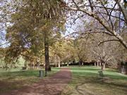
Vincent St Highgate
MHI notes other address as 505 William St
Third Swamp
Third Swamp Reserve
Vincent
Metropolitan
Constructed from 1897
| Type | Status | Date | Documents |
|---|---|---|---|
| Heritage List | Adopted | ||
| State Register | Registered | 30 Oct 1998 | HCWebsite.Listing+ListingDocument, HCWebsite.Listing+ListingDocument |
| Type | Status | Date | Documents |
|---|---|---|---|
| (no listings) |
| Type | Status | Date | Grading/Management | |
|---|---|---|---|---|
| Category | ||||
| Municipal Inventory | Adopted | 13 Nov 1995 | Category A | |
| Library Id | Title | Medium | Year Of Publication |
|---|---|---|---|
| 8002 | Hyde park conservation plan. | Heritage Study {Cons'n Plan} | 2003 |
| 9250 | Hyde Park Lakes preparation of a masterplan for their restoration. | Heritage Study {Other} | 2008 |
| 9272 | Hyde Park. Photograph record of Children's playground. | Archival Record | 0 |
| 7321 | Hyde park artwork proposal. | C D Rom | 2005 |
Urban Park
| Epoch | General | Specific |
|---|---|---|
| Original Use | PARK\RESERVE | Park\Reserve |
| Present Use | PARK\RESERVE | Park\Reserve |
| Style |
|---|
| Other Style |
| General | Specific |
|---|---|
| SOCIAL & CIVIC ACTIVITIES | Community services & utilities |
| DEMOGRAPHIC SETTLEMENT & MOBILITY | Aboriginal Occupation |
| OUTSIDE INFLUENCES | Depression & boom |
| DEMOGRAPHIC SETTLEMENT & MOBILITY | Environmental change |
| SOCIAL & CIVIC ACTIVITIES | Sport, recreation & entertainment |
This information is provided voluntarily as a public service. The information provided is made available in good faith and is derived from sources believed to be reliable and accurate. However, the information is provided solely on the basis that readers will be responsible for making their own assessment of the matters discussed herein and are advised to verify all relevant representations, statements and information.
Constructed from 1897
Hyde Park is highly valued by the local and wider community as a fine and mature Federation Arcadian landscape. It forms a visual, social and recreational focus for the neighbourhood and the wider community. It has scientific and historic value as a remnant of a chain of wetlands that extended through the district. It is a notable example of the aspirations for wetlands that were held during the Federation period. The site has important associations for Aboriginal people. It also has a significant collection of mature introduced trees and remnant indigenous flora.
Hyde Park is a well established park bounded by Vincent, Glendower, Throssell and William Streets. Its lake feature has been divided into two basins with islands, surrounded by mature London Plane trees. Numerous other mature trees are spread throughout the park, including Moreton Bay Figs and Port Jackson Figs in the lawn areas, Pines around the boundaries and Jacarandas in the south-east corner. Other plantings include Swamp Cypress, Red Cedar, Bunya Pine and remnant indigenous Eucalyptus and Melaleuca. Each portion of the lake has an island occupied by breeding birds. The park contains a network of pathways, BBQ facilities and children's playground equipment. Hyde Park was established in the Arcadian style of landscape design, which attempts to recreate an idyllic rural landscape, featuring gently undulating grassed areas, irregular groups of large trees, winding pathways, irregularly shaped shrubberies and natural water bodies. Landscaped parkland, tree lined lakes and meandering paths. Recent additions of limestone-edged planter beds and ornate paving depart from the original Arcadian style.
Originally known as Third Swamp, the area was an Aboriginal camping ground prior to and during the early part of European settlement. In the latter half of the 19th Century, when Aboriginal people were restricted from entering the Perth City area, Third Swamp was one of the few camping places remaining to them. The Swamp was prone to flooding and attempts were made to drain it and reclaim the land for residential purposes. Drainage was stopped after nearby wells began to dry up and the area was set aside as a reserve in 1873. Third Swamp was considered a good duck-hunting area by Europeans, and it was used as a camping ground by travelers, particularly during the gold rush period of the 1890s. A Public Works Department (PWD) Sewerage Plans dated 1897 shows that the area was a swamp full of vegetations. On 30 September 1897, largely through the efforts of Lyall Hall, Perth auctioneer and land agent, Third Swamp was gazetted for the purpose of Public Gardens. On 31 July 1899, Third Swamp was renamed Hyde Park, after London's park of the same name. The Park was placed in the care of the City's Gardening inspector, John Braithwaite, who was the municipal gardener from 1896 to 1936. A Government grant of £1,000 was made to Perth City Council for improvements. The area was surrounded with a picket fence to prevent cattle and horses entering, 600 trees were planted, rushes were removed from the swamp and a lake was formed. An ornate fountain was donated by William Brookman in 1901, and installed at the intersection of Glendower and Lake streets. A practice cricket pitch was added in 1906, and the perimeter Pine trees were planted in 1912. The lake dried up that same year and, in 1913, it was dredged and the soil used to create two islands. A roadway was begun through the centre of the park, but as a result of public opposition it was modified to a walkway separating the lake into two. In 1914-15 the picket fence was replaced with a fence of concrete posts and iron railing (not extant), and a bandstand rotunda was added. The Jacaranda trees were planted in 1921-23 and the Park was extended to include additional land on Vincent Street. The stone retaining walls around the lakes were built in 1936-37. Prior to1930s, the Wise's Post Office Directories list Hyde Park as at Vincent Street whilst from that year the place is listed under William Street. In the 1960s, the Park was refurbished with new play equipment, water playground, barbecues, picnic areas, improved lavatory facilities, lighting and upgraded pathways. A resurgence of use saw the first Hyde Park Festival held in 1968. The last Festival was held in 1985 but a more limited Hyde Park Fair was resurrected a few years later and continues to be held annually. The Park is a popular venue for other community events, social gatherings and private ceremonies such as weddings. On 6 January 1977, Perth Town Lot Y228 was granted to the City of Perth as freehold land to be used and held solely for recreation purposes. It was transferred to the Town of Vincent under the same conditions on 11 April 1995. In 1998 Hyde Park was placed on the State Register of Heritage Places. In June 2003 a Conservation Plan was prepared for the Park which provides a detailed documentary and physical evidence of the Park, and recommendations to guide any redevelopment and changes to the Park in line with its cultural heritage significance. In 2007, the Town of Vincent Council resolved to approve the design of the Hyde Park Stage. This stage proposal was also supported by the Heritage Council.
High
This information is provided voluntarily as a public service. The information provided is made available in good faith and is derived from sources believed to be reliable and accurate. However, the information is provided solely on the basis that readers will be responsible for making their own assessment of the matters discussed herein and are advised to verify all relevant representations, statements and information.
50 Vincent St Highgate
Bishop Gibney's House (fmr)
Lourdes
Vincent
Metropolitan
Constructed from 1911
| Type | Status | Date | Documents |
|---|---|---|---|
| Heritage List | Adopted |
| Type | Status | Date | Documents |
|---|---|---|---|
| RHP - To be assessed | Current | 25 Jan 2006 |
| Type | Status | Date | Grading/Management | |
|---|---|---|---|---|
| Category | ||||
| Catholic Church Inventory | Adopted | 01 Jul 1998 | ||
| Municipal Inventory | Adopted | 13 Nov 1995 | Category A | |
The place was built for Bishop Matthew Gibney, a prominent Bishop in the Catholic Church in Western Australia, who resided in the house.
The place is rare as an example of Federation Queen Anne style church housing.
The place is representative of the development of the Catholic Church in Western Australia, largely due to the efforts of Bishop Matthew Gibney.
‘A single storey brick and tile residence with prominent tiled gambrel style roof and projecting central porch with half battened gable screen and art nouveou style timber verandah brackets. The roof line is broken by several tall brick chimneys with terracotta pots.’
The establishment of a Roman Catholic presence in Highgate Hill dates from 1891, when Bishop Matthew Gibney supervised the subdivision of the Church’s land known as ‘Mount Heart Estate.’ Gibney house was built for Matthew Gibney and he resided in the house. ‘Cornafean’ website states: ‘Matthew Gibney was born at Aghaknock, Cornafean, County Cavan, Ireland, on 2 November 1837, son of Michael Gibney, a farmer, and his wife Alice, nee Prunty. He was educated in Kilmore Academy and studied for the priesthood at the Preparatory Seminary at Stillorgan and from 1857 at the All Hallows College in Dublin. He was ordained on 14 June 1863 and arrived on the “Tartar” in Perth on the 12th of December of the same year.’ ‘Father Gibney was a man of great energy and charity. In 1868 he opened the Catholic Girls Orphanage in Perth and in 1871 the Clontarf Orphanage for boys in Subiaco.’ ‘In 1886 he became Coadjutor Bishop of Perth, and in the following year was consecrated Bishop after the death of Dr. Griver. During his episcopate, he expanded greatly the numbers of churches, schools, and orphanages within the diocese and also established a number of hospitals and a monastery. In 1898 he divided the diocese and created the diocese of Geraldton.’ ‘Gibney identified himself closely with the political and social aspirations of his fellow Irishmen in Australia. He had been partly responsible for the 1871 Elementary Education Act by which the subsidisation of religious education was extended to the catholic schools. In the Perth by-election of 1888 Catholics voted en bloc for John Horgan, Gibney’s Solicitor. Gibney deplored the restrictions which disqualified many of the people from voting, and publicly condemned the electoral system on several occasions.’ ‘In the 1894 elections the principle of government aid to Catholic schools was defeated, despite the Bishop’s efforts to mobilise votes for candidates supporting it. Next year the ecclesiastical grant was abolished; he requested £50,000 in compensation and received £5,000.’ ‘This caused a financial crisis for the diocese, which was worsened by some ill-advised investments. From the late 1890’s the church bought many shops, offices houses and a hotel in the city of Perth. In 1905 he acquired control of the Morning Herald, he banned horse racing information from it, circulation dropped and the paper went into liquidation in 1909.’ ‘By 1908 the Church was seriously in debt and two years later Gibney retired after an inquiry instigated by Cardinal Moran of Sydney. Father Patrick Clune succeeded him. Matthew died at his North Perth home, from cancer on 22nd June 1925. He was buried under the nave of St. Mary's Cathedral, Perth.’ ‘Matthew died at his North Perth home, from cancer on 22nd June 1925. He was buried under the nave of St. Mary's Cathedral, Perth.’
High
good
Individual Building or Group
| Epoch | General | Specific |
|---|---|---|
| Present Use | RELIGIOUS | Housing or Quarters |
| Original Use | RELIGIOUS | Housing or Quarters |
| Style |
|---|
| Federation Queen Anne |
| Federation Arts and Crafts |
| Type | General | Specific |
|---|---|---|
| Other | TIMBER | Other Timber |
| Wall | BRICK | Face Brick |
| Roof | TILE | Cement Tile |
| General | Specific |
|---|---|
| SOCIAL & CIVIC ACTIVITIES | Religion |
This information is provided voluntarily as a public service. The information provided is made available in good faith and is derived from sources believed to be reliable and accurate. However, the information is provided solely on the basis that readers will be responsible for making their own assessment of the matters discussed herein and are advised to verify all relevant representations, statements and information.
Constructed from 1911
Bishop Gibney’s House (Lourdes) at No. 50 Vincent Street is a fine example of the Federation Arts & Crafts style and a sophisticated example of balanced assymmetrical design. Lourdes has close associations with its original owner Bishop Gibney and the development of the area, particularly the Sisters of Our Lady of the Missions and the Redemptorist Monastery. More latterly it has associations with the Highgate Hill parish and the Franciscan Friars.
The single storey bungalow is an impressive example of the Federation Arts and Crafts style. It has a hipped roof over the main body of the house, with a smaller hipped roof over the projecting front room. The roof is extended with a crippled verandah to a low eaves line. The entry porch is drawn forward from the hipped roof and verandah to form a central decorative feature which balances the assymmetry of the composition. The tiled roof has been replaced with cement tiles. The entry porch and the verandah have paired corner timber posts. The entry has a timber arch set under a timber and plaster gable, between pairs of posts with fretwork bressemer panels. It is capped with a decorative cross. The verandah bays are given a skipping rhythm with their elongated decorative brackets. A bay window with 5 casement lights and fanlights forms the front wall of the projecting room and the front room under the verandah has a pair of french doors. Garden setback behind the low brick and wrought iron (1950s) front fence Roof tiles replaced
The house at No 50 Vincent Street was constructed in 1911, and occupied by Catholic Bishop, Matthew Gibney following his resignation from the Bishopric. Matthew Gibney was ordained Bishop of the Perth Diocese in 1886, but problems with financial management resulted in his resignation in 1910. He is recorded as occupying a house at No 60 Vincent Street in 1915, but this is clearly the same house with an earlier street number, as although the street numbers changed over the following years, the number of houses in that section of Vincent street remained the same until at least 1930. Bishop Gibney's House was known as 'Lourdes'. The house was located in close proximity to the Sacred Heart precinct at Highgate Hill. Bishop Gibney had purchased (or built) some other houses in the area in the late 1890s, which were occupied by the Sisters of Our Lady of the Missions (1897-1899) and the Redemptorist Fathers (1899-1903) prior to them obtaining their own accommodation. Bishop Gibney's House was built next door to the two cottages originally occupied by the Redemptorist Fathers. The MWSSDD sewerage plan of 1930 shows an identical semi-detached pair on either side of No. 50 Vincent Street (Nos. 46-48 & Nos. 52-54), which were most likely the cottages referred to. In 1897, Bishop Gibney engaged architect Michael Cavanagh to design 20 houses for the Highgate area. These earlier cottages may have been some of them. Following Bishop Gibney's death in June 1925, No. 50 Vincent Street was sold. In January 1942, the Highgate Hill parish priest, Father Wallace, purchased the property for use as his Presbytery. It continued in this function until at least 1964 (possibly much later), when a house adjoining the Sacred Heart Church was acquired for that purpose. No. 50 is still owned by the Catholic Church and is occupied by the Franciscan Friars.
Intact
This information is provided voluntarily as a public service. The information provided is made available in good faith and is derived from sources believed to be reliable and accurate. However, the information is provided solely on the basis that readers will be responsible for making their own assessment of the matters discussed herein and are advised to verify all relevant representations, statements and information.
William St Highgate
near corner of William and Glendower St, next to bus stop on Hyde Park side of William St
Vincent
Metropolitan
| Type | Status | Date | Documents |
|---|---|---|---|
| Heritage List | Adopted |
| Type | Status | Date | Documents |
|---|---|---|---|
| (no listings) |
| Type | Status | Date | Grading/Management | |
|---|---|---|---|---|
| Category | ||||
| Municipal Inventory | Adopted | 28 Jun 2016 | Category A | |
23992 Metropolitan Sewerage Vents
Other Built Type
| Epoch | General | Specific |
|---|---|---|
| Original Use | GOVERNMENTAL | Other |
| Type | General | Specific |
|---|---|---|
| Other | METAL | Cast Iron |
| General | Specific |
|---|---|
| SOCIAL & CIVIC ACTIVITIES | Community services & utilities |
| DEMOGRAPHIC SETTLEMENT & MOBILITY | Settlements |
This information is provided voluntarily as a public service. The information provided is made available in good faith and is derived from sources believed to be reliable and accurate. However, the information is provided solely on the basis that readers will be responsible for making their own assessment of the matters discussed herein and are advised to verify all relevant representations, statements and information.
This information is provided voluntarily as a public service. The information provided is made available in good faith and is derived from sources believed to be reliable and accurate. However, the information is provided solely on the basis that readers will be responsible for making their own assessment of the matters discussed herein and are advised to verify all relevant representations, statements and information.